Archive for the ‘exploring New Brunswick’ Category
harvesting colour … colour of the harvest
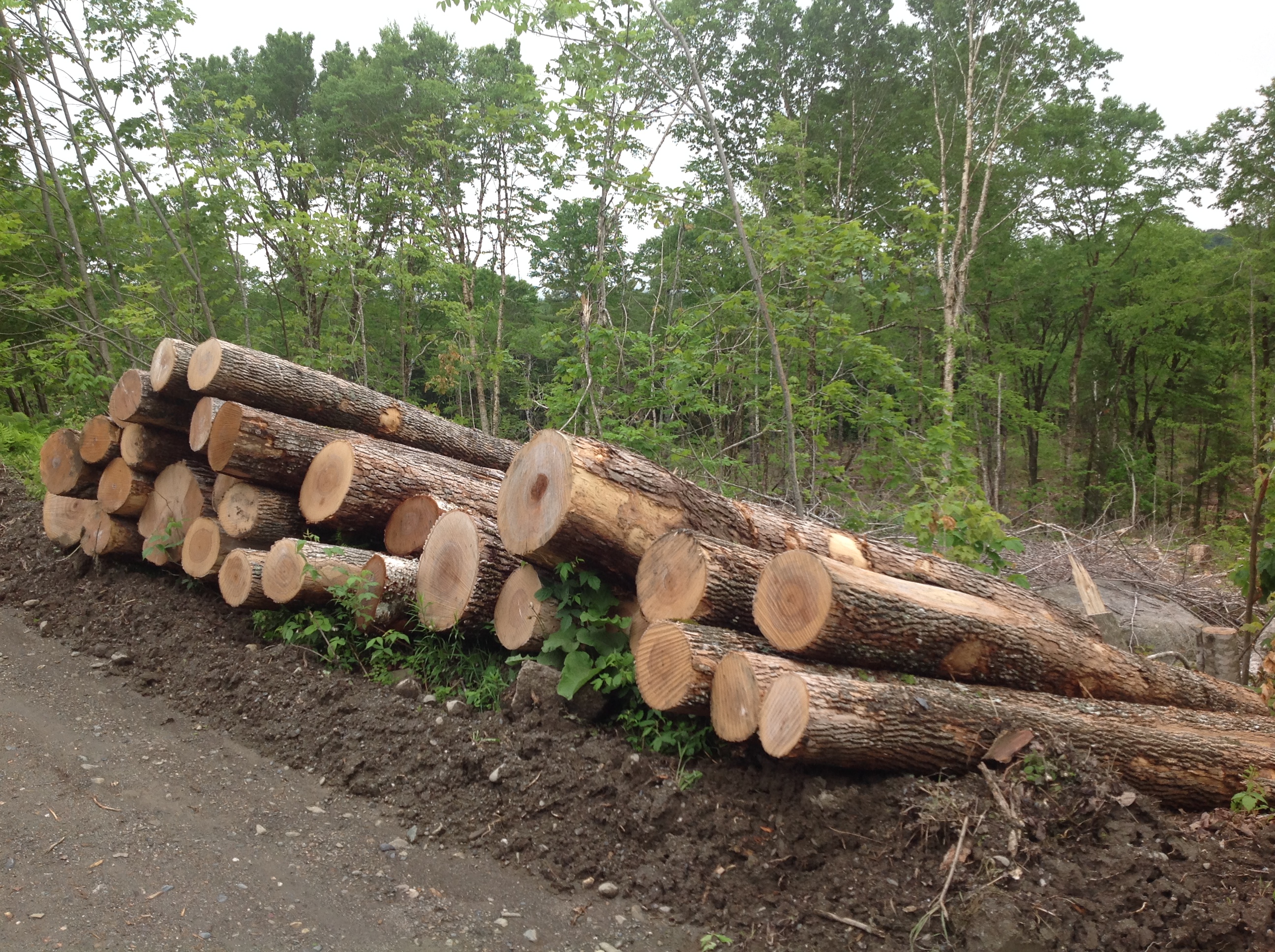
On our weekend drive from Canterbury to McAdam, I saw another aspect of the ‘harvesting colour’ theme. Anywhere you travel in New Brunswick, you usually come across wood harvesting activity and Highway 630 was no exception. About half way along, a turn in the road brought us to a large forest harvest.
~

forest harvesting operation
~
The wood from the cut was stacked into gigantic walls.
~
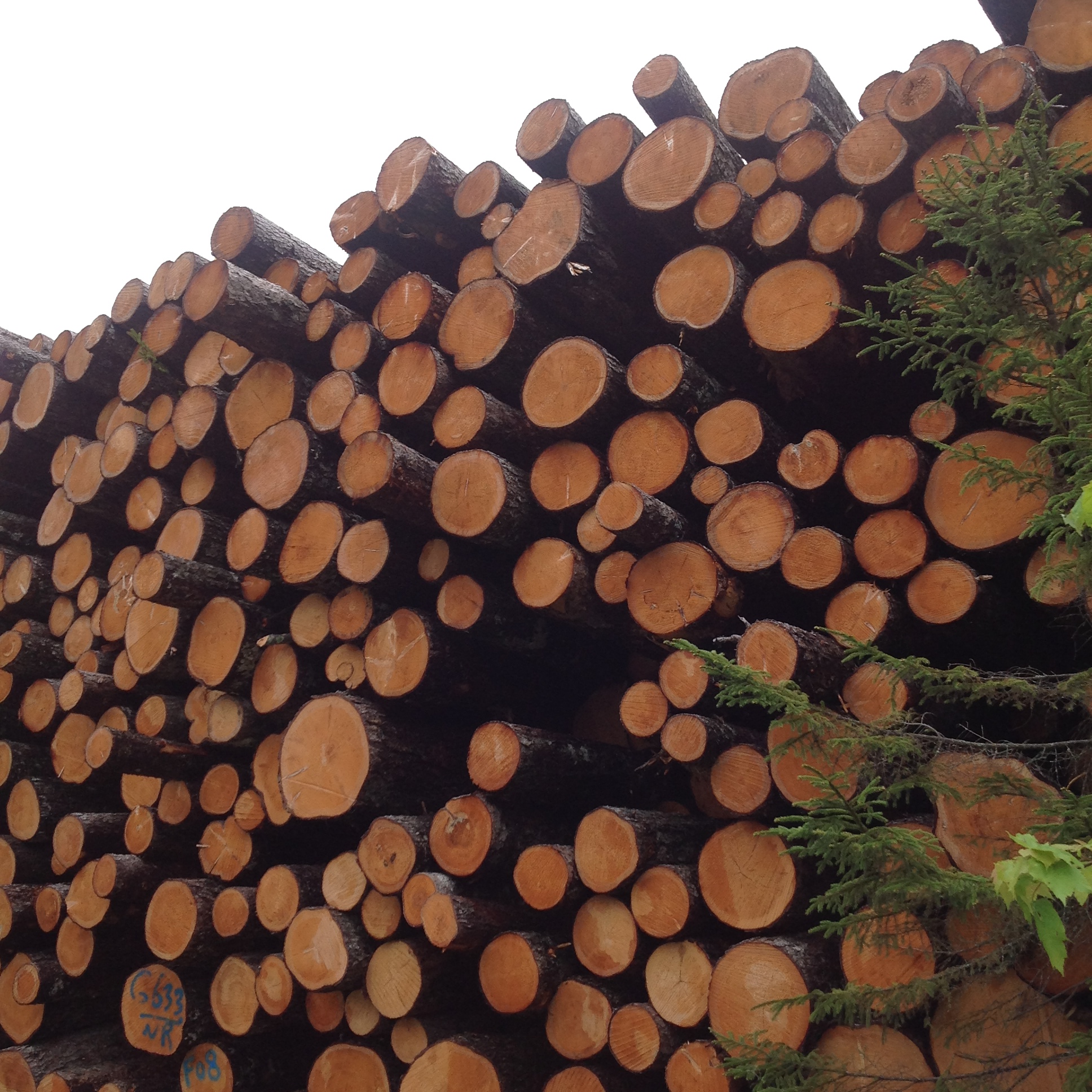
wall of cut wood
~
The clearcut laid the land quite bare. It will be many years before this area returns to the hardwood habitat typical of the area, if at all.
~

spruce and fir
~
The wood from the cutting had been piled according to species. The colours of the cut wood were quite distinctive. The largest colour contrast was between the pale almost white, ash …
~
ash
~

ash
~
and the very orange wood of the spruce and fir …
~

spruce and fir
~
I have no particular point to make, except to honour the very individual characteristics of these trees.
~
Copyright 2014 Jane Tims
blue in the woodland
About a decade ago, we took a drive from Canterbury to McAdam on a gravel road. The memory I have carried with me for years is of a section of woodland absolutely blue with flowers. I often wondered what the flowers were and if I’d be able to find the spot again. This weekend we tried to find the place and the sea of blue in the woodland.
~

Highway 630 from Canterbury to McAdam in New Brunswick (map from Google Maps)
~
Canterbury, like many rural communities of New Brunswick, has faced a shrinking population over the years. Settled by Loyalists, it was a center for logging and railroad traffic and, in the late 1800s, had a population of over 1000. Today it has only about 340 residents. Nevertheless, it is a charming village and has a newly renovated school, housing all 12 grades.
~
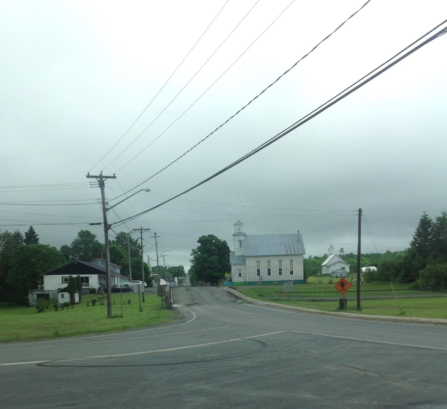
Village of Canterbury at the turn to Highway 630
~
The route from Canterbury toward the south is a numbered road. But Highway 630 is not paved and quite rutted in some sections. In one place we had to ask some ATVers if we were on the right road!
~

Highway 630
~
As we drove, I watched the woods for those blue flowers. Wildflowers were certainly a theme of our drive. By the road we saw Pink Lady’s Slipper (Cypripedium acaule), Bluebead Lily (Clintonia borealis), Bunchberry (Cornus canadensis) and Quaker Ladies (Houstonia caerulea).
~
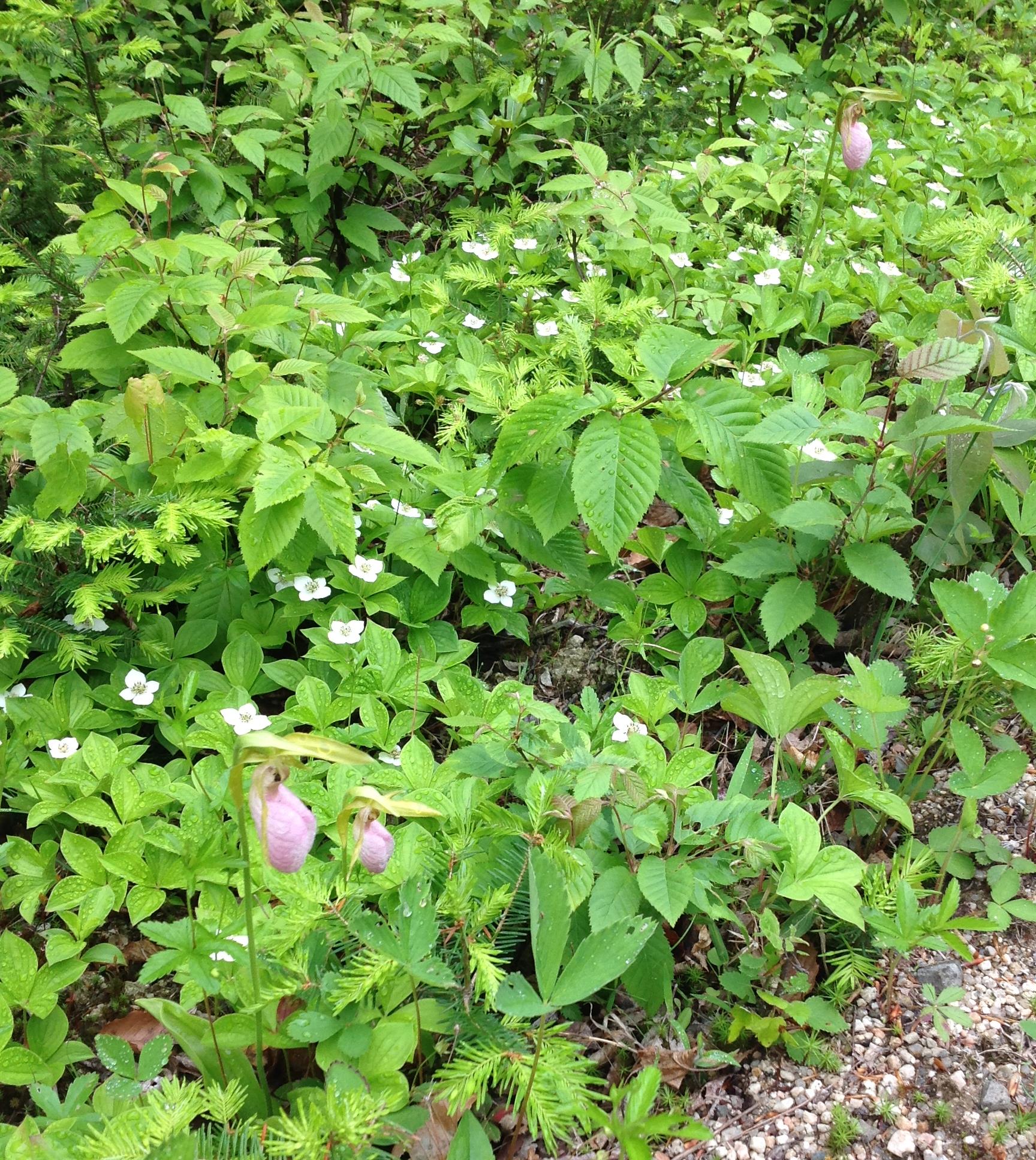
Lady’s Slipper and Bunchberry along the road
~
The map shows a community named Carroll’s Ridge just south of Canterbury. When we reached the location marked on the map, there were no homes or buildings, only a few old roads and cleared areas. But there in the woods was evidence people had once lived there. I found my sea of blue! Forget-me-nots, escaped from some forgotten garden to thrive in the near by woods.
~

Forget-me-nots escaped from an old garden
~
In my memory, the ‘blue’ of the flowers was more intense a decade ago. But we noticed many of the Forget-me-nots there now are a white variety. Who knows if flower colour or memory really changed during those ten years.
~

blue flowers in the woodland
~
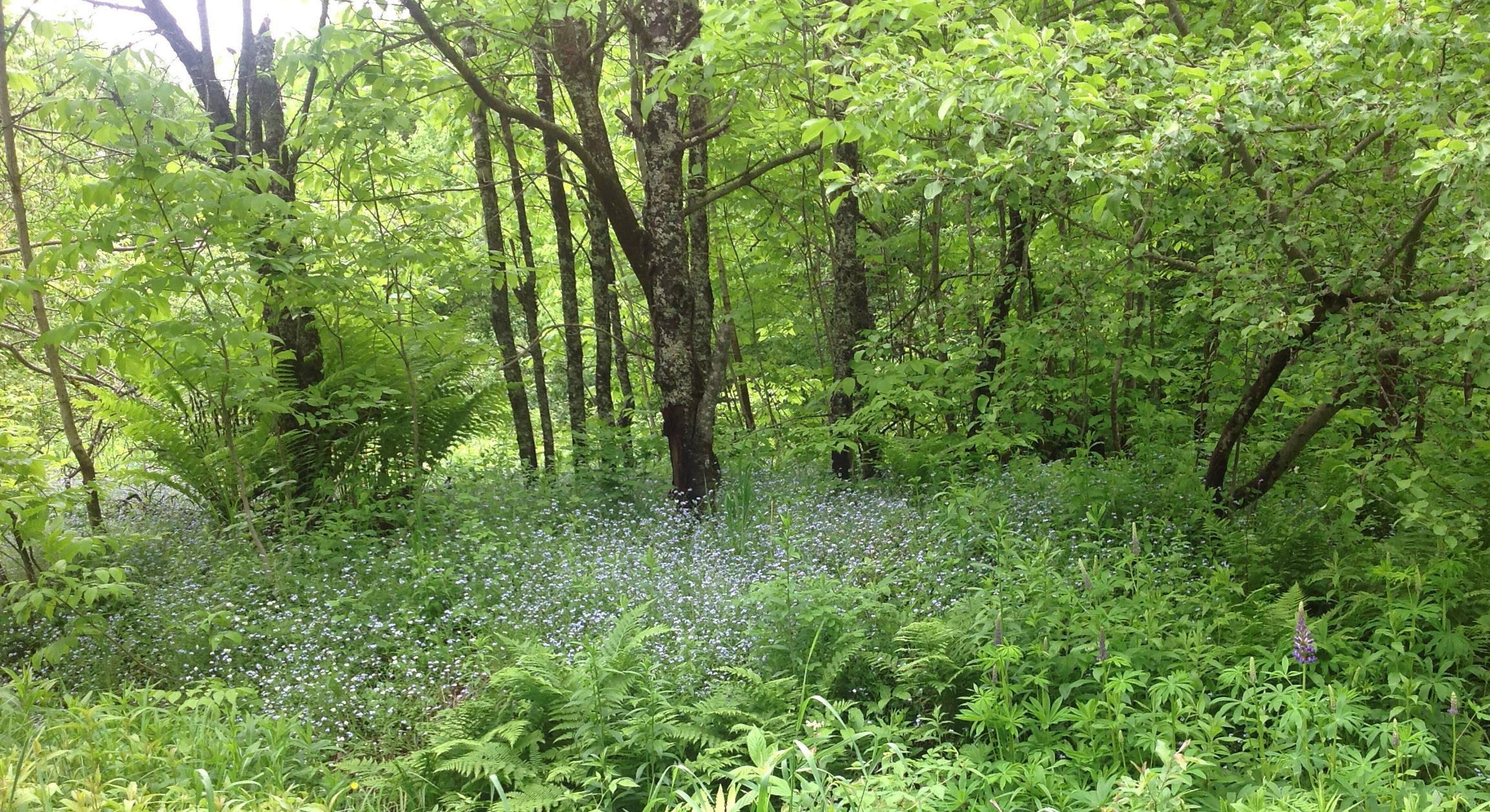
Forget-me-nots in the woods
~
I picked a few of the Forget-me-nots, to try an ‘eco-print’ dyeing experiment in coming days. But what I really took away was another image of a sea of blue flowers in the woods.
~
Copyright 2014 Jane Tims
industry and old barns (day 15 and 16)
One of the best things about ‘biking’ a new section of road every time I exercise is – I never know what theme is going to suggest itself …
~
~
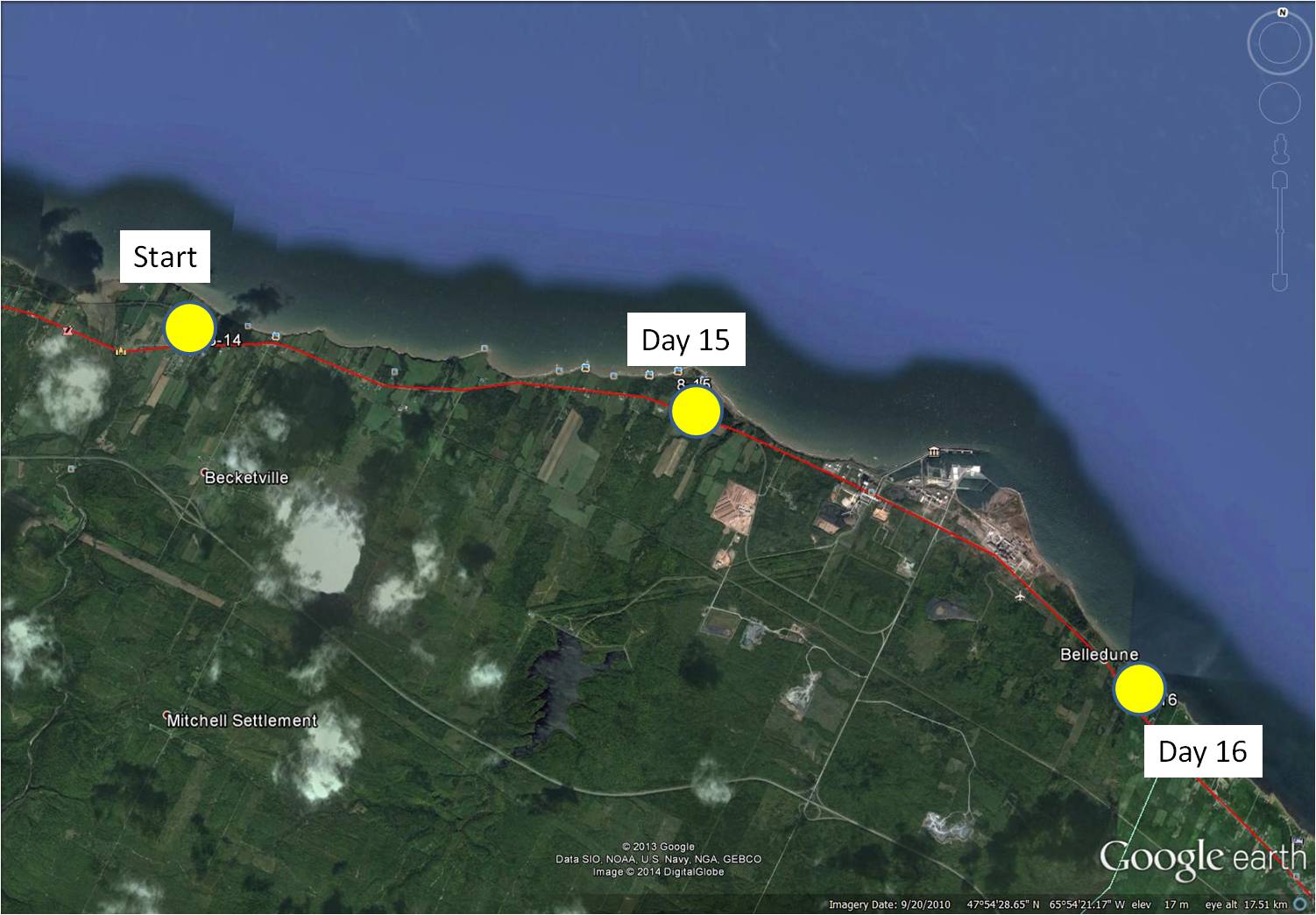
8-15 February 12, 2014 30 minutes (Jacquet River to Culligan)
8-16 February 16, 2014 35 minutes (Culligan to Belledune)
~
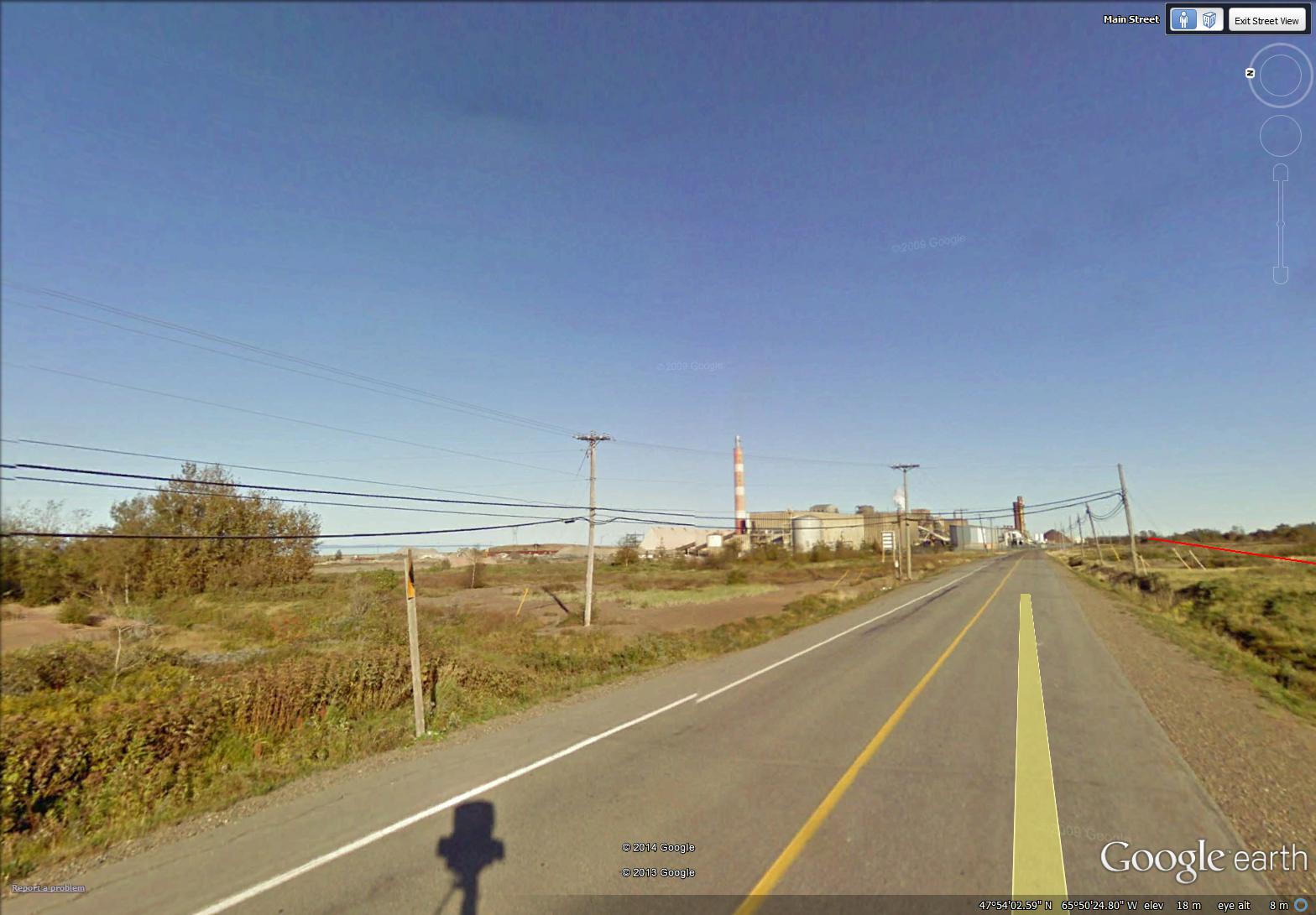
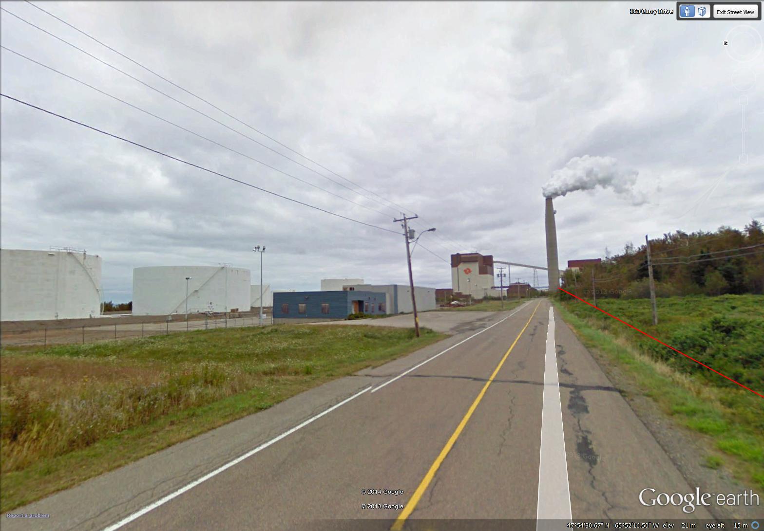
This session of virtual touring took me to Belledune. The area is quite industrialized, since it is the site of the Xstrata Zinc Canada Brunswick Smelter …
~
~
and the location of the Belledune Thermal Generating Station …
~
~
The smelter is a primary lead smelter and refinery. Its air emissions are controlled by various process-specific pollution control equipment including a scrubber and baghouse facilities.
The 450 MW (megawatt) generator burns coal and has a ‘scrubber’ to help remove sulphur dioxide emissions. At the present time, there are only two thermal generating stations still operating in New Brunswick. Most of the rest of our power comes from hydroelectric and nuclear stations; we also have some wind power.
I studied the air emissions of both the thermal generating station and the smelter at Belledune.
~
At first glance, this industrial activity in a mostly rural area may seem out-of-place. However, the smelter and generating station use the Port of Belledune. This is a world-class deep water port in the Baie-des-Chaleurs with year-round cargo handling ability. The port, one of Atlantic Canada’s most successful, offers a gateway to North America.
~
In the midst of all this industrial activity, in my search for paintings to represent my ‘travels’, I chose images of the rural landscape …
~
an old barn with red doors …
~
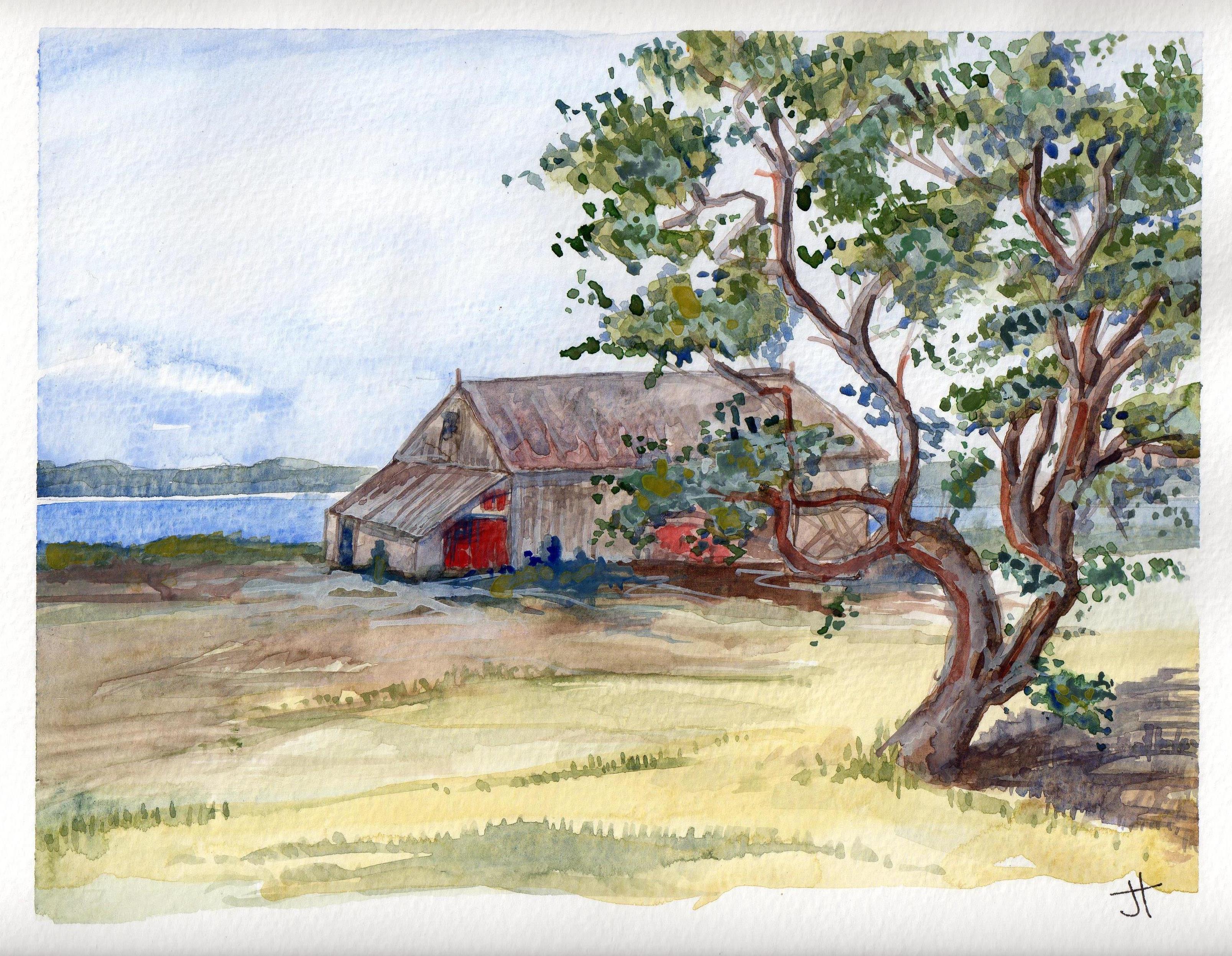
February 21, 2014 ‘barn along the bay’ Jane Tims
~
and a barn near a huge Mountain Ash, its red berries magnificent …
~

February 22, 2014 ‘red berries – Mountain Ash’ Jane Tims
~
Copyright 2014 Jane Tims
dangers on the roads (day 5)
On day 5 of my virtual cycling beside the Restigouche River, towards Dalhousie, New Brunswick, I encountered part of a story …
~

map showing distance travelled (map from Google Earth)
~
8-5 January 14, 2014 35 minutes 3.0 km (Maple Green to Dalhousie Junction)
~
Along the route, I passed two police cars, headed in the opposite direction. Hmm, I said to myself, you never see two police cars together unless something bad has happened.
~
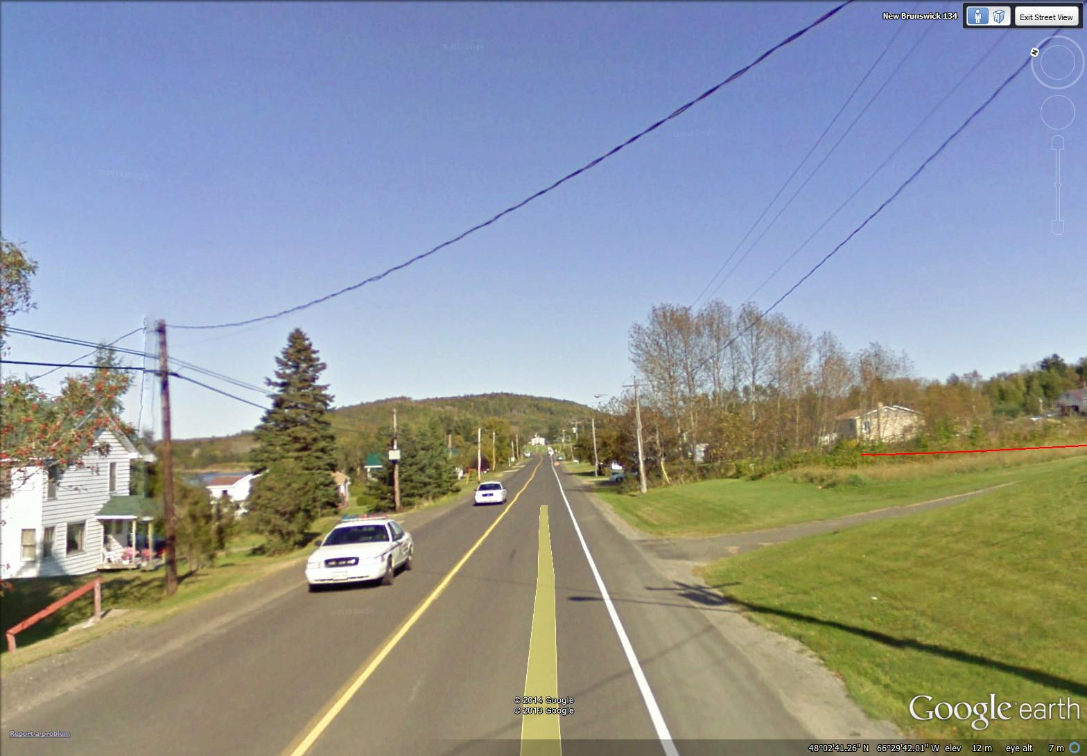
(image from Street View)
~
So I was not surprised to see this figure flagging me down …
~

(image from Street View)
~
Or the real flagman and two power trucks …
~

(image from Street View)
~
And a broken power pole. An accident, now four and a half years in the past (the Street View image was taken in 2009). But a reminder of the dangers and sad history of our highways.
~
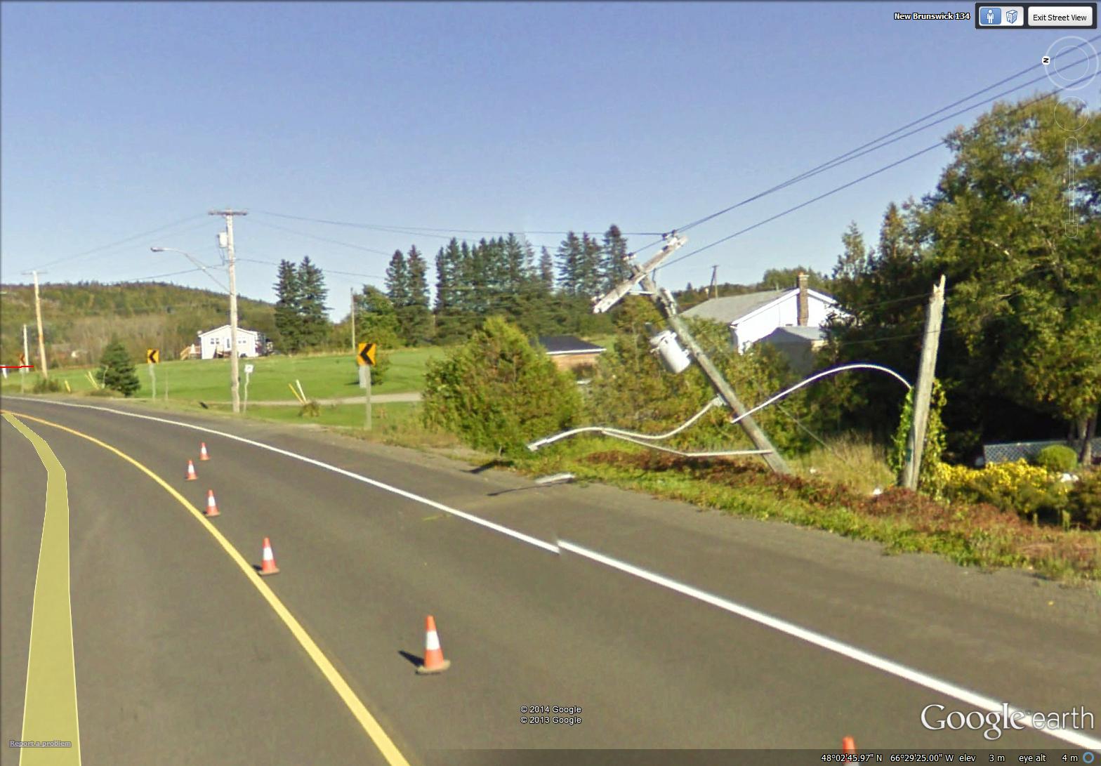
power pole, broken in half (image from Street View)
~

January 14, 2014 ‘railway crossing on Route 134’ Jane Tims
~
Copyright 2014 Jane Tims
a close look at the landscape (day 4)
On day 4 of my virtual travels in northern New Brunswick, I continued to follow the Restigouche River …
~

~
8-4 January 11, 2014 30 minutes 3.0 km (McLeods to Maple Green)
~
I love the topography of the area. As I’ve said before, the mountains here are part of the northern Appalachians. These mountains were created about 480 million years ago and were gradually eroded to a flat plain. Then, upheaval of the earth’s crust gave us the undulating hills and mountains we see today.
~
Today on my virtual bike trip, I could see one of these features, a low dark hill on the right of the horizon.
~
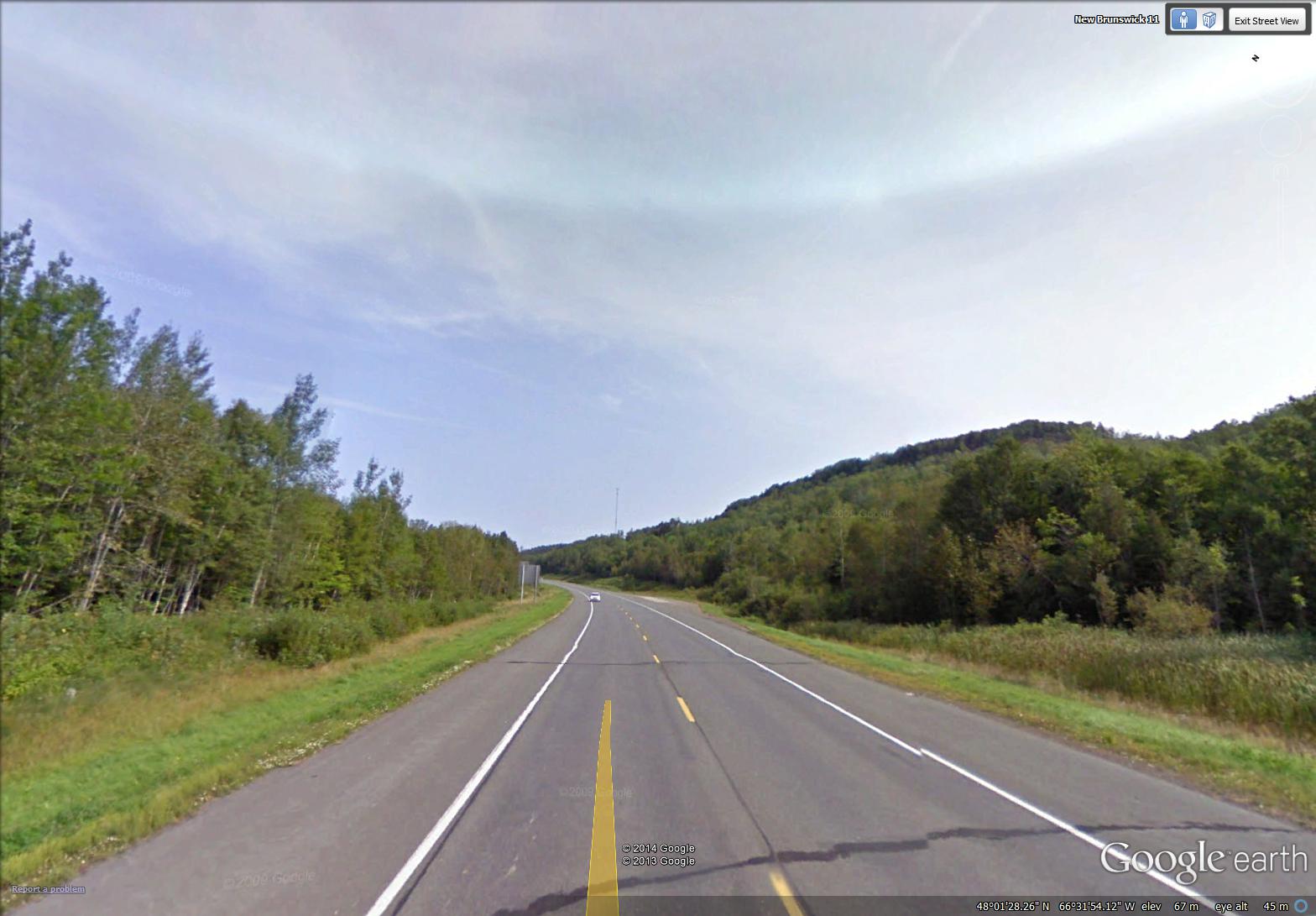
mountain along the highway near Maple Green (image from Street View)
~
I think it is interesting to look for these elements of landscape on the satellite map – I found this feature easily, a dark curved escarpment, just south of Maple Green. It is a ‘mountain’ caught between the water of Porcupine Brook (flowing out of Hicks Lake) and the deposits of the Restigouche River …
~

labelled satellite image (image from Google Earth)
~
You can also look at the mountain in the ‘ground-level view’ of Google Earth. I don’t know how this ‘mountain’ was formed, but a geologist could likely tell an interesting story of its history …
~

the ‘mountain’ is in the upper right hand corner (image from Google Earth)
~
A look at the view above shows how different land owners have taken different approaches to managing their woodlands (the tan-coloured band is a strip of clear-cut forest). The property boundaries, of course, pay little attention to geology, so there are several landowners on the ‘mountain’.
~
In one respect, the property boundaries do pay attention to the landscape. As in other areas along rivers or the coast, properties were historically arranged so each land owners had access to the waterway. You can see this on the satellite image …
~

properties along the river – every owner originally had some access to the river (image from Street View)
~
and also on an old property map of the area …
~

old property map of area around Maple Green (Source: Provincial Archives of New Brunswick)
~
Sometimes, to get access to property by the river, people need long driveways. Sometimes the road has to cross the railroad …
~

January 12, 2014 ‘railroad crossing’ Jane Tims
~
Copyright 2014 Jane Tims
trees and more trees (day 3)
Once I was asked to conduct a bus tour of southern New Brunswick for some visiting city administrators. I prepared well for the tour and had lots to show and tell them. I got a laugh for beginning my tour with: ” There’s a tree and there’s a tree and there’s a tree…. ” All joking aside, New Brunswick has a lot of trees. A drive almost anywhere means driving through many kilometers of forest or woods.
~

map showing distance travelled (map from Google Earth)
~
8-3 January 7, 2014 30 minutes 3.0 km (south of McLeods to McLeods)
~
On the third day of my virtual cycling trip in northern New Brunswick, I took a few backroads and, you guessed it – saw lots of trees. Well I love trees, so that may be one reason New Brunswick, in my opinion, is a great place to call home.
For the most part, we have a mixed wood composition to our forests – both hardwood and softwood. One thing I’ve noticed in painting my first watercolours of New Brunswick is the dark blue tinge to hills on the horizon. I think this is due to the large number of conifers (White, Black and Red Spruce, Balsam Fir and White Pine, among other species).
~

January 8, 2014 ‘Route 280 near Dundee’ Jane Tims
~
Painting trees is a challenge for me. My biggest problem is ‘green’ … I use Sap Green and Oxide of Chromium, and mix these with blue and yellow, but I can never seen to capture the emeralds of nature!
~
Copyright 2014 Jane Tims
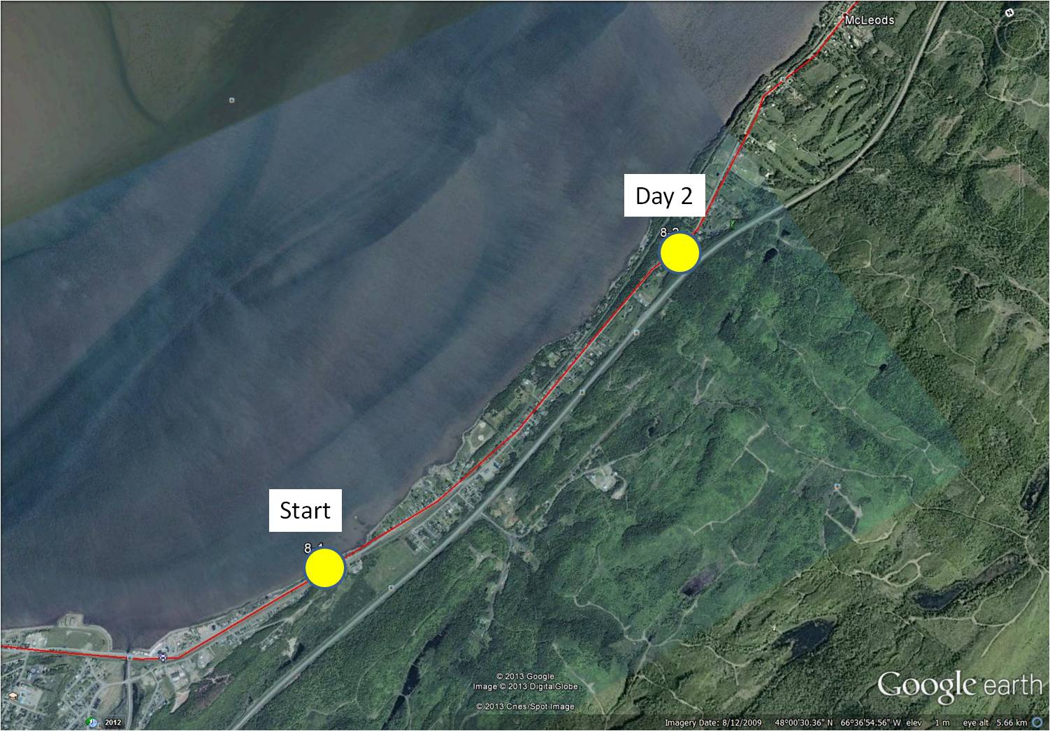
along the river (day 2)
For many days of my virtual travel during Phase 8, I will be ‘biking’ along the north shore of New Brunswick. At first, I will travel along the Restigouche River. Then I will continue as the river opens into the Baie-des-Chaleurs. Just across the water will be the distant hills of the Gaspé Peninsula of the Province of Quebec.
~

~
map showing distance travelled (map from Google Earth)
~
8-2 January 5, 2014 35 minutes 3.0 km (Richardsville to south of McLeods)
~
On day 2 of my travels, I followed the relatively straight road along the coast. The houses in rural New Brunswick are usually arranged in small communities with houses in a linear pattern along the main road. New Brunswick has a lot of Crown Land (about 48% of the area), arranged in large blocks. As a result, communities (and the associated privately-owned land) are often separated by long stretches of largely forested Crown Land. Crown Lands are not privately owned but are managed by Federal or Provincial Departments for the people of the Province.
~

a typical stretch of road along the north shore (image from Street View)
~
Most of the communities along the northern shore of New Brunswick are French-speaking, so when I see people along the road, I will be able to practice my French, as I did in France.
~

January 7, 2014 ‘Restigouche River and the hills of Gaspe’ Jane Tims
~
Have you ever travelled in New Brunswick? If so, I hope you enjoyed your stay!
~
Copyright 2014 Jane Tims
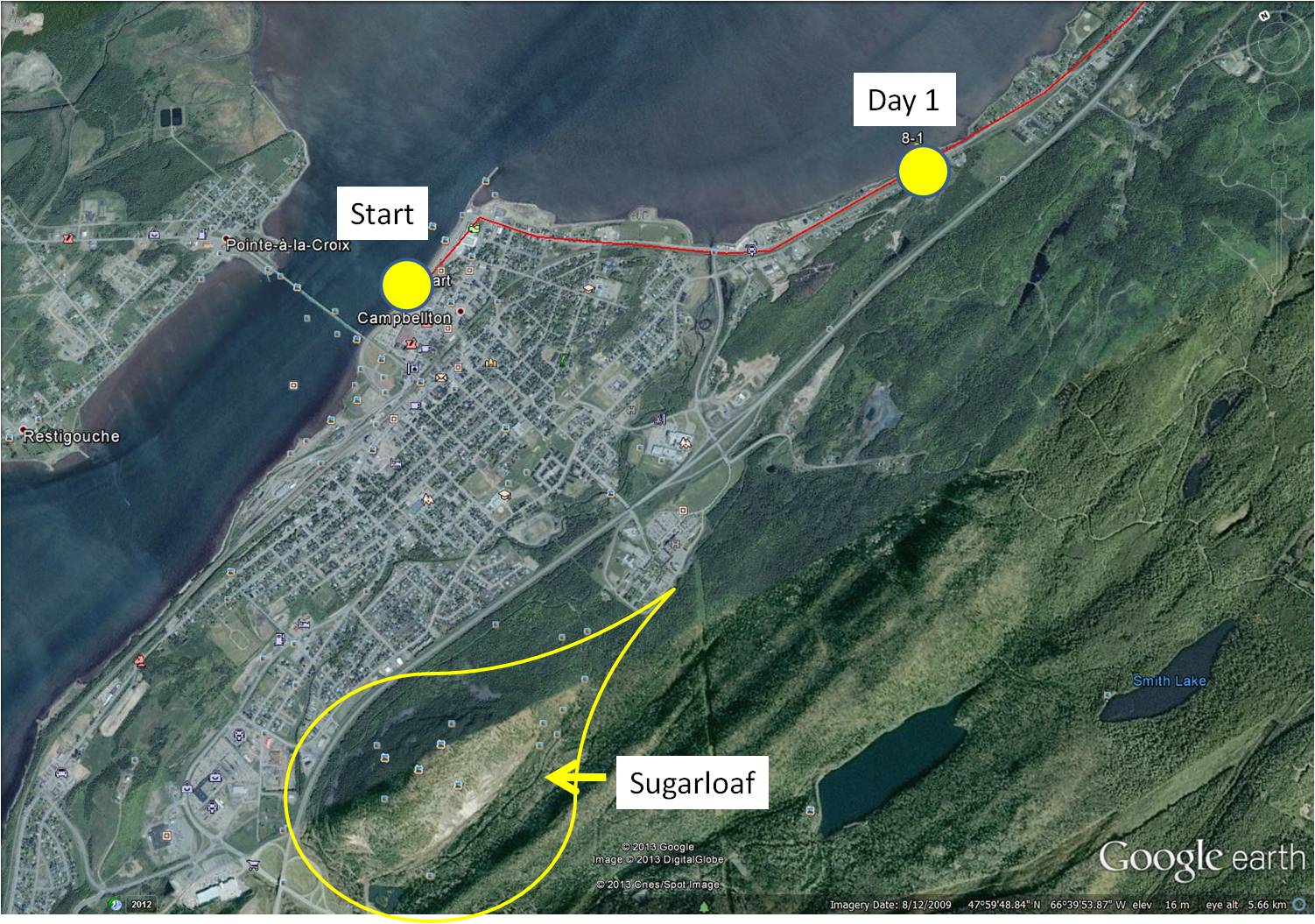
a leaping salmon and a mountain (day 1)
On December 31, 2013, I started on Phase 8 of my virtual cycling program. In this Phase, I am going to ‘travel’ on my stationary cycle along the north shore of my own Province, New Brunswick. I decided to start in the City of Campbellton because I have so many pleasant memories of working and vacationing in that area. Most of the roads I am ‘cycling’ in Street View, I have driven in reality, so most scenes are familiar.
~
8-1 December 31, 2013 35 minutes 3.0 km (Campbellton to Richardsville)
~
I began at a familiar landmark in the Campbellton area, the statue of the leaping salmon. The Restigouche River is world famous for its Atlantic Salmon population so the salmon is a fitting symbol for the area. In 1999 when my husband, son and I vacationed in the Gaspé of Quebec, we stopped here for a photo before leaving New Brunswick.
~
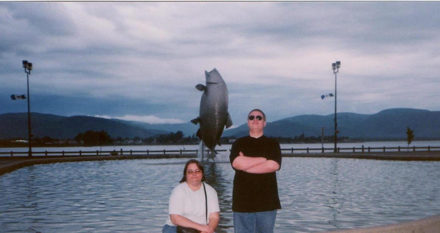
my son and I in front of the leaping salmon in 1999
~

start of my 2014 virtual cycling trip (image from Street View)
~
Across the street from the leaping salmon (and visible in the photo of my son and me) are the waters of the Restigouche River and the distant hills of the Gaspé. Since these will be with me for the first few days of my virtual adventure, I took a side trip a few kilometers inland for the subject of my first watercolour – Sugarloaf Mountain.
~
Sugarloaf is 281.1 meters in height, a part of the Appalachian Mountains and of volcanic origin. The mountain is within the City limits of Campbellton and is the location of Sugarloaf Provincial Park. Sugarloaf is the site of a ski resort, hiking and cross-country ski trails and a system of mountain biking trails.
~
In the late 1970’s and early 1980’s I climbed Sugarloaf a few times, gathering plants for air quality studies. I’ll talk more about those hikes as I proceed on my virtual trip since I have many memories of working in the area.
~

December 31, 2013 ‘Sugarloaf, New Brunswick’ Jane Tims
~
~
Although I enjoyed my virtual cycling in France and England, I find I have a more accurate perspective and sense of scale as I travel in New Brunswick. I am looking forward to showing you some of the beautiful scenery along the Restigouche River and la Baie-des-Chaleurs!
~
Copyright 2014 Jane Tims
‘cold’ place names in New Brunswick
Yesterday morning we woke to a dusting of snow on the roof of the garage and deck table. I am not too crazy about the perils of driving in bad weather, but I love the look of new snow.

cold day in December 2011
Thinking about new snow reminded me about the several communities in New Brunswick named for adverse or chilly conditions:
Snowdon, York County – perhaps after the family name.
Coldbrook, Saint John County (now part of Saint John) – originally thought to have been called Moosepath, then Three Mile House … renamed Coldbrook in 1889, reason unknown.
Coldstream, Carleton County – first called Rockland, was renamed Coldstream in 1852.
Blowdown, Carleton County – originally called South Richmond, the community was renamed in 1869, after a significant leveling of forest as a result of the Saxby Gale (October 4-5, 1869).
Frosty Hollow, Westmorland County (now part of Sackville)– originally called Mapleburg, the community was renamed in 1927 because the first frost in the Sackville area is said to settle there.
~
For information on other community names in New Brunswick, you can use the search feature at the Provincial Archives of New Brunswick http://archives.gnb.ca/exhibits/communities/.

new snow on car roof
~
~
newfall: words escape me
~
the white ephemeral
perhaps frost
the fir boughs divided
the sculptured steel
of a flake of snow
~
try again
~
paper stencil
on chocolate cake
powdered sugar
sifted on the rills
of the new plowed field
~
again
~
sweet in my mouth
the bitter melted in morning sun
white hot on my cheek
the writing lamp
~
a lamp to the left
casts no shadow
(the shadow of a pen
or a hand)
~
(unless you are wrong-handed)
~
chimney shadow
on a fresh-snowed roof
or trees on the eastern edge of the road
where the sun cannot warm
~
the morning
dusting of ice
~
try again
~
~
Published as: ‘newfall: words escape me’, The Fiddlehead 196: 147, Summer 1998.
Copyright Jane Tims 2012
Mountain Road adventure
Last week, we decided to take a drive along Mountain Road. This is a trail extending from Mazerolle Settlement outside Fredericton, New Brunswick to Newmarket, near Harvey Station. We used to take it regularly when my husband and I first knew one another, over 30 years ago. In those days, it was a narrow road built along the side of Porcupine Mountain. It was overhung with hardwoods and crossed the upper part of the Woolastook Game Refuge. We decided it would make a good drive on an October afternoon.

The drive started with a sighting of White-tailed Deer near the road entrance.

Then we stopped briefly at an inlet of the St. John River, to watch a Blue Heron take off and circle the cove.

Although there are a few houses along the first part of the road, the area is generally uninhabited and the woods on either side of the road were still natural. The trees were beautiful – oak, maple and beech were all in various autumn hues.

It has rained recently, and as we went further along the road, its deteriorated condition became evident. Culverts were heaved at several points and we had to take our time as the waterholes in the road became deeper and deeper.

Although the road bed was generally solid, we could feel the tires slipping sideways in a couple of the puddles.

At last, unable to see through the muddy water, and wondering if there were any big rocks lurking there, ready to hang us up, my husband decided to turn back. It was foolish to proceed with summer tires and no winch to help us if we did get stuck. In the old days, we would have pressed on, willing to walk to the nearest main road, but arthritis interferes with foolish bravado!
Later, we’ll try the road from the other end. Perhaps we were through the worst, and pavement was just beyond the next big puddle.

Copyright Jane Tims 2012
www.nichepoetryandprose.wordpress.com


