Archive for March 2013
a stone church
~

Chapelle de Sainte-Macrine (image from Street View)
~

~
On March 13, I strayed from my planned path to take a 3 km side trip to see the Chapelle de Sainte-Macrine. I have seen very few churches on my virtual bike trip, since Street View follows only the main roads – churches tend to be on side streets.
~

map showing distance travelled (map from Google Maps)
~
The first part of my trip was along the Rue des Ouches (meaning garden or orchard). True to the name, many of the properties had neat gardens…
~

one of the gardens along Rue des Ouches (image from Street View)
~
The church was of stone, cross-shaped, with buttresses and a large rose window. The buttresses project from the sides of the church and serve to reinforce its walls. Saint Macrine was a fourth century Saint who lived in the woods near Niort, France for seven years to escape persecution…
~

Chapelle de Saint-Macrine (image from Street View)
~
Best View: the rose window in the church…
~

~
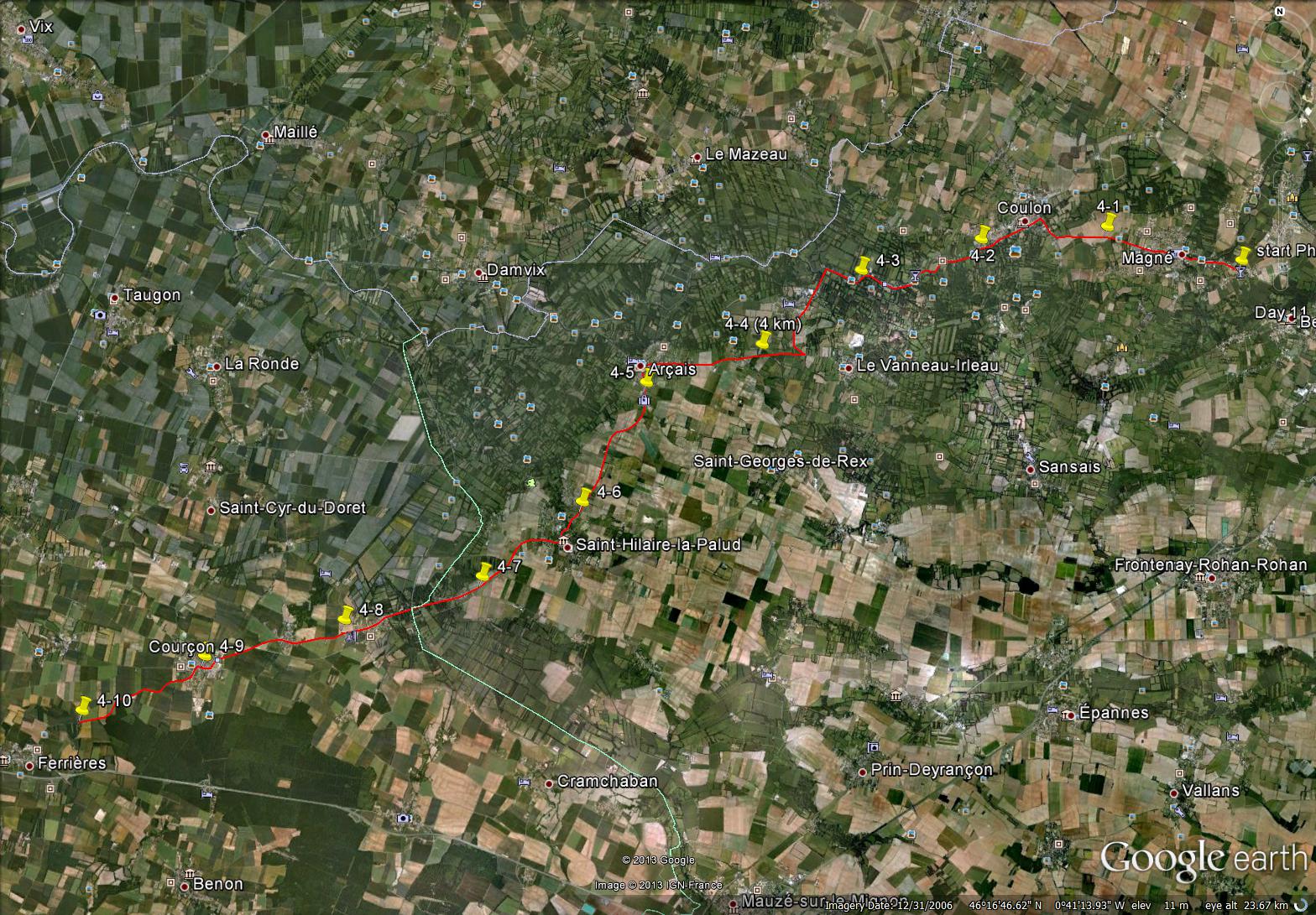
I have realised that by following a single route, I have missed many features of the countryside. In Phase 4 of my virtual bike trip, I am going to plan some side trips to see some interesting features of the French countryside.
~
Don’t you think that side trips can be the best part of a journey?
~
Copyright Jane Tims 2013
flowers and fences
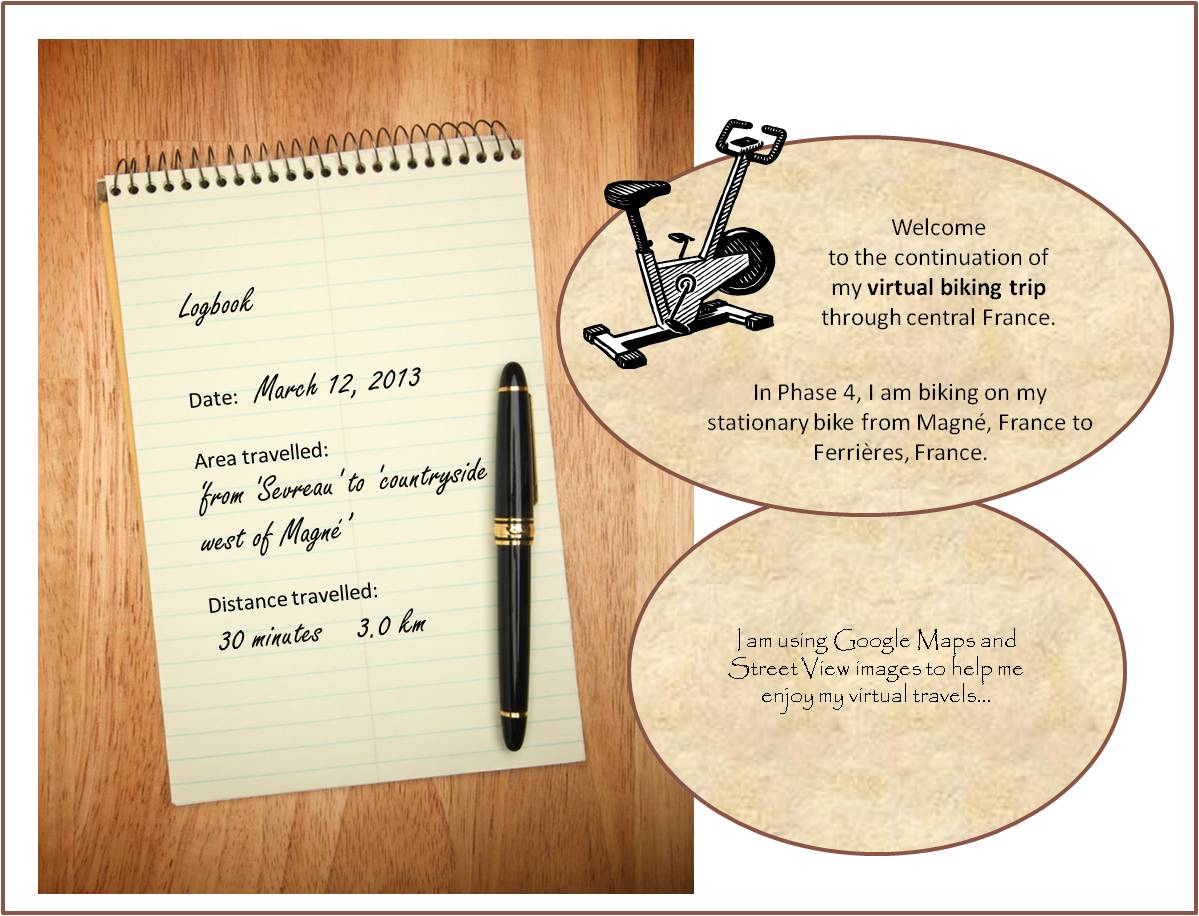
The beginning of Phase 4 ! My exercise scheme of virtual biking is paying off. After going 385 minutes (67.8 km) on my stationary bike in Phases 1, 2 and 3, I have lost weight, I feel stronger and I have more walking stamina. I am looking forward to my progress in Phase 4. I am also going to try to make my trip more interesting for you, my reader.
~

map showing distance travelled (map from Google Maps)
~
Interesting views along the route on my first day of Phase 4 included a young hardwood plantation…
~

a plantation of trees (image from Street View)
~
and a fence made of woven grasses…
~

hay fence … appears to be made from grasses ‘sewn’ together (image from Street View)
~
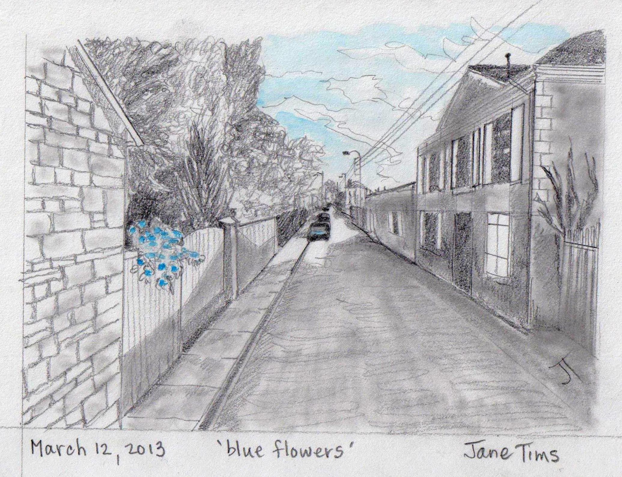
Best view: a pot of blue flowers perched on a fence in Magné…
~
~
Copyright Jane Tims 2013
visiting Town Hall – biking log book Day #12
I can’t belive it – I have completed the third phase of my virtual bike trip through central France. In this phase, I biked (virtually) 36 km in 12 days from Exireuil to Magné just west of Niort.
~

Phase 3 map (map from MapQuest)
~
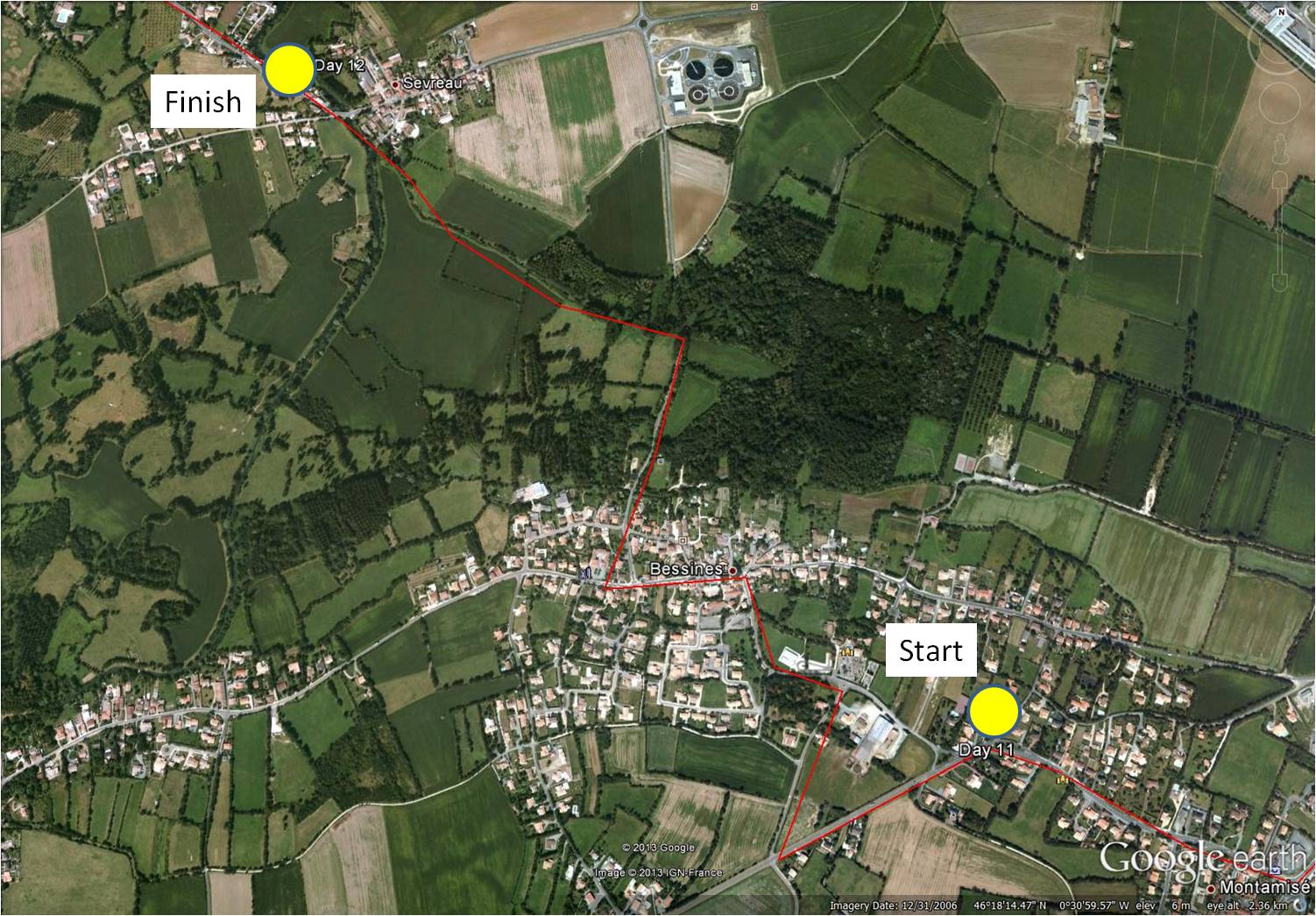
On March 10, I continued my virtual biking through the pretty town of Bessines and into the river town of Sevreau.
~
~
It was pleasant to be back in the rural areas – I appreciated the flat land – biking where there are a lot of hills is not fun!!!
~

~
The town hall (mairie) in Bessines had red shutters and a big town bulletin board…
~

town hall in Bessines – note bulletin boards
~
I think the bulletin board must tell people to be on the look-out for a crazy Canadian lady pretending to bike through the French countryside…
~

Town Hall – not ‘Mairie’ in stone over door
~
The final stretch of the trip was in a shaded road called the Rue des Trois Ponts…
~

one of three bridges
Log Book: March 10, 2013
Area travelled: ‘outskirts of Magné’ to ‘town of Sevreau’
Distance: 30 minutes 3.0 km
Best view: house with blue shutters along the Place de la Mairie
Notes: took a shortcut to Sevreau along the stream!
~

~
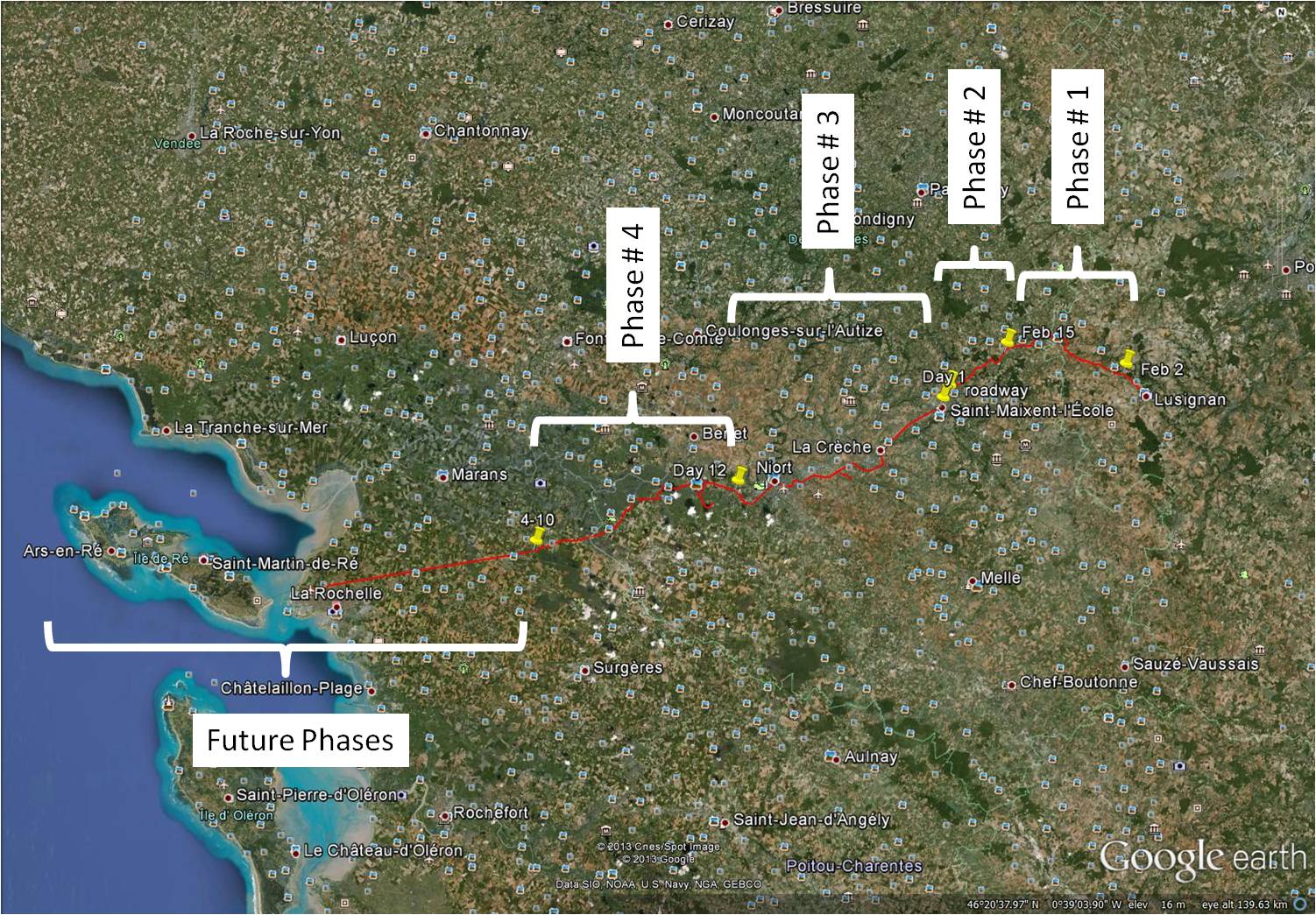
Total distance in Phase 1 (Jan 30 to Feb 11): 14.0 km (145 minutes of stationary biking)
Total distance in Phase 2 (Feb 12 to Feb 18): 17.8 km (180 minutes of stationary biking)
Total distance in Phase 3 (Feb 21 to March 10): 36.0 km (360 minutes of stationary biking)
~
Total Distance: 67.8 km (685 minutes or 11 hours and 25 minutes of stationary biking)
~
This ends Phase 3 of my virtual biking adventure. I plan to continue this virtual bike trip in Phase 4, a 10 day trip from Magné to Ferrières.
~
~
Eventually, I want to reach the west coast of France and see an island called Îsle de Ré.
~
~
I hope you will continue to follow me as I travel virtually through central France. I want to make my posts more interesting, so I would like to know what you would like to see in a posting of my Log Book.
~
~
Copyright Jane Tims 2013
negotiating traffic circles – biking log book Day #11
Since February 21, I have been in the third phase of my virtual bike trip through central France. For Phase 3 of my trip, I am biking in 12 days from Exireuil to Magné just west of Niort.
~
On March 8, I continued my virtual biking through the city of Niort to a town on the outskirts called Montamisé. Only 1 more day to go before Phase 3 of my virtual biking adventure is over.
~

~
I will always remember this as the ‘day of the traffic circle’.
~

completely understandable (%^&#$@$!) traffic circle sign (image from Street View)
~
I didn’t get lost because I took some shortcuts … directly across the island in the middle of each traffic circle!
~

one of a few traffic circles I negotiated – notice my red ‘path’ goes directly through the middle of the circle…I love shortcuts!!!! (image from Street View)
~
The traffic was intimidating and I especially worried about the big trucks who couldn’t see me at all (because I wasn’t there)…
~

truck traffic
~
Log Book: March 9, 2013
Area travelled: ‘in the city of Niort’ to ‘town of Montamisé’
Distance: 30 minutes 3.0 km
Best view: white house on la Rue de la Rochelle
Notes: in real life, I vow to be more considerate to cyclists!
~

~
Distance Travelled Feb 21 to Mar 9: 33.0 km (330 minutes of stationary biking)
Total Distance Travelled Jan 30 to Mar 9 : 64.8 km (655 minutes of stationary biking)
~
Do you prefer driving through a traffic circle or a regular intersection?
~
Copyright Jane Tims 2013
the mystery of the uniformed man – biking log book Day #10
Welcome to my report for Day #10 of the third phase of my virtual bike trip through central France. For Phase 3 of my trip, I am biking in 12 days from Exireuil to Magné just west of Niort.
~
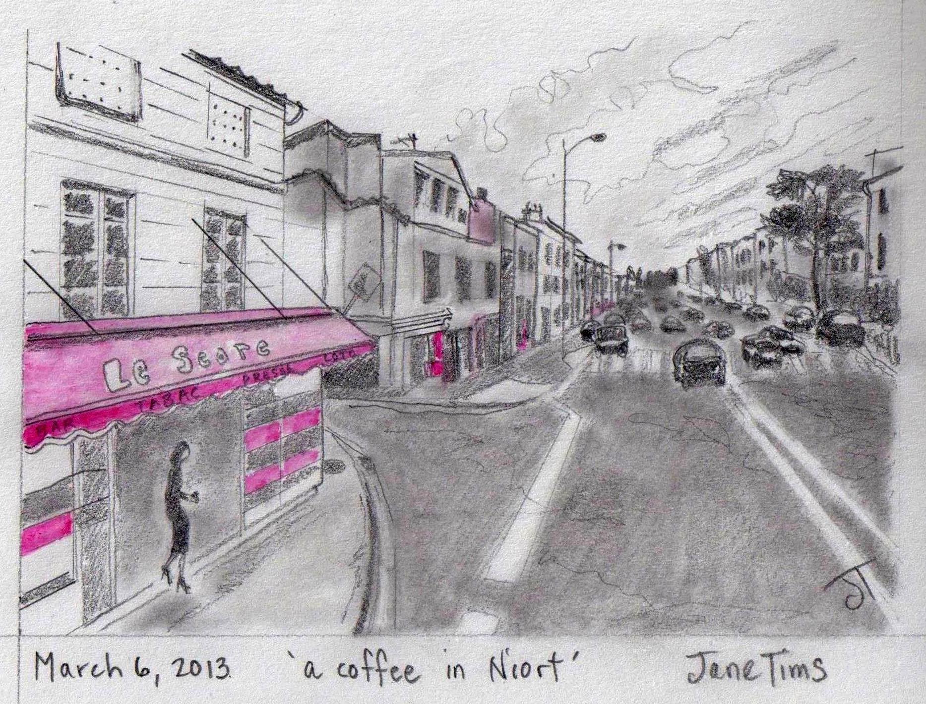
On March 6, I continued my virtual biking through the city of Niort.
~

map showing distance travelled (map from Google Earth)
~
Niort is a city of older buildings, most 2 or 3 stories in height. There was lots of traffic but I remembered the sage driving advice … ‘go with the flow’…
~

buildings and traffic on l’Avenue de Limoges (image from Street View)
~
There were some interesting architectural surprises…
~

narrow building along ramp from highway to city street (image from Street View)
~
And beautiful flower gardens…
~

flower garden along ramp (image from Street View)
~
I encountered a mystery as I biked through the streets. Along the Avenue de Limoges, I saw a man in a uniform and his scooter…
~

uniformed man and his scooter to the left (image from Street View)
~
But in the next Street View frame, he had disappeared…
~

where did he go??? (note the palm tree in the yard) (image from Street View)
~
I think he must have stepped out to talk to the odd-looking ‘Street View camera car’ and then scooted off before the camera commenced its photography!!
~
Log Book: March 6, 2013
Area travelled: ‘in the city of Niort’
Distance: 30 minutes 3.0 km
Notes: I saw an apartment for sale on la Rue de la Rochelle and thought hmmmmm………
~

a place to buy (image from Street View)
~
Distance Travelled Feb 21 to Mar 6: 30.0 km (300 minutes of stationary biking)
Total Distance Travelled Jan 30 to Mar 6 : 61.8 km (625 minutes of stationary biking)
~
Best view: a lady buying coffee at a shop in Niort
~
Do you think I should have bought that apartment on la Rue de la Rochelle ???
~
Copyright Jane Tims 2013
a dragon on a wall – biking log book Day #9
I am continuing with the third phase of my virtual bike trip through central France. For Phase 3 of my trip, I am biking in 12 days from Exireuil to Magné just west of Niort.
~
Log Book: March 5, 2013
Area travelled: from ‘outskirts of Niort’ to ‘edge of Niort’
Distance: 30 minutes 3.0 km
Notes: only three more days to go on my virtual trip to Magné!
~
Distance Travelled Feb 21 to Mar 5: 27.0 km (270 minutes of stationary biking)
Total Distance Travelled Jan 30 to Mar 5 : 58.8 km (595 minutes of stationary biking)
~

map showing distance travelled (map from Google Earth)
~
On March 5, I finally made it off the train track and entered the city of Niort. It is a neat city with lots of one-way streets, enclosed yards and lots of greenery.
~
As in many cities, there were lots of interesting sights to see. I grabbed a bottle of Perrier to drink as a Perrier truck passed by…
~

Perrier truck (image from Street View)
~
I saw a school yard where the children seem to have hung up their artwork to dry on a line between two trees…
~

school yard and art hanging on the line (image from Street View)
~
I was able to visit yet another Pâtisserie… yummmmm!
~

patisserie (image from Street View)
~
I also saw what looked like remarkable graffiti on one fence, a rendition of a dragon…
~

dragon wall (image from Street View)
~
~
wall dragon
~
he peers from under
a fall of vines
growls at the passing cars
ignore him
fueled with their own
bellyfuls
of fossil fire
~
~

closeup of dragon wall (image from Street View)
~
Best View: a charming enclosed yard in Niort
~

~
Do you think the homeowners had the dragon painted on the wall, or was it ‘noncommissioned’?
~
Copyright Jane Tims 2013
a name for a novel – biking log book Day #8
Biking, biking, biking!!! I am still working on Phase 3 of my virtual bike trip through central France. For Phase 3 of my trip, I am biking in 12 days from Exireuil to Magné just west of Niort.
~
On March 4, for the second biking day in a row, my bike trip was along a railroad track!

~
I had lots of time to think, so I thought about the title of the novel I have been working on. For those of you who do not know about my novel, it is about a woman who sets out to save an abandoned church.
~
On Day #6 of my virtual bike trip, in Chavagné on the Route de la Mothe, I saw an old church…
~

~
At first, I thought the roof had been removed from this church, leaving it open to the elements. On closer look, there is a low-pitch roof in place (note the rafters and clay tiles)…
~

old church on the Route de la Mothe
~
However, the image reminded me of another abandoned church I had read about in my research for my book:
‘The Old Church of St. Nidan, in Llanidan, North Wales, is a ruin. All that is left of this medieval church are the four stone walls of the western wing and its central arcade. The nineteenth century clergyman Harry Longueville Jones wrote that the church had succumbed to a ‘melancholy fate’. In 1850, church historian Sir Stephen Glynne wrote that most of the church is ‘open to the skies.’ (partly quoted from Wikipedia, ‘Old Church of St Nidan, Llanidan’, January, 2013).
I think I will use the phrase ‘Open to the Skies’ as the title for my novel. It refers to the fate of an abandoned church, but also to the ability of people to open themselves up to possibilities. I think it is perfect for my book.
~
Log Book: March 4, 2013
Area travelled: from ‘field south of Trévins-le-Bas’ to ‘outskirts of Niort’
Distance: 30 minutes 3.0 km
Best view: no best views today; biking on the railroad is not inspiring
Notes: after this, I will be careful to plot my bike trip on roads rather than rails!!!!
~
Distance Travelled Feb 21 to Mar 4: 24.0 km (240 minutes of stationary biking)
Total Distance Travelled Jan 30 to Mar 4 : 55.8 km (565 minutes of stationary biking)
~
What do you think of the title ‘Open to the Skies’ for my book?
~
Copyright Jane Tims 2013
biking log book – Day #7 – a diamond in a tree!
I am still continuing on the third phase of my virtual bike trip through central France. For Phase 3 of my trip, I am biking in 12 days from Exireuil to Magné just west of Niort. As of March 1st, I was over half way there!
~
Unfortunately, all of the trip of March 1 was along a railroad track!

It was bumpy and boring. Big fields, no houses, few trees to give me shade and no Street View images.

Day 7 map showing side trip (marked A to B) (map from Google Earth)
So I did what all virtual bikers are able to do. I ‘flew’ a little to the south and followed a route from Villeneuve to Le Pont d’Homme, along two country roads: Rue du Moulin and Rue du Marteau.

Rue du Moulin (image from Street View)
~
These were hilly, winding country roads, bounded by small fields and interesting fences.
~
Log Book: March 1, 2013
Area travelled: from ‘east of Chavagné’ to ‘field south of Trévins-le-Bas’
Distance: 30 minutes 3.0 km
Best view: vine-covered gate on Rue du Marteau
Notes: I have discovered that most yellow fields in this part of France are Colza (Brassica rapa), a relative of Turnip, grown for oil.
~

~
I saw a runner in the Rue du Marteau…
~

~
We had a brief conversation (please excuse my poor French!):
Jane: Bonjour! (Hello!)
Runner: Lentement, Madame, lentement! Tu manques tout le paysage! (Slowly, Madame, slowly! You are missing all the countryside!)
Jane (able to see the future): Tu dois courir plus vites! Il y a un diamant dans l’arbre tout droite! (You’ve got to run faster! There’s a diamond in a tree straight ahead!)
~

diamond in tree on Rue du Marteau (look closely – probably a drop of water on the Street View camera!) (image from Street View)
~
Distance Travelled Feb 21 to Mar 1: 21.0 km (210 minutes of stationary biking)
Total Distance Travelled Jan 30 to Mar 1 : 52.8 km (535 minutes of stationary biking)
~
Do you think diamonds grow on trees in France??
~
Copyright Jane Tims 2013
biking log book – Day #6 – biking on a train track
Welcome to the continuation of the third phase of my virtual bike trip through central France. For Phase 3 of my trip, I am biking in 12 days from Exireuil to Magné just west of Niort. As of February 28, I was half way there!
~
Most of my virtual biking trip on February 28 was through the town of Chavagné. I am still very motivated by my virtual travels through France. In February, I have biked on my stationary cycle 17 days out of 28. To compare, in January, I only biked twice.
~

Day 6 map showing route followed (map from Google Earth)
~

Town of Chavagne, showing stone houses and walls (image from Street View)
~
Log Book: February 28, 2013
Area travelled: from ‘east of Chavagné’ to
Distance: 30 minutes 3.0 km
Best view: house with red shutters in Chavagné
Notes: the properties very neat and bounded from the road by stone walls
~

~
Imagine my surprise when I discovered part of my planned travel route diverges onto a train track! From n-n-ow-ow on-n-n-n the route will b-b-b-be b-b-b-b-bumpy-py-py-py…
~
when I plotted my path, I didn’t realise that part of the travel distance would be on a train track!!!! (image from Street View)
~
~
Distance Travelled Feb 21 to Feb 28 : 18.0 km (180 minutes of stationary biking)
Total Distance Travelled Jan 30 to Feb 28 : 49.8 km (505 minutes of stationary biking)
~
Have you ever biked or walked on a train track????
~
Copyright Jane Tims 2013
biking log book – Day #5 – gardens, bridges and highways
This is the continuation of the third phase of my virtual bike trip through central France. For Phase 3, I plan to bike in 12 days from Exireuil to Magné just west of Niort.
~
My February 26 bike ride took me from La Crèche to Chavagné.
~

Day 5 map showing route followed (map from Google Earth)
~
First, I biked along a country stretch of road lined with stone walls, orchards and gardens…
~

walls and gardens along Route de Tressauve (image from Street View)
~
I travelled beneath an impressive stone arch train bridge…
~

~
Then I biked for about 15 minutes along the A 10 highway…
~

along the A 10 … all the lines painted on the road are white … the yellow line is from Street View and shows the path of the camera car … the red line is my bike path
~
Log Book: February 26, 2013
Area travelled: from ‘La Crèche’ to ‘east of Chavagné’
Distance: 30 minutes 3.0 km
Best view: stone arch train bridge
Notes: The A 10 highway was so boring, but it made me pedal faster! In France, highways are painted with solid and dotted white lines. In Canada, the painted line between opposing directions of traffic is yellow. I guess it was not surprising that I strayed to the left side of the road on the highway!
~
Distance Travelled Feb 21 to Feb 26 : 15.0 km (150 minutes of stationary biking)
Total Distance Travelled Jan 30 to Feb 26 : 46.8 km (475 minutes of stationary biking)
~
How are the highways marked where you live?
~
Copyright Jane Tims 2013


