Archive for the ‘making maps, GIMP’ Category
next book in the Meniscus Series: the maps
One day in 2016, when I was first deciding how I would put the Meniscus books together, I puzzled over how I would make the maps I wanted to include in each book.
~
At first, I wanted to produce hand-drawn maps, re-drawing each map and making erasures and changes as each book advanced the story. Every book would need adjustments to the map and a new dotted ‘trail’ to show the path my characters followed.
~
The idea of hand-drawn maps ended when I found out how boring it would be to draw the 300 trees in the Themble Wood.
~
I didn’t know a thing about digital image creation. So I went on line and found GIMP, the GNU Image Manipulation Program … what a great place to learn the craft of making maps! https://www.gimp.org/
~
Now, four years later, I have not needed to move from GIMP. First I learned how to make trees …. in quantity and with shadows! There are three kinds of tree on Meniscus: grammid, yarnel and banyan:


~
Once I had trees all across my maps, I added the geological features I knew were essential for world-building: in the first book of the Meniscus Series I wanted (left to right) a gully, a line of huge burrows, a fault (and high associated cliff), a hill and a large water feature (a churn).

~
I also knew I wanted towns and cities, as well as the roads between them:

~
I also add trails to show where my characters travel during the book.
~
GIMP has met every need. And my maps can change with time; all I do is turn various layers on and off, creating new combinations of features and paths.
~
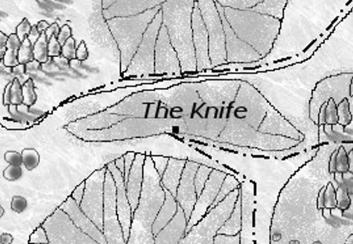
Here is one of the maps for my next book Meniscus: The Knife:

The dotted line (– . — . — . –) shows Tagret’s path as she goes on her quest to rescue Rist.
~
All my best,
staying home and in my two-family bubble,
Jane


