Posts Tagged ‘water’
in the shelter of the covered bridge – Baker Brook #2
Of the 60 covered bridges in New Brunswick, most are in the southern part of the province. Last week we went to see the three remaining covered bridges in Madawaska County in the north-western part of the province.
~
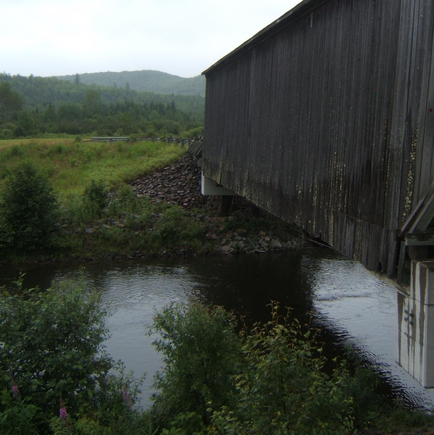
One of these was Baker Brook #2. It crosses the Baker Brook west of Edmunston and is no longer in service. The bridge has been protected in a small park with a parking area. Bird boxes, flags and hanging flower baskets show there is local stewardship of the bridge.
~

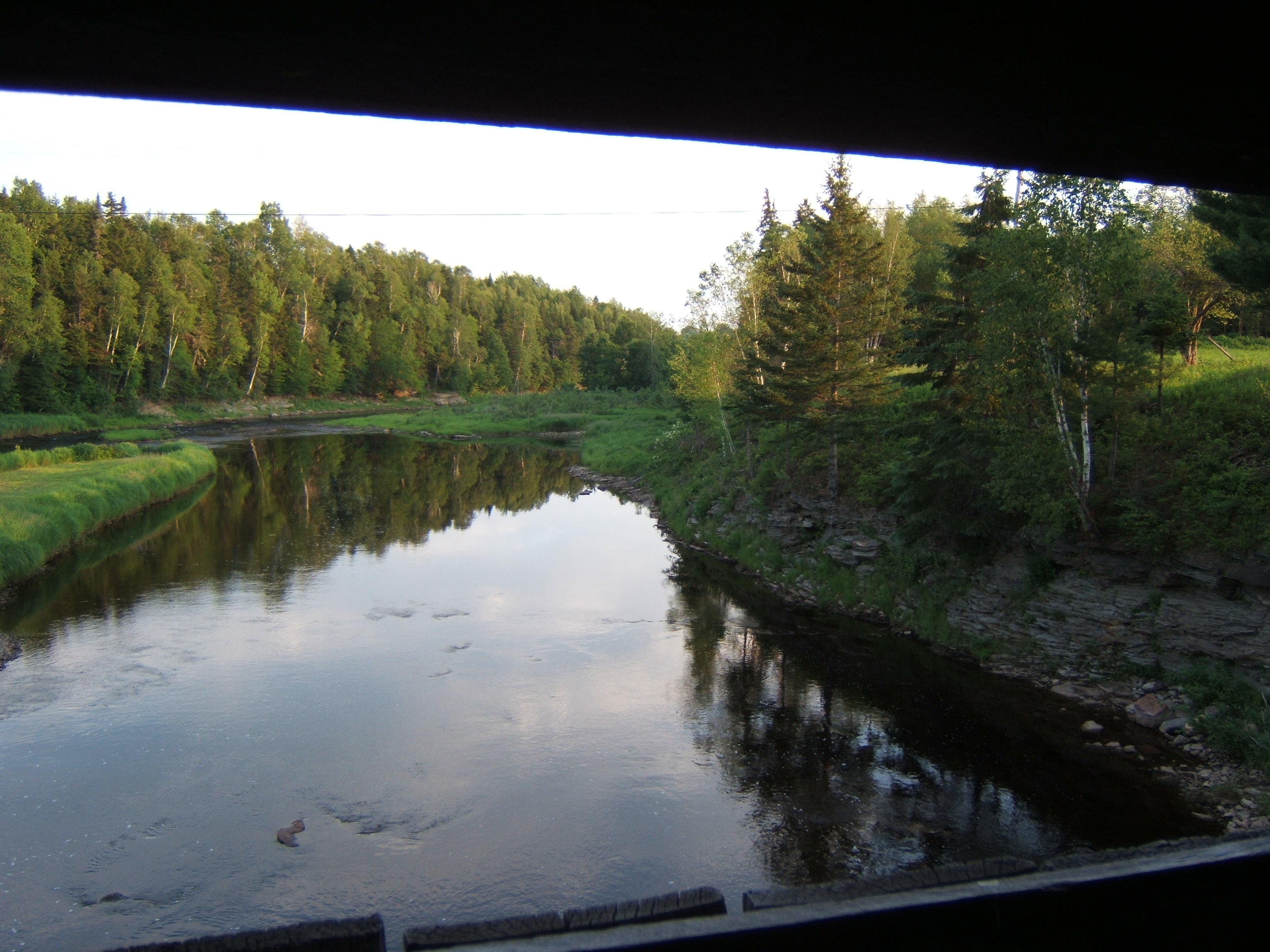
Baker Brook #2 in Madawaska County, New Brunswick
~
The Baker Brook #2 bridge was the essence of quiet. As we entered the bridge, the only sound was the patter of rain and the trickle of water under the bridge.
~
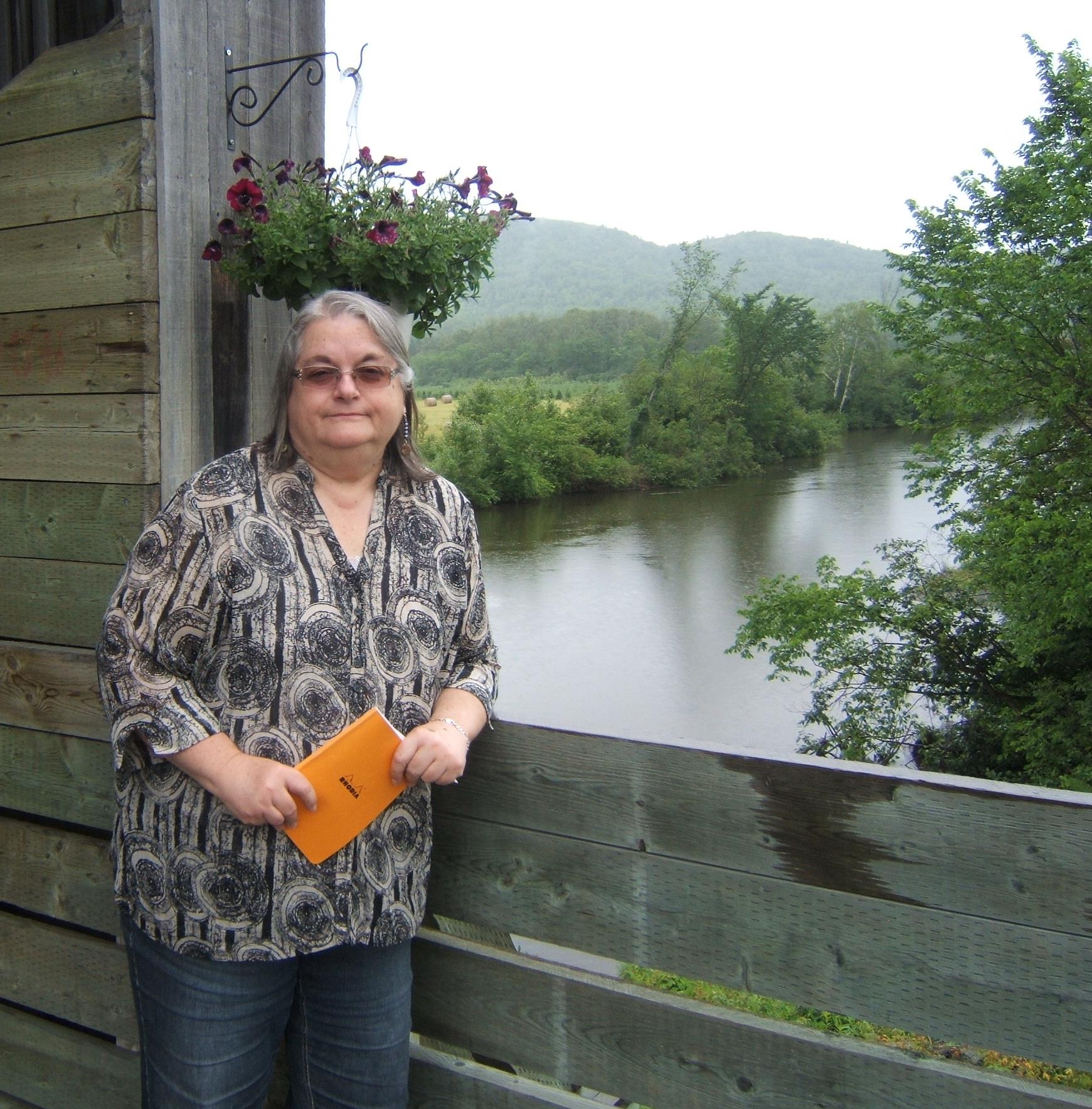
I don’t get many photos of myself, but this is a good one – I am ready to take notes on the plants and animals I see in the Baker Brook # 2 covered bridge … these notes and my photos and memories become the basis for future poems
~
The bridge is set against a backdrop of tranquil hills and fields. A deer watched us from a hayfield at the north end of the bridge. A white-throated sparrow called once and a crow made a few comments from the top of a round bale of hay. Otherwise, we were alone.
~

~
I love the way the lichens have colonized the bridge and follow the boards, like rain, in lines down the outer walls.
~
~
Some visitor had left a small collection next to the outer wall of the bridge. Three rocks and a broken bit of glass…
~

~
Copyright Jane Tims 2015
in the shelter of the covered bridge – Milkish Inlet
We continue to drive around to look at covered bridges in New Brunswick. Eventually, I would like to write a series of poems about the plants and animals living in or around a covered bridge.
~
Last Saturday we visited a covered bridge on the Kingston Peninsula at Bayswater. The Milkish Inlet #1 (Bayswater Covered Bridge) was built in 1920. At 66.5 meters, it is the longest covered bridge in Kings County, New Brunswick. It is by far the busiest bridge I have seen – it was hard to amble through the bridge since there always seemed to be a car going through and a car waiting.
~

~
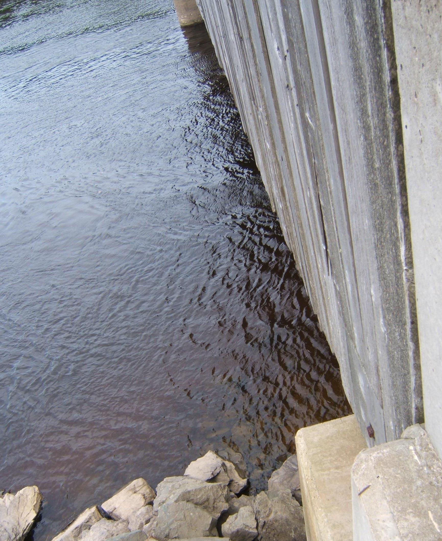
The bridge crosses the Milkish Inlet at Bayswater. The water here is under the influence of the tides.
~
~
Swimmers, wanting to dive from the height of the bridge, have removed a section of the bridge’s wall boards.
~

~
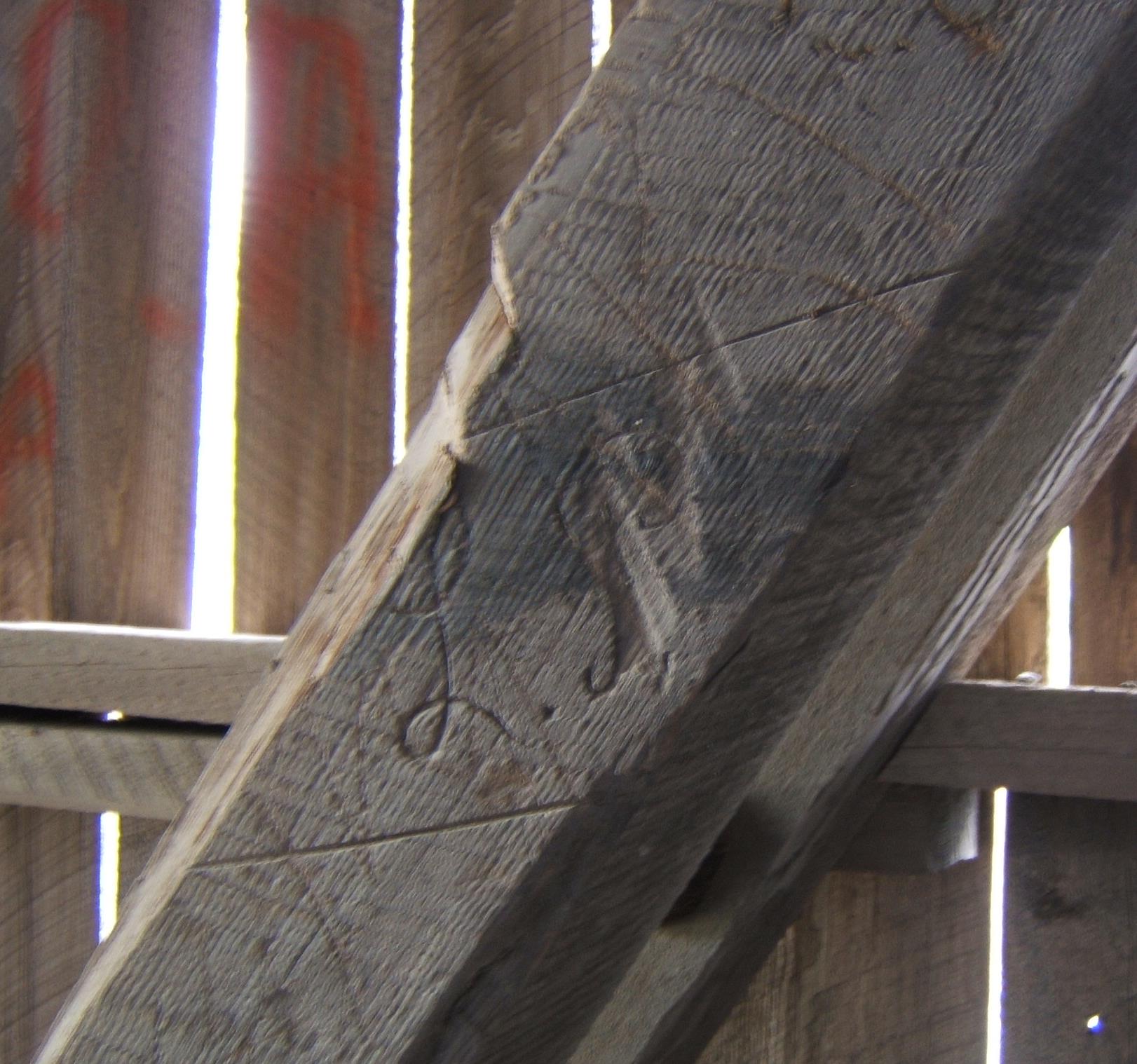
There are many carvings inside the bridge, including this rather charming L. P.
~
~
Another covered bridge once crossed Milkish Creek, but it has been replaced by a causeway.
~
I wondered about the name of the Inlet. The water is not ‘milkish’ in colour!
~
I have discovered the name is from a First Nations word meaning ‘the place where food is dried’ (Source: http://coveredbridgevic.com/festival/Bridges.htm ).
~
Copyright 2015 Jane Tims
summer on the river
~
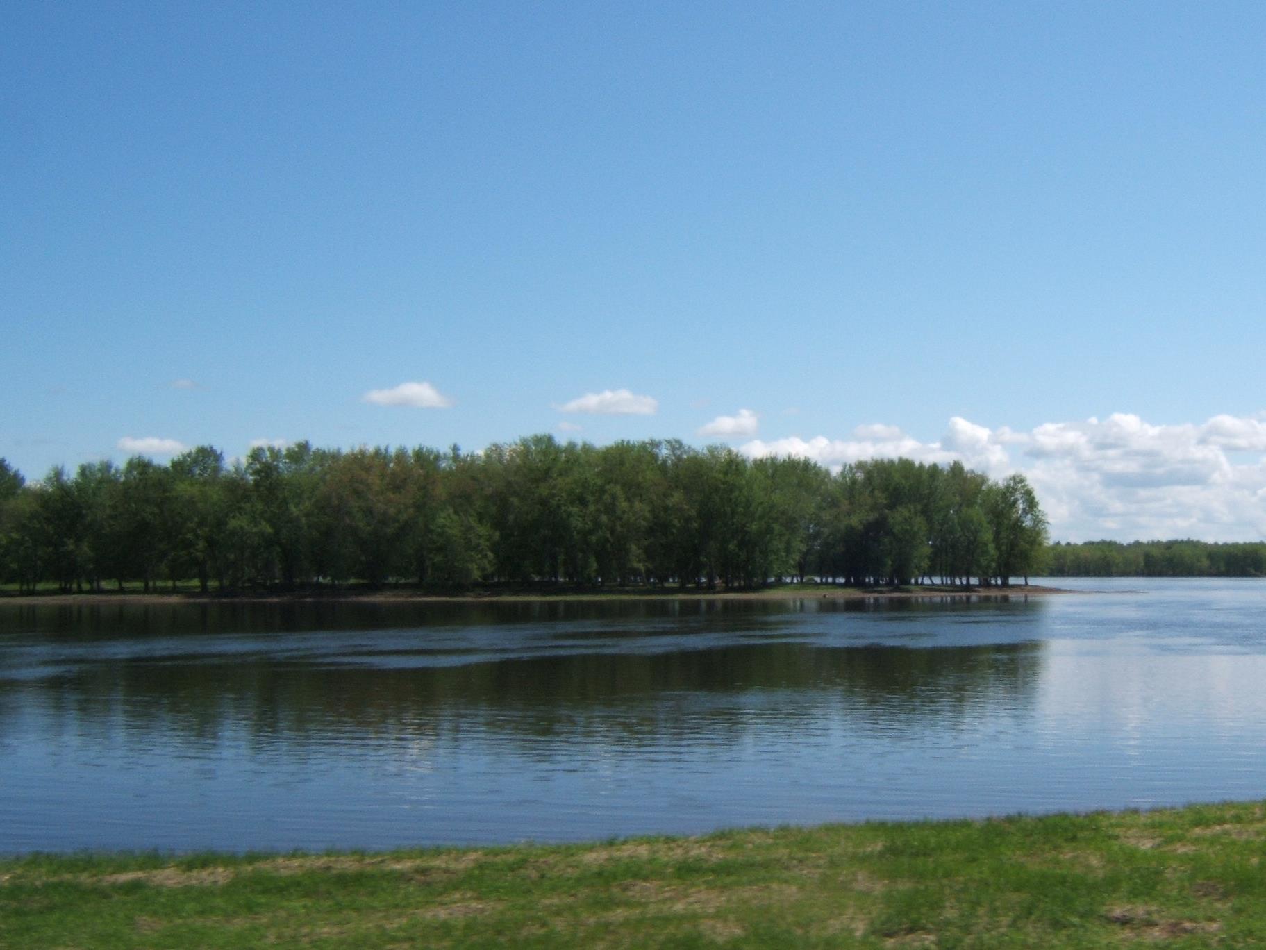
St. John River, south of Fredericton
~
drinks on the patio
~
the setting spins
on the river
golden while the mayflies dance
with gilded wings
~
this is conversation!
a cold glass
singing ice
white wicker
umbrella shade
the hills
wistful beyond the gauze
of mayfly dancing
~
you are dazzled by the play of sun
and words on water
your voice
your smile
who cares what you are saying
as long as the lines are long
and the tone is light
and the mayflies stir
the air above the river
~
I listen
with a nod of my head
a flutter of my hand
the corners of my mouth lift
to smile
~
my ears and eyes
have better things to do
~
the sunlight slides on cobwebs
spun across the river
our voices slur
while the mayflies dance
the rise and fall
of their glass bodies
and your laughter
~
liquid on water
~
~

St. John River, south of Fredericton
~
Published as ‘drinks on the patio’, Pottersfield Portfolio 17 (3), Spring 1997.
Copyright 2015 Jane Tims
in the shelter of the covered bridge – drip line

clear and amber water of the South Oromocto River
~
~
Drip line
~
slices river into upstream
and down, opaque and transparent,
dead calm and riffle, dark and light.
As water and air are cut
by meniscus, erratic in rain,
as her voice slips past present tense,
concentric rings expand. Three trout
~
and gravels, perpendicular
rocks, embedded in amber. Rain
disconnects today from yesterday,
slips from the roof of the covered
bridge, slides from edge, corrugated
steel, sheet of rain, crosses river
linear, liminal, shore to shore.
~
~
Copyright 2015 Jane Tims
~
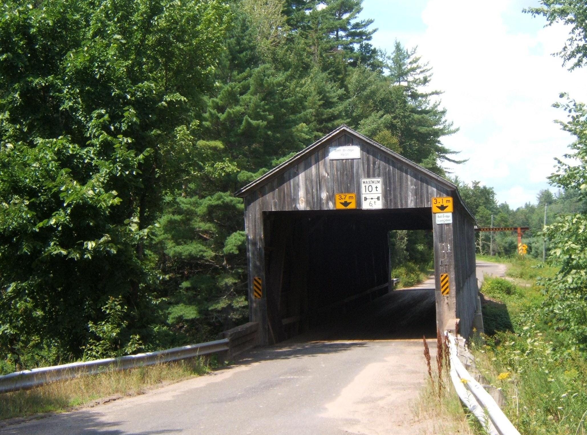
Bell Bridge, South Branch Oromocto River
harvesting colour – Sea Lavender
~

Sea Lavender, picked long ago and woven into a wreath
~
~
Sea Lavender
Limonium Nashii Small.
1.
bunch of lavender, dry
picked at the edge
of the sea
2.
at high tide, overcome
by salt water, linear
leaves buffeted
as rags, tattered purple papers
echoed in oil-slick
mirrors of foam
3.
on-shore breeze, stiff
sprays of Sea Lavender
tremble
~
~
Published as ‘Sea Lavender’, Canadian Stories 17 (99),October/November 2014
Copyright 2014 Jane Tims

dry Sea Lavender
crossing the brook
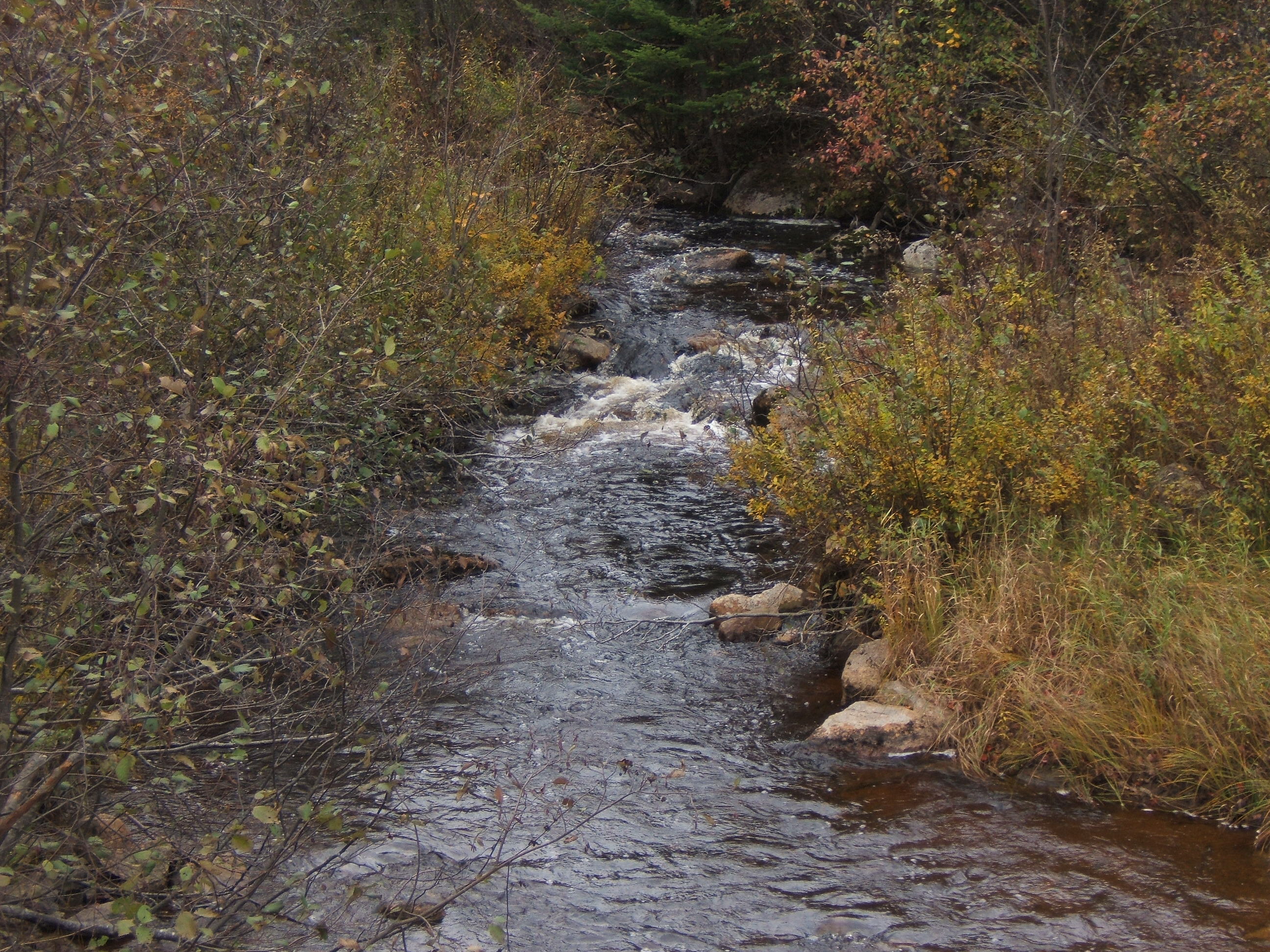
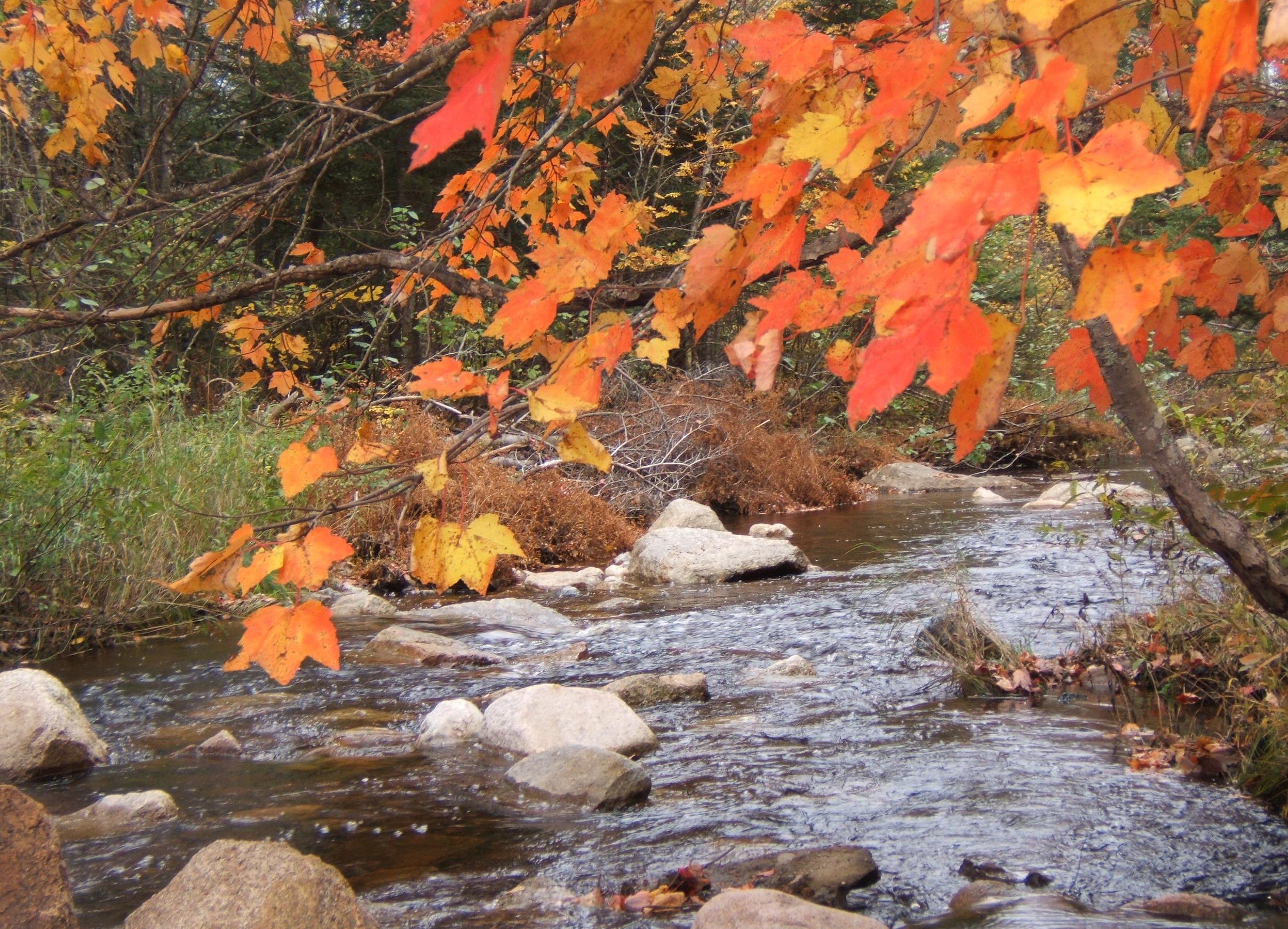
Of all kinds of waterways, I certainly love a brook the best.
~
~
When I was a child, I spent many summer hours playing in the brook at my mother’s ‘old home place’. The brook was in a small wooded valley between farms. The woods around the brook were always cool and shady, especially on a hot summer day.
~
Building stone causeways in the brook was one of my favorite pastimes. I would find flat stones and place them like stepping stones. Then, once the stones were in place, I would plant them with mosses.
~
I haven’t returned to the brook for many years, but I like to think you could still find the grey and green remnants of my causeways at intervals along the brook!
~
a brook in south-west New Brunswick with its own stepping stones
~
construction of moss and stone
~
in the valley between farms
a brook needs crossing
a freshet-proof ford
lattice-work built
of slate, grey stepping
stones, packed and decked with
moss, hydrophilic flourish
~
~
© Jane Tims 2014
aromatic spring
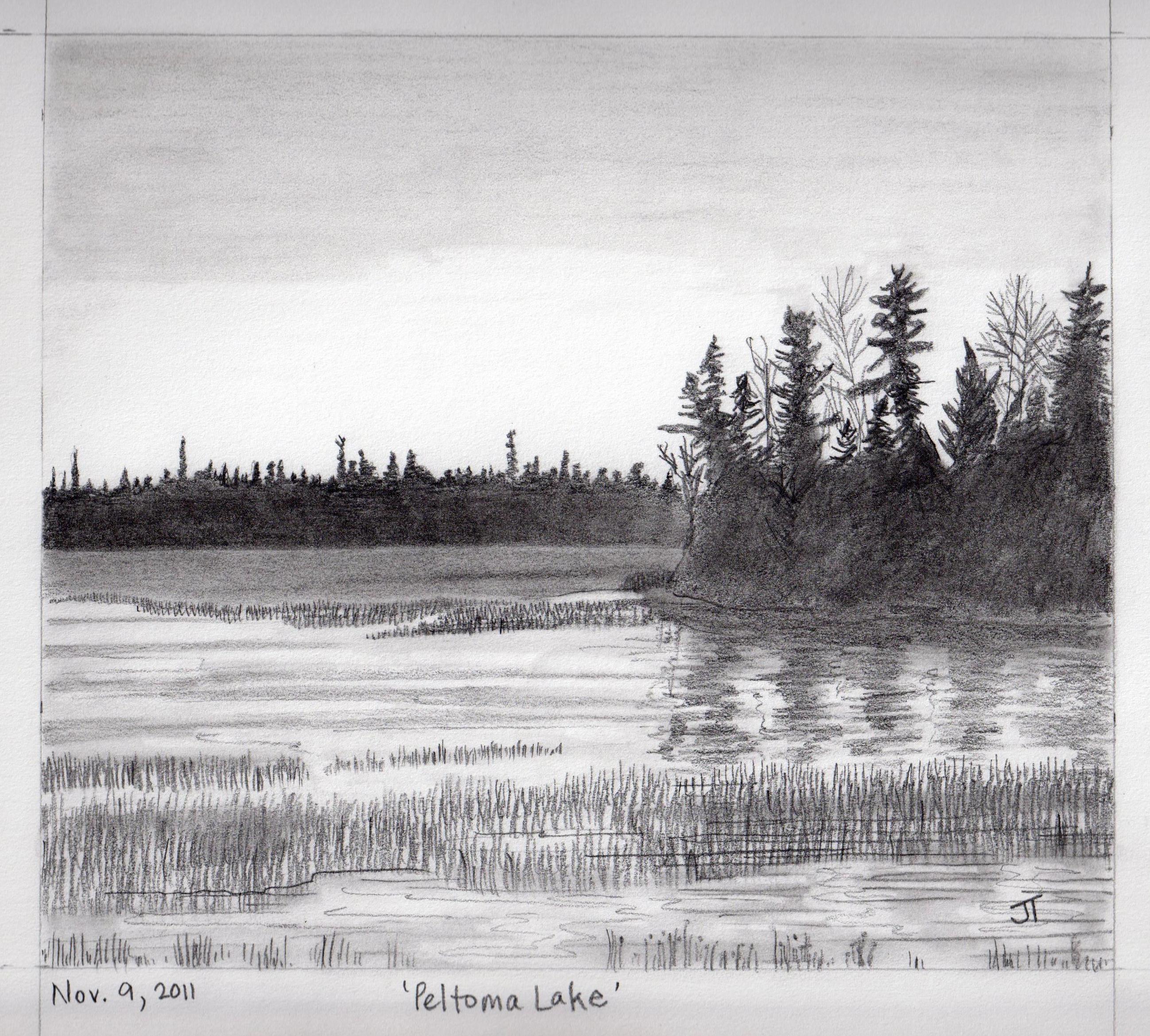
November 9, 2011 ‘Peltoma Lake’ Jane Tims
~
meadow aromatic
~
ozone lightning, late
waters cede, shoots
of cattail merge
end of day, end of June
fireflies, mosquito nights
~
lake-land meadow seeps
wetland meets nostril
marsh musk percolates
half sour, half sweet
methane ooze, decay
~
damp fiddleheads unfurl
bird beaks simmer
in duckweed soup
skin of salamander, frog
steeplebush, meadowsweet
~
angels crave human years, allow
their pores release, scent imitates
reek of sweat, of work
tears mingle with perfume
aftershave and powder
~
~
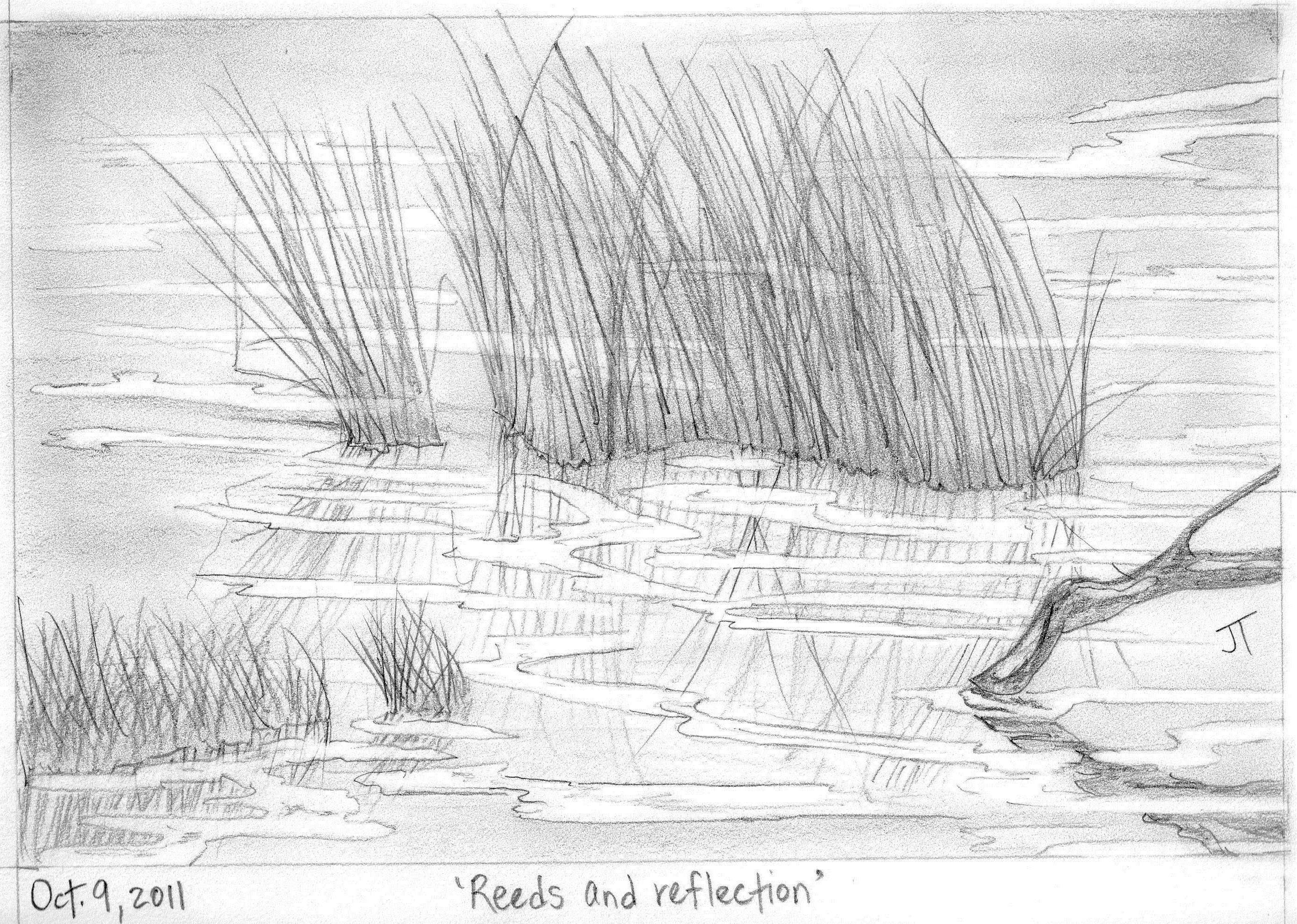
Oct. 9, 2011 ‘Reeds and reflection’ Jane Tims
~
Copyright 2014 Jane Tims
islands and gorges (day 13 and 14)
My virtual bike ride continues with a ride from Blackland to Belledune …
~
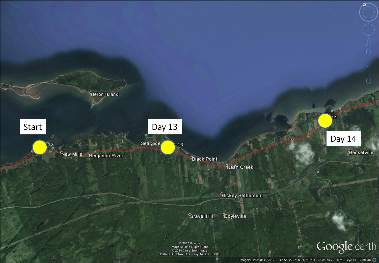
distance travelled (map from Google Earth)
~
8-13 February 5, 2014 20 minutes 3.0 km (Blackland to Sea Side)
8-14 February 8, 2014 35 minutes 7.0 km (Sea Side to west of Belledune)
~
As I have said, I have often visited the area I am ‘biking’ through as part of my past work. In the 1970s and 1980s, we visited many sites in the area to measure the levels of air pollutants in local lichens. We collected lichens of the genus Cladina (reindeer lichens) since they absorb all of their nutrition from the air and air pollutants accumulate in their tissues …
~

species of the lichen ‘Cladina’ grow in tufts on high elevation, rocky areas and in low-lying bogs
~
One of our sampling locations was Heron Island, an island 3.5 km long, lying just off the coast …
~
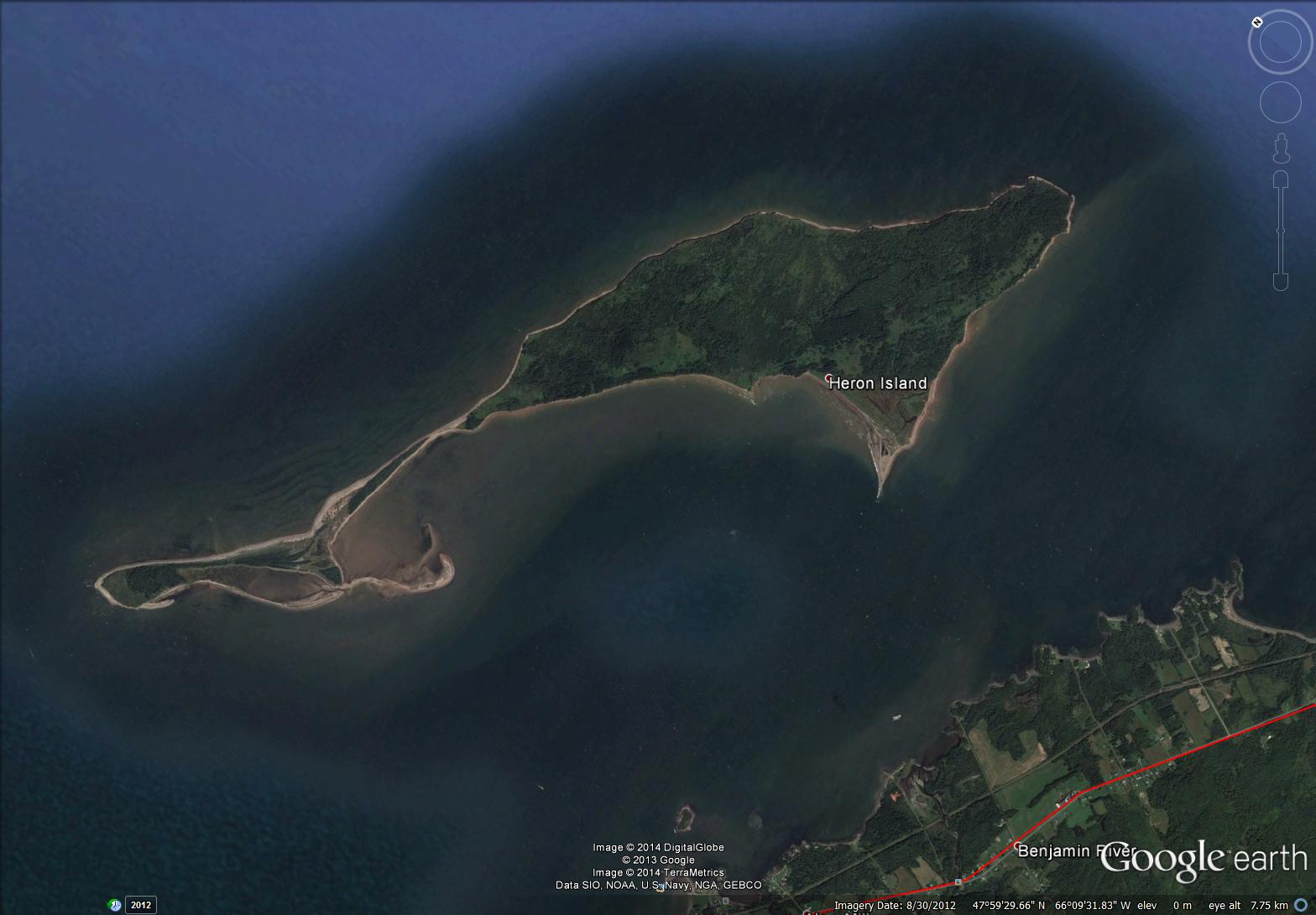
satellite image of Heron Island (map from Google Earth)
~
I have been on the island several times … it was a good place to collect lichens since there are not many local emissions to contaminate the sample (no cars, dusty roads, and so on).
~
The island is a landscape of low-lying salt marsh and beach as well as forested and grown-over old-field areas. On the boat on the way to the island, I remember watching scallop fishermen working on their barges in the shallow waters. Although people have lived on the island as recently as 1940, the island is now protected and co-managed by the provincial government and First Nations peoples who have traditionally used the island as a summer residence.
~
Today’s painting is of a rather stormy day along the bay shore just east of Heron Island …
~

February 11, 2014 ‘Baie des Chaleurs’ Jane Tims
~
Also in the area where I was ‘biking’ is the very hilly landscape of the Jacquet River. The high elevation plateau has been deeply eroded by the Jacquet River – the river and its tributaries flow through deep gorges. The 26,000 hectare ‘Jacquet River Gorge’ is one of New Brunswick’s Protected Natural Areas. Reaching the locations of our lichen collections took us deep into the area and I remember how steep the hills (and the roads) were as we went to our collection sites.
~

February 17, 2014 ‘lower Jacquet River’ Jane Tims
~
Copyright 2014 Jane Tims
a moment of beautiful – ice windows on woodland pools
the space: pools of water in the Grey Woods
the beautiful: patterns in the thin ice
~
While we wait for a lasting snow in New Brunswick, ice defines the season. On every pool of standing water, ice-windows have formed. I love the patterns these make against the amber-colored water! These are photos of ice windows taken last spring, after the snow had gone.


Copyright 2013 Jane Tims
a covered bridge – the Burpee Bridge, Queens County, New Brunswick
Last weekend, driving home from Miramichi, we followed the Grand Lake Road. It is mostly unpopulated, devoted to tree plantations and a preservation site for mature white pine.
~
Along the way, we stopped in at the Burpee Covered Bridge on the Gaspereau River near Gaspereau Forks, Queens County. This bridge is listed as Gaspereau River #2 in the April 1992 pamphlet ’Covered Bridges in New Brunswick’ (no author indicated). This means there was once another covered bridge crossing the Gaspereau River but it is now gone.
~

~
The Burpee Bridge was built in 1913. It is 167′ 9″ long with a span of 163′ 6″. The roadway width is 14′ 8″, and the load limit is 8 t. The maximum clearance is 3.9 meters.
The bridge is on a main road and the grounds on both sides of the river are nicely kept and mowed. The bridge was named for the family living nearby in 1913.
Inside the bridge, there is a window, with a good view of the Gaspereau River, showing the exposed bedrock of the river banks.
~
~
The rafters of the bridge are populated with swallows and their nests. The swallows chirped at me and swooped in and out of the bridge while I was there.
~
I couldn’t find any carvings in the failing light, but the inside of the bridge is covered in graffiti.
~

~
A lot of fluorescent paint has been used and it would be interesting to shine a black light inside the bridge … no doubt it would glow with spooky color …
~

~
We didn’t visit this bridge in 1992 as part of our Covered Bridge Project for Canada’s 125th anniversary. I am sorry we didn’t do more bridges that year … some are now gone, and it is interesting to compare the information for those that have survived.
~
This year, on July 27, the community plans a celebration of the 100th anniversary of the Burpee Bridge. The bridge will be turned (temporarily) into a museum of photos and artifacts about the bridge and community. Keeping our covered bridges in the eye of the community helps to preserve their heritage and value. It also encourages sharing of the wonderful stories about the part these bridges have played in our communities and lives.
~
Copyright 2013 Jane Tims


