Posts Tagged ‘bridge’
celebration of a covered bridge
Do you love covered bridges?
Have you done any writing about the Patrick Owens Bridge or any other covered bridge?
On Saturday August 25, 2018 at 2:00 pm join us at the Rusagonis Covered Bridge Park to celebrate our Bridge.
- We will hear from Jeff Carr, MLA.
- Linda Cogswell will tell us a bit about the history of the bridge.
- I will be reading from my book ‘in the shelter of the covered bridge’ (Chapel Street Editions, 2017) and $10 from every sale of my book will be donated for the upkeep of the Park.
- Rose Burke will read a piece about the Upper Mills Bridge and cross-border travel in former years.
- Ian LeTourneau, Fredericton’s Cultural Laureate, will read his poem about the loss of the Bell Covered Bridge.
- We will also have an ‘open mic’ where you can join others in reading from your own work (about bridges or any other related theme).
We will have cake and lemonade as part of the afternoon. There will also be a BBQ, courtesy of MLA Jeff Carr! Everyone is welcome!
Let me know if you would like to read (in the comments or at timstims@nbnet.nb.ca).

All my best,
Jane
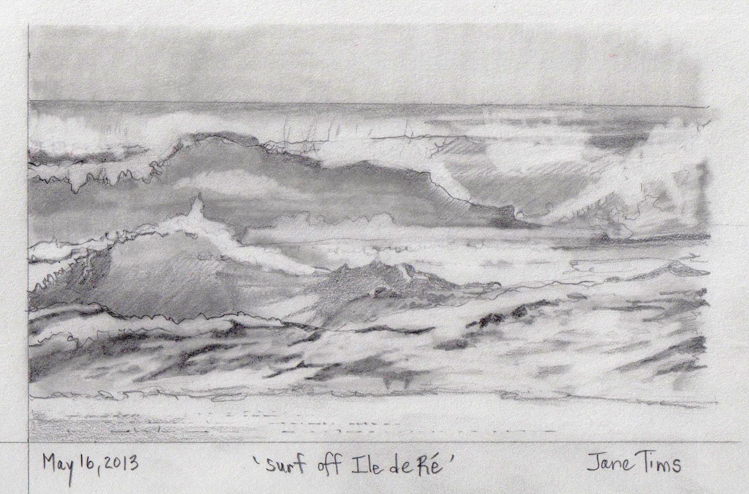
looking out to sea 6-4
~

view from Ile de Ré with the bridge in the distance (image from Street View)
~

~

map showing distance travelled (map from Google Earth)
~
I am enjoying my glimpse into the way of life on Ile de Ré. The houses include the now-familiar two-story dwellings on narrow streets. Most of the houses have painted shutters …
~

narrow street in Rivedoux-Plage (image from Street View)
~
I also see more modern houses tucked away behind fences and walls …
~

street on Ile de Ré (image from Street View)
~
Where the route runs along the ocean, there are pleasant walkways and marinas for boaters …
~

houses along Rivedoux-Plage (image from Street View)
~
There are lots of places to sit and watch the ocean. Some views overlook extensive oyster farms in the zone of the low tide …
~

~
A closer look at my route map shows the rectangular oyster-growing areas just off-shore …
~

~
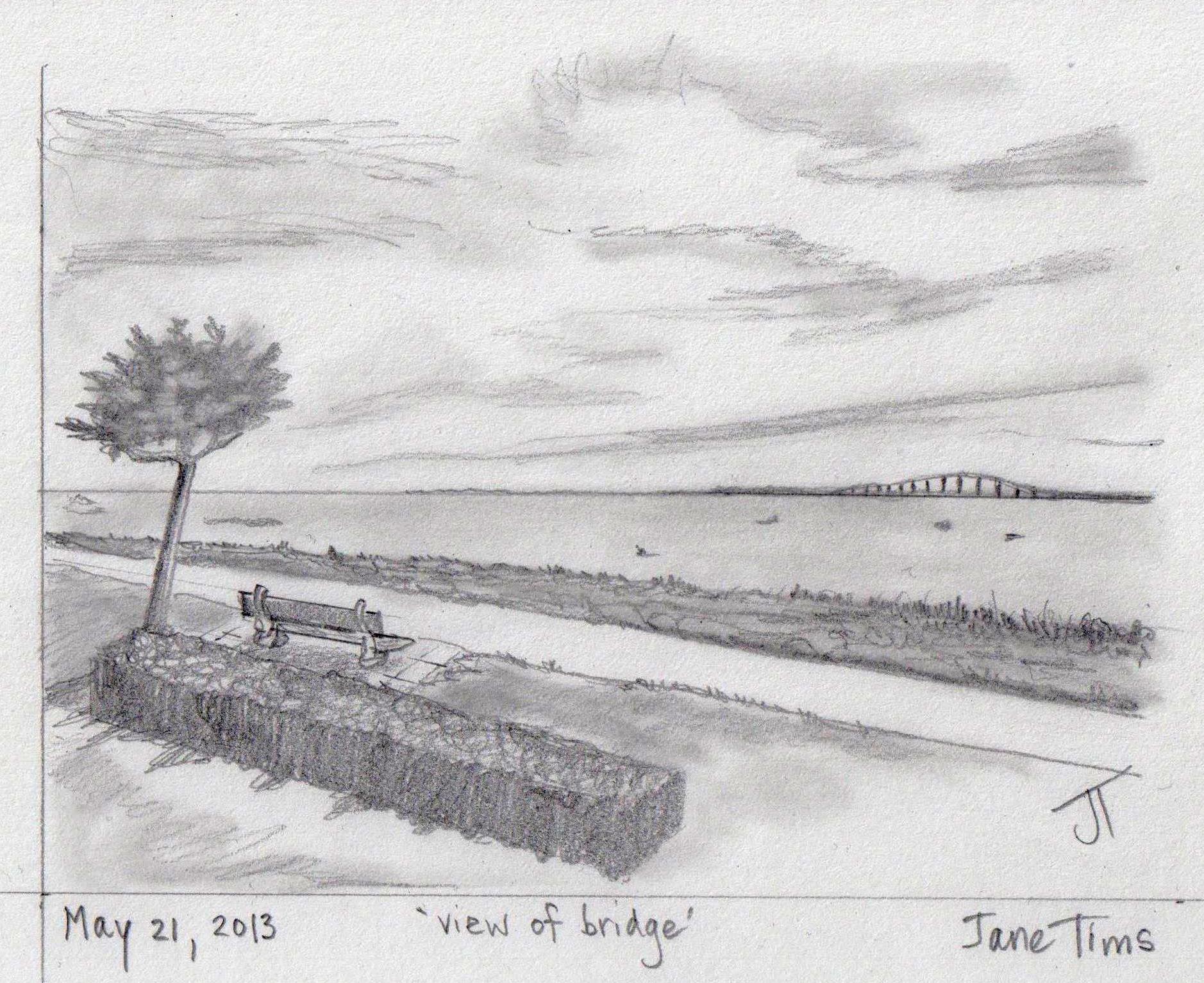
Best View: view across the Bay of Biscay toward the Ile de Ré Bridge – a place to sit and watch the ocean …
~
~
Copyright Jane Tims 2013
on the Bridge to Ile de Ré 6-2
~

on the bridge to Ile de Ré – lots of traffic (image from Street View)
~
~

map showing distance travelled (map from Google Earth)
~
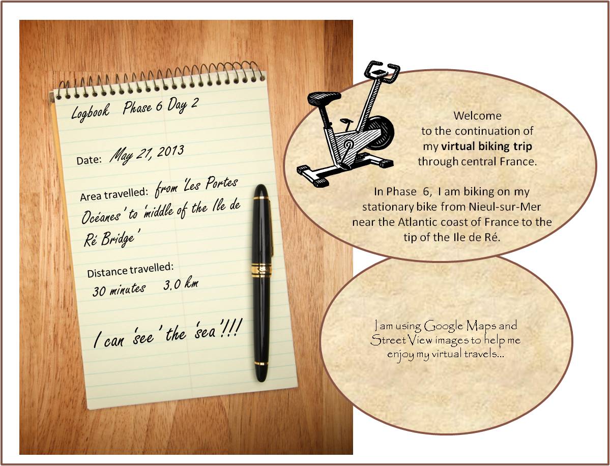
On May 21, I continued my virtual ‘bike ride’, so excited to finally see the big bridge to Ile de Ré. I began with another view of the ocean. It makes me happy to know I share the Atlantic Coast with this part of France – I am just the width of the ocean and a continent away!
~

another view of that Bay of Biscay (image from Street View)
~
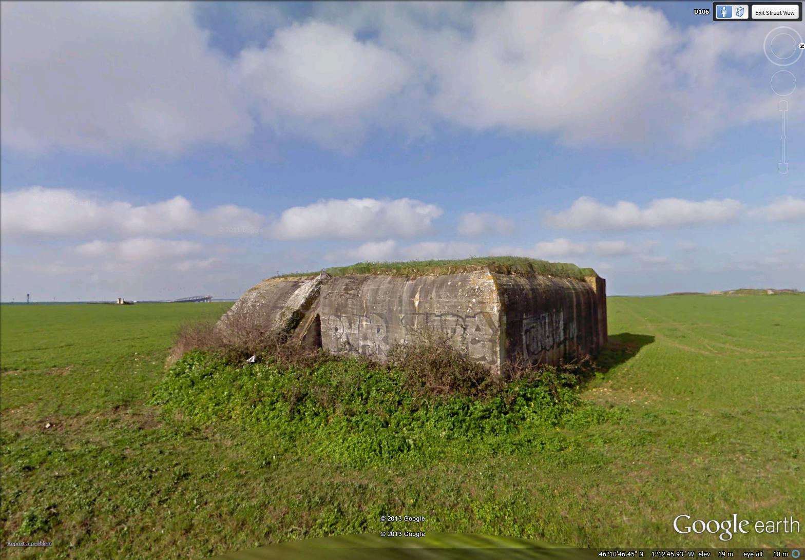
It was interesting to see World War II fortifications on this part of the coast. I usually associate these with northern France. I wouldn’t make much of a military strategist …
~
~
My first glimpse of the bridge was a small tilted structure on the horizon. This bridge reminds me of the big Confederation Bridge between New Brunswick and Prince Edward Island. The Confederation Bridge was opened in 1997 and is 13 km across. It replaces a ferry that ran there for years. The Ile de Ré Bridge is only about 3 km long, but the big curve in the structure makes it look magnificent. It was built in 1987 to replace a car ferry ( a bac) …
~

in the distance, at about 8 o’clock, you can see the Ile de Ré bridge, a small tilted bit of the horizon (image from Street View)
~
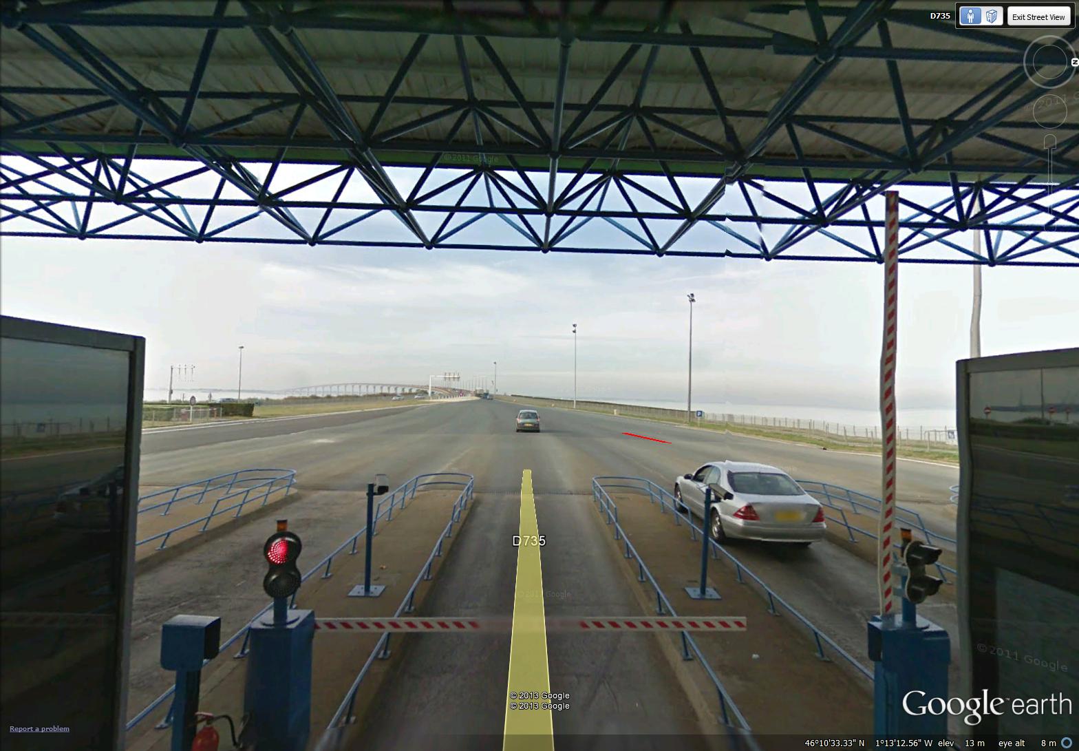
It was exciting to approach the bridge on my bike, particularly since I think bikes are free (a car paid a toll of 16 € in early 2012). The toll booth is called the Belvedere …
~

the toll booth for the Ile de Ré bridge (image from Street View)
~
I whizzed right through without paying (don’t know if I was free) …
~
~
Glad to see there were bike lanes on the bridge, coming and going …
~

bike lanes on the bridge (image from Street View)
~
I could also look back and see the cliffs along the coast of France …
~

looking back at the coast of continental France (image from Street View)
~
Best View: beaches of Ile de Ré …
~
~
Copyright Jane Tims 2013
keeping watch for dragons #5– river dragon
It’s like getting an old song stuck in your head… I am now seeing dragons… everywhere.
Yesturday, as I crossed the bridge on the way to my work, I saw the piers of the old bridge and their reflections in the water. To me they were the protruding plates along the spine of a river dragon, resting in the water.


Have you seen any dragons lately?
~
~
river dragon
~
eight bevelled piers
(only remains of the old bridge)
idle in still water, reflections rigid
plates along the spine of a spent dragon
lolling on his side
taking a break in the river
~
~
© Jane Tims 2012
a safe space in the bridge
This past week I have been in Halifax for a conference. A part of my morning commute was the slow moving traffic on the ‘old bridge’ across Halifax Harbour, the Angus L. Macdonald Bridge. The second day, I was more familiar with the traffic and the correct lane to be in, so I had a chance to experience the architecture and some of the wild life of the bridge (by this I do not mean that the commuters are holding wild parties).
The Angus L. Macdonald is an amazing structure, built the year I was born and opened in 1955. It is a long-span suspension bridge, supported by cables between two vertical towers. The bridge is 1.3 km long, with a supported length of 762.1 meters.
The bridge is usable by pedestrians and cyclists. Because of its reputation as a suicide bridge, it is equipped with various barriers to potential suicides, including high inward-facing bars on the pedway and nets suspended in the open area between the traffic deck and the pedway.
In these areas, hordes of starlings (Stumus vulgaris) gather, creating a din and an occasional cloud of startled starlings. Starlings are known for their synchronized group flights – the birds move as one in a shifting horde of birds. To hear the birds, I had my car windows open, but I quickly rolled them up since the birds were flowing very near to my car!
Starlings are an invasive species, introduced by Eugene Schieffelin to Central Park in 1890 as part of a project of the American Acclimatization Society. Their goal was to introduce all the birds mentioned in Shakespeare’s writings into North America. All of the birds I saw in the bridge are descendants of the 60 to 100 birds released in 1890!
A group of starlings is known as a ‘murmuration’.
For those of you familiar with the excellent series of made-for-TV Jesse Stone movies (starring Tom Selleck), The Angus L. Macdonald Bridge is the bridge featured in the movies (although the setting for the movie is a small town in Massachusetts).
~
morning, Angus L. Macdonald Bridge
~
traffic huddles and a thousand Shakespearian
starlings squabble one another
yellow beaks and feathers packed
soft slate bodies rolled into the safety
of the suicide net and pedway bars
porous barriers: a cyclist whips by
and starlings sift through wire
a mumuration between orange
cables and green girders
impossible way, red and blue
pulse of bridge security
weaves the path materialized
within three tangled
lanes of traffic
~
© Jane Tims 2011

a bridge for the soul
In eleventh century Sweden, rune stones were often raised by landowners as a memorial of their accomplishments.
Jarlebanke was a landowner and a local magnate who lived in Uppland, Sweden during the second half of the eleventh century. He took pains to ensure he would be remembered, and six stones survive of the many he ordered to be carved.
Four of the surviving stones stand at the ends of the Täby bru. The Täby bru is a ‘bridge’ or causeway marked with two rune stones at each end.
One of these stones (U127) was used in the 17th century as the threshold of the church in Täby; it now stands to the side of the church door. The inscription (in runes) says: Iarlabanki let ræisa stæina Þessa at sik kvikvan, ok bro Þessa gærđi fyr and sina ok æinn atti Tæby allan. This has been translated as: “Jarlebanke let raise these stones after himself, while he was living, and he made this bridge for his soul, and he himself owned the whole Täby.”
The stone depicts two serpent creatures enclosing a Latin cross. Symbols of the old religion and Christianity are often found together on rune stones, evidence of transition in belief systems. Jarlebanke was not taking any chances when he recognized both religions on his rune stones. The facimile (below) of the runes on the stone is from:
http://www.ludd.luth.se/~frazze/history/mirror/viking_age/runes/nytt/images/u127.gif

facimile of carvings on rune stone U127
a bridge for the soul
Danderyds church, Täby, Uppland
~
ok bro Þessa gærđi fyr and sina…
and he made this bridge for his soul…
– inscription on a Täby bridge runestone
~
Jarlabanke made this bridge
for his soul
a causeway crossing marshy ground
~
uncertain
for though he owned all Täby
he was afraid
~
he raised these four while living
a rare deed
the stones, of course, never care
~
first at the ends of the Täby bru
then at the threshold
of the south church door
~
the Cross tethered to old faith
dragon-kind
best wager for passage into heaven
~
© Jane Tims 2003

inside the covered bridge
")
the Starkey Bridge over Long Creek
One of New Brunswick’s ‘claims to fame’ is its covered bridges. A covered bridge is a bridge constructed with high sides and a roof, made to cope with winter snow loads. The covered bridge was designed to be easier to cross in winter. Also, these bridges don’t have to be shovelled free of snow after storms.
There are 60 covered bridges in New Brunswick, one less after the Mangrum Bridge, crossing the Becaguimec River, was destroyed by vandals earlier this month. Communities really love their covered bridges and try to keep them safe by holding watches at Halloween and other times of the year. It is a huge disappointment to anticipate driving across a covered bridge you have visited in the past, only to find it has been burnt and replaced with a metal Bailey Bridge.
Visiting covered bridges is a favourite pastime for many New Brunswickers. On a hot day, the bridges are cool inside and there are usually open ‘windows’ to encourage breezes and allow a view of the river. When a car drives through the bridge, the whole structure vibrates and the car tires make a deep-toned rumble. The floor timbers in a covered bridge are pleasant to walk on and the rafters make interesting study for the carvings and writings people have left as mementos of their visits.
In 1992, my husband and son and I began a project to celebrate Canada’s 125thbirthday. We intended to visit all the covered bridges in the province and make a record of the carvings and graffiti inside each bridge.

we promised to include the ‘Canada 125’ logo whenever we reported on our project, so here it is!
We explored many of the bridges, and made pencil rubbings of some of the more memorable carvings. I particularly remember the girl’s name ‘Phoebe’ carved in elegant lettering in the Wheaton Bridge (bridge installed 1916) over the Tantramar River, and a carving of an old car and the date 1910 in the Maxwell Crossing Bridge over the Dennis Stream (bridge installed 1910).

some of the notations in our record for the Maxwell Crossing Bridge over the Dennis Stream
Other markings were also noteworthy. Inside the Falls Brook Bridge at Nortondale over the Nackawic River were the following words in India ink: ‘Ptarmigan Hunter Ray Brown May 12th 1896 Horse had bad leg”. An expert birder in the area told me Ptarmigan have never been recorded in New Brunswick and this could be a valid record.
Another bit of graffiti I particularly liked were the words I AM THE WIND, printed in yellow in at least three of the bridges in Charlotte County, including the covered bridge on Stillwater Road over the Digedeguash River. This bridge is now gone and a Bailey Bridge was in its place the last time we visited.
I am the wind
~
I am the wind
of the Digedeguash
shaped by valley walls
~
I race trout
lift ferns
blow quick kisses
under the wings of butterflies
~
I am the wind
spoken in the beams
of the covered bridge
slipped into space
between
boards
I rattle the roof, the reeds
vibrate with my breath
~
I am the wind
from the County line
to the Passamaquoddy Bay
I race
~
refreshed by the waterfall, salted
by the rising tide
~
carve my name
on the boards, block
my name in yellow
chalk
~
I am the wind
~
Published as: ‘I am the Wind’, Spring 1995, The Cormorant XI (2)
(revised)
© Jane Tims
")
Smyth Bridge, crossing a small tributary of the South Oromocto River


