on the Bridge to Ile de Ré 6-2
~

on the bridge to Ile de Ré – lots of traffic (image from Street View)
~
~

map showing distance travelled (map from Google Earth)
~
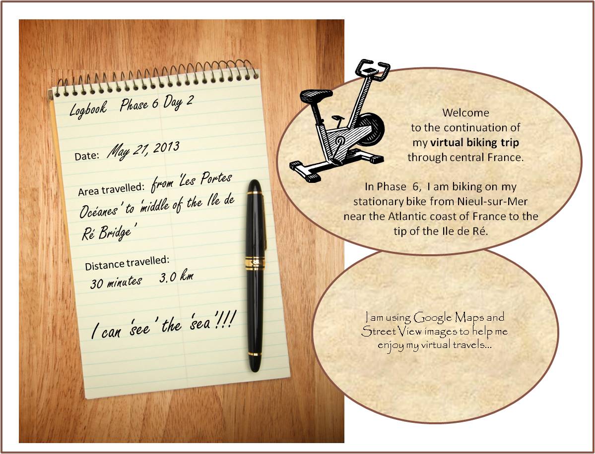
On May 21, I continued my virtual ‘bike ride’, so excited to finally see the big bridge to Ile de Ré. I began with another view of the ocean. It makes me happy to know I share the Atlantic Coast with this part of France – I am just the width of the ocean and a continent away!
~

another view of that Bay of Biscay (image from Street View)
~
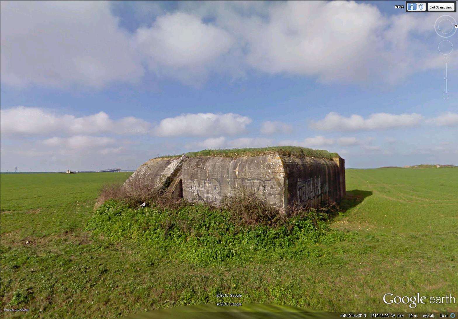
It was interesting to see World War II fortifications on this part of the coast. I usually associate these with northern France. I wouldn’t make much of a military strategist …
~
~
My first glimpse of the bridge was a small tilted structure on the horizon. This bridge reminds me of the big Confederation Bridge between New Brunswick and Prince Edward Island. The Confederation Bridge was opened in 1997 and is 13 km across. It replaces a ferry that ran there for years. The Ile de Ré Bridge is only about 3 km long, but the big curve in the structure makes it look magnificent. It was built in 1987 to replace a car ferry ( a bac) …
~

in the distance, at about 8 o’clock, you can see the Ile de Ré bridge, a small tilted bit of the horizon (image from Street View)
~
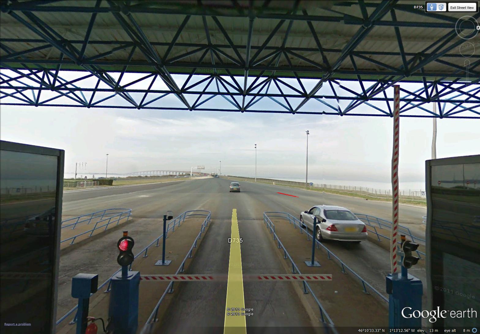
It was exciting to approach the bridge on my bike, particularly since I think bikes are free (a car paid a toll of 16 € in early 2012). The toll booth is called the Belvedere …
~

the toll booth for the Ile de Ré bridge (image from Street View)
~
I whizzed right through without paying (don’t know if I was free) …
~
~
Glad to see there were bike lanes on the bridge, coming and going …
~

bike lanes on the bridge (image from Street View)
~
I could also look back and see the cliffs along the coast of France …
~

looking back at the coast of continental France (image from Street View)
~
Best View: beaches of Ile de Ré …
~
~
Copyright Jane Tims 2013


It does look similar to the Confederation Bridge. I am amazed at all the things you can see using Google Earth. I may have to work out something similar for my walking program. I’m using the treadmill for now because it’s too hot, humid, and buggy outside. I currently stare at a blank wall. It’s not very exciting.
Love the drawing. 🙂
LikeLike
Robin
June 25, 2013 at 12:06 pm
Hi Robin. Google Earth only gets a tiny percentage of the attention it deserves. It is so muggy here today, I am grateful for my bike in our cool basement. Do you know, I am due to finish my French cycling adventure tomorrow as I will reach the furthest point west (it will take a while to catch up in the Blog). Thanks, Jane
LikeLike
jane tims
June 25, 2013 at 8:09 pm
The ocean is such a healing place to be. I don’t always comment on each post but read them all and am impressed with your self-discipline in riding your bike this far.
LikeLike
Carol Steel
June 12, 2013 at 9:20 am
Hi Carol. This method has worked so well for me. I plan to keep it up. I agree about the lure of the ocean. Jane
LikeLike
jane tims
June 12, 2013 at 6:37 pm