Archive for the ‘my exercise plan’ Category
along the river (day 2)
For many days of my virtual travel during Phase 8, I will be ‘biking’ along the north shore of New Brunswick. At first, I will travel along the Restigouche River. Then I will continue as the river opens into the Baie-des-Chaleurs. Just across the water will be the distant hills of the Gaspé Peninsula of the Province of Quebec.
~

~
map showing distance travelled (map from Google Earth)
~
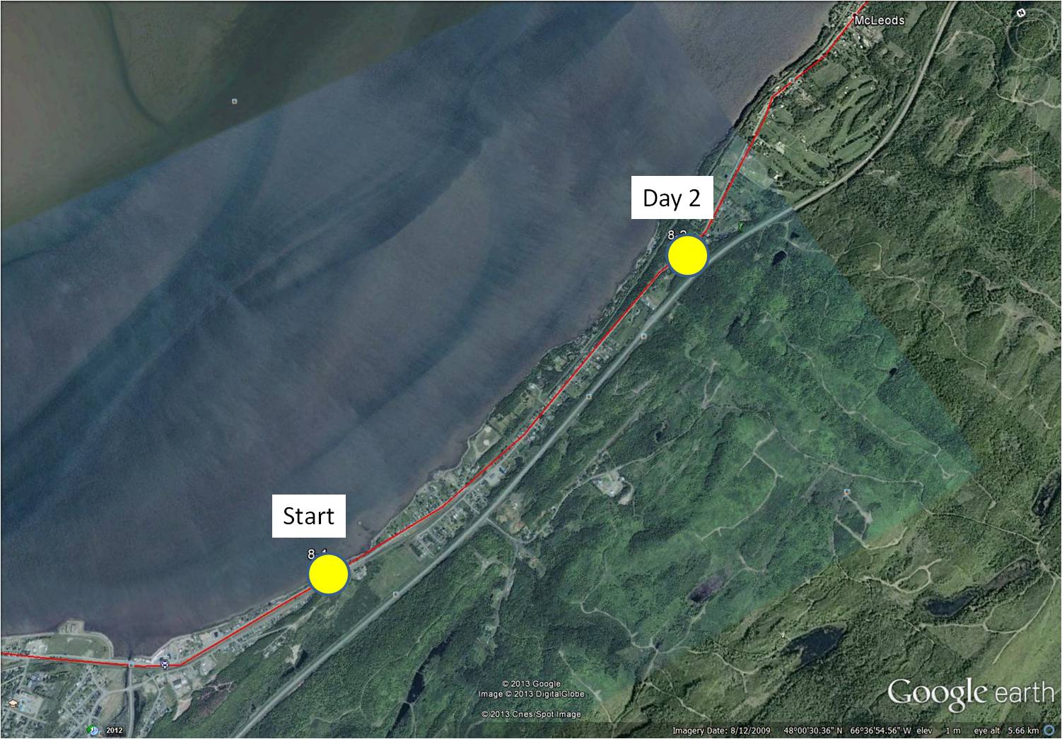
8-2 January 5, 2014 35 minutes 3.0 km (Richardsville to south of McLeods)
~
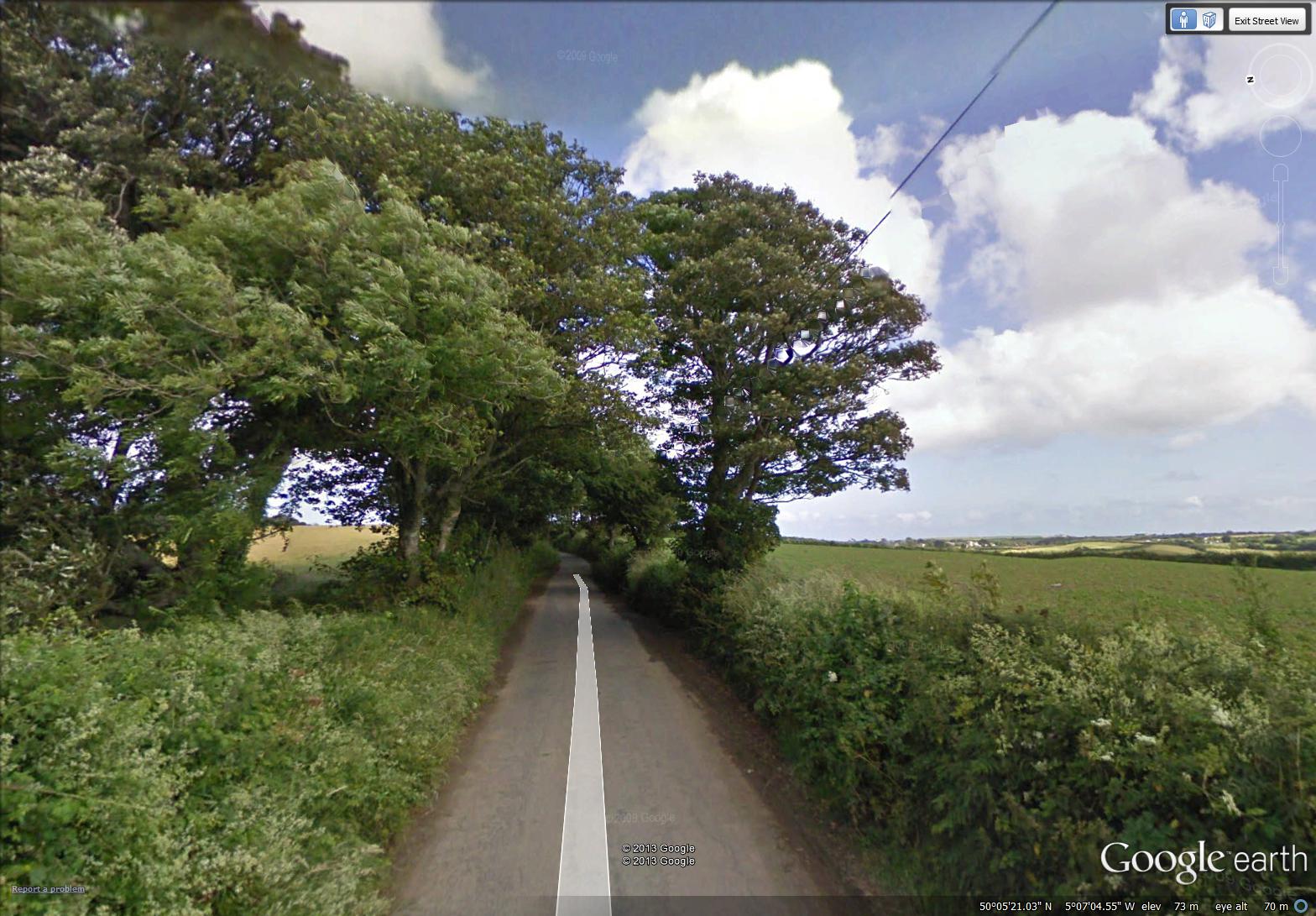
On day 2 of my travels, I followed the relatively straight road along the coast. The houses in rural New Brunswick are usually arranged in small communities with houses in a linear pattern along the main road. New Brunswick has a lot of Crown Land (about 48% of the area), arranged in large blocks. As a result, communities (and the associated privately-owned land) are often separated by long stretches of largely forested Crown Land. Crown Lands are not privately owned but are managed by Federal or Provincial Departments for the people of the Province.
~

a typical stretch of road along the north shore (image from Street View)
~
Most of the communities along the northern shore of New Brunswick are French-speaking, so when I see people along the road, I will be able to practice my French, as I did in France.
~

January 7, 2014 ‘Restigouche River and the hills of Gaspe’ Jane Tims
~
Have you ever travelled in New Brunswick? If so, I hope you enjoyed your stay!
~
Copyright 2014 Jane Tims
a leaping salmon and a mountain (day 1)
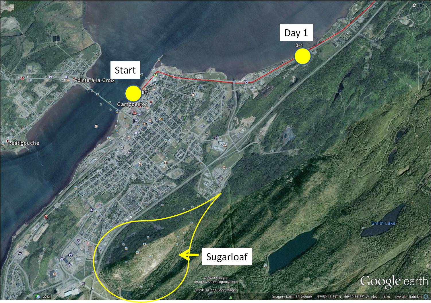
On December 31, 2013, I started on Phase 8 of my virtual cycling program. In this Phase, I am going to ‘travel’ on my stationary cycle along the north shore of my own Province, New Brunswick. I decided to start in the City of Campbellton because I have so many pleasant memories of working and vacationing in that area. Most of the roads I am ‘cycling’ in Street View, I have driven in reality, so most scenes are familiar.
~
8-1 December 31, 2013 35 minutes 3.0 km (Campbellton to Richardsville)
~
I began at a familiar landmark in the Campbellton area, the statue of the leaping salmon. The Restigouche River is world famous for its Atlantic Salmon population so the salmon is a fitting symbol for the area. In 1999 when my husband, son and I vacationed in the Gaspé of Quebec, we stopped here for a photo before leaving New Brunswick.
~
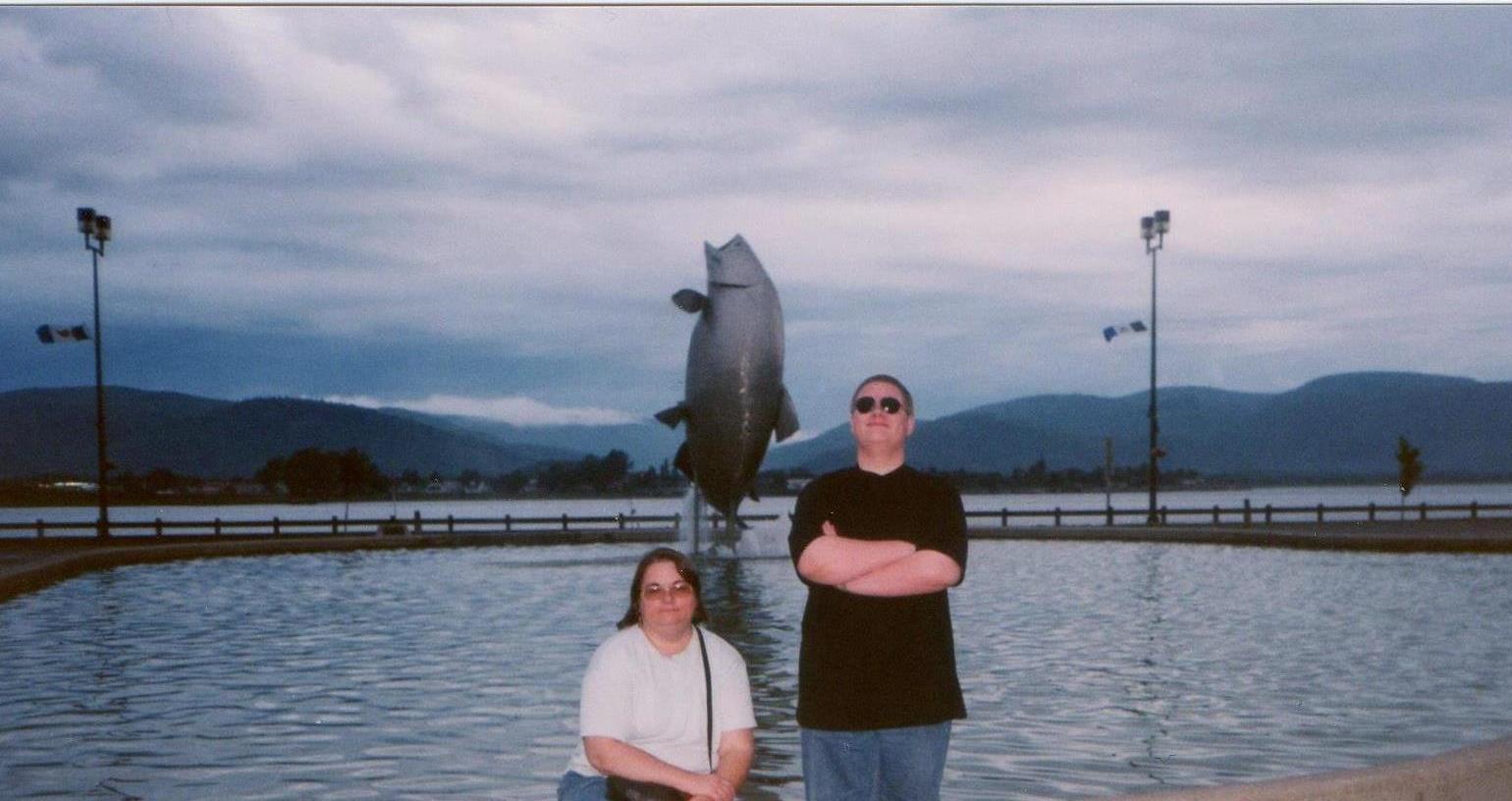
my son and I in front of the leaping salmon in 1999
~

start of my 2014 virtual cycling trip (image from Street View)
~
Across the street from the leaping salmon (and visible in the photo of my son and me) are the waters of the Restigouche River and the distant hills of the Gaspé. Since these will be with me for the first few days of my virtual adventure, I took a side trip a few kilometers inland for the subject of my first watercolour – Sugarloaf Mountain.
~
Sugarloaf is 281.1 meters in height, a part of the Appalachian Mountains and of volcanic origin. The mountain is within the City limits of Campbellton and is the location of Sugarloaf Provincial Park. Sugarloaf is the site of a ski resort, hiking and cross-country ski trails and a system of mountain biking trails.
~
In the late 1970’s and early 1980’s I climbed Sugarloaf a few times, gathering plants for air quality studies. I’ll talk more about those hikes as I proceed on my virtual trip since I have many memories of working in the area.
~

December 31, 2013 ‘Sugarloaf, New Brunswick’ Jane Tims
~
~
Although I enjoyed my virtual cycling in France and England, I find I have a more accurate perspective and sense of scale as I travel in New Brunswick. I am looking forward to showing you some of the beautiful scenery along the Restigouche River and la Baie-des-Chaleurs!
~
Copyright 2014 Jane Tims
endings and beginnings (day 58 to 60)
During the Christmas break, I completed my 60 day virtual bike trip along the south coast of Cornwall. The final two days of my trip took me beyond the heathlands of Goonhilly Down, toward the southern-most extent of England, near Lizard and Landewednack.

hotel and seascape near Landewednack (image from Street View)
~

distance travelled from day 58 to day 60 (map from Google Earth)
~
7-58 December 16, 2013 30 minutes 3.0 km (from Kuggar to Cadgwith)
~
7-59 December 19, 2013 30 minutes 3.0 km (from Cadgwith to Cadgwith ‘Turn’)
~
7-60 December 21, 2013 35 minutes 3.0 km (from Cadgwith ‘Turn’ to Lizard)
~
This completes Phase 7 of my virtual biking adventure. My ‘trip’ began on January 30, 2013 as a way of encouraging me to do more exercise on my stationary bicycle. It has taken me (in Phase 1 to 5) from Lusignan, France to La Patache, France and (in Phase 7) from Rame, UK to Landwednack, UK.
~
In Phase 7, I biked for 180 km and 1980 minutes. This represents an overall improvement in the length of each of my biking sessions (in Phase 1 to 6, I biked for 196.8 km and 1975 minutes).
In total, I have biked for 376.8 km and 3955 minutes! I have improved my health, my mobility and my stamina, although I have not lost any weight. And I have been able to see and get to know the interesting and magical countryside of central France and the southern Cornwall coast!
~

map showing distance travelled in Phase 7, from Rame to Landewednack (map from Google Earth)
~
Of course, I am going to continue with my biking adventures. However, I want to change gears a bit and do some virtual biking closer to home. At my brother-in-law’s suggestion, I am going to do Phase 8 of my virtual cycling in New Brunswick, where I live. This will help me develop a portfolio of watercolours of more local scenes. Since I have actually travelled most of the roads I will see in Street View, I will be able to tell some stories of past adventures. It will also introduce my readers to the beautiful landscape of New Brunswick and a little of our regional history.
~
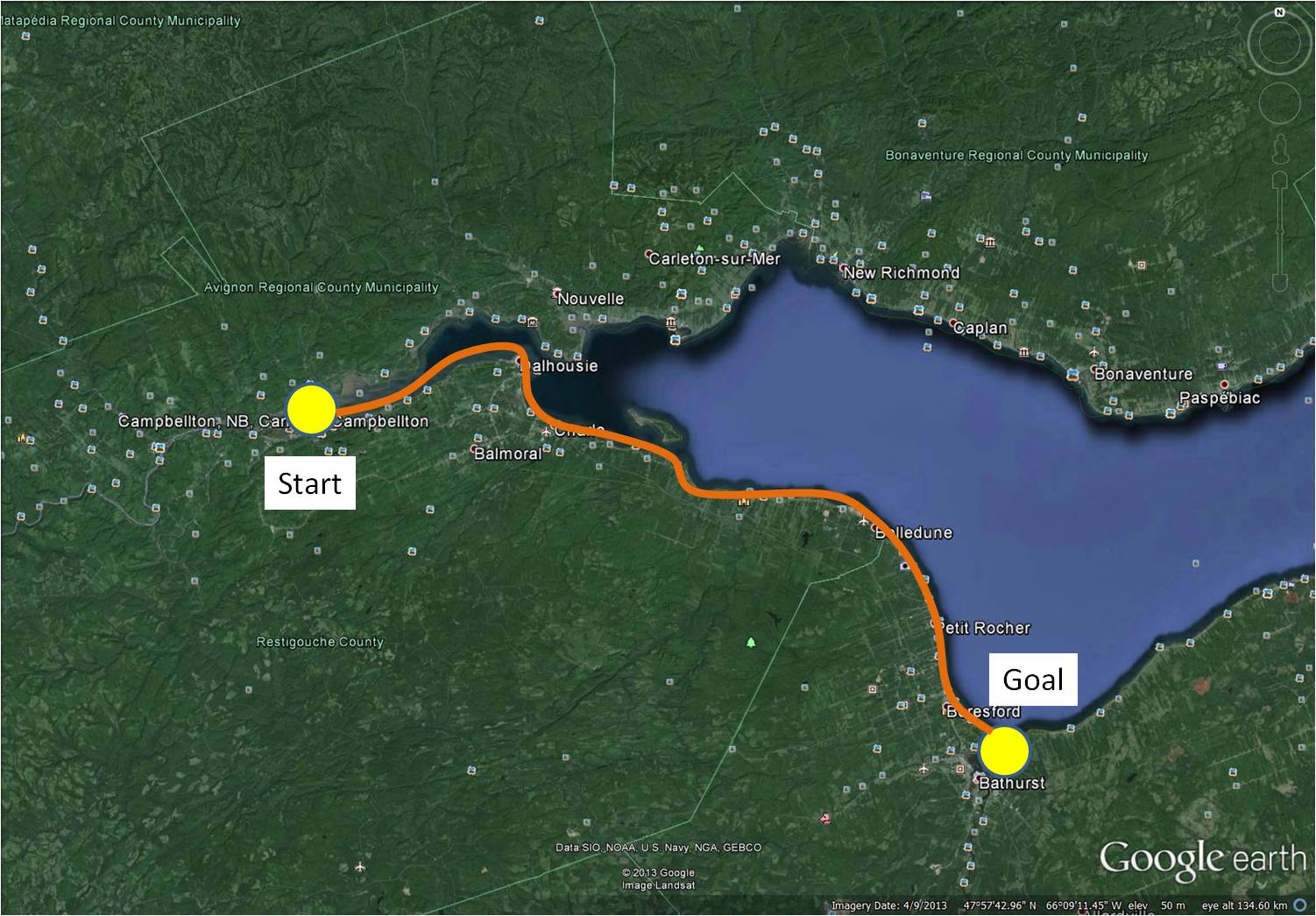
In Phase 8 of my virtual travel, I will start in northern New Brunswick, in Campbellton, and follow along the coast of the Baie de Chaleur to the city of Bathurst for a distance of about 110 km. This is the area I explored in the 1980s as part of my work on air quality in the province. It is also an area where we have taken various drives and vacations.
~
I hope you will continue to follow me on my virtual adventures!
~
Copyright 2013 Jane Tims
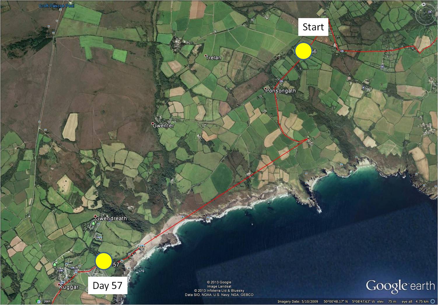
heathland and heather (day 57)
~
~
7-57 December 12, 2013 30 minutes 3.0 km (from Ponsongath to Kuggar)
~
Something different has appeared in the maps of the area where I am ‘travelling’. Today’s virtual bike trip took me just south of a large ‘brown’ area of topography (seen in the aerial photo above). To find out about this area, I turned my stationary cycle for a side trip in the direction of Gwenter, just to the north of my planned path.
~
The area I found is anything but brown (Street View images were done in July). These are the Goonhilly Downs, a raised plateau of heathlands above serpentinite rock. Besides being a Site of Special Scientific Interest and the home of many rare plants, the heathlands are the location of a large windfarm (I could just see the turbines in the distance) and the Goonhilly Satellite Earth Station (the largest in the world).
~

Goonhilly Downs … wind turbines and satellite dishes are just visible along the horizon (image from Street View)
~
From the road I could see expanses of grass, tufts of fern, and ericaceous shrubs. Patches of purple reminded me of the Rhodora that blooms here in spring. From my reading about the Cornwall heathlands, I am certain this plant must be Cornish heath (Erica vagans), a species of heather common in Cornwall. I have a small patch of heather growing in my own garden, so this plant has a spot in my heart. I first learned about heathers in our history club in high school – we took a field trip to see the heathers growing abundantly in Point Pleasant Park in Halifax. They grow there in a 3300 square meter patch, called the ‘Heather Patch’, south of the Cambridge Battery. The heathers are not native but grow there as an escape – from the stuffing in the bedrolls of British soldiers in the 1700s!
~

December 17, 2013 ‘Goonhilly Down’ Jane Tims
~
Copyright 2013 Jane Tims
Christmas lights in Cornwall (day 56)
~
As I continue my virtual bike trip along the Cornwall Coast, I am heading towards Day 60 when I will reach Lizard and the southern-most point of England.
~

~
7-56 December 9, 2013 30 minutes 3.0 km (from Coverack to Ponsongath)
~
On the 56th day of my bike trip, I could not seem to find an image to paint. Then I took a side road northward and was inspired by a string of coloured lights across a walled courtyard. Perhaps they were not lights at all, but brightly coloured clothespins on a line. In any case, I saw my painting in my mind’s eye!
~
~
It was only after I painted this and showed it to my husband, I realised I had painted a string of Christmas lights! The lights in the Street View image could have been patio lanterns, but my paint brush was thinking Christmas!!!
~

December 10, 2013 ‘lights near St. Keverne’ Jane Tims
~
One of the light bulbs in my painting has burned out and has not been replaced.
~
Copyright 2013 Jane Tims
return to the shore (day 54 and 55)
For a few days of my virtual travel along the Cornwall coast, I haven’t been seeing much of the coast. This is because my route took me inland, to skirt the tributaries of the Helford River. Now, though, I am travelling along the coast again.
~

map showing distance travelled (map from Google Earth)
~
7-54 December 4, 2013 35 minutes 3.0 km (from Porthoustock to St. Keverne)
~
This is the famous Lizard Coast, called, not for the serpentine rock in the area, or for any reptile, but after the Cornish word meaning ‘high court’ (Lys Ardh). I have seen a few references to the Lizard, including this sign in St. Keverne …

sign showing a lizard in St. Keverne (image from Street View)
~
7-55 December 6, 2013 35 minutes 3.0 km (from St. Keverne to Coverack)
~
I haven’t attempted many people in my paintings, but in the watercolour below, I tried to capture a couple of the many people I saw enjoying the walk along the coastal road in Coverack. With artists’ licence, I paired two people who in real-life have likely never met one another !!!!
~

December 10, 2013 ‘walking in Coverack’ Jane Tims
~
Copyright 2013 Jane Tims
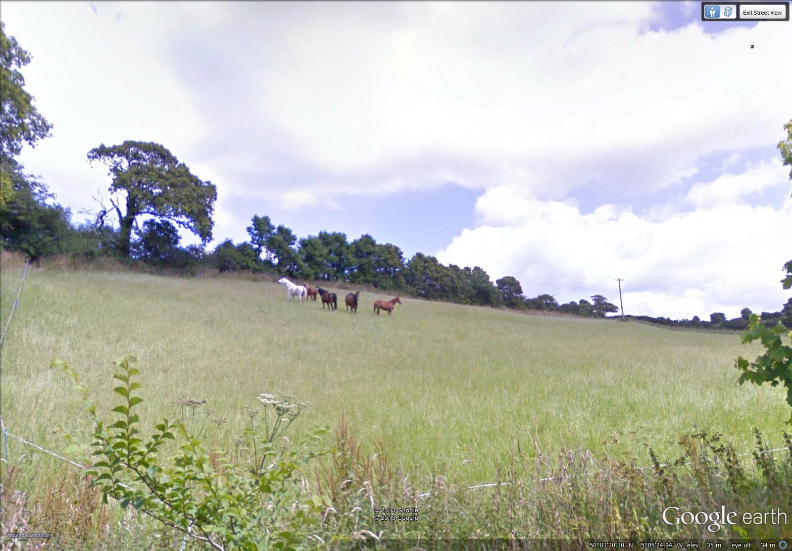
horses in a field (day 53)
7-53 December 1, 2013 35 minutes 3.0 km (from north of Porthallow to Porthoustock)
~
This week on my stationary bike trips and my virtual tour of Cornwall, I saw this group of horses near Porthallow. They stood so serenely in the field, I decided to paint them.
~
~

~
As anyone who knows me will tell you, I am not always comfortable around animals. I like horses and I have ridden, but this little story will tell you how afraid I am. When my sister went to England years ago, she asked me to take care of her horse for the summer. Marengo was a kind horse, and never did anything to frighten me, but my approach to feeding him probably made him wonder. I would go to one end of the pasture, count out his ‘leaves’ of hay and spread them for him to eat. By the time he got to the hay, I would be running to the other end of the fence to measure out his oats. That way, I could feed him but never have to stay near him! What a dreadful story. Most girls would be delighted to have care of a horse for a whole summer!
~
Copyright 2013 Jane Tims
water and glass (days 51 and 52)
~
Today, I’ll let my paintings speak for themselves…
~
7-51 November 29, 2013 30 minutes 3.0 km (from St. Anthony-in-Meneage to south of Flushing)
~

December 1, 2013 ‘swans on Gillan Creek’ Jane Tims
~
7-52 December 1, 2013 35 minutes 3.0 km (from south of Flushing to north of Porthallow)
~

December 1, 2013 ‘reflections in Porthallow’ Jane Tims
~
Copyright 2013 Jane Tims
a closer look at trees (days 48, 49 and 50)
~
One of the natural history lessons learned during my trip to California concerned the oak. On a trip to ‘Safari West’ near Santa Rosa, our guide pointed out the scarred trunks of various trees. The bark was embedded with acorns! The Acorn Woodpecker places the acorns in holes in the bark of these trees, storing them for a later source of food. The storage trees or ‘granaries’ are used over and over through the years!
~

acorns planted in a ‘granary’ tree by the Acorn Woodpecker
~
Perhaps as a result of seeing so many new tree species in California, I have looked more closely at the trees I see in Street View as I cycle ‘virtually’ along the Cornwall coast. Identification is usually difficult since the images do not show details. However, occasionally a leafy branch is close enough to see the leaves clearly. So far, I have seen the Common Ash, the Field Maple, and the English Oak. In the image below, you can see the lobed leaves of the English Oak.
~
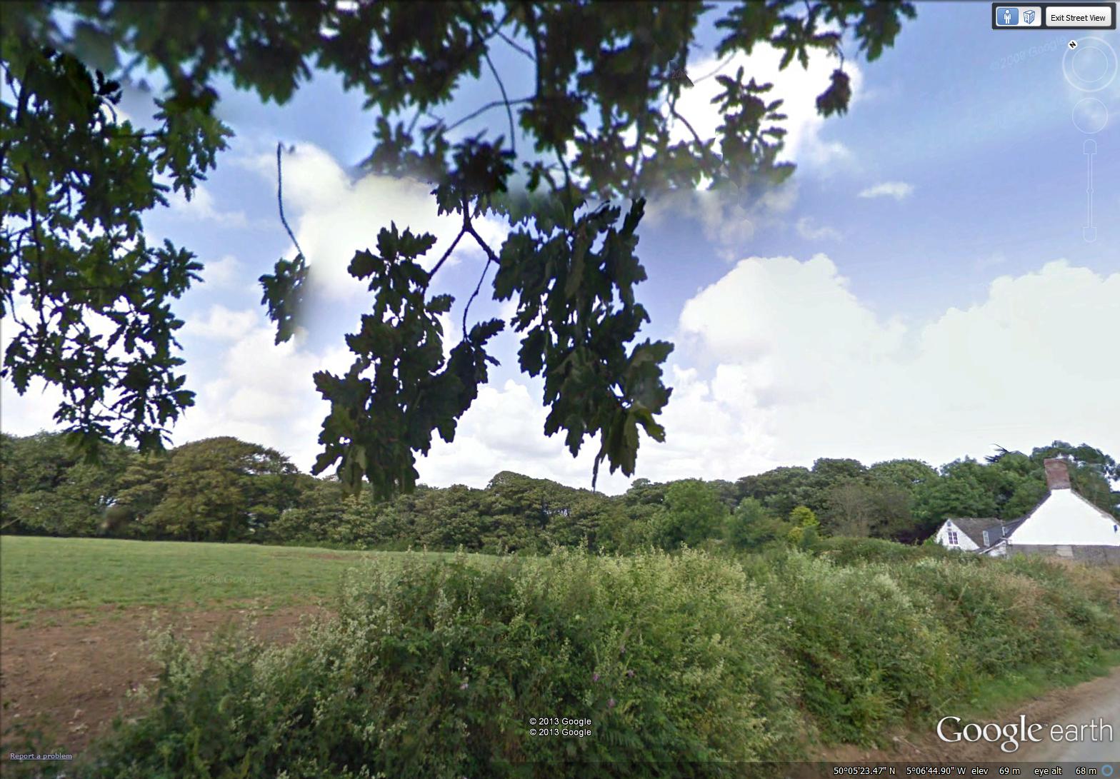
lobed leaves of an English Oak along the road to St. Anthony (image from Street View)
~

map showing distance travelled (map from Google Earth)
~
7-48 November 21, 2013 30 minutes 3.0 km (from Mawgan to St. Martin)
~

November 26, 2013 ‘oak on Fords Hill’ Jane Tims
~
7-49 November 23, 2013 35 minutes 3.0 km (from St. Martin to Helford)
~

November 26, 2013 ‘maple and oak near Helford’ Jane Tims
~
7-50 November 25, 2013 30 minutes 3.0 km (from Helford to St. Anthony-in-Meneage)
~
Oak and Ash along the road to St. Anthony (image from Street View)
~
Copyright 2013 Jane Tims
jet-lag (days 46 and 47)
~
I had a great time during my week in California, but it has been hard to return to my regular routines. The four-hour time shift left me out of sync. For about ten days after arriving home, I was constantly sleepy, napping at odd times through the day. I also had a hard time regulating my eating and for a few days, breakfast was a three course meal (doesn’t make sense since in California, I would still be sleeping).
~
I slacked off my biking as well and after only two 30 minute sessions in 10 days, I woke one morning to find my knee in pain and almost locked into a bent position. Besides its other benefits, I think the stationary biking keeps my knee flexible and lubricated. I started biking again every two days and now my knee is back to ‘normal’.
~

~
7-46 November 13, 2013 35 minutes 3.0 km (from Port Navas to Constantine)
~
Being able to climb stairs easily is important, especially since I wanted to try out this set of stone stairs along the road in Cornwall …
~

November 21, 2013 ‘stone stair near Constantine’ Jane Tims
~
My experience with jet-lag has shown me how much easier it is to just hop on my stationary bike and see the Cornwall coast via Street View.
~
7-47 November 19, 2013 30 minutes 3.0 km (from Constantine to Mawgan)
~
The route for the last few days of my virtual travel has taken me across the inlets of the Helford River. This is interesting to me since I worked on waterways for so much of my career. I also saw a flock of ducks on the water of the Mawgan Creek, also worthy of a look since Street View captures so little wildlife.
~

~
A short distance farther along, the road crosses another branch of Mawgan Creek. It was a good subject for a watercolour, so I tried to capture the reflections in the water and the contrast between the soft vegetation and the hard stone bridge. In a lazy mood (more jet-lag???), I decided to use a spatter technique to give some interest to the scene. I got a little carried away with the red!
~

November 18, 2013 ‘Mawgan Creek’ Jane Tims
~
I coped so badly with my ‘jet-lag’ experience, I now have renewed admiration for those who must travel constantly because of their work.
~
I’d love to hear about your experiences with ‘jet-lag’.
~
Copyright 2013 Jane Tims


