Posts Tagged ‘Cornwall coast’
fortification against the sea
On the second day of my virtual biking last week, I toured Porthleven, a large town along the Cornwall coast. Street View had done its image-taking on a clear day, but the steep cliffs along the ocean made me ponder what it might be like to stand on this exposed coast in a storm.
~
I wondered why so many foundations along the cliff side of the street were abandoned. One of the foundations enclosed what might be a giant chess board!
~

abandoned foundations along the coast at Porthleven (image from Street View)
~
Then I had a first glimpse of the seawall and signs warning sightseers to beware …
~
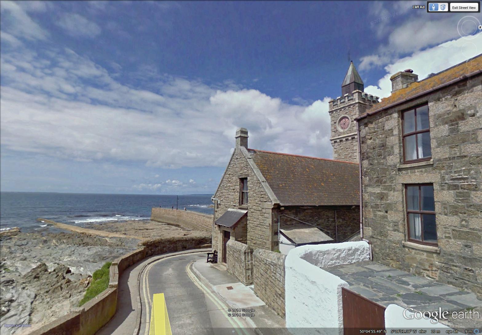
seawall and clock tower at Porthleven (image from Street View)
~
The harbour itself is a maze of thick, high walls and the piers of a now absent bridge …
~
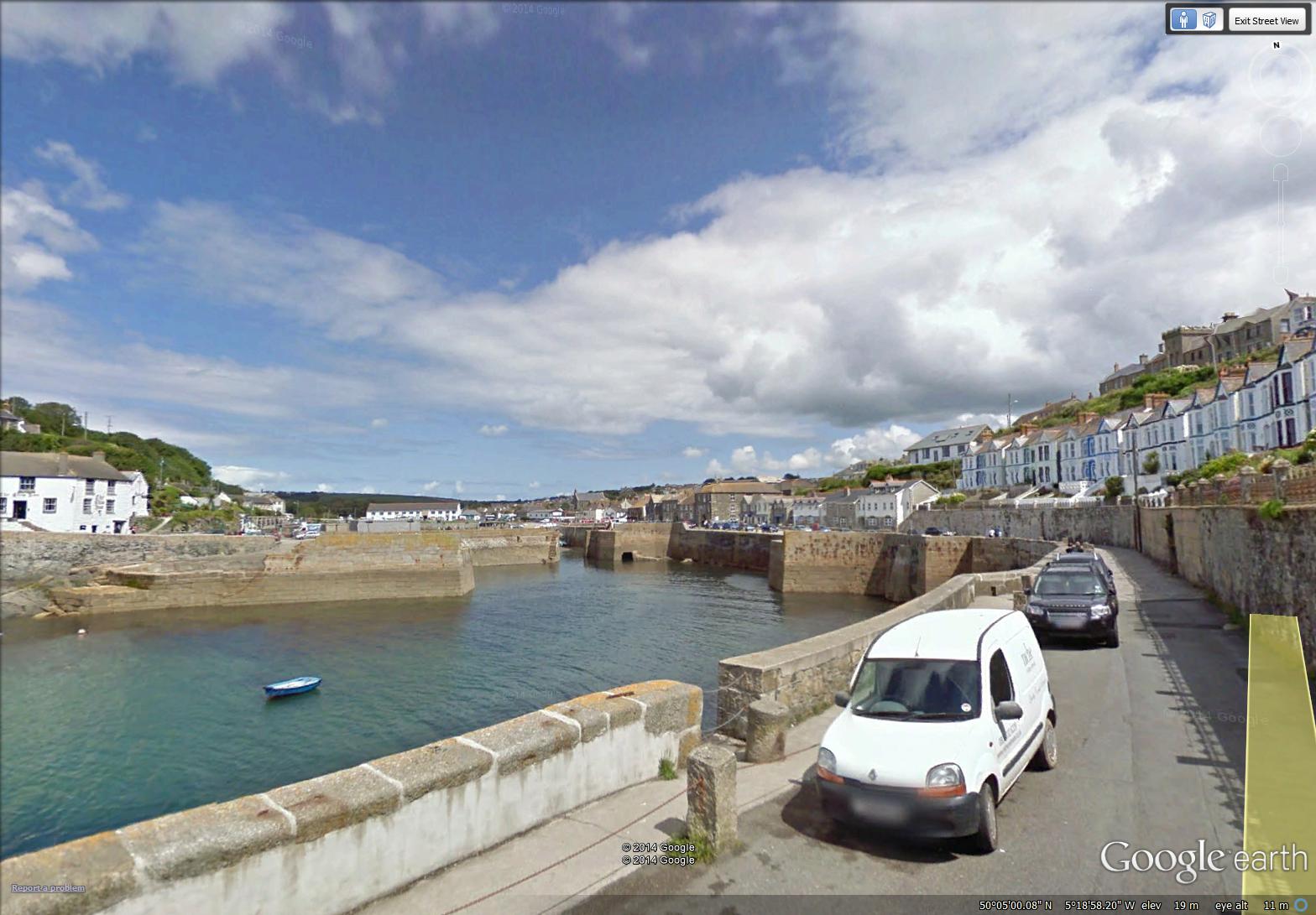
the fortified harbour of Porthleven (image from Street View)
~
A little searching on the internet found a dramatic photo (credit: Annabel May Oakley-Watson/REX) of the clock tower in the first image above, during a coastal storm … (‘Should Coastal Britain Surrender to the Tides?’, Patrick Barkham, The Guardian, February 7, 2014). http://www.theguardian.com/environment/2014/feb/07/should-coastal-britain-surrender-to-tide
~
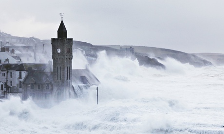
(photo credit: Annabel May Oakley-Watson/REX)
~
~
Copyright 2014 Jane Tims
along the pond
On my stationary bike last week, I travelled (virtually) along the Cornwall coast from the mouth of Loe Pond to Rinsey. During the week, I biked for 90 minutes, and saw 11 km of the Cornwall countryside.
~
The first day took me from the mouth of ‘The Loe’, along the pond to just west of Porthleven, in Shadywalk Wood.
~

from the beach at the mouth of Loe Pond to Shadywalk Wood (map from Google Earth)
~
The beach is a wide crescent of endless sand …
~
August 16, 2014 ‘beach at Loe’ Jane Tims
~
The path along ‘The Loe’ is narrow, tree-lined and shady. I saw lots of hikers and fellow bikers, but not a single car.
~

a typical part of the path along ‘The Loe’ (image from Street View)
~

August 16, 2014 ‘along Loe Pond’ Jane Tims
~
Biking along a shady lane, with no worries about traffic, thick ferny woods to one side and the sparkle of a pond on the other … a lovely way to ponder the days of summer …
~
Copyright 2014 Jane Tims
back to Cornwall
Although I have done some stationary biking since I ended my virtual trip across northern New Brunswick, I want to get back to the regular schedule I followed when I biked virtually in France and Cornwall. So I have decided to hop back on the Street View road and see some more of Cornwall.
~
In Phase 7 of my virtual cycling, I finished the southern coast of Cornwall at Landewednack and Lizard. I’ll begin Phase 9 at Predannack Wollas and cycle around the west coast of Cornwall. I’ll look forward to seeing Arthur’s Titagel and Doc Martin’s Port Isaac. Mostly, my knees will benefit from more regular exercise.
~
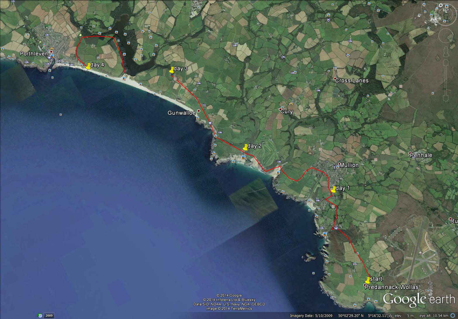
Predannack Wollas to Porthleven
~
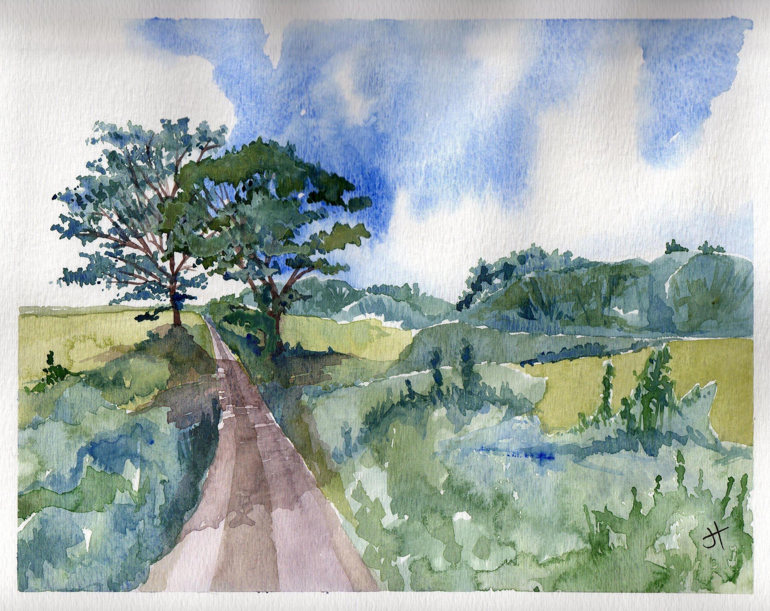
I have my first four days plotted and I start tomorrow. Just for old time’s sake, here is one of my earlier paintings from southern Cornwall …
~
~
Copyright 2014 Jane Tims
endings and beginnings (day 58 to 60)
During the Christmas break, I completed my 60 day virtual bike trip along the south coast of Cornwall. The final two days of my trip took me beyond the heathlands of Goonhilly Down, toward the southern-most extent of England, near Lizard and Landewednack.

hotel and seascape near Landewednack (image from Street View)
~

distance travelled from day 58 to day 60 (map from Google Earth)
~
7-58 December 16, 2013 30 minutes 3.0 km (from Kuggar to Cadgwith)
~
7-59 December 19, 2013 30 minutes 3.0 km (from Cadgwith to Cadgwith ‘Turn’)
~
7-60 December 21, 2013 35 minutes 3.0 km (from Cadgwith ‘Turn’ to Lizard)
~
This completes Phase 7 of my virtual biking adventure. My ‘trip’ began on January 30, 2013 as a way of encouraging me to do more exercise on my stationary bicycle. It has taken me (in Phase 1 to 5) from Lusignan, France to La Patache, France and (in Phase 7) from Rame, UK to Landwednack, UK.
~
In Phase 7, I biked for 180 km and 1980 minutes. This represents an overall improvement in the length of each of my biking sessions (in Phase 1 to 6, I biked for 196.8 km and 1975 minutes).
In total, I have biked for 376.8 km and 3955 minutes! I have improved my health, my mobility and my stamina, although I have not lost any weight. And I have been able to see and get to know the interesting and magical countryside of central France and the southern Cornwall coast!
~

map showing distance travelled in Phase 7, from Rame to Landewednack (map from Google Earth)
~
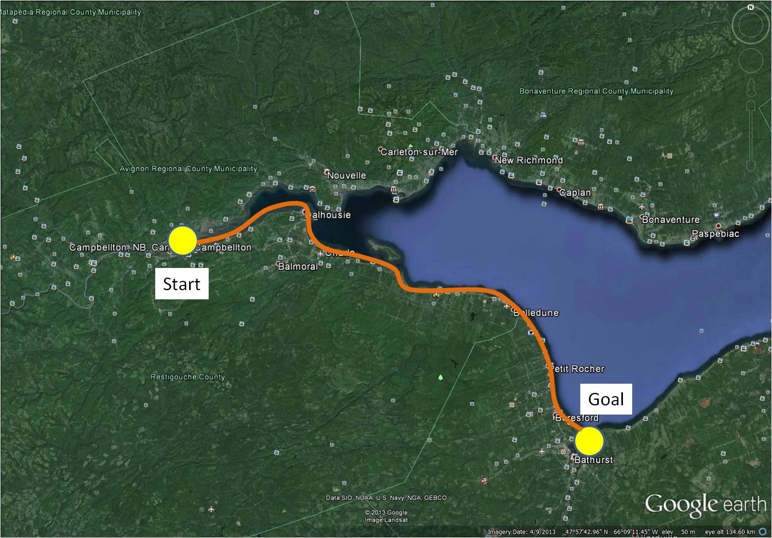
Of course, I am going to continue with my biking adventures. However, I want to change gears a bit and do some virtual biking closer to home. At my brother-in-law’s suggestion, I am going to do Phase 8 of my virtual cycling in New Brunswick, where I live. This will help me develop a portfolio of watercolours of more local scenes. Since I have actually travelled most of the roads I will see in Street View, I will be able to tell some stories of past adventures. It will also introduce my readers to the beautiful landscape of New Brunswick and a little of our regional history.
~
In Phase 8 of my virtual travel, I will start in northern New Brunswick, in Campbellton, and follow along the coast of the Baie de Chaleur to the city of Bathurst for a distance of about 110 km. This is the area I explored in the 1980s as part of my work on air quality in the province. It is also an area where we have taken various drives and vacations.
~
I hope you will continue to follow me on my virtual adventures!
~
Copyright 2013 Jane Tims


