Posts Tagged ‘rock’
the rock project – update
It sometimes takes years to make progress on a project. That has certainly been the case with ‘the rock project,’ begun November 2011 and reported here https://janetims.com/2011/11/13/plans-for-a-rocky-road/
~
The original project was to add a circular component to the driveway and to install a few rock features along the way. In part, this was to allow us to avoid backing out to the road in front of our house. It was also meant to give us an interesting walking ‘trail’ as we get older. This was the feature map as it existed in 2011.
~

~
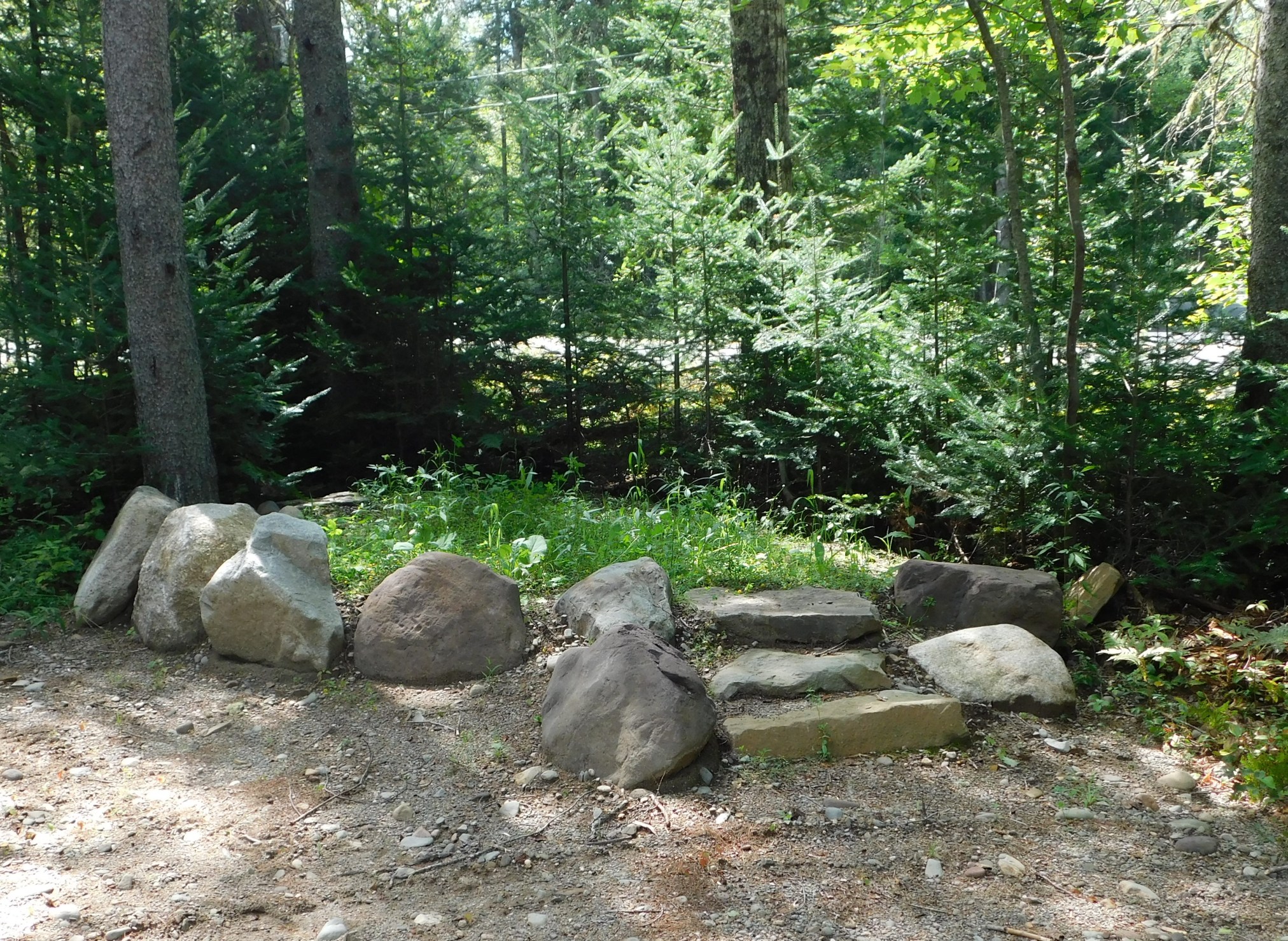
Over the years, we built a rock fireplace and added a concrete bench. And, last summer, we brought in gravel and rock to finish the circular roadway and a rock feature I refer to as ‘rockhenge.’
~

~
‘Rockhenge’ consists of a platform, fronted by six very large rocks and accessed by a stone stair. Eventually it will be planted in periwinkle and moss.
~
The roadway allows a pleasant walk in the grey woods.
~

~

~
Now that the road is done, we have more plans for the rock project.
~
~
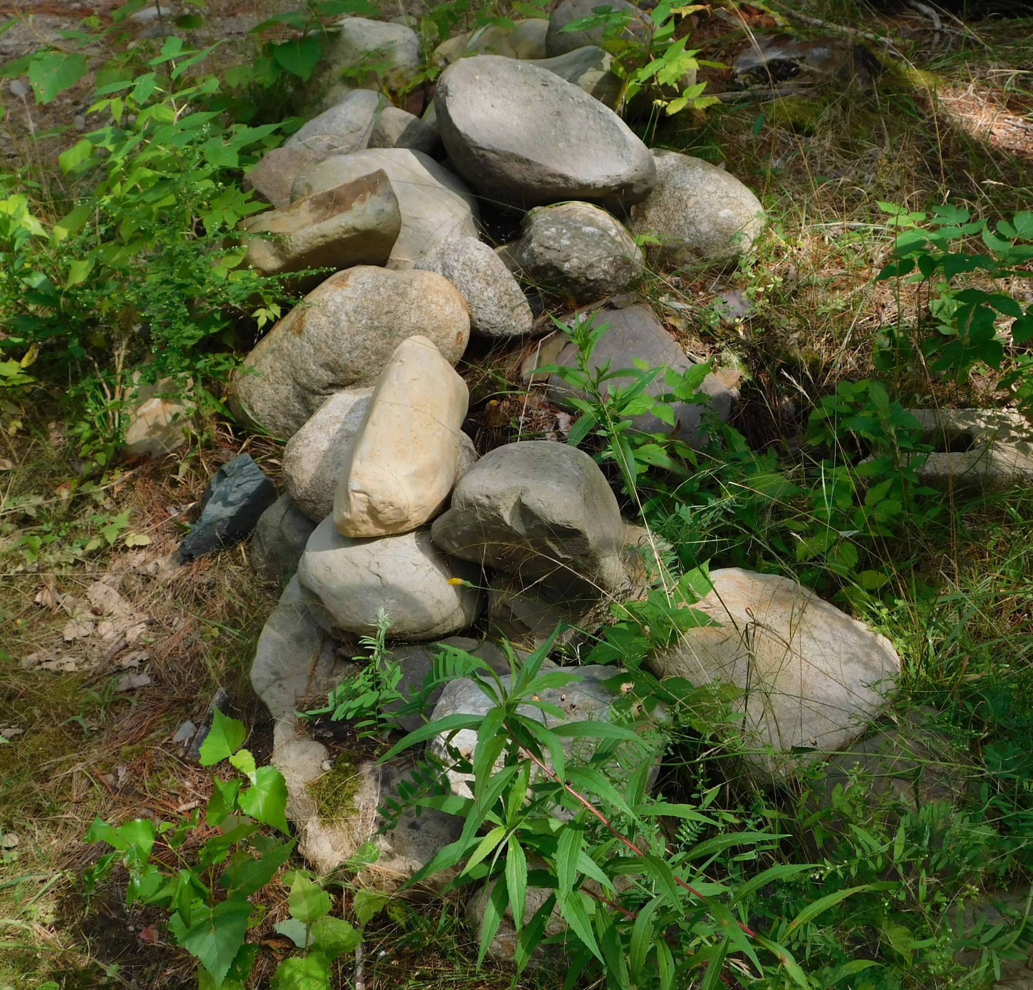
This summer, every time we go for a drive, I bring back one or two rocks towards the building of a stone wall along the front of the area where I feed the birds. I also added two small solar-powered lanterns; they shine every night and make the woods less dark.
~
The next step in our project has begun, with the creation of a small platform, a flat surface to put another concrete bench. It will be a place to sit and watch the woods and occasional wildlife.
~

~
A future part of the plan will be to build a narrow roadway through the grey woods, to the back of our property.
~

~
Not having to back out of our driveway has made life better and safer for us. The circular drive is also an exercise opportunity — every day I try to find the time to walk the loop. Every evening I watch the little lanterns flicker and shine. I love this place where we have lived now for 43 years. And with the ‘rock project’ ongoing, I love it even more.
~
All my best,
Jane
(a.k.a. Alexandra)
a snippet of landscape – glacial erratics and boulder fields
Last week we went for a drive to explore some of the back roads in Sunbury County. As we drove, we encountered large boulders everywhere along the road. I know from my reading and a course years ago, these are a remnant of the glaciers that once covered this area. Large boulders were carried along by the ice and deposited on the landscape far from their place of origin.

In one place, a clear-cut lay the landscape bare and we were able to see how frequently these glacial erratics occurred in the area. In the photo, you can see the boulders scattered in a ‘boulder field’. These boulders would have been deposited here by a glacier, thousands of years ago, perhaps during the Wisconsinan glaciation when almost all of Canada was covered by ice.

It is strange to drive along the road today and know that thousands of years ago, a sheet of ice, perhaps a few kilometers thick, would have covered us.
~
~
gravel pit
~
ten thousand years it took
a glacial stream to set
the sinew of the esker –
cobbles sorted to layers,
screened by a giant hand
~
ten scant years to sever
esker snake from his tail –
the excavator bucket
reaching, fingers lifting sand,
pit-run, ready for road
~
~
Copyright Jane Tims 2012
snippets of landscape – ice falls on rock walls
When highways are built, they often cut through the bedrock, leaving rock walls along the margins of the road. If these intersect a brook or seep of water, the result is a waterfall on the face of the rock. In spring or summer, rains can create wild cataracts. In winter the water freezes, building frozen walls of blue-shadowed ice. In sunlight, especially when they begin to melt, these ice falls are dazzling.

~
~
one warm hand
~
icicles seep between
layers of rock frozen
curtains separate
inner room from winter storm
glass barrier between blue
light and sheltered eyes
memory of water flows
along the face of the rock
one warm hand melts ice
consolation, condensation
on the inward glass
~
~
© Jane Tims 2012

monuments in stone
inuksuk n. (plural inuksuit) a stone landmark or cairn used by Arctic and northern peoples to mark a point of reference or a place of significance; an Inuit cultural symbol.
inunnguaq n. (plural inunnguat) a stone cairn in the shape of a human figure, meant to represent a human figure, and distinguished from an inuksuk.
Wikipedia.org
Our rock project is progressing slowly. We are collecting rocks for a stone monument. Since I want this to be a sculptural piece, I am sure the rocks we select will play a role in the final look of the monument.
One possibiity is to build an inuksuk. These stone landmarks are a part of the culture of the north, but they have caught the general imagination and are now encountered throughout Canada. On our trip out west, the inuksuk built along the Trans-Canada highway in Manitoba were particularly memorable.
For a few years, the inuksuk (plural inuksuit) and inunnguaq were common along the New Maryland highway in New Brunswick. On the stretch of road between New Maryland and Fredericton, the highway is carved through rock and outcrops are part of the roadscape. A women who walked along the road every morning for a few years was responsible for building many of the inuksuit. The local newspaper did a story on her, explaining that she walked and built the monuments as exercise following by-pass surgery. She wore a white jogging outfit with black splotches and was fondly referred to as the ‘Cow Lady’.
The ‘Cow Lady’ no longer walks the road and her inuksuit and inunnguat have fallen into disrepair. I remember her fondly and dedicate the poem below to her.
Inunnguaq 101
~
these are the hill people
sometimes without arms and legs
sometimes with other, alien parts
but proud
honor the woman who walks here
~
sometimes toppled
often reassembled
constructed one day at a time
optimism of increment
a community on the hillside
~
© Jane Tims 2004

plans for a rocky road
This fall, we have begun a new landscaping project, using rocks to embellish a length of road on our property.
On our travels this summer, we were impressed by the many ways home landscapers use stone as a signature element. Some of these ventures were as simple as a stone wall snaking through the woods. Some had elaborate stone benches, stone sculptures, or carefully-built piles of stones.
We have an offshoot to our driveway, intended some day to form half of a circular road. Over the years, we have added some stone embellishments to this road and its associated path, so it seems to me to be the perfect place to develop our own rock project.

To date, we have the following features in place, some in an advanced state of disrepair:
- two stone pillars, about three feet in diameter – each is a page-wire cage filled with rock
- an ‘old-fashioned’ rock wall constructed of granite stones, each about the size of a large honeydew melon
- a lopsided (fallen-down) sundial built of small angular rocks in the shape of a cone
- a chunk of black basalt, a five-sided, columnar volcanic feature, harvested from the shore where my ancestors came to Canada via shipwreck
- a stone ‘stream’ built years ago before we purchased more property and Fern Gully Brook entered our lives – this stream is a one foot wide course of small stones screened from a pile of pit-run gravel. It ‘runs’ from a small artificial pond and is now completely overflowing with dry leaves.

- existing rock and stone features on the road and path
Over the next months, we want to add some features to the road:
- rebuild our formerly wonderful granite fire pit in a new location along the road
- create two new lengths of stone wall to match the existing wall
- build a stone statue or monument
- lay out a circle of stones to mark the one area where we can see the Milky Way from our property (star-gazing is difficult since we have so many trees)
- build a stone embankment-with-moss feature to emulate a lovely roadway we saw at my brother’s wedding last year.

- rock and stone features we plan to add
Over the next year, it is my intention to report back on the progress made on our Rock Project. If you never hear another word about this project, remember – I like to plan.
Copyright Jane Tims 2011

the stone between farms
How do you show the boundary line between you and your neighbor?
At Ågersta Village in Uppland, Sweden, is a rune stone positioned to mark a boundary between two properties. The stone is carved with two serpent creatures entwined, their heads in profile. Each has two sets of legs, the forelegs strong, and the rear legs weak and helpless.
The stone was carved by Balle, a frequent carver of rune stones in Sweden, and raised by Vidhugse, in memory of his father. The boundry, established in the twelfth century, showed the boudary until 1856 when the property lines were finally changed!
The inscription reads, in part: Hiær mun standa stæinn miđli byia – “Here shall stand the stone between farms.”

from my imagination and not the rune stone at Ågersta Village
stone between farms
(rune stone in Ågersta Village, Uppland)
Do not move your neighbor’s boundary stone…
– Deuteronomy 19:14
~
ninth morning already
irate I rise
gather my tools
trudge to the hillside
~
stone waits for me, Balle
(master carver of runes)
shadows pulled into dragon
compete with guidelines
‘what is not’ more complete than ‘what is’
~
another fair day
Vidhugse to the west and south
Austmadr to the east
surely their bickering over boundaries
will cease
~
by noon the sun
embroils the rock
streaks my brow with sweat
floods the serpent creature’s clever eye
lip lappets drip
~
mosquitoes dither about
the creature’s profile acquires
the look of an insect head
reckless slip of the rune tool
could end its smirk
~
hill of rock dust
settles on my shoe
birches stir the air
odor of leaf layer
memory smell of Birka
~
© Jane Tims 2005

niche beneath waterfall
This past weekend, we made a visit to two of New Brunswick’s waterfalls: Erbs Falls and Smith Falls, both on the Kingston Peninsula.

Erbs Falls begins as a quickening of the water of Peters Brook in a narrowing gorge.

At this time of year, the water proceeds in one of two pathways, down the labyrinth of the fish ladder…

…or into a deep, narrow gorge through the bedrock…

… to emerge into the sunlight as Erbs Falls.

Smith Falls begins as a series of smaller falls in the brook. The path runs along the brook, so we saw every ripple and dip.

The water plunges over the lip of the falls…

…flows past a small cave…

… and forces its way between rocks over the lower part of the falls.
Waterfalls are the ultimate experience of water. At the base of the waterfall are the mingled sounds of the thundering water and the gurgle of the stream. The shade and mists are cooling, refreshing. Sneakers get wet, hands are washed in cold water, and balance is tested as you follow the downward path of the waterfall.
I also like to think about the shape of the rock under the falls. I watch the spout and flume of the water to see what solid shapes beneath the flow have shaped the waterfall. I try to see through the white curtain of water to see the rock and stone, and understand how they are both revealed and concealed by the waterfall.
beneath waterfall
~
what can I do
to cover me
feign a drip of waterfall
from a single eye
or a flume
from the fluid of two
~
shall I arrange
my hair to hide beneath
my skin a wasp-nest
paper waterfall
hung lightly
~
who will see me
if I place my hands on rock
freckles are dapples of sun
fingernail glints of mica
or whorls in fingerprint
swirl like water
~
the spare notes of white-throat
or fluid jubilee of robin
flow over, compose sheet
music of quarter notes
to cover me
~
sitting here
on the edge of the bed
far from waterfall
electric fan for breeze
electric bulbs for sparkle
down-filled white duvet
to hide beneath
~
© Jane Tims 2011
‘niche’ on a rock
In July, we went to the Saint Martins area for the day and spent some time exploring the caves and beach-combing. We also took the short drive to the lighthouse at Quaco Head. The lighthouse is perched on the cliff overlooking Quaco Bay.

the Quaco Head Lighthouse ....... “The present Quaco Head Lighthouse was constructed in 1966 and consists of a square tower rising from one corner of a concrete fog signal building. The light in its lantern room produces a white flash every ten seconds, while the fog signal emits a three-second blast every thirty seconds, when needed.” from http://www.lighthousefriends.com/
If you look out over the Bay, you can see some exposed rocks where sea birds make their home, and, to the north-east, Martin Head, about 30 kilometers away.

the view to the north-east ...... Martin Head is on the horizon, to the left
Wildflowers were everywhere, but what caught my eye was a lichen on a flat rock at the base of the lighthouse. It was bright orange, like a splash of paint.
There are two orange lichens that live on rocks in the coastal area of New Brunswick, Xanthoria and Caloplaca. The orange lichen I found at Quaco Head is likely one of two species: Xanthoria sorediata (Vain.) Poelt or Xanthoria elegans (Link) Th. Fr.

bright orange Xanthoria lichen on a rock .... there are also two or more other species of lichen present
A lichen is not a plant, but a composite organism, consisting of an algae and a fungus, living together in a symbiotic, mutually beneficial, relationship.
Ringing
Swallow Tail Lighthouse, Grand Manan
air saltfresh and balsam
walls lapped by a juniper sea
pale mimic of the salt sea
battering its foundations
its endurance
a mystery
until I found
an iron ring
anchored deep
in rock
almost lost
in lichen
Xanthoria orange
lifted and dropped
run round
its axis
clashing on stone
creak and clank of the metal door
echoes climbing the welded stair
ground glass grit of the light
fog washed clang of the channel bell
rock lashed to the lighthouse
salt breakers turned to stone
Published as: ‘Ringing’, Spring 1995, The Cormorant XI (2)
(revised)
© Jane Tims


