Posts Tagged ‘water’
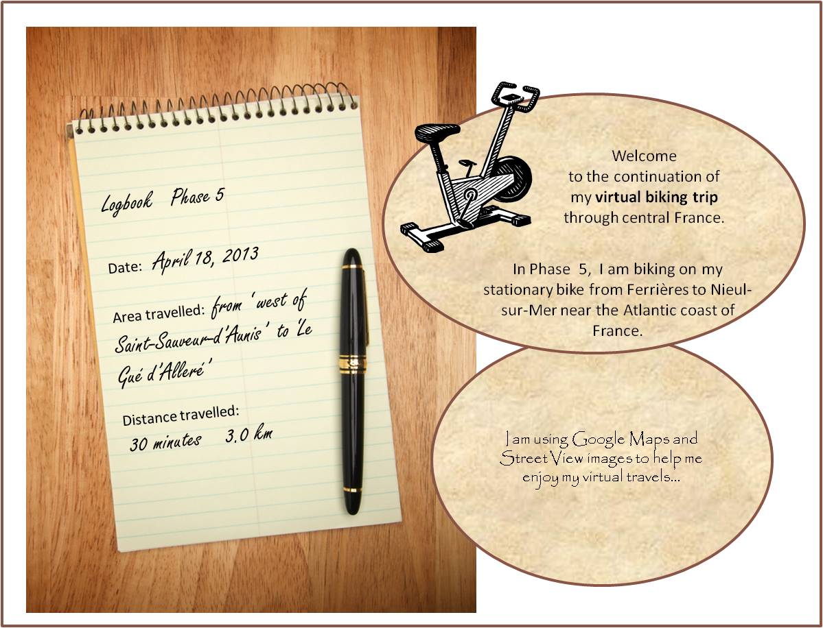
a ford in the river 5-3
~

houses in Le Gué d’Alleré (image from Street View)
~
~

map showing distance travelled (map from Google Maps)
~
April 18’s virtual bike ride took me through the town of Le Gué d’Alleré. A ‘gué’ is a place on a river where the water is shallow enough to allow easy passage, in other words, a ford.
The river in Le Gué d’Alleré was so shallow, it had no water at all. I know this river sometimes holds water since there is an image embedded in Street View showing the river full of water!
~

river in Le Gué d’Alleré (image from Street View)
~
When I was young, we often visited my grandfather’s farm in Nova Scotia. One of the places I remember well was the ford across the stream at the end of his road. The water was shallow at this spot and people from the community would bring their cars to the ford to wash them. It would not have been good for the environment. Soap suds and leaking oil and gasoline would pollute the downstream water, probably harming the aquatic life, including the fish people liked to catch.
~
~
ford
~
at the intersection
of the lane and the County Road,
a ford crossed the stream–
flat stones and riffles
~
in the shade of serviceberry and maple
we watched as distant cousins
washed their cars,
all suds and Daisies
~
then took clean cars
further down the road
(further down the stream),
for an hour of fishing
~
~
~
Best View: an image from my memory …
~

~
Copyright Jane Tims 2013
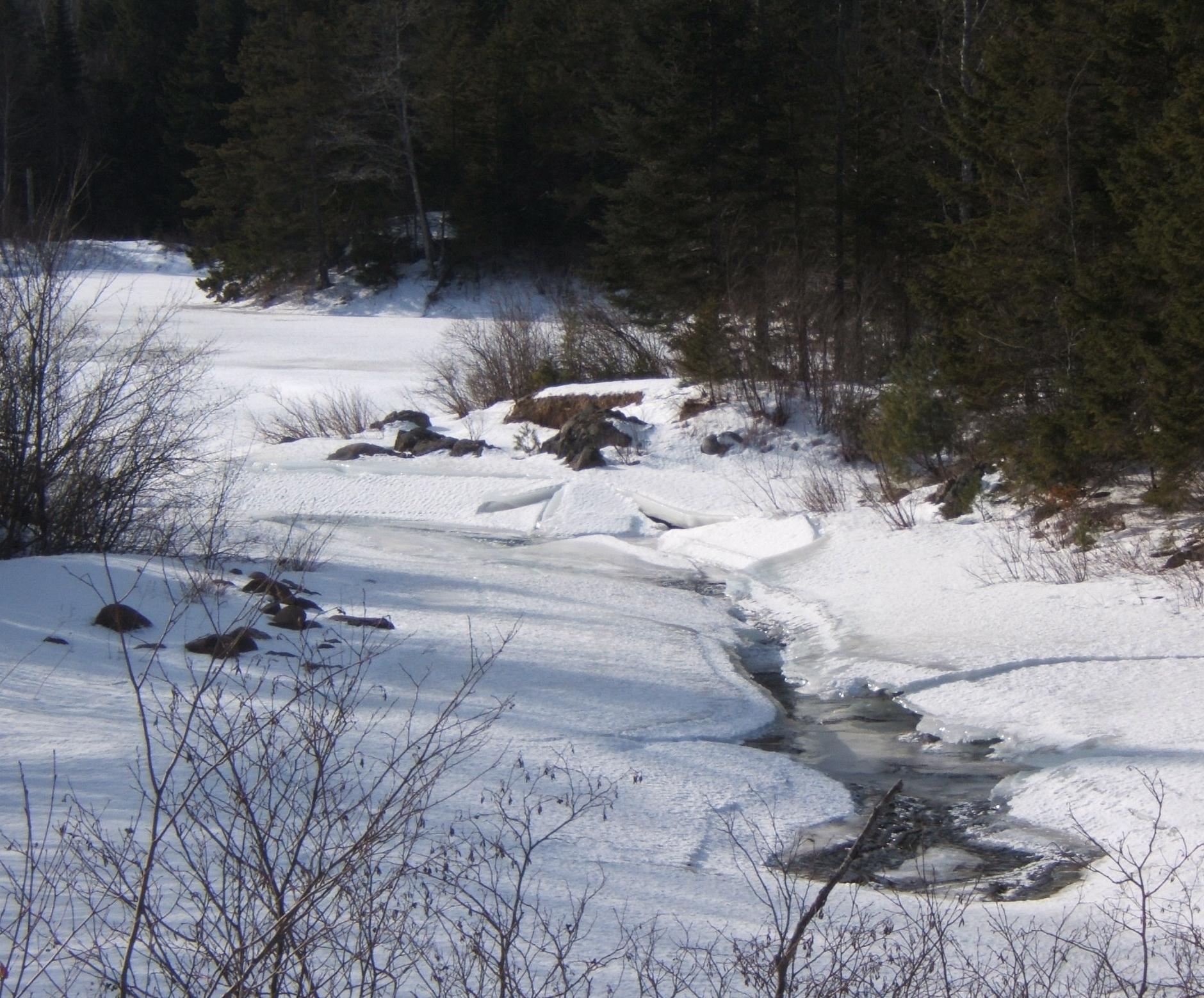
winter water-scape
On our drive to Black’s Harbour this past Monday, we took the cross-country highway #785. It travels directly to the southern part of the province through the woods.
Many streams cross the roadway. All are lined in snow, but the center channel is just a sheet of ice away in most streams and rivers. In some cases, the water is moving so swiftly, the ice has been breached by the flow. The result is a carved ice-world of frozen water. At these openings in the frozen river, you can catch a glimpse of the winter water-scape: the layers of ice, the icicles and frosted caverns beneath the smooth upper layer of ice and snow.
~
winter water-scape
~
under the ice
the river registers
its sinew
~
carves a crystal path
between layers
of frost
~
transparent panes
of polished glass,
lofted by pillars of ice
~
ice caverns, edged by froth
a mingling of winter breath
and river tears
~
Copyright Jane Tims 2013
a moment of beautiful – icicles
the space: drip line of a house on a winter day
the beautiful: icicles
~
On the day after an increase in temperature, when the snow from the roof is melting, the front of our house, on the south side and in full sun, is always dripping and making icicles.
They glitter and sparkle, sculptural wonders of frozen water.
~

~
~
ice storm
~
for three days
freezing rain and willow
have hung uncertain magic
along the river
~
ice in layers
laid on the bones
of the tree tops, branches break
candy-coats crack in the sun
~
I refuse the sparkle
resist the awe
worry
the bones will not recover
~
~
© Jane Tims 2009
Mountain Road adventure
Last week, we decided to take a drive along Mountain Road. This is a trail extending from Mazerolle Settlement outside Fredericton, New Brunswick to Newmarket, near Harvey Station. We used to take it regularly when my husband and I first knew one another, over 30 years ago. In those days, it was a narrow road built along the side of Porcupine Mountain. It was overhung with hardwoods and crossed the upper part of the Woolastook Game Refuge. We decided it would make a good drive on an October afternoon.

The drive started with a sighting of White-tailed Deer near the road entrance.

Then we stopped briefly at an inlet of the St. John River, to watch a Blue Heron take off and circle the cove.

Although there are a few houses along the first part of the road, the area is generally uninhabited and the woods on either side of the road were still natural. The trees were beautiful – oak, maple and beech were all in various autumn hues.

It has rained recently, and as we went further along the road, its deteriorated condition became evident. Culverts were heaved at several points and we had to take our time as the waterholes in the road became deeper and deeper.

Although the road bed was generally solid, we could feel the tires slipping sideways in a couple of the puddles.

At last, unable to see through the muddy water, and wondering if there were any big rocks lurking there, ready to hang us up, my husband decided to turn back. It was foolish to proceed with summer tires and no winch to help us if we did get stuck. In the old days, we would have pressed on, willing to walk to the nearest main road, but arthritis interferes with foolish bravado!
Later, we’ll try the road from the other end. Perhaps we were through the worst, and pavement was just beyond the next big puddle.

Copyright Jane Tims 2012
www.nichepoetryandprose.wordpress.com

water, water
In the middle of the night, five days ago, I woke to the sound of our water pump laboring. The pump never comes on if no one is using the water, so I guessed something could be wrong. I counted the seconds and after a count of sixty, I knew we had trouble. The pump usually shuts off after about a minute. While I ran off a bit of water, my husband went down and shut off the pump. Our little saga of renewed water appreciation had begun!
We are on a private well, and so we tend to take our water for granted. It has a delicious earthy taste, and our well supplies water at a rate of about 20 gallons per minute, so we never have quantity problems. I am always grateful for our well water when I taste the chlorinated city water, which I have never been able to get used to. For 20 years, our jet pump has done its work faithfully, so we are never without good, clean water, except during the occasional power outage. Just in case, I always keep about 40 liters of water available in jugs, as a supply for these situations (the Emergency Measures Organisation suggests an emergency supply of at least 2 liters of water per person per day for the first 72 hours).
The next morning, we called the plumbing company and they came right away, replacing our old pump. But after using all my emergency supply of water to try to prime the new pump, it became obvious that we have a clogged foot-valve… the pump would not prime.

We now have to wait until Friday for another service to come, pull up the well pipe and replace the foot-valve. In the meanwhile, we are getting a lesson in water use and conservation.
Our main uses of water are for drinking and cooking, washing ourselves, rinsing vegetables, cleaning our dishes, and flushing toilets. Fortunately, I had a done a big laundry after returning from our recent vacation, so laundry will not be a problem for a while.

Meanwhile, we have adopted a hierarchy for water use, saving the remnants of each use … the grey water from bathing and doing dishes gets reused for toilets.
It also rained for the first two days of our water shortage, so I collected enough water to keep ahead of our bathroom needs for the first couple of days.
Our other source of water for the bathrooms is our dehumidifier. It puts out about a half-bucket of water a day. In ordinary times, this water goes down the drain without a thought, but now it is an important source for flushing the toilet.
For our other uses, we are lucky to be able to buy water from the grocery shelves. I can’t remember when water became a commodity, but I know my parents bought water occasionally in the 1980s.
Of course, we can also get our water from relatives and neighbors, or drive to a nearby lake, but our ‘crisis’ should be over by Friday.
This experience has been a good reminder for me, not to take water for granted. I used to repeat this message when I worked in the field of water conservation during my years with government. How easily I have forgotten my own advice!!!

Copyright Jane Tims 2012
a walk through the covered bridge – disappearing covered bridges
Last week we took a drive to re-visit some of the covered bridges we saw in 1992 as part of a special project to celebrate Canada’s 125th birthday. One of these was the Stone Ridge Covered Bridge (formally known as Keswick River #6), crossing the Keswick River at Upper Stone Ridge in York County. I was looking forward to seeing the bridge because we had recorded some interesting carvings in 1992. Among the usual initials, someone had craved the images of three houses, one with steps and two chimneys, and one, a cottage, on the sill of the bridge window.
A short drive on a pretty country road along the Keswick River brought us to the bridge… a metal Bailey bridge, constructed to cross the river at the point where the covered bridge had once stood. The new bridge was sturdy and had its own charm, but it was so disappointing to know the old covered bridge was gone forever. The Stone Ridge Covered Bridge was lost to fire on October 10, 2008.

The Stone Ridge Covered Bridge was built in 1914 and had a span of 123′ 4″ and a total length of 126′ 4″. It had a roadway width of 14′ 10″ and a capacity of 10 T.
I wrote in our journal, on May 1, 1992: “most carvings were on the flat of the horizontal plate that formed the window sill and ran the length of the bridge”.’ I also wrote: “lots of hacking and hewing done on the window part of the sill”. The oldest date we recorded was ‘May 9, 1951 VHA’.
Some of the other carvings on the bridge in 1992 were: ‘LA + LB’, ‘WLR 54’, ‘VHA MARCH 7, 1952’, ‘1951 [or 1957] MAY 7 WLB [and a small heart]’, ‘KM 1952’, ‘KMB 9/55’, and ‘BB 1951’. There was also a separate carving of an upward arrow beside a ‘B’ and on the next line, ‘KM A4 54’.
I wonder who was VHA and how often did he or she return to the bridge over the years? Who was KM in 1952, and did she return, married, in 1955 with her new last name beginning with ‘B’? Was she married on April 4, 1954 to ‘B’? A mystery, perhaps solvable by looking into some local marriage records?!
It is sad to see the covered bridges in New Brunswick disappear, one at a time. Some are lost due to the dramatic power of the spring freshet. Others are lost to vandalism (fire) – every Hallowe’en residents keep a careful watch on the covered bridge in our community. In 1992 when we did the covered bridge project, our list had 71 covered bridges. The New Brunswick Department of Transportation website http://www.gnb.ca/0113/coveredbridges/coveredbridges-e.asp says there are presently 61 covered bridges in New Brunswick.
~
Copyright Jane Tims 2012
a walk through the covered bridge – Bell Bridge, South Branch of the Oromocto River
Another covered bridge crossing the South Branch of the Oromocto River is the Bell Bridge near Juvenile Settlement, Sunbury County (listed as South Oromocto Rover #3 in the April 1992 pamphlet ‘Covered Bridges in New Brunswick’, no author indicated). This bridge was built in 1931. It is 126′ 4″ long with a span of 123′ 4″. The roadway width is 15′ 5″, and the load limit is 10 t (6 t for double axle vehicles). The maximum clearance is 3.7 meters and a metal height barrier has been installed to ensure trucks exceeding the clearance cannot proceed through the bridge since this can do significant damage to the bridge structure.

The water at this point in the river is shallow and clear. I watched for a long time to see a fish, but they will be hiding in the cooler waters of the deeper pools.


We visited this bridge on April 26, 1992 as part of our Covered Bridge Project for Canada’s 125th anniversary.
In 1992, we found many carved initials inside the bridge, on the various timbers. The oldest date we found was ‘April 3, 1932’. Some of the other initials included ‘LYL May 1, 1932′, RPC [perhaps PRC] June 6 /32’, ‘RS ’77 ‘, ‘ RT MAY 49’, ‘RM AUG 38’, ‘EK’, and ‘AE Mc APR 3/32’. We also found the initials ‘A.K.O.G. APPI 35.’ with the ‘O’ written as a diamond.
On our August drive, I noticed two unrecorded inscriptions: ‘ALIE 69’ and ‘M.O. L R.A.’

I also found a large carved ‘S’, very hard to see…

the ‘S’ is hard to see, just above the knot and about three times the length
Do you suppose ‘M.O.’ still loves ‘R.A.’ ?
~
~
forever
~
we carve our initials
in the beams of the covered bridge
pledge our love to endure
~
but these words may
outlast the love
even the people
~
~
Copyright Jane Tims 2012
a walk through the covered bridge – Smyth Bridge, South Branch of the Oromocto River
On our August drive along the South Branch of the Oromocto River, we crossed two covered bridges. I love these bridges… they are picturesque and so pleasant to walk through. They are also part of the local history of many communities in New Brunswick. I’ve talked a little about covered bridges before in my Blog – please have a look at https://nichepoetryandprose.wordpress.com/2011/09/05/inside-the-covered-bridge/
One of the bridges we saw on this drive was the Smyth Bridge. It crosses the South Branch of the Oromocto River, near Mill Settlement in Sunbury County (listed as South Oromocto Rover #2 in the April 1992 pamphlet ‘Covered Bridges in New Brunswick’, no author indicated).

Inside the bridge, it is cool and dark. When a car drives through, you hug the side, hoping the driver will see you and slow down. I love the sound of the tires on the timbers making up the floor of the bridge.

Down-river, the shallow water of the river glows in the sun. Most of our local rivers are the color of tea, a consequence of their origins in wetland areas.

Up-river of the Smyth Bridge is a gravel beach and water for wading and swimming.

The Smyth Bridge was built in 1912 and has a total length of 139′ 1/2 “, and a span of 136′ 1/2 “. Its roadway width is 14′ 9”. Its Maximum Load is 10 t (6 t for double axle vehicles) and its center clearance height is 3.7 m.
During our Covered Bridge Project for Canada’s 125th anniversary, we visited the Smyth Bridge on April 16, 1992.
In 1992, the oldest dates we could find carved into the bridge were ‘Oct 3, 1915 Sunday’ under the initials ‘R K’ (in pen or pencil) and ‘Feb 1931’ beside the initials ‘LTF’ and ‘LEIK’ to the right of three simple crosses. There was also the totem of a face carved into the south side of the bridge, on the outside corner post. We also found a few other initials, deeply carved: ‘M B’, ‘R H’, ‘C B’, and ‘CED ER May 63’.
Finding these carvings requires patience, a good flashlight and about an hour per bridge, so I didn’t check to see if any of the carvings were still there on our recent visit. Sometimes they are lost when boards are replaced in the bridge during renovations.
I wonder if these people remember leaving their initials in the bridge so long ago?
~
~
‘LEIK’
– initials carved on the boards of the Smyth Covered Bridge, 1931
~
dark
silent
sequestered
~
light leaks between gable
boards, window squares cut high
river water below
sparkles in August sun
~
carved initials announce
the focused presence of
ghosts with knives
~
the clatter of tires
on timbers, as a car
rattles across the bridge
~
~
Copyright Jane Tims 2012
ponds and pond lilies
Water is a favorite feature of the landscape for many people. On our drives we encounter streams and rivers, lakes and ponds. Thoreau, writing about his Walden Pond, said that water features are the eyes of the landscape. Reflected in those eyes are sky and clouds and the dazzle of the sunlight.
‘A lake is the landscape’s most beautiful and expressive feature. It is earth’s eye; looking into which the beholder measures the depth of his own nature. The fluviatile trees next the shore are the slender eyelashes which fringe it, and the wooded hills and cliffs around are its overhanging brows.’ Henry David Thoreau, Walden, 1854
This time of year, pond vegetation is lush and in bloom. Some ponds and wetland waters are alwost covered by Duckweed (Lemna minor L.), Pickerel-weed (Pontederia cordata L.) and Pond-lilies.

Pond lilies are in bloom and their flat pad-like leaves cover the water like pieces of a puzzle. White Water-lilies, Nymphaea odorata Ait., speckle the edge of almost every pond…


and the yellow cup-like blooms of Cow-lily (Nuphar variegatum Engelm.) brighten the sluggish waters of meandering brooks and wetland ponds…


Last week we drove to South Oromocto Lake in Charlotte County and stopped beside the lake outlet where there is a dam, including a water control structure and a fish ladder. The long, red stems of up-rooted Water-shield (Brasenia Schreberi Gmel.) were gathered in tangles at the control structure.

the red stems and green leaves of up-rooted Water-shield, gathered in the dam at the outlet of South Oromocto Lake

Do you have Pond-lilies and Water-shield where you are?
~
Copyright Jane Tims 2012
rescuing a turtle
On a recent drive to St. Stephen, we took the cross-country Route 785, a haul-road, recently upgraded and chip-sealed (this creates a hard, smooth pavement-like surface). For us, it is the perfect short-cut to the Bay of Fundy coast.

Since it is so far from ‘civilization’, cars travel a little fast on this road. Sometimes this is a peril for wild life.
Along the way, we helped a Painted Turtle (Chrysemys picta) in its desperate attempt to cross the road.

He was certainly suspicious of my help and my camera angle, and retreated into his shell rather than be properly photographed.

In the end, I helped him over a steep bank of gravel left by a grader, and he was on his way to the pond on his preferred side of the road.


‘Turtle-Crossing’ sign in southern Ontario
© Jane Tims 2012


