Posts Tagged ‘history’
family history – the Johnson brothers
If you have followed my blog for a while, you may be wondering what has happened to my virtual biking along the northern coast of New Brunswick.
~
Well, this is what happened. As I cycled one day, I took a side road. It was a narrow road I had not travelled in quite a few years. And as I cycled, I felt drawn further and further into the past. I began to explore this past, lured by wiggling leaves that popped up as I biked along. Yes, you have guessed it … I found myself at http://www.Ancestry.ca , building a forest of family trees.
~
I discovered I could learn about my family quite quickly… thirty minutes of biking gives me time to explore an ancestor or two … I can travel back in time to the 1880 USA Census to search the byways of Wyoming or the country roads of Pennsylvania … I can discover great-grandparents I have known for some time, or great-great grandparents I have never encountered before.
~
So, for a little while, my exercise program will not be about discovering new places, but about discovering new family members. I promise to return to the present and my virtual geographic travels eventually.
~
The first people I have met on my new travels are the Johnson brothers, my great-granduncles. They are the sons of my great-great-grandfather James Johnson. My Mom was very interested in this part of our family and worked to leave us a little of their history. I have photos of most of them, including a family grouping in a sepia tin-type. The original tin-type is small, about 2″ by 3″. Tin-types are photos imprinted on a metal surface. Most tin-types are on iron, coated with black paint or lacquer. This type of photo was popular from the 1860s through to the 1910s.
~

some of the Johnson brothers in an old tin-type photo
~
The brothers were John (born 1849 ), Daniel (born 1851), James (1854), Alexander (1857), and Isaac (1866). They had two sisters Kate (born 1847) and Mary Jane (my grandmother, born 1859). There is some question about which of the brothers are in the photo, but my Mom had it figured out based on the boys’ ages, and photos of them at an older age.
~
Only a few details survive for the brothers. I know birth and death dates, as well as the names of wives and children. John, James and Alexander were farmers. John and James were adventurers and visited the west. Daniel and Isaac were doctors.
~
So much information is lost, but for now, I am enjoying small discoveries about their lives.
~
Copyright 2014 Jane Tims
the unknown thousands – family history
Today, I will divert a little from my usual topics and mutter about genealogy. Along with my other projects, I try to keep learning about my family. Fortunately, I have a lots of materials to look at: family letters, post cards, diaries, well-researched family trees and so on.
~
I am always surprised at how much is lost. Some of this is due to the loss of records, some is due to the overwhelming numbers of people involved in the family history of just one person. When I first became interested in family history, I thought about how many lives have contributed to make ‘me’. The numbers of ‘grandparents’ add up quickly as I go back in time.
~
| Generation | Numbers of parents/‘grandparents’ |
| 1 (me) | |
| 2 (my parents) | 2 |
| 3 (my grandparents) | 4 |
| 4 (my great-grandparents) | 8 |
| 5 (great-great-grandparents) | 16 |
| 6 | 32 |
| 7 | 64 |
| 8 | 128 |
| 9 | 256 |
| 10 | 512 |
| 11 | 1024 |
| 12 | 2048 |
| 13 | 4096 |
| 14 | 8192 |
| 15 | 16384 |
| 16 | 32768 |
| 17 | 65536 |
| 18 | 131072 … and so on … |
~
So, to make any one of us, it took thousands of people. I knew this before, but knowing I have 131 thousand ‘grand-parents’ in 18 generations is unsettling.
~
I began by just trying to know the names of those 16 great-grandparents in the 5th generation. I have them almost figured out. Those with an * beside their name have a published family tree. Those with a ? are uncertain.
~
Charles Clark (*) (farmer)
Margaret Aitcheson
James Johnson (farmer)
Mary MacIntosh
Lewis Norramon (?) (farmer)
Mary ……. (?)
Josiah Hawk (*) (shoemaker) https://nichepoetryandprose.wordpress.com/2012/10/17/occupation-shoemaker/ )
Sara Kresge (*)
William Spavold (carpenter) (shipwrecked off Briar Island) (https://nichepoetryandprose.wordpress.com/2011/12/03/briar-island-rock-2-the-shipwreck/ )
Phelena Warner
Robert Manzer
Eleanor Evan
George Cook
Eliza Jane Smith
George Sabean (*)
Jane Mullen
~
~
About some, like William Spavold, I know quite a lot (thanks to the efforts of my Dad). I am also gradually assembling a history of my great-grandmother Ella Hawk (daughter of Josiah and Sara) (thanks to the efforts of my aunt). The sad thing is, all I will ever know about most of these people is a name. In spite of this, I owe them my existence.
~

my drawing of William Spavold, his mother and brother after their shipwreck
~
Copyright 2014 Jane Tims
small scale economy – picking berries
~

~
small-scale economy
~
my box of berries spilled
on the footpath,
between leaves
of Kalmia and wintergreen
hawkweed and cow pies
~
the cousins, their boxes brimming,
stood gawking, dismayed,
I was certain they were thinking
dumb city girl, spilled her berries
box only half full anyway
~
instead, they gathered around me
sympathy in every hand
scooped most of the berries
into the box
added a few from nearby bushes
~
seventeen cents he paid me
half the value of a box at full
the cousins had picked a crate or more,
remembered the wasted berries, left on the trail
and wept at the loss
~
~
Published as: ‘small scale economy’, Canadian Stories 16 (94), December 2013/ January 2014
Copyright 2014 Jane Tims
heathland and heather (day 57)
~
~
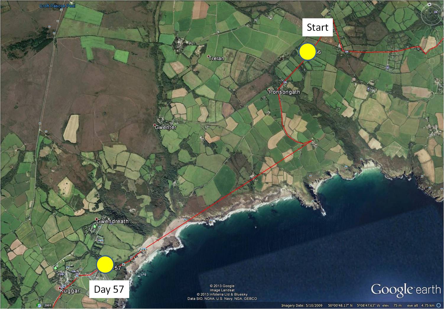
7-57 December 12, 2013 30 minutes 3.0 km (from Ponsongath to Kuggar)
~
Something different has appeared in the maps of the area where I am ‘travelling’. Today’s virtual bike trip took me just south of a large ‘brown’ area of topography (seen in the aerial photo above). To find out about this area, I turned my stationary cycle for a side trip in the direction of Gwenter, just to the north of my planned path.
~
The area I found is anything but brown (Street View images were done in July). These are the Goonhilly Downs, a raised plateau of heathlands above serpentinite rock. Besides being a Site of Special Scientific Interest and the home of many rare plants, the heathlands are the location of a large windfarm (I could just see the turbines in the distance) and the Goonhilly Satellite Earth Station (the largest in the world).
~

Goonhilly Downs … wind turbines and satellite dishes are just visible along the horizon (image from Street View)
~
From the road I could see expanses of grass, tufts of fern, and ericaceous shrubs. Patches of purple reminded me of the Rhodora that blooms here in spring. From my reading about the Cornwall heathlands, I am certain this plant must be Cornish heath (Erica vagans), a species of heather common in Cornwall. I have a small patch of heather growing in my own garden, so this plant has a spot in my heart. I first learned about heathers in our history club in high school – we took a field trip to see the heathers growing abundantly in Point Pleasant Park in Halifax. They grow there in a 3300 square meter patch, called the ‘Heather Patch’, south of the Cambridge Battery. The heathers are not native but grow there as an escape – from the stuffing in the bedrolls of British soldiers in the 1700s!
~

December 17, 2013 ‘Goonhilly Down’ Jane Tims
~
Copyright 2013 Jane Tims
getting ready for Christmas #4 – vintage postcards
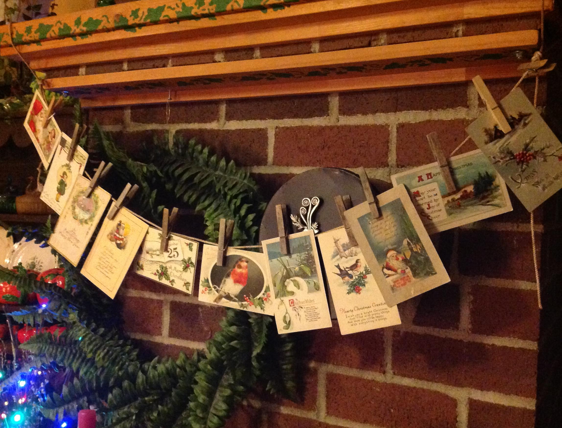
For a few years, I have hung examples from my collection of postcards on a string above the fireplace. I have postcards for all the major holidays – New Years, Valentine’s Day, St. Patrick’s Day, Thanksgiving, Halloween and, of course, Christmas.
~
This year, when I hung my Christmas postcards, I could only find six. I need more, I decided, and went on eBay to find just three more.
~
By the time I finished my bidding and winning, I had 14 postcards to add to my collection.
~
~
After I had hung some of the postcards over my fireplace, I discovered 7 other postcards from a collection that belonged to my grandmother. So now I have 27 vintage Christmas postcards. The eBay extravaganza was not necessary at all, but, oh, it was fun!
~
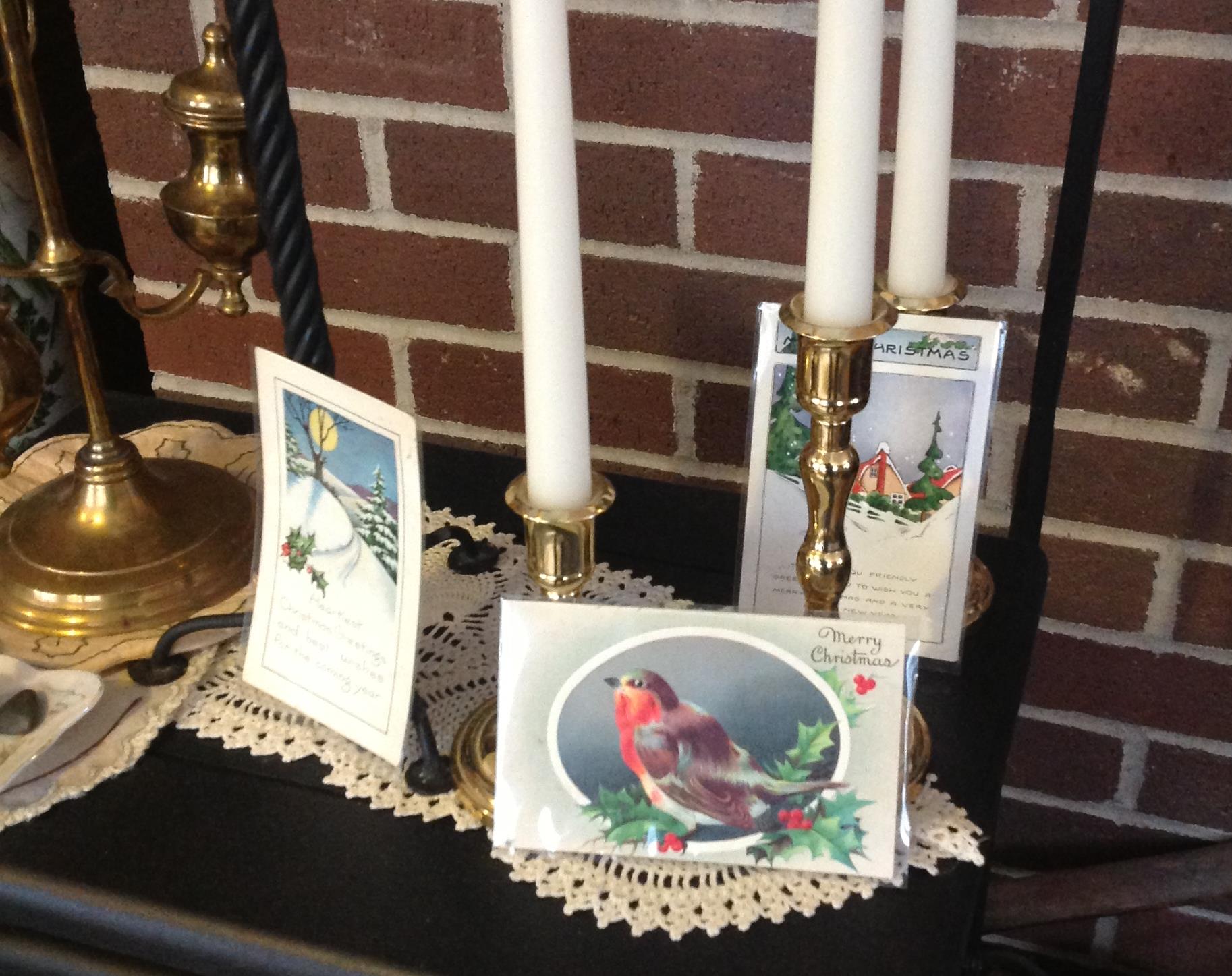
three of my new postcards – notice, I now have two of a set of ‘robin’ postcards – will I go out to find three more I know are in the set????
~

Vintage postcards, mailed in 1922 (left) and 1926 (right)
~
Copyright 2013 Jane Tims
a covered bridge – the Burpee Bridge, Queens County, New Brunswick
Last weekend, driving home from Miramichi, we followed the Grand Lake Road. It is mostly unpopulated, devoted to tree plantations and a preservation site for mature white pine.
~
Along the way, we stopped in at the Burpee Covered Bridge on the Gaspereau River near Gaspereau Forks, Queens County. This bridge is listed as Gaspereau River #2 in the April 1992 pamphlet ’Covered Bridges in New Brunswick’ (no author indicated). This means there was once another covered bridge crossing the Gaspereau River but it is now gone.
~

~
The Burpee Bridge was built in 1913. It is 167′ 9″ long with a span of 163′ 6″. The roadway width is 14′ 8″, and the load limit is 8 t. The maximum clearance is 3.9 meters.
The bridge is on a main road and the grounds on both sides of the river are nicely kept and mowed. The bridge was named for the family living nearby in 1913.
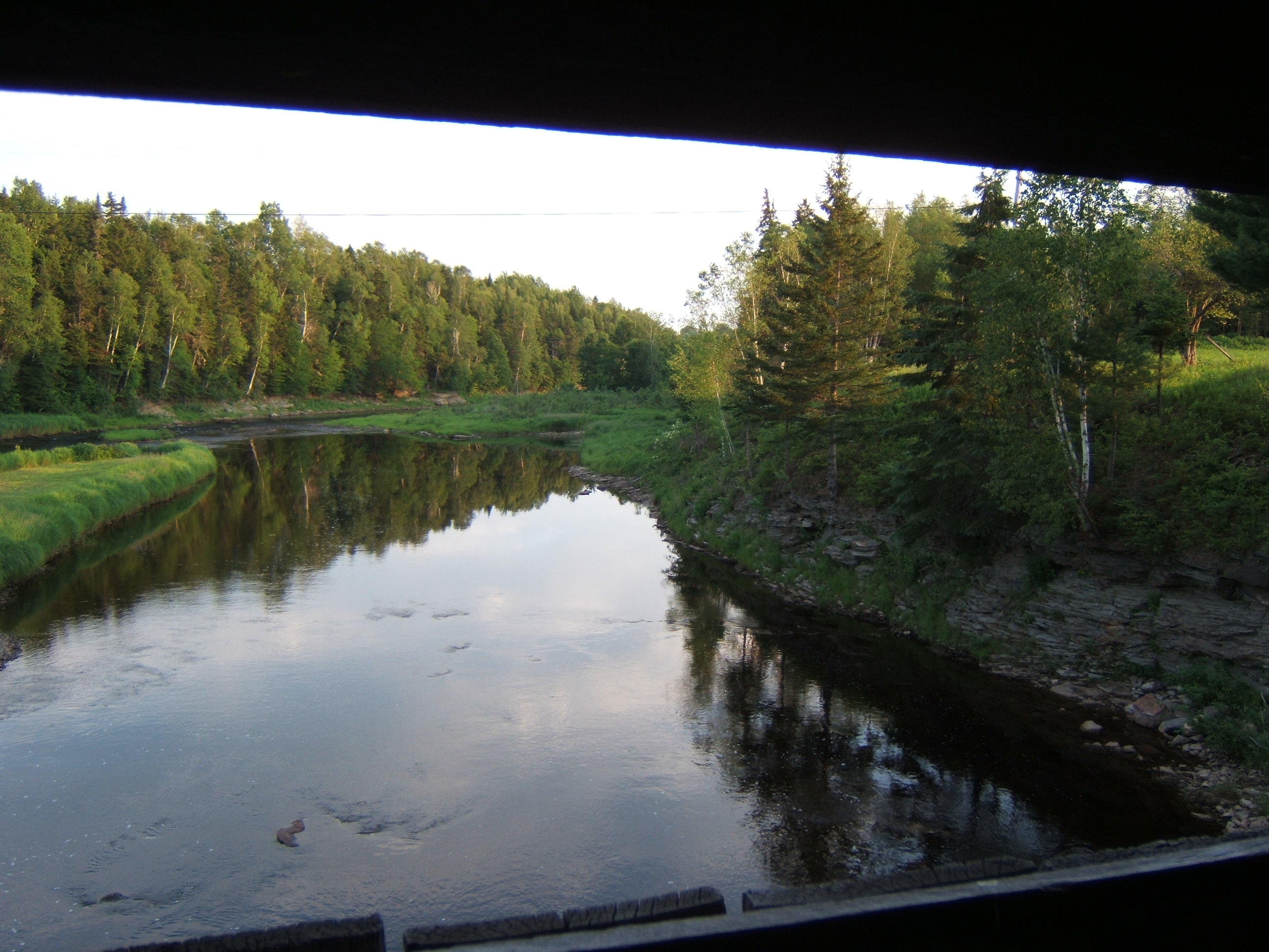
Inside the bridge, there is a window, with a good view of the Gaspereau River, showing the exposed bedrock of the river banks.
~
~
The rafters of the bridge are populated with swallows and their nests. The swallows chirped at me and swooped in and out of the bridge while I was there.
~
I couldn’t find any carvings in the failing light, but the inside of the bridge is covered in graffiti.
~

~
A lot of fluorescent paint has been used and it would be interesting to shine a black light inside the bridge … no doubt it would glow with spooky color …
~

~
We didn’t visit this bridge in 1992 as part of our Covered Bridge Project for Canada’s 125th anniversary. I am sorry we didn’t do more bridges that year … some are now gone, and it is interesting to compare the information for those that have survived.
~
This year, on July 27, the community plans a celebration of the 100th anniversary of the Burpee Bridge. The bridge will be turned (temporarily) into a museum of photos and artifacts about the bridge and community. Keeping our covered bridges in the eye of the community helps to preserve their heritage and value. It also encourages sharing of the wonderful stories about the part these bridges have played in our communities and lives.
~
Copyright 2013 Jane Tims
a covered bridge – the Marven Bridge, Kings County, New Brunswick
In late June, we drove to Sussex to do some errands. On the way back, we drove off the highway to find the covered bridge over the Belleisle Creek (Kings County). This bridge is known as the Marven Bridge and is listed as Belleisle Creek #2 in the April 1992 pamphlet ’Covered Bridges in New Brunswick’ (no author indicated). This means there was once another covered bridge crossing the Belleisle Creek but it is now gone.
The Marven Bridge was built in 1903. It is 79′ long with a span of 71′. The roadway width is 15′ 8″, and the load limit is 10 t. The maximum clearance is 15′ 8″.
The bridge is on a relatively good road in a steep valley. The blackberries were blooming in profusion along the road near the entryway to the bridge.
Inside the bridge, there is damage to the window openings where boards have been kicked out beside and below the windows. Otherwise the bridge is in good condition. We didn’t stop to look at carvings inside the bridge, but I saw a lot of graffiti as we crossed, including a giant ‘2012’.
We didn’t visit this bridge in 1992 as part of our Covered Bridge Project for Canada’s 125th anniversary. However, my husband remembers going fishing there many years ago.
I was disappointed to discover we did not bring the camera on this drive, but I did a quick sketch on site and a painting when we arrived home. I hope you like it!!!
~

June 26, 2013 ‘Marven Covered Bridge, Kings County’ Jane Tims
~
Copyright Jane Tims 2013
a citadel and a walled town 6-6

bright whites and blue-greens near Saint-Martin (image from Street View)
~

~

map showing distance travelled (map from Google Earth)
~
Another day on the flat, flat island of Ré. I saw more poppies …
~

poppies in a field near Saint-Martin (image from Street View)
~
huge vineyards …
~

a large vineyard (image from Street View)
~
and more vineyards …
~

a vineyard near Saint-Martin (image from Street View)
~
Although Street View doesn’t allow too close a look, I reached the fortified town of Saint-Martin-de-Ré. The major feature was the wall, around the citadel …
~

white wall around citadel at Saint-Martin (image from Street View)
~
and enclosing the town of Saint-Martin …
~

walled town of Saint-Martin (image from Street View)
~
Ile de Ré has been of strategic importance throughout history and is extensively fortified. This includes the citadel at Saint-Martin-de-Ré which was built around 1620 during the Wars of Religion to protect Catholic Saint-Martin from the Protestant population of La Rochelle. The Citadel was also used as a prison in the 18th and 19th centuries …
~

map of citadel (map from Google Earth)
~
On my next bike trip, I’m looking forward to a closer look at the walled town and its population of donkeys!
~
Best View: a courtyard in La Flotte, and some practice with my watercolours …
~

May 28, 2013 ‘walled courtyard in La Flotte’ Jane Tims
~
Copyright Jane Tims 2013
a walk along the quay 6-5

quay at La Flotte (image from Street View)
~

~

map showing distance travelled (map from Google Earth)
~
At last, vineyards! My virtual bike trip along the coast of Ile de Ré on May 27 took me past some beautiful vineyards …
~

to the right, the Abbaye des Chateliers (image from Street View)
~
In the distance, I could see the ruin of the Abbaye des Châteliers. Many of the images available for the abbey show fields of poppies – as I ‘drove’ by, a tractor was preparing the soil for the next round of bloom!
~

preparing a field for next season’s poppies (image from Street View)
~
The establishment of the abbey dates to 1150 although the exact date is unknown. The abbey was demolished and rebuilt several times … today’s ruin is 16th century. The facade of the church is almost intact, and shows the ornate enclosure of the huge windows. It was fun to explore, although in reality I was at a computer rather than admiring the stone walls in person. For more information on the Abbey, see http://www.patrimoine-histoire.fr/Patrimoine/IledeRe/Ile-de-Re-Abbaye-des-Chateliers.htm
~

vineyard with church ruin in distance (image from Street View)
~
The town of La Flotte was charming and very old. There were so many green shutters, I think they must be legislated in the town ordinance …
~

street in La Flotte with plantings and green shutters (image from Street View)
~
Flowers were planted everywhere along the street …
~

the edge of the wall along the street in La Flotte was planted with different types of flowers in bloom (image from Street View)
~
I thought the quay in La Flotte was inviting and sunny, the quinessential opportunity to wander along the dockside buildings and have a drink at one of the tables overlooking the harbour …
~

the quay in La Flotte (image from Street View)
~
Best View: a blue gate outside La Flotte … and my first effort at line and wash watercolor …
~

May 27, 2013 ‘blue gate near La Flotte’ Jane Tims
~
Copyright Jane Tims 2013
restoring an old church 5-9
~

vine-covered arch in enclosed garden in Belle Croix (image from Street View)
~
~

map showing distance travelled (map from Google Maps)
~
On May 7, I took my virtual bike through the area of Dompierre-sur-Mer and saw so many interesting sights. The gardens were lush and green. Even the traffic circles were small oases of interesting plants …
~

planted traffic circle in Dompierre-sur-Mer (image from Street View)
~
In the town, I was very interested to see an old church, the Prieuré Saint-Pierre, in the process of restoration. Thanks to the magic of Street View, I could see a photo of ‘before’ …
~

Prieuré Saint-Pierre before restoration in October of 2009 (image from Street View)
~
and ‘during’ …
~

Prieuré Saint-Pierre during restoration in September 2010 – the small building at the rear of the church has been demolished and the restoration of the back wall is underway (image from Street View)
~
The Prieuré Saint-Pierre in Dompierre-sur-Mer was founded in the 11th century by the monks of the Abbey of Maillezais. I ‘visited’ this abbey in the post for April 24, https://nichepoetryandprose.wordpress.com/2013/04/24/a-side-trip-to-an-old-abbey/ .
~
I could see the outside of some of the stained glass windows …
~
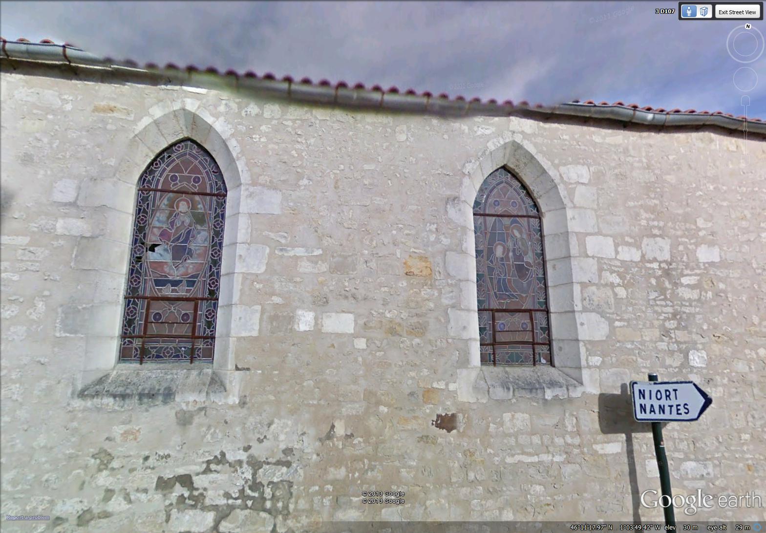
~
and the Bell Tower. From my reading, I learned a spiral staircase provides access to this tower …
~
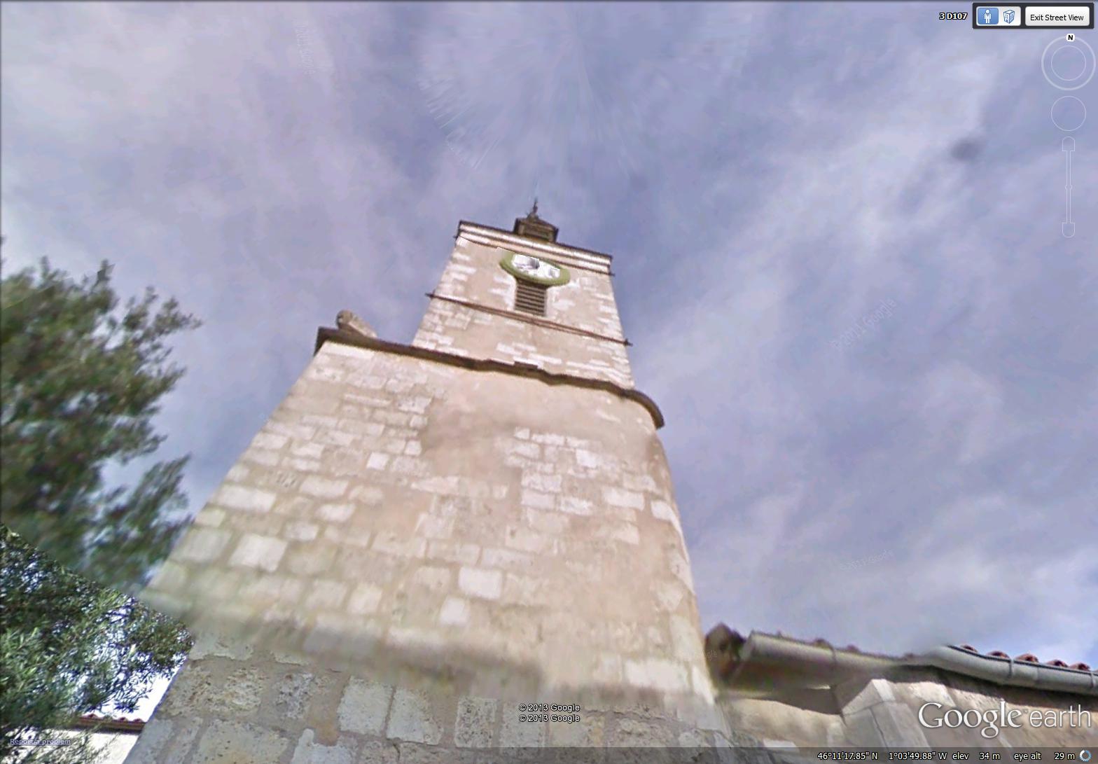
~
As I passed the church, I looked back to see a worker restoring the entryway of the church …
~

~
A description of this entry is found in a short account of the church’s architecture and its long history of collapse and restoration at http://en.patrimoine-de-france.com/charente-maritime/dompierre-sur-mer/prieure-saint-pierre-2.php
~
The account reads, in part: ‘The western façade has a triangular pediment surmounted by a Latin cross. The entrance gate is a double leaf door surmounted by a tympanum in carpentry, highlighted by an arcade basket. A molded headband short above the door. Above is drilled an oculus …’
~
You can see each of these features in the image above. A ‘pediment’ is an element of classical architecture, a triangular gable. A ‘tympanum’ is the decorated element over a door, above the lintel. An ‘oculus’ is a central opening in a wall, allowing light to enter the building.
~
Best View: the outside of a stained glass window in the Prieuré Saint-Pierre. The scene in the window depicts the Ascension of Jesus …
~

~
Copyright Jane Tims 20131


