Posts Tagged ‘exercise’
along the pond
On my stationary bike last week, I travelled (virtually) along the Cornwall coast from the mouth of Loe Pond to Rinsey. During the week, I biked for 90 minutes, and saw 11 km of the Cornwall countryside.
~
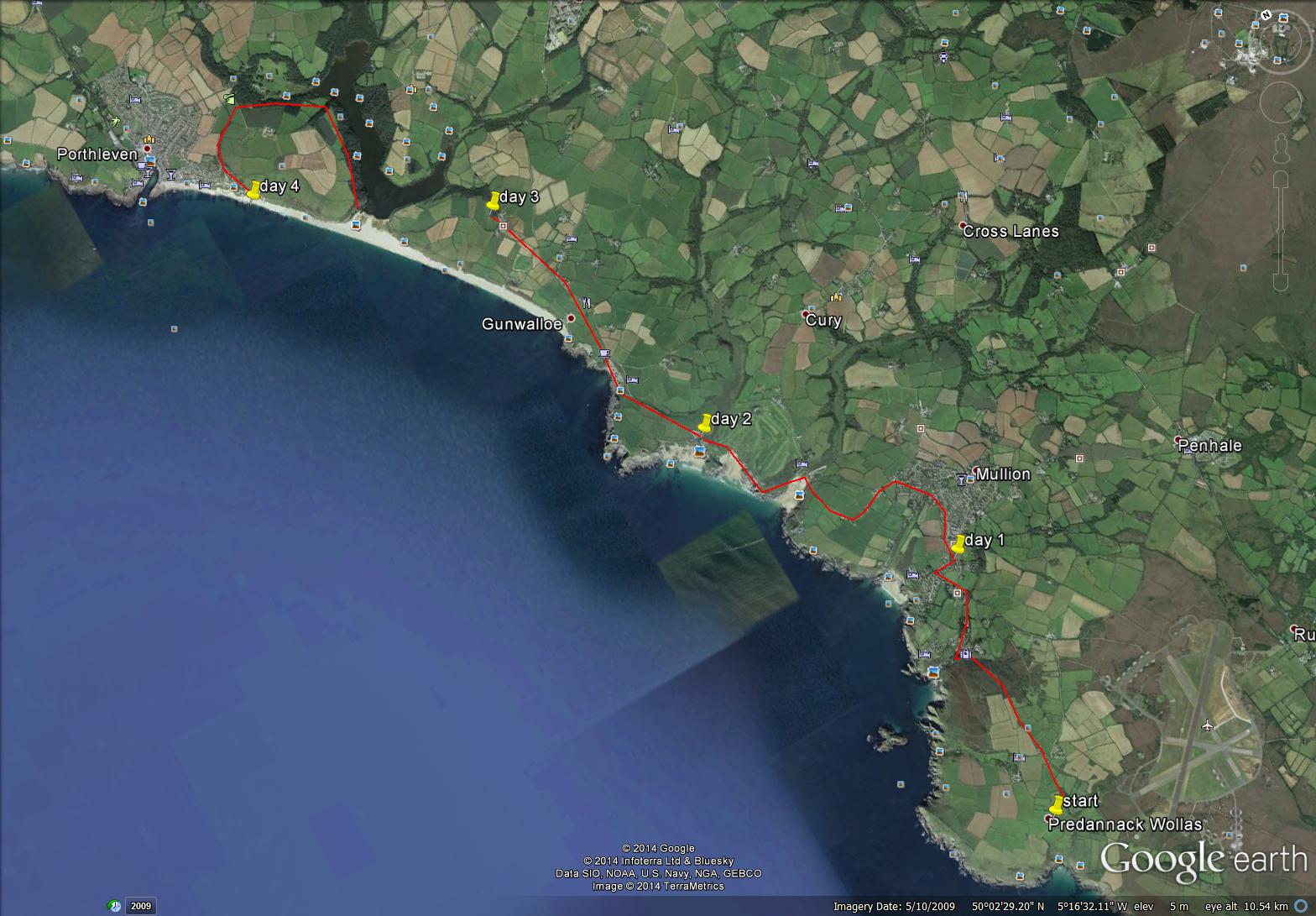
The first day took me from the mouth of ‘The Loe’, along the pond to just west of Porthleven, in Shadywalk Wood.
~

from the beach at the mouth of Loe Pond to Shadywalk Wood (map from Google Earth)
~
The beach is a wide crescent of endless sand …
~
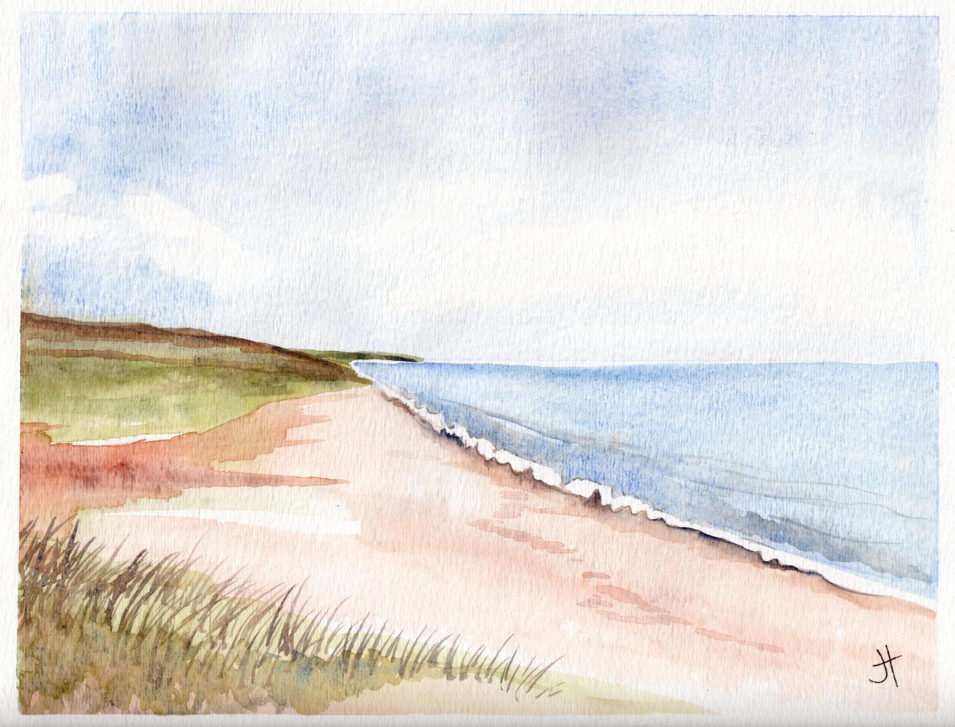
August 16, 2014 ‘beach at Loe’ Jane Tims
~
The path along ‘The Loe’ is narrow, tree-lined and shady. I saw lots of hikers and fellow bikers, but not a single car.
~

a typical part of the path along ‘The Loe’ (image from Street View)
~

August 16, 2014 ‘along Loe Pond’ Jane Tims
~
Biking along a shady lane, with no worries about traffic, thick ferny woods to one side and the sparkle of a pond on the other … a lovely way to ponder the days of summer …
~
Copyright 2014 Jane Tims
back to Cornwall
Although I have done some stationary biking since I ended my virtual trip across northern New Brunswick, I want to get back to the regular schedule I followed when I biked virtually in France and Cornwall. So I have decided to hop back on the Street View road and see some more of Cornwall.
~
In Phase 7 of my virtual cycling, I finished the southern coast of Cornwall at Landewednack and Lizard. I’ll begin Phase 9 at Predannack Wollas and cycle around the west coast of Cornwall. I’ll look forward to seeing Arthur’s Titagel and Doc Martin’s Port Isaac. Mostly, my knees will benefit from more regular exercise.
~
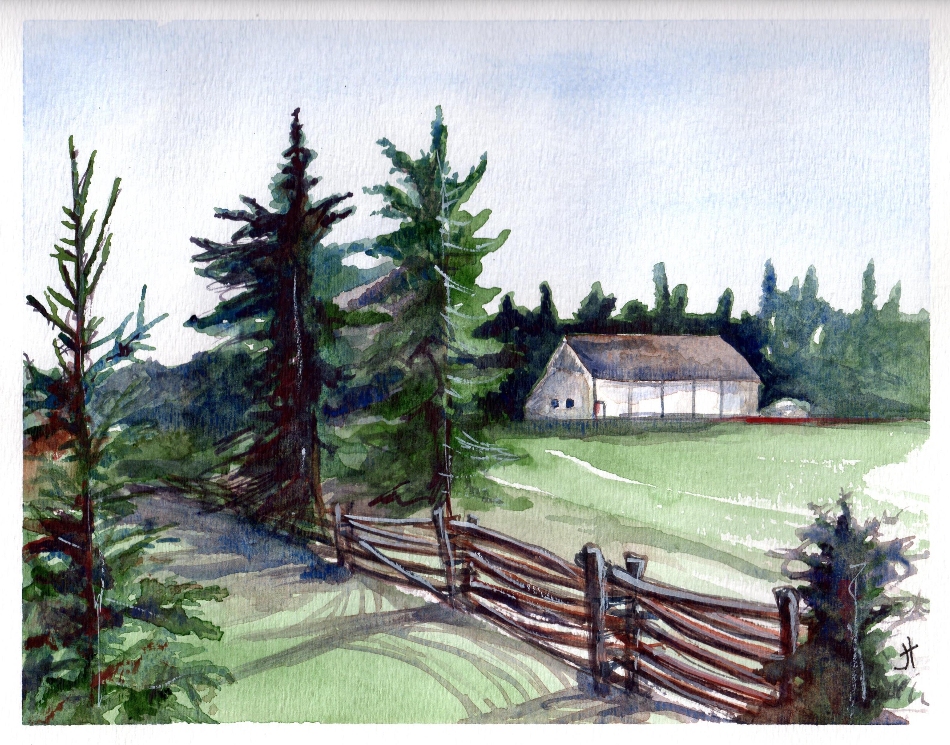
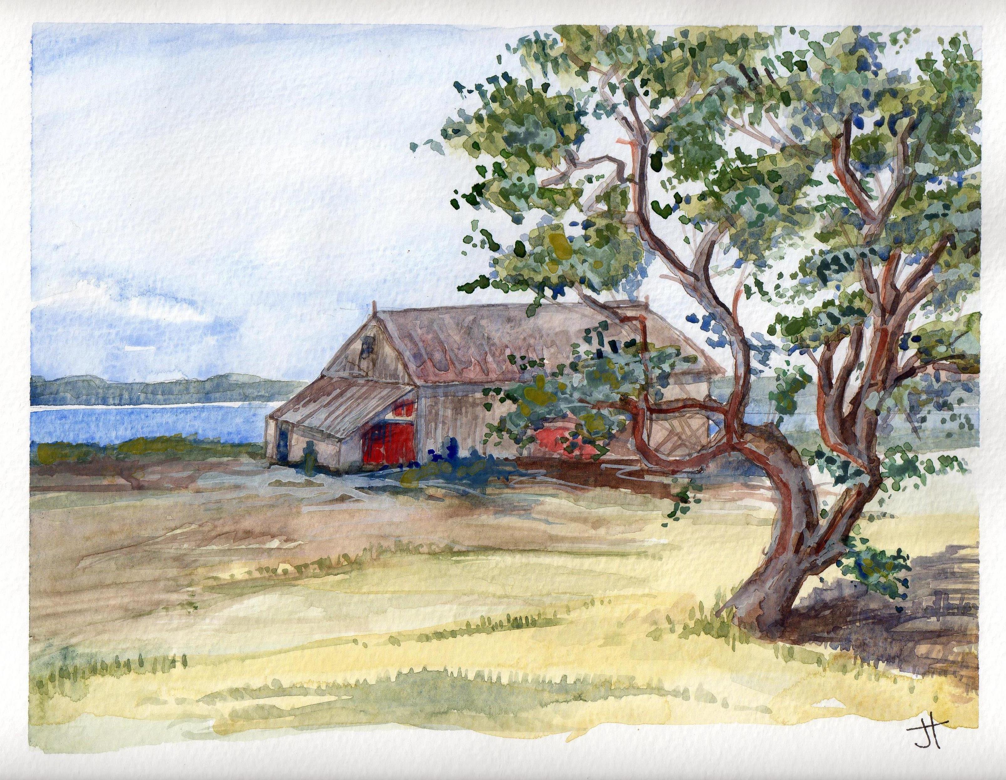
Predannack Wollas to Porthleven
~
I have my first four days plotted and I start tomorrow. Just for old time’s sake, here is one of my earlier paintings from southern Cornwall …
~
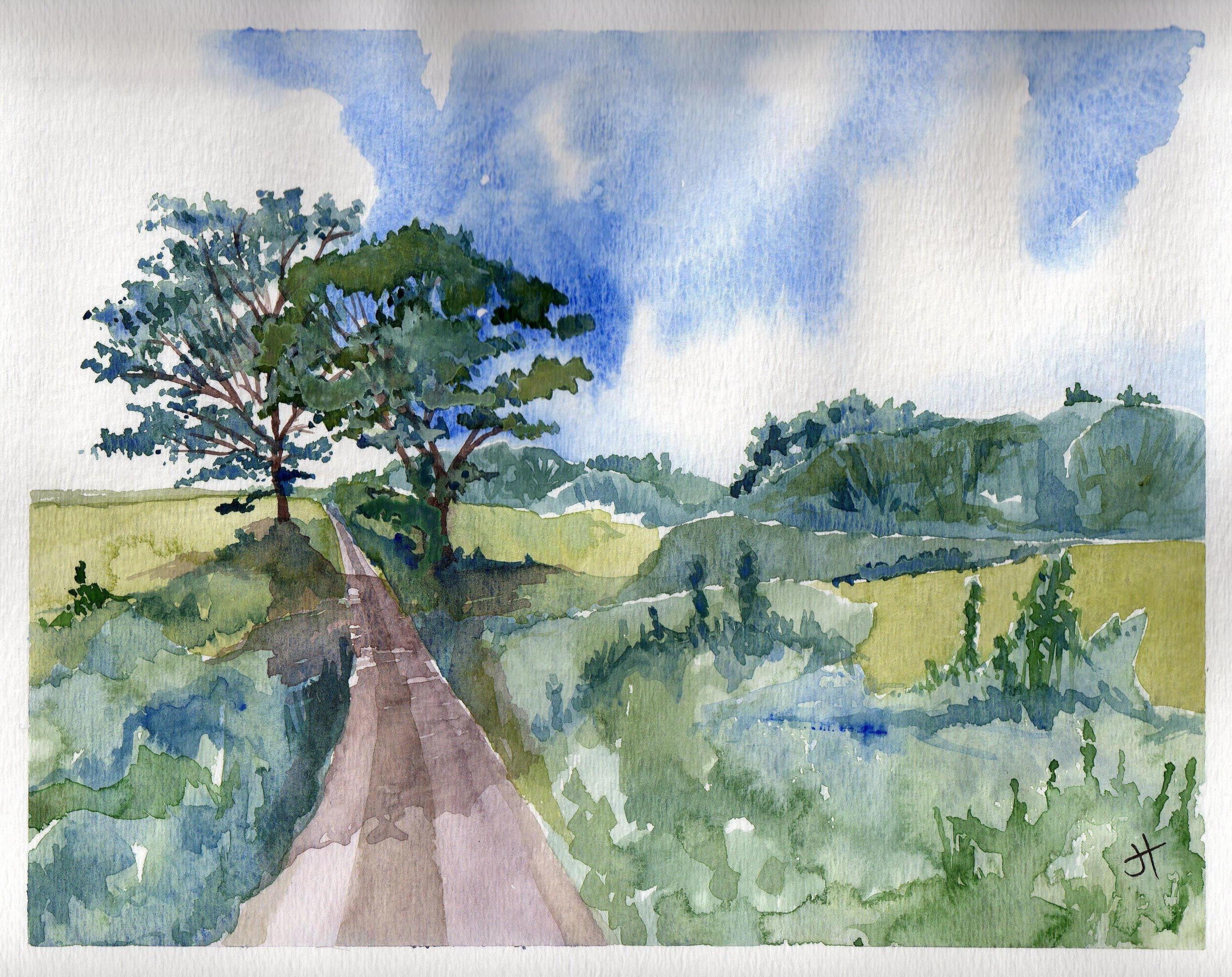
~
Copyright 2014 Jane Tims
family history – the Johnson brothers
If you have followed my blog for a while, you may be wondering what has happened to my virtual biking along the northern coast of New Brunswick.
~
Well, this is what happened. As I cycled one day, I took a side road. It was a narrow road I had not travelled in quite a few years. And as I cycled, I felt drawn further and further into the past. I began to explore this past, lured by wiggling leaves that popped up as I biked along. Yes, you have guessed it … I found myself at http://www.Ancestry.ca , building a forest of family trees.
~
I discovered I could learn about my family quite quickly… thirty minutes of biking gives me time to explore an ancestor or two … I can travel back in time to the 1880 USA Census to search the byways of Wyoming or the country roads of Pennsylvania … I can discover great-grandparents I have known for some time, or great-great grandparents I have never encountered before.
~
So, for a little while, my exercise program will not be about discovering new places, but about discovering new family members. I promise to return to the present and my virtual geographic travels eventually.
~
The first people I have met on my new travels are the Johnson brothers, my great-granduncles. They are the sons of my great-great-grandfather James Johnson. My Mom was very interested in this part of our family and worked to leave us a little of their history. I have photos of most of them, including a family grouping in a sepia tin-type. The original tin-type is small, about 2″ by 3″. Tin-types are photos imprinted on a metal surface. Most tin-types are on iron, coated with black paint or lacquer. This type of photo was popular from the 1860s through to the 1910s.
~

some of the Johnson brothers in an old tin-type photo
~
The brothers were John (born 1849 ), Daniel (born 1851), James (1854), Alexander (1857), and Isaac (1866). They had two sisters Kate (born 1847) and Mary Jane (my grandmother, born 1859). There is some question about which of the brothers are in the photo, but my Mom had it figured out based on the boys’ ages, and photos of them at an older age.
~
Only a few details survive for the brothers. I know birth and death dates, as well as the names of wives and children. John, James and Alexander were farmers. John and James were adventurers and visited the west. Daniel and Isaac were doctors.
~
So much information is lost, but for now, I am enjoying small discoveries about their lives.
~
Copyright 2014 Jane Tims
preserving coastal marsh (day 24 and 25)
The last few days of my virtual biking have reminded me of the need to preserve coastal areas, including barrier beaches and coastal salt marsh. Day 24 and 25 of my virtual travels took me along Youghall Beach near Bathurst. This barrier beach has been almost entirely developed with seasonal and year-round residences.
~

map showing distance travelled (map from Google Maps)
~
8-24 March 24, 2014 35 minutes (south of Youghall Beach to Youghall)
8-25 March 25, 2014 30 minutes ( Youghall to south of Youghall)
~

aerial view of Peters River salt marsh (right) and Youghall Beach (left) (image from Street View)
~

Peters River salt marsh (image from Street View)
~
One of the reasons to protect barrier beaches from development is the close association with coastal marshes and their sensitive wild life. For example, the coastal marshes in the Bathurst area, including the coastal salt marshes of the Peters River near Youghall Beach, are home to the Maritime Ringlet Butterfly. The Maritime Ringlet (Coenonympha nipisiquit McDunnough) is a small butterfly with a wing-span of four centimeters. It is buff-and-rusty-coloured, with a dark eyespot.
~
This butterfly is endangered, because it faces extinction. It is ‘endemic’ to the salt marshes of the Baie-des-Chaleurs – this is the only place in the world where this butterfly lives. The butterfly can only live in the salt marsh – the Maritime Ringlet caterpillar lives on salt marsh grasses (Spartina patens) and the adult uses Sea Lavender (Limonium nashii) as its nectar source.
~
Government and conservation groups in New Brunswick have worked together to educate homeowners about protecting the Maritime Ringlet Butterfly. They list practical steps people can take to ensure the habitat of this endangered butterfly is protected. These include: not filling in the marsh, not burning marsh grasses, not using vehicles in the marsh, not picking marsh wildflowers such as Sea Lavender, and not going into the marsh. For more information on the Maritime Ringlet Butterfly and its protection, see http://www.bathurstsustainabledevelopment.com/userfiles/file/HSP%20Final%20MR%20ENGLISH%20brochure.pdf
~

March 27, 2014 ‘Maritime Ringlet Butterfly’ Jane Tims
~
Copyright 2014 Jane Tims
between the salt marsh and the sea (day 21, 22 and 23)
My virtual biking in early March took me along the last length of coast before Bathurst. This is an area of coastal salt marsh and barrier beach. It is also an area where a lot of coastal development has occurred. My bike ride revived many memories of days when I worked on the provincial coastal policy.
~

distance travelled (map from Google Earth)
~
8-21 March 1, 2014 40 minutes (Petit-Rocher-Sud to east of Nigadoo)
8-22 March 4, 2014 30 minutes (east of Nigadoo to Beresford)
8-23 March 8, 2014 30 minutes (Beresford to south of Yougall Beach)
~
The prominent landscape feature in the area is a huge coastal salt marsh and a barrier beach. I certainly understand why people would want to live near to the sea. However, the development of the barrier beach can harm the beach environment, puts the health of the ecologically important salt marsh at risk, and sometimes creates a safety issue for the homes and cottages along the beach (people who live along the beach are at risk of coastal erosion, storm surge and walls of ice that build up along this coast).
~

aerial view showing Beresford barrier beach, the coastal salt marsh behind it and the waters of the Baie-des-Chaleurs (map from Google Earth)
~
The community of Beresford has preserved a portion of the beach and marsh, creating the Passerelle, a long boardwalk to enable people to appreciate the marsh and the bird life there. The Passerelle can also be seen in the upper left corner of the aerial view above (a white, curved structure crossing a corner of the marsh pond).
~

a view of the Passerelle boardwalk on the Beresford Marsh (image from Street View)
~
Once private land is developed, either for seasonal or year-round residential use, the only way to protect the beach and salt marsh is to encourage homeowners along the barrier beach to live as gently as possible.
~
Copyright 2014 Jane Tims
fencing us in (day 19 and 20)
When I first moved to New Brunswick, rail fences could be seen almost everywhere in rural areas. The design was simple – stacks of very long cedar logs in a zigzag without posts at the junction. The logs were piled from 3 to 4 high and were very weathered. These fences used cedar in the construction because of its natural ability to withstand rot.
~
As the years go by, these fences have gradually disappeared from the landscape. Part of this is because the fences eventually deteriorate. Also, people salvage the rails for landscaping and other projects.
~

distance travelled (map from Google Earth)
~
8-19 February 25, 2014 30 minutes (Petit-Rocher-Nord to Petit-Rocher)
8-20 February 27, 2014 30 minutes (Petit-Rocher to Petit-Rocher-Sud)
~
Although I haven’t seen the zigzag style of rail fence on my virtual bike trip along the northern New Brunswick coast, I have seen other rail fence designs. These fences are also built of cedar, but the rails are supported at the junctions by short lengths of cedar …
~

rail fence near Nash Creek (image from Street View)
~
or on a sort of ladder, consisting of two posts and cross-members …
~

rail fence near Pointe Verte (image from Street View)
~
When I was younger, sitting on a fence like any of these was on my list of favorite things to do. Today, our property is fenced with a zigzag style cedar rail fence, built by my husband who is proud to say not a nail is used in the construction …
~
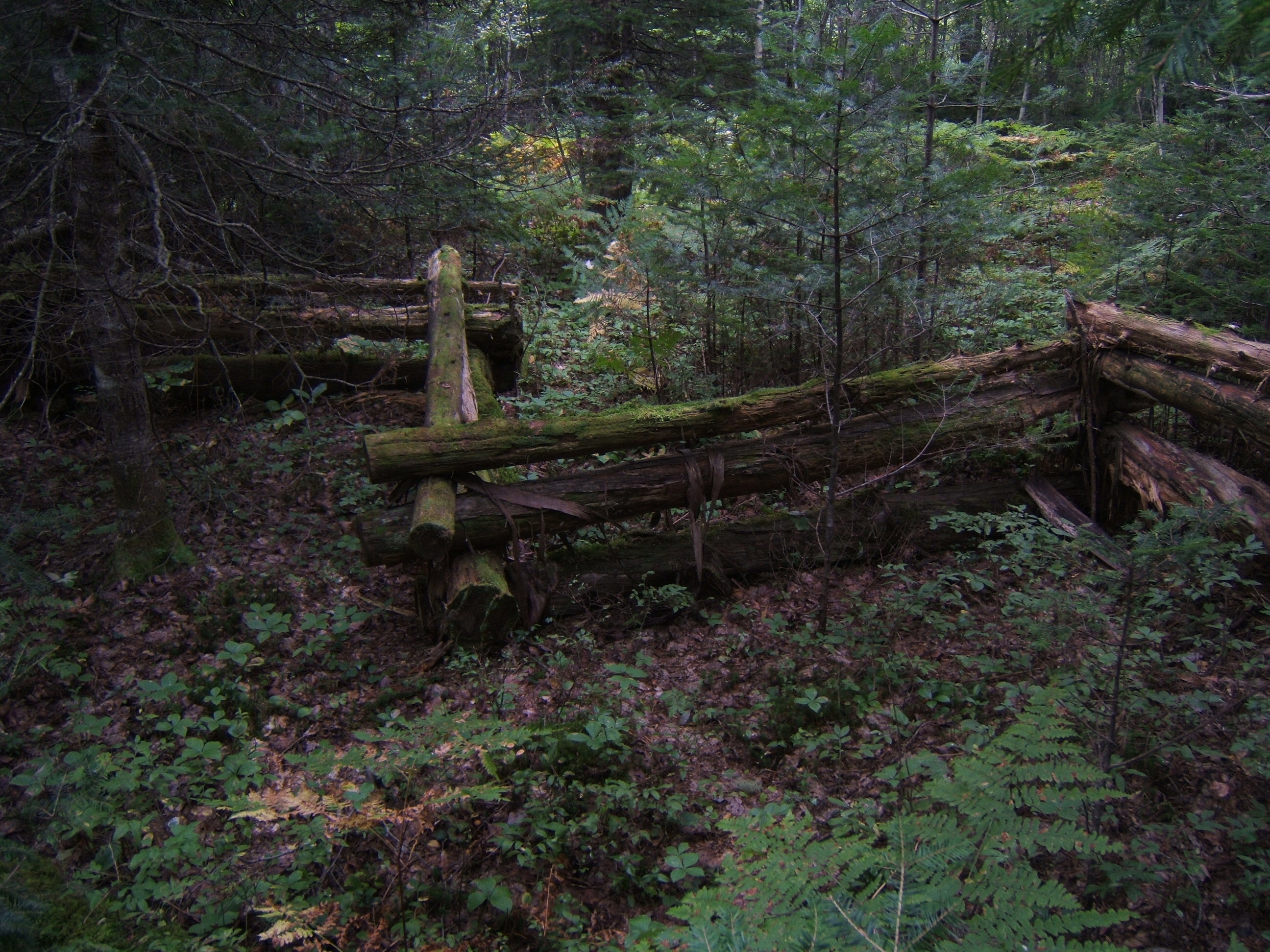
zigzag rail fence round our property
~
I wonder if there are nails used in this rail fence …
~
March 5, 2014 ‘rail fence’ Jane Tims
~
Copyright 2014 Jane Tims
flags all flying (day 17 and 18)
During my virtual travelling along the north shore of New Brunswick I often see flags flying, representing the esteem of people for their country and their heritage …
~

distance travelled (map from Google Earth)
~
8-17 February 21, 2014 30 minutes (Belledune to Devereau)
8-18 February 25, 2014 35 minutes (Devereau to Petit-Rocher-Nord)
(I also took a quick sidetrip on the highway south to Madran – the beauty of travelling virtually)
~
All along the coast of northern New Brunswick, people are proud to display their flags. As I ‘cycle’ along the road I see three flag designs …
~
The red and white Canadian flag with its maple leaf …

a Canadian flag near Campbellton (image from Street View)
~
the New Brunswick flag (based on the province’s Coat of Arms and depicting a red lion and a ship) …

the yellow, red and blue New Brunswick flag showing the ship from the Coat of Arms (image from Street View)
~
and the Acadian flag …

the blue, white and red Acadian flag showing its gold star (image from Street View)
~
The Acadians are the descendants of French colonists of the 17th century who settled in Acadia (the Maritime Provinces, parts of Quebec and Maine). Today, over 1/3 of New Brunswickers are Acadian and New Brunswick is officially bilingual (French and English).
~
The Acadian flag represents Acadians all over the world. The flag is blue, white and red, like the flag of France. On the blue field is a gold star, the Stella Maris (Star of the Sea). The star represents the Virgin Mary, patron saint of the Acadians.
~
Along the north shore of New Brunswick, the colours of the Acadian flag are represented on various objects, including telephone poles in some communities …
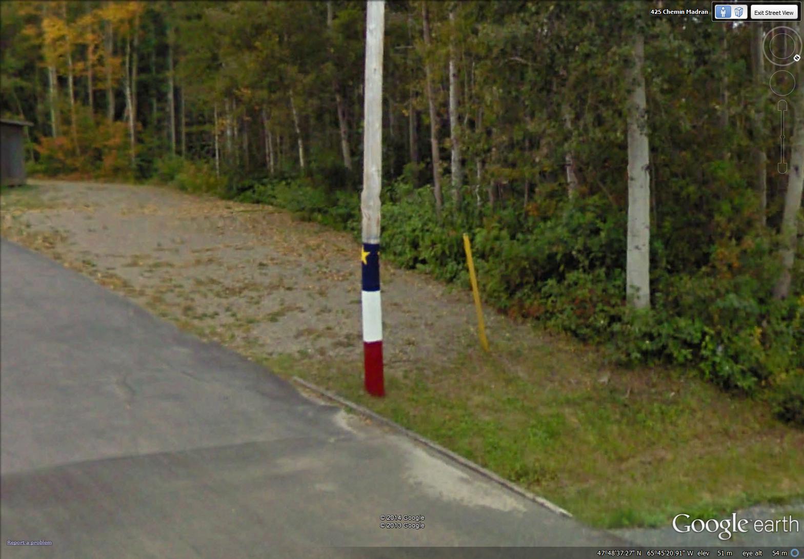
a painted telephone pole in Madran (image from Street View)
~
on lobster traps …

colours of the Acadian flag on a lobster trap (image from Street View)
~
and on rocks …

February 25, 2014 ‘roche Acadienne’ Jane Tims
~
The Acadian flag and its representations remind me how proud I am to live in a province that includes the rich culture and history of the Acadian people.
~
Copyright 2014 Jane Tims
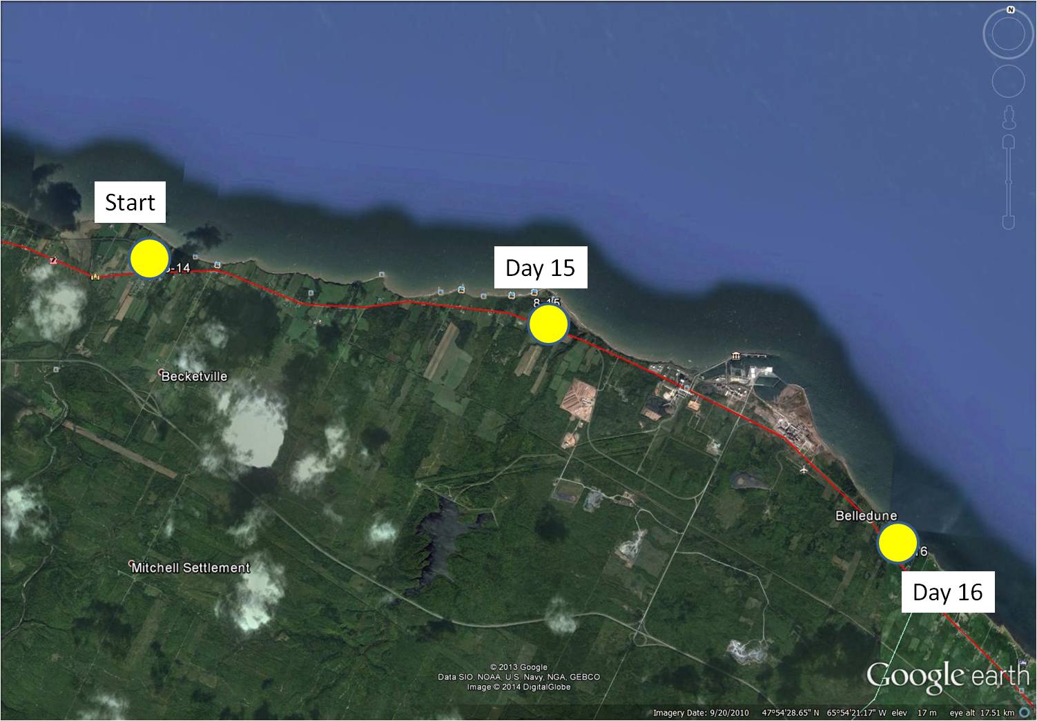
industry and old barns (day 15 and 16)
One of the best things about ‘biking’ a new section of road every time I exercise is – I never know what theme is going to suggest itself …
~
~
8-15 February 12, 2014 30 minutes (Jacquet River to Culligan)
8-16 February 16, 2014 35 minutes (Culligan to Belledune)
~
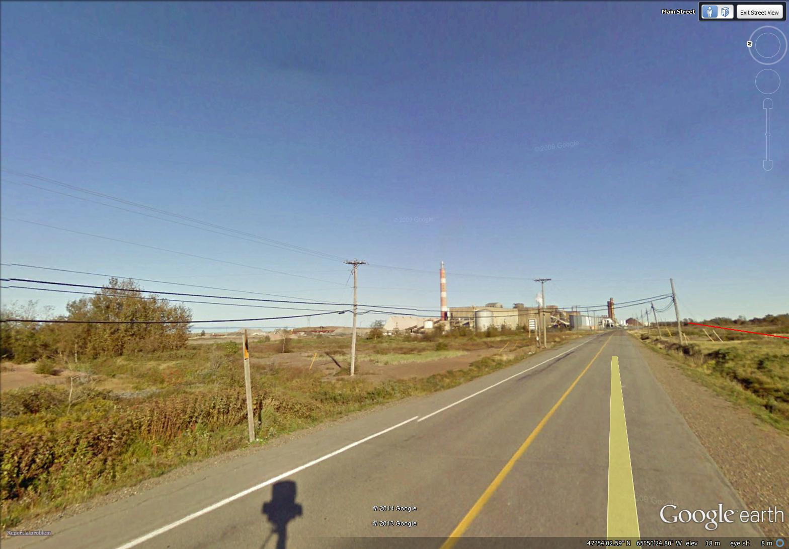
This session of virtual touring took me to Belledune. The area is quite industrialized, since it is the site of the Xstrata Zinc Canada Brunswick Smelter …
~
~
and the location of the Belledune Thermal Generating Station …
~
~
The smelter is a primary lead smelter and refinery. Its air emissions are controlled by various process-specific pollution control equipment including a scrubber and baghouse facilities.
The 450 MW (megawatt) generator burns coal and has a ‘scrubber’ to help remove sulphur dioxide emissions. At the present time, there are only two thermal generating stations still operating in New Brunswick. Most of the rest of our power comes from hydroelectric and nuclear stations; we also have some wind power.
I studied the air emissions of both the thermal generating station and the smelter at Belledune.
~
At first glance, this industrial activity in a mostly rural area may seem out-of-place. However, the smelter and generating station use the Port of Belledune. This is a world-class deep water port in the Baie-des-Chaleurs with year-round cargo handling ability. The port, one of Atlantic Canada’s most successful, offers a gateway to North America.
~
In the midst of all this industrial activity, in my search for paintings to represent my ‘travels’, I chose images of the rural landscape …
~
an old barn with red doors …
~
February 21, 2014 ‘barn along the bay’ Jane Tims
~
and a barn near a huge Mountain Ash, its red berries magnificent …
~

February 22, 2014 ‘red berries – Mountain Ash’ Jane Tims
~
Copyright 2014 Jane Tims
rural relics (day 10 to 12)
On my virtual bike trip along the north coast of New Brunswick, I am seeing many aspects of rural New Brunswick that are almost relics in our modern world.
~

distance travelled (map from Google Earth)
~
8-11 January 31, 2014 45 minutes 3.0 km (Eel River Bar to Charlo)
8-12 January 28, 2014 30 minutes 7.0 km (Charlo to Blackland)
~
relic:
- object that is interesting because of its age or association
- surviving custom, belief or object from a past age
(Oxford dictionary)
~
One of these relics is the rural mailbox. Amid controversy, the single mailbox at the end of a driveway is gradually being replaced, so there are very few end-of-drive mailboxes along the route I am travelling.
~
We had a mailbox for many years and it was always fun going to the end of the drive to get our mail. Once when I was at my grandfather’s farm for a vacation, my Aunt Anna sent me a parcel so I would have the fun of getting a box in the mail. I remember well reaching up to get the parcel and I remember what was inside – a snow globe!

getting a parcel at my grandfather’s mailbox
~
About ten years ago, we were shifted to a community mail box. We have a key and an assigned box. It is still fun to get the mail, but less convenient …
~

mailboxes near New Mills (image from Street View)
~
Another relic of a more self-sufficient way of life is the remnant apple orchard. In some cases, the apples are still used by thrifty families, but often the fallen fruit is left for the deer …
~

orchard near Blackland (image from Street View)
~
I also see derelict barns and sheds along the road, abandoned as people give up farming and a more rural way of life …
~

February 11. 2014 ‘old shed near Charlo’ Jane Tims
~
Do you encounter remnant bits of our past in your travels? Do they bring back memories?
~
Copyright 2014 Jane Tims
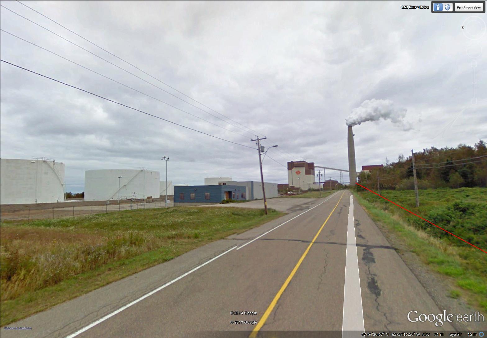
a bay and a bar (day 7 to day 10)
Today I am happy to announce – it has been one year since I began my virtual travel, as part of my efforts to exercise and to motivate me to ride my stationary bike more regularly. Although I have really only biked in my tiny exercise room in our basement, I have travelled, with the help of Street View (Google Earth) to central France, to the south coast of Cornwall and, now, to northern New Brunswick. During the past year, I biked 143 days (an average of 30 minutes on each day) and over 530 kilometers. I am so proud of myself!!
~
During the last four days of my virtual biking, I went through the Town of Dalhousie, at the mouth of the Restigouche River. At this point, the river opens into the Bay of Chaleur (la Baie des Chaleur) …
~
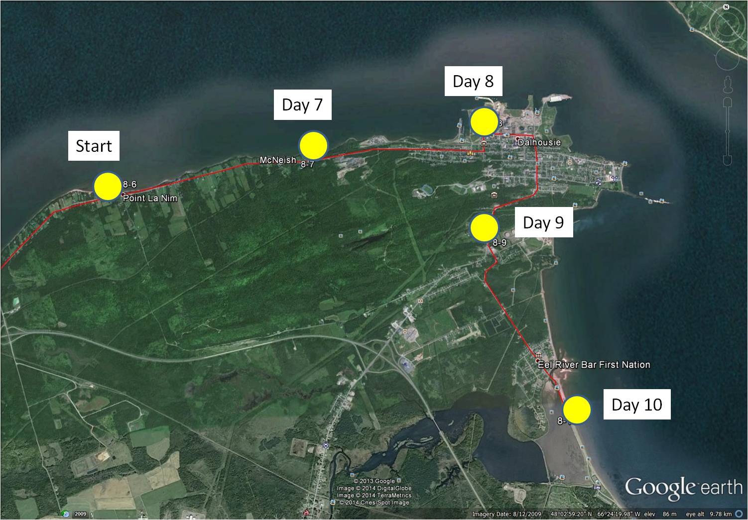
8-7 January 21, 2014 30 minutes 3.0 km (Point La Nim to McNeish)
8-8 January 23, 2014 30 minutes 3.0 km (McNeish to Dalhousie)
8-9 January 25, 2014 30 minutes 3.0 km (Dalhousie to Darlington)
8-10 January 28, 2014 35 minutes 3.0 km (Darlington to Eel River Bar)
~
One of the sights along this part of my journey is the 315 MW power generating station at Dalhousie, once operated by NB Power. This generating station was decommissioned in 2012 but remains interesting to me since I was hired in 1978 to monitor the biological effects of air emissions of the various industries in the Province. One of the reasons I travelled in northern New Brunswick was to carry out a monitoring program to study the effects of the Dalhousie power generating station.
~

Dalhousie power generating station (image by Street View)
~
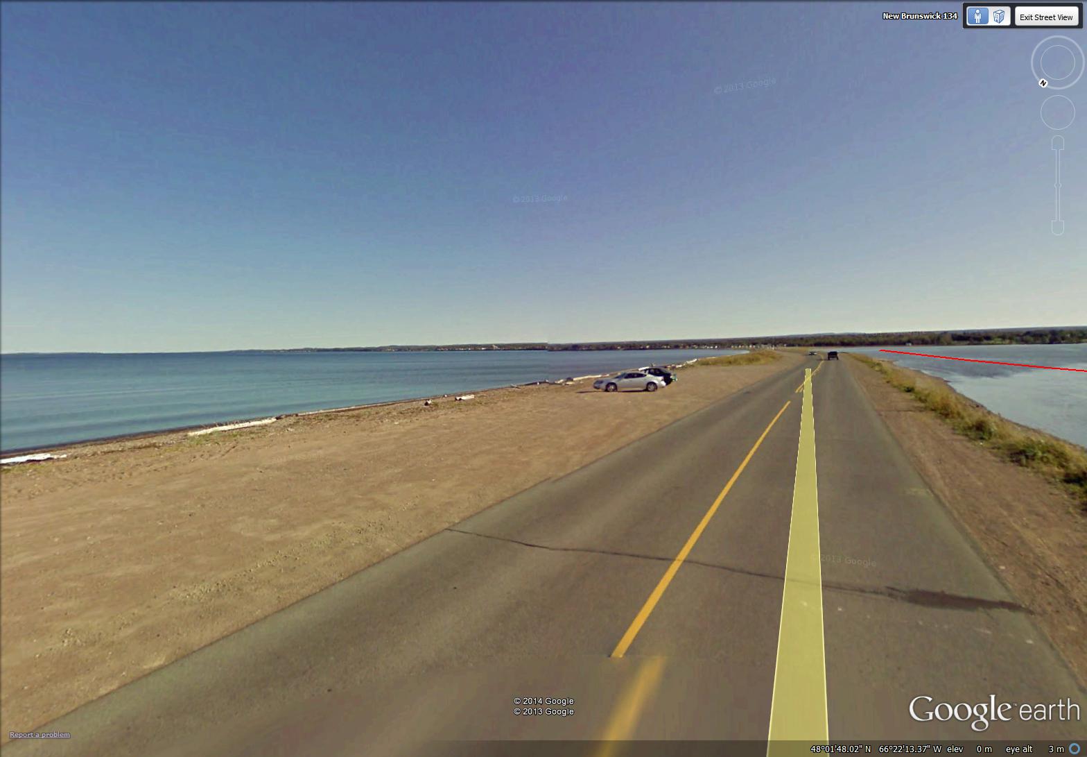
At the end of my four day ‘virtual travel’ last week, I crossed the beautiful Eel River Bar. This is the location of the Eel River Bar First Nation (Mi’kmaq people). The sandy bar is a barrier beach and one of the longest natural sand bars in the world. Water on one side of the Bar is salt and on the other is fresh. The highway is built directly on the Bar …
~
~
Across the Bay from the Bar is the low-lying peninsula of Miguasha, Quebec and the backdrop of the hills and mountains of the Gaspé peninsula. Boats at the entrance to Eel River are tethered as part of a fish netting system …

February 2, 2014 ‘boats at Eel River Bar’ Jane Tims
~
Copyright 2014 Jane Tims


