Posts Tagged ‘stationary cycling’
a dragon on a wall – biking log book Day #9
I am continuing with the third phase of my virtual bike trip through central France. For Phase 3 of my trip, I am biking in 12 days from Exireuil to Magné just west of Niort.
~
Log Book: March 5, 2013
Area travelled: from ‘outskirts of Niort’ to ‘edge of Niort’
Distance: 30 minutes 3.0 km
Notes: only three more days to go on my virtual trip to Magné!
~
Distance Travelled Feb 21 to Mar 5: 27.0 km (270 minutes of stationary biking)
Total Distance Travelled Jan 30 to Mar 5 : 58.8 km (595 minutes of stationary biking)
~

map showing distance travelled (map from Google Earth)
~
On March 5, I finally made it off the train track and entered the city of Niort. It is a neat city with lots of one-way streets, enclosed yards and lots of greenery.
~
As in many cities, there were lots of interesting sights to see. I grabbed a bottle of Perrier to drink as a Perrier truck passed by…
~

Perrier truck (image from Street View)
~
I saw a school yard where the children seem to have hung up their artwork to dry on a line between two trees…
~

school yard and art hanging on the line (image from Street View)
~
I was able to visit yet another Pâtisserie… yummmmm!
~

patisserie (image from Street View)
~
I also saw what looked like remarkable graffiti on one fence, a rendition of a dragon…
~

dragon wall (image from Street View)
~
~
wall dragon
~
he peers from under
a fall of vines
growls at the passing cars
ignore him
fueled with their own
bellyfuls
of fossil fire
~
~

closeup of dragon wall (image from Street View)
~
Best View: a charming enclosed yard in Niort
~

~
Do you think the homeowners had the dragon painted on the wall, or was it ‘noncommissioned’?
~
Copyright Jane Tims 2013
a name for a novel – biking log book Day #8
Biking, biking, biking!!! I am still working on Phase 3 of my virtual bike trip through central France. For Phase 3 of my trip, I am biking in 12 days from Exireuil to Magné just west of Niort.
~
On March 4, for the second biking day in a row, my bike trip was along a railroad track!

~
I had lots of time to think, so I thought about the title of the novel I have been working on. For those of you who do not know about my novel, it is about a woman who sets out to save an abandoned church.
~
On Day #6 of my virtual bike trip, in Chavagné on the Route de la Mothe, I saw an old church…
~

~
At first, I thought the roof had been removed from this church, leaving it open to the elements. On closer look, there is a low-pitch roof in place (note the rafters and clay tiles)…
~

old church on the Route de la Mothe
~
However, the image reminded me of another abandoned church I had read about in my research for my book:
‘The Old Church of St. Nidan, in Llanidan, North Wales, is a ruin. All that is left of this medieval church are the four stone walls of the western wing and its central arcade. The nineteenth century clergyman Harry Longueville Jones wrote that the church had succumbed to a ‘melancholy fate’. In 1850, church historian Sir Stephen Glynne wrote that most of the church is ‘open to the skies.’ (partly quoted from Wikipedia, ‘Old Church of St Nidan, Llanidan’, January, 2013).
I think I will use the phrase ‘Open to the Skies’ as the title for my novel. It refers to the fate of an abandoned church, but also to the ability of people to open themselves up to possibilities. I think it is perfect for my book.
~
Log Book: March 4, 2013
Area travelled: from ‘field south of Trévins-le-Bas’ to ‘outskirts of Niort’
Distance: 30 minutes 3.0 km
Best view: no best views today; biking on the railroad is not inspiring
Notes: after this, I will be careful to plot my bike trip on roads rather than rails!!!!
~
Distance Travelled Feb 21 to Mar 4: 24.0 km (240 minutes of stationary biking)
Total Distance Travelled Jan 30 to Mar 4 : 55.8 km (565 minutes of stationary biking)
~
What do you think of the title ‘Open to the Skies’ for my book?
~
Copyright Jane Tims 2013
biking log book – Day #7 – a diamond in a tree!
I am still continuing on the third phase of my virtual bike trip through central France. For Phase 3 of my trip, I am biking in 12 days from Exireuil to Magné just west of Niort. As of March 1st, I was over half way there!
~
Unfortunately, all of the trip of March 1 was along a railroad track!

It was bumpy and boring. Big fields, no houses, few trees to give me shade and no Street View images.

Day 7 map showing side trip (marked A to B) (map from Google Earth)
So I did what all virtual bikers are able to do. I ‘flew’ a little to the south and followed a route from Villeneuve to Le Pont d’Homme, along two country roads: Rue du Moulin and Rue du Marteau.

Rue du Moulin (image from Street View)
~
These were hilly, winding country roads, bounded by small fields and interesting fences.
~
Log Book: March 1, 2013
Area travelled: from ‘east of Chavagné’ to ‘field south of Trévins-le-Bas’
Distance: 30 minutes 3.0 km
Best view: vine-covered gate on Rue du Marteau
Notes: I have discovered that most yellow fields in this part of France are Colza (Brassica rapa), a relative of Turnip, grown for oil.
~

~
I saw a runner in the Rue du Marteau…
~

~
We had a brief conversation (please excuse my poor French!):
Jane: Bonjour! (Hello!)
Runner: Lentement, Madame, lentement! Tu manques tout le paysage! (Slowly, Madame, slowly! You are missing all the countryside!)
Jane (able to see the future): Tu dois courir plus vites! Il y a un diamant dans l’arbre tout droite! (You’ve got to run faster! There’s a diamond in a tree straight ahead!)
~

diamond in tree on Rue du Marteau (look closely – probably a drop of water on the Street View camera!) (image from Street View)
~
Distance Travelled Feb 21 to Mar 1: 21.0 km (210 minutes of stationary biking)
Total Distance Travelled Jan 30 to Mar 1 : 52.8 km (535 minutes of stationary biking)
~
Do you think diamonds grow on trees in France??
~
Copyright Jane Tims 2013
biking log book – Day #6 – biking on a train track
Welcome to the continuation of the third phase of my virtual bike trip through central France. For Phase 3 of my trip, I am biking in 12 days from Exireuil to Magné just west of Niort. As of February 28, I was half way there!
~
Most of my virtual biking trip on February 28 was through the town of Chavagné. I am still very motivated by my virtual travels through France. In February, I have biked on my stationary cycle 17 days out of 28. To compare, in January, I only biked twice.
~

Day 6 map showing route followed (map from Google Earth)
~

Town of Chavagne, showing stone houses and walls (image from Street View)
~
Log Book: February 28, 2013
Area travelled: from ‘east of Chavagné’ to
Distance: 30 minutes 3.0 km
Best view: house with red shutters in Chavagné
Notes: the properties very neat and bounded from the road by stone walls
~

~
Imagine my surprise when I discovered part of my planned travel route diverges onto a train track! From n-n-ow-ow on-n-n-n the route will b-b-b-be b-b-b-b-bumpy-py-py-py…
~
when I plotted my path, I didn’t realise that part of the travel distance would be on a train track!!!! (image from Street View)
~
~
Distance Travelled Feb 21 to Feb 28 : 18.0 km (180 minutes of stationary biking)
Total Distance Travelled Jan 30 to Feb 28 : 49.8 km (505 minutes of stationary biking)
~
Have you ever biked or walked on a train track????
~
Copyright Jane Tims 2013
biking log book – Day #5 – gardens, bridges and highways
This is the continuation of the third phase of my virtual bike trip through central France. For Phase 3, I plan to bike in 12 days from Exireuil to Magné just west of Niort.
~
My February 26 bike ride took me from La Crèche to Chavagné.
~

Day 5 map showing route followed (map from Google Earth)
~
First, I biked along a country stretch of road lined with stone walls, orchards and gardens…
~

walls and gardens along Route de Tressauve (image from Street View)
~
I travelled beneath an impressive stone arch train bridge…
~

~
Then I biked for about 15 minutes along the A 10 highway…
~

along the A 10 … all the lines painted on the road are white … the yellow line is from Street View and shows the path of the camera car … the red line is my bike path
~
Log Book: February 26, 2013
Area travelled: from ‘La Crèche’ to ‘east of Chavagné’
Distance: 30 minutes 3.0 km
Best view: stone arch train bridge
Notes: The A 10 highway was so boring, but it made me pedal faster! In France, highways are painted with solid and dotted white lines. In Canada, the painted line between opposing directions of traffic is yellow. I guess it was not surprising that I strayed to the left side of the road on the highway!
~
Distance Travelled Feb 21 to Feb 26 : 15.0 km (150 minutes of stationary biking)
Total Distance Travelled Jan 30 to Feb 26 : 46.8 km (475 minutes of stationary biking)
~
How are the highways marked where you live?
~
Copyright Jane Tims 2013
biking log book – Day #4 – a haunting in the Rue de l’Aumônerie !
On February 21, I began the third phase of my virtual bike trip through central France. For Phase 3 of my trip, I plan to bike in 12 days from Exireuil to Magné just west of Niort.
~
Day #4 of my adventure followed a virtual path along a country road, past large fields, over the Sèvre Niortaise River, and into the town of La Crèche.

Day 4 map showing distance travelled (map from Street View)
~
My trip ended at a Chocolatier/Patissier in La Crèche … yum!!!!
~

patissier in La Creche (image from Google Street View)
~
Log Book: February 25, 2013
Area travelled: from ‘a field south-west of Kadore’ to ‘La Crèche’
Distance: 30 minutes 3.0 km
Best view: man on bike in Rue de l’Aumônerie
Notes: Tried to talk to the cyclist … a chance to practice my French!!!
Jane: Bonjour, Monsieur! (Hello Sir!)
Man on bicycle: Quoi? ???!? (What?!)
Jane: Bonjour, je m’appelle ‘Jane’. Je viens du Canada! (Hi. My name is Jane. I come from Canada.)
Man on bicycle: Qui est là? Qui dit ça????!? (Who is there? Who said that?)
Jane: Il fait beau temps, eh? (It’s nice out, eh?)
Man on bicycle: Aghhh! C’est un fantôme! Au secours!!!!! (Aghhh! It’s a ghost! Help, Help!)
~

~
Distance Travelled Feb 21 to Feb 25 : 12.0 km (120 minutes of stationary biking)
Total Distance Travelled Jan 30 to Feb 25 : 43.8 km (445 minutes of stationary biking)
~
Do you think the Rue de ‘Aumônerie is haunted????
~
Copyright Jane Tims 2013
biking log book – virtual bike trip from Exireuil, France to Magne – Day #3
On February 21, I began the third phase of my virtual bike trip through central France. For Phase 3 of my trip, I plan to bike in 12 days from Exireuil to Magné just west of Niort.
~
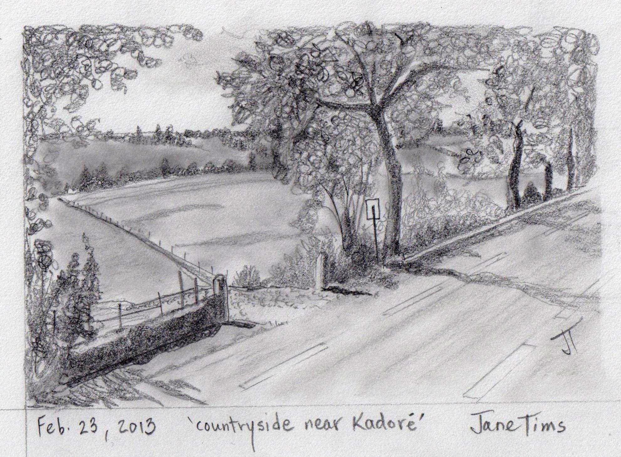
Today I (virtually) biked 3.0 km from Azay-le-Brûle to a big field south-west of Kadoré. The route was in three parts, including a country stretch, the village of Kadoré, and the tree-lined Route Nationale Kadoré.

map showing distance travelled (image from Google Earth)
Kadoré is a small village with charming homes and lots of greenery.

houses and greenery in Kadore (image from Street View)
~
Log Book: February 23, 2013
Area travelled: from ‘Azay-le-Brûle’ to ‘a field south-west of Kadore’
Distance: 30 minutes 3.0 km
Best view: countryside and tree-lined highway … gentle hills reminded me of Kennebecasis Valley in New Brunswick
Notes: late in day, so lots of shadows … bike trip along tree-lined highway fluctuated light, dark, light, dark, light, dark ……
~
~
Distance Travelled Feb 21 to Feb 23 : 9.0 km (90 minutes of stationary biking)
Total Distance Travelled Jan 30 to Feb 23 : 40.8 km (415 minutes)
~
If you lived in Kadoré, would you rather have a lawn mower or a hedge-trimmer?
~
Copyright Jane Tims 2013
biking log book – virtual bike trip from Exireuil, France to Magne – Day #2
On February 21, I began the third phase of my virtual bike trip through central France. For Phase 3 of my trip, I plan to bike in 12 days from Exireuil to Magné just west of Niort.
~
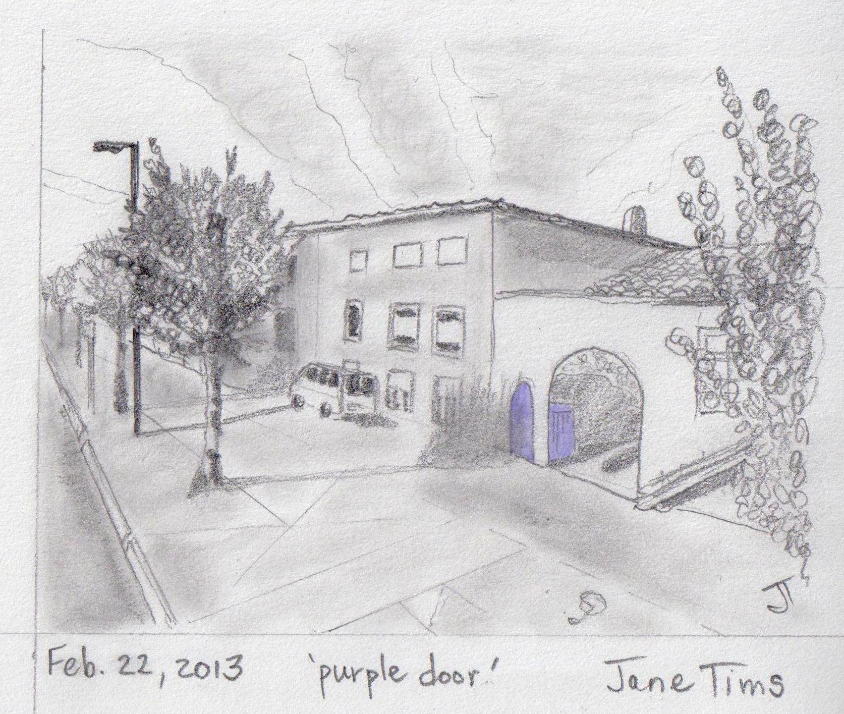
Today I (virtually) biked 3.0 km of a very straight stretch of road between Exireuil and Azay-le-Brûle. The first part of the road was in the town. I saw a McDonald’s … looked like the ones at home … but I did not stop in for a burger and fries!!!!
The second part of the road was a pleasant boulevard lined with trees.

~
Log Book: February 22, 2013
Area travelled: from ‘center of Exireuil’ to ‘Azay-le-Brûle’
Distance: 30 minutes 3.0 km
Best view: white house with archway to inner court – door and gate were painted bright purple!
Notes: boulevard was lovely, but lots of litter in ditches
~
~
Distance Travelled Feb 21 to Feb 22 : 6.0 km (60 minutes of stationary biking)
Total Distance Travelled Jan 30 to Feb 22 : 37.8 km (385 minutes)
~
What do you think of the idea of using just a touch of color on doors, gates and windows to add curb appeal ?
~
Copyright Jane Tims 2013
biking log book – virtual bike trip from Exireuil, France to Magne – Day #1
On February 21, I began the third phase of my virtual bike trip through central France. For Phase 3 of my trip, I plan to bike in 12 days from Exireuil to Magné just west of Niort.
~
Although the first two phases of my trip have been a success, I have encountered two problems:
1. the time it takes to print the maps and views and scan them for the notebook, and
2. the ink it has taken to print out enough views to make the trip more interesting.
~
With some trial and error, I have found a solution. I have gone digital. To save time, I am now using my Flash Drive and a portable computer.
1. I now prepare my trip by saving the Street View images to a file on my Flash Drive (USB portable drive). I don’t print the images and this saves ink. I can also save as many Street View images as I want to represent the trip.
2. I transfer the images to my small computer via its USB port. You could use a laptop, but I have an inexpensive ASUS Eee PC my son gave me several years ago. It is just the right size to put on the book shelf of my stationary cycle.

small PC and notebook on the book shelf of my stationary bike
3. If my small computer is not available, I can also use my SONY S-Frame (a digital Photo Display unit). It also has a USB port and it cycles through the photos or lets me view them one by one.
4. When I begin my bike ride, I just turn on the PC, call up the USB drive and look at the photos one at a time, or in a slide show. I also save an image of the Google Map so I can follow along at my rate of ’10 minutes equals 10 km’.

view of Street View map on PC – thin red line represents the path I am following – this is generated in Street View of Google Earth
5. I miss my ‘notebook’ version, so I do print out a map and a memento image of my bike trip on a given day.
6. I can easily use the images on my PC to do my drawings!
~

Day 1 map (from Google Earth) showing distance travelled
Log Book: February 21, 2013
Area travelled: from ‘outskirts of Exireuil’ to ‘center of Exireuil’
Distance: 30 minutes 3.0 km
Best view: two people out working in their very tidy garden
Notes: Not at all the rural landscape of my earlier biking. I saw apartment buildings and a roundabout for the first time on my trip. I got lost and went around the roundabout eight times before I found the right road!!!!
~

apartment building in Exireuil (image from Google Street View)
~
Distance Travelled Feb 21 : 3.0 km
Total Distance Travelled Jan 30 to Feb 21 : 34.8 km
~

~
When you bike, do you prefer rural or urban areas??
~
Copyright Jane Tims 2013
biking log book – virtual bike trip from Sanxay to Exireuil, France #3
I’ve now completed the second phase of my virtual bike trip through central France! In this phase, I travelled on my stationary bike from Sanxay to Exireuil, a distance of almost 18 km.
~

~
My bike ride for February 16 started in Fomperron, France. Imagine my surprise to see a donkey watching me as I biked by an old shed on the outskirts of the town!
~

a donkey watches near an old shed in Fomperron
(image from Google Earth Street View)
~

Feb 16 notebook showing distance travelled and Street View images
~
Log Book: February 16, 2013
Area travelled: from ‘Fomperron’ to ‘just north of La Robelière’
Distance: 25 minutes 3.0 km
Best view: old stone shed with a tile and moss-covered roof in Fomperron
Notes: Took a side road not on the Street View grid, so I travelled ‘blind’ for a day through uncharted countryside.
~
Distance Travelled Feb 12 to Feb 13 : 11.8 km
Total Distance Travelled Jan 30 to Feb 13 : 25.8 km
~

~
~
Log Book: February 17, 2013
Area travelled: from ‘field just north of La Robelière’ to ‘intersection of road to La Clavelière’
Distance: 30 minutes 3.0 km
Best view: a lone oak in the middle of a field
Notes: Travelling ‘blind’ for a day through uncharted countryside.
~
Distance Travelled Feb 12 to Feb 17 : 14.8 km
Total Distance Travelled Jan 30 to Feb 17 : 28.8 km
~

~
Log Book: February 18, 2013
Area travelled: from ‘intersection of road to La Clavelière’ to ‘Exireuil’
Distance: 45 minutes 3.0 km
Best view: old stone fence along road
Notes: Did a lot of walking this trip because I have a bad cold. Rejoined Street View at intersection and glad to be able to ‘see’ the road. First time I’ve seen a subdivision or a cemetery.
~
Distance Travelled Feb 12 to Feb 13 : 17.8 km
Total Distance Travelled Jan 30 to Feb 13 : 31.8 km
~

~
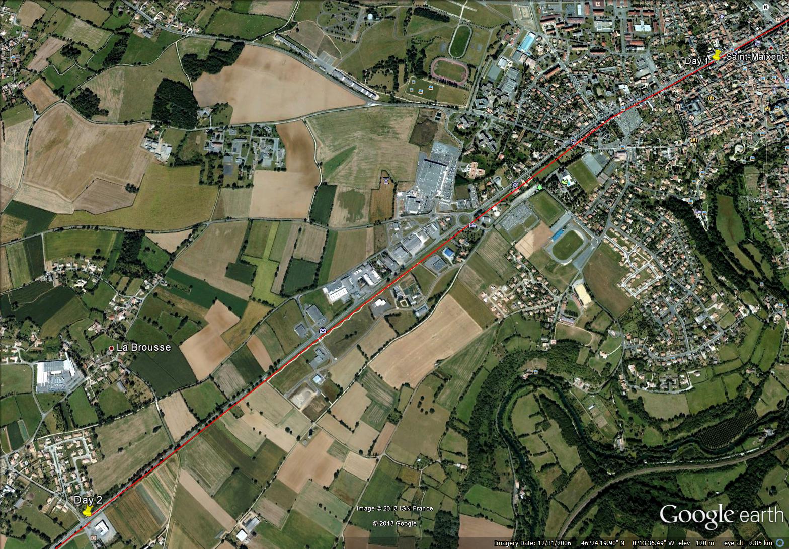
This virtual bike trip has really worked to encourage me to exercise. I am going to keep going! For Phase 3 of my trip, I plan to bike in 12 days from Exireuil to Magné just beyond Niort.
~

map showing plan for Phase 3 (12 day virtual bike trip from Exireuil to Magne)
~
Follow me in Phase 3 to see more sights in the French countryside, to see some more drawings and to hear about my virtual adventures!
~
Copyright Jane Tims 2013


