farms in hidden valleys 7-3

Tregantle Fort near Freathy (image from Street View)
~

~
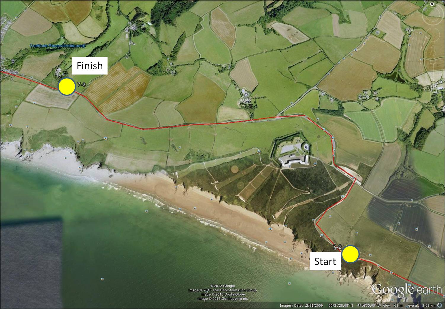
map showing distance travelled (map from Google Earth)
~
Gradually, I am learning the layout of this part of the Cornwall coast. The uplands are mostly devoted to wild land or agriculture (grazing or crops) …
~
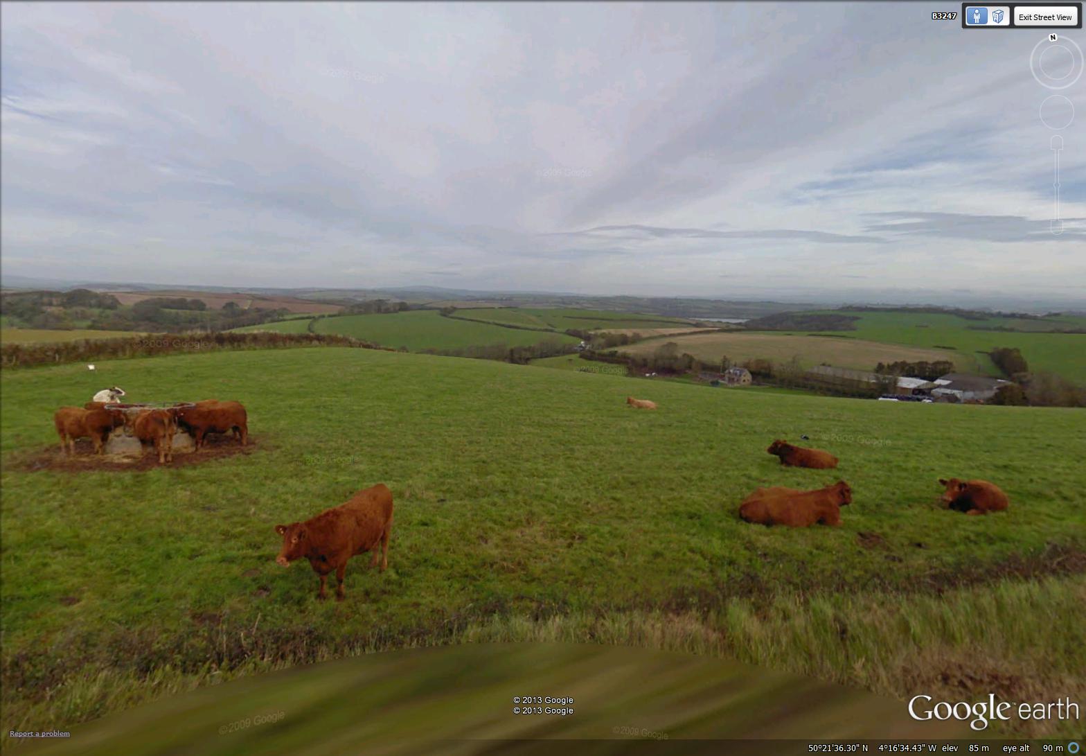
cattle in a field near Freathy (image from Street View)
~
The houses are either along the coast, at the very edge, or in the treed valleys that peek at intervals from the countryside …
~

fields and valleys … a reservoir in the distance (image from Street View)
~
Driving down into these valleys, I find farmsteads, made up of clusters of buildings and usually associated with water …
~

farmstead in a valley (image from Street View)
~
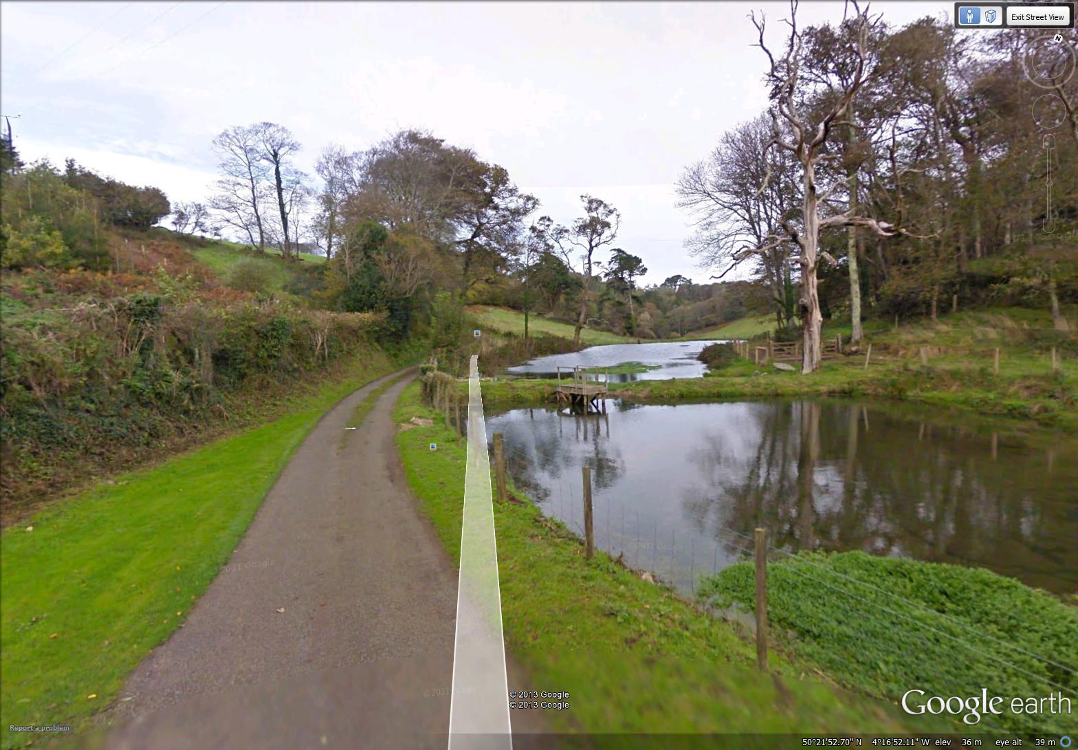
ponds at a valley farm (image from Street View)
~
Cattle must stray into the roads on occasion. The entryway of the house below is guarded by a ‘Texan Gate’ or ‘cattle stop’. I am familiar with these from my days in Alberta. Cattle will not cross these gates because of the spaces in the surface, but cars can cross quite easily …
~
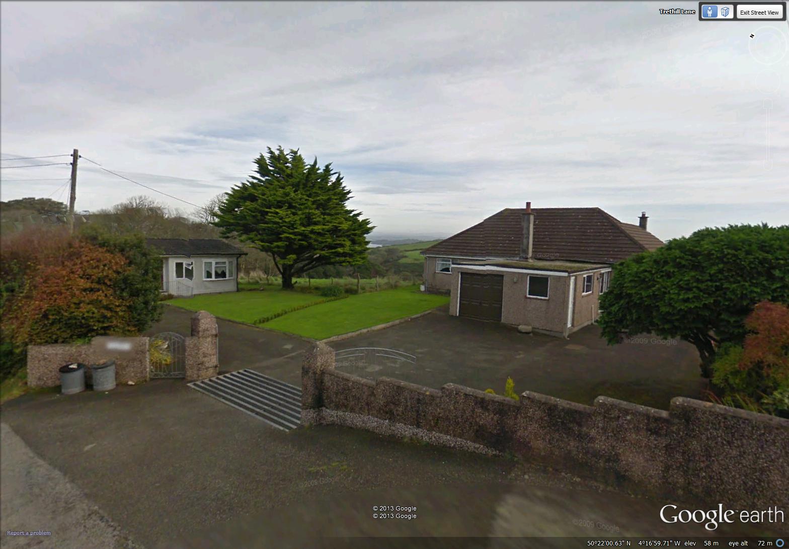
a Texan Gate (image from Street View)
~
Best View: the Cornwall coast stretching before me …
~

July 2, 2013 ‘Cornwall coast’ Jane Tims
~
Copyright 2013 Jane Tims
Paper Birch
In the last five months, I have been learning how to paint with watercolors. I’ve painted with acrylics for some time, and I love to draw with pencil, but watercolors always seemed daunting to me.
If you are a follower of my Blog, you will know my early attempts at watercolor have been of views from my virtual cycling trip in central France and on the Ile de Ré. I have also done some studies of New Brunswick wildflowers.
Among the subjects I found fun to paint on Ile de Ré were the vine-covered trees that grow along the road.
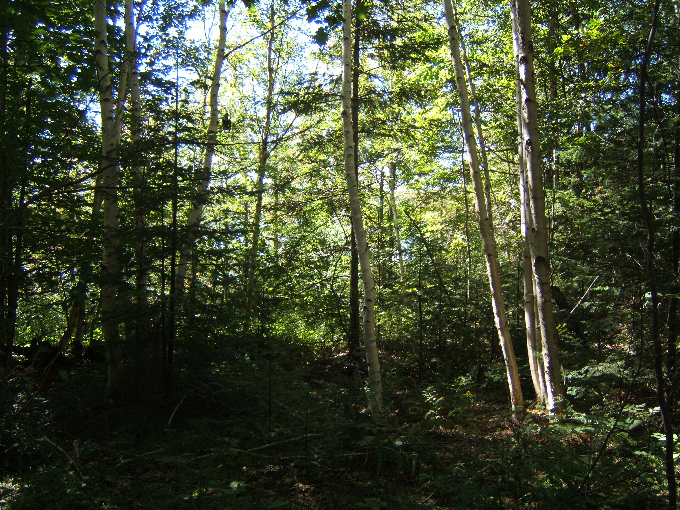
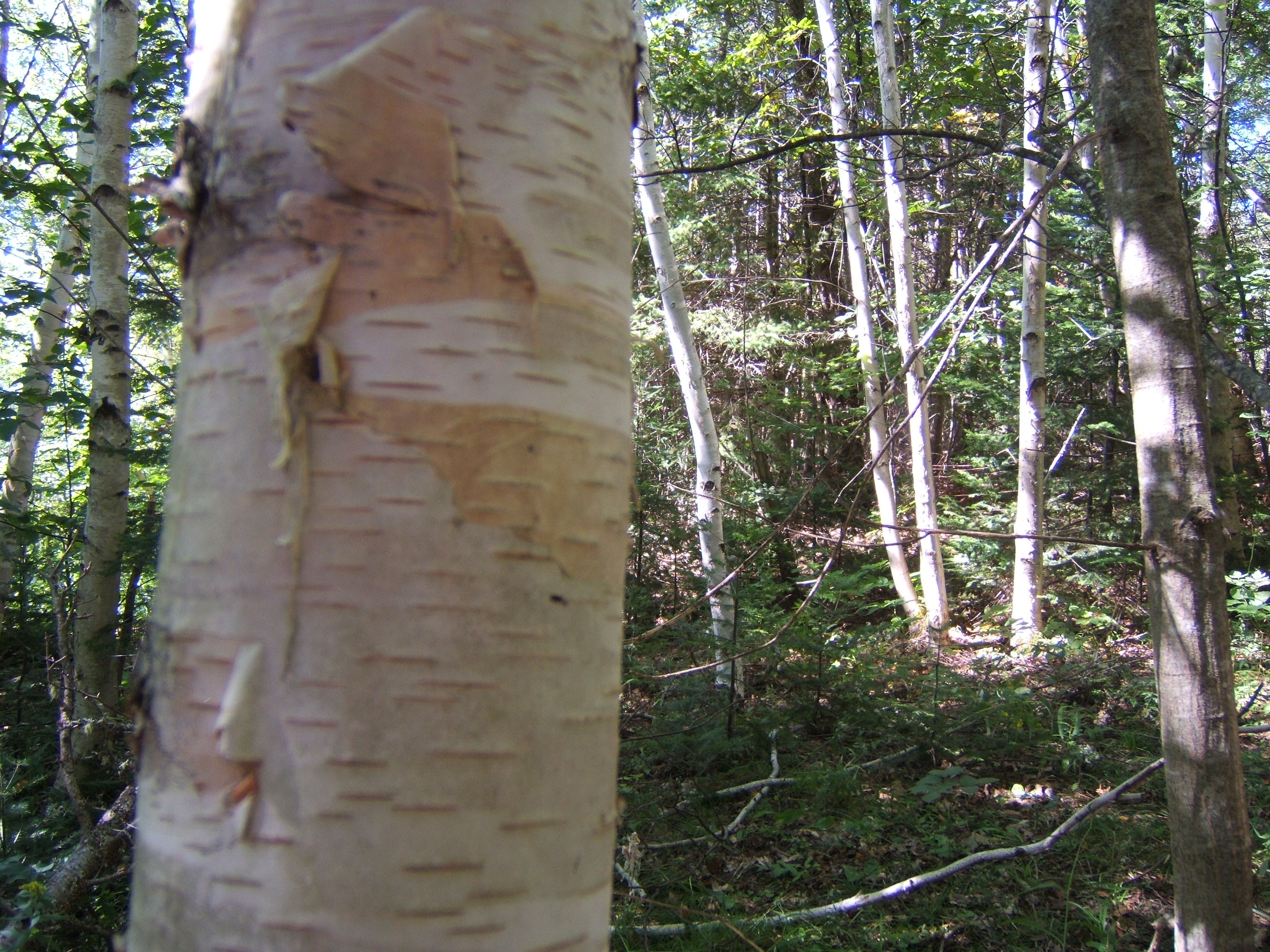
This week, on a trip to see our camp, I studied some of the characteristics of Paper Birch (Betula papyrifera Marsh.), a tree growing everywhere on our property by the lake …
~
~
Some of these trees are actually Mountain Birch (Betula papyrifera Marsh. var. cordifolia (Reg.) Reg.), a variety of the Paper Birch. This variety is quite common in eastern Canada. Its distinguishing characteristic is the heart-shape of its leaves, especially at the base of the leaf.
~
The bark of the Paper Birch and Mountain Birch is predominantly white, although parts of the tree can be yellowish or quite black. Its bark strips readily from the tree, in sheets, leaving a reddish-orange inner bark which turns black with age …
~
~
To paint the birch, I used Painter’s Tape to mask the trunks of the trees. Then I painted the background. Once the background was dry, I stripped the Painter’s Tape away and added the bark details in the white space left behind. Here are three paintings of Mountain Birch …
~
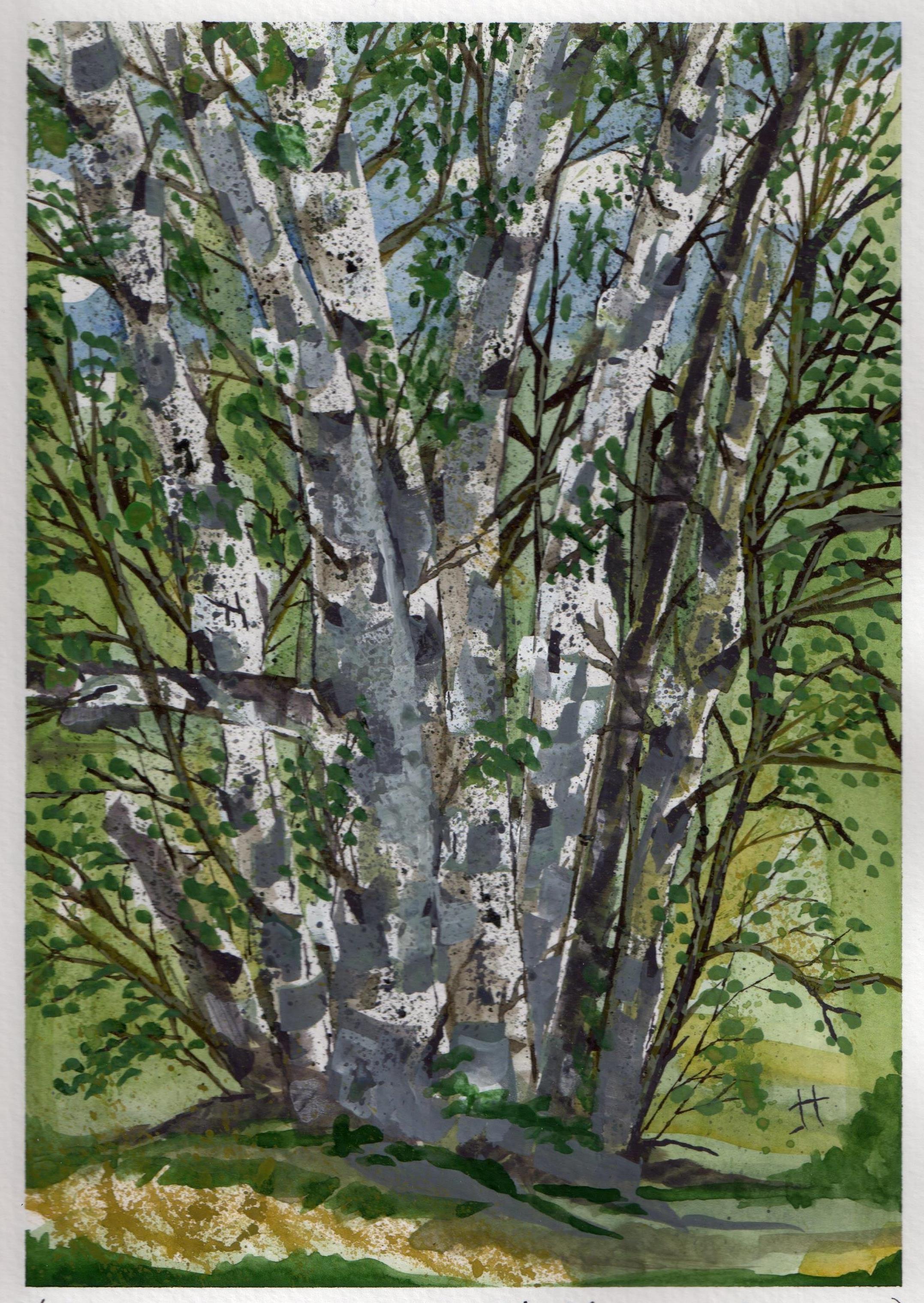
June 21, 2013 ‘Mountain Birch’ Jane Tims
~
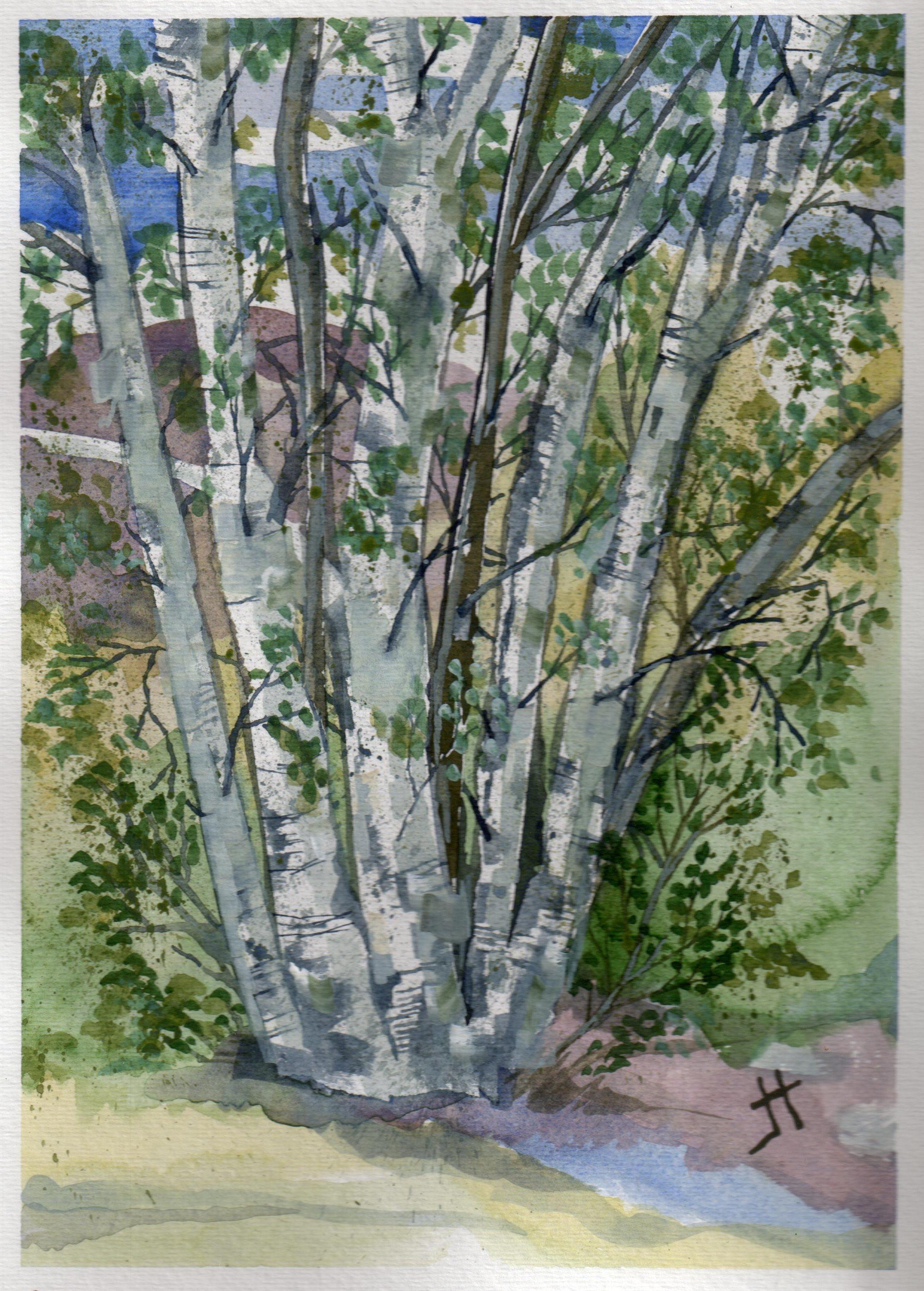
June 22, 2013 ‘Mountain Birch #2’ Jane Tims
~

June 23, 2013 ‘Mountain Birch #3’ Jane Tims
~
Copyright Jane Tims 2013
a holiday by the sea 7-2
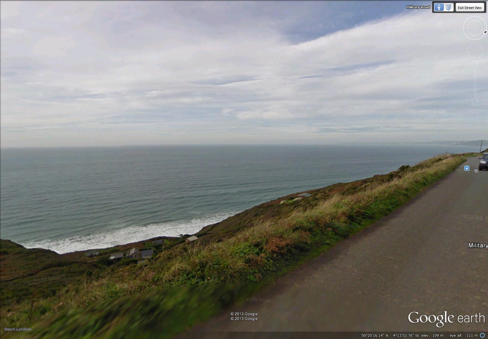
a view along the coast near Freathy … note the houses down the hill nearer the ocean (image from Street View)
~

~
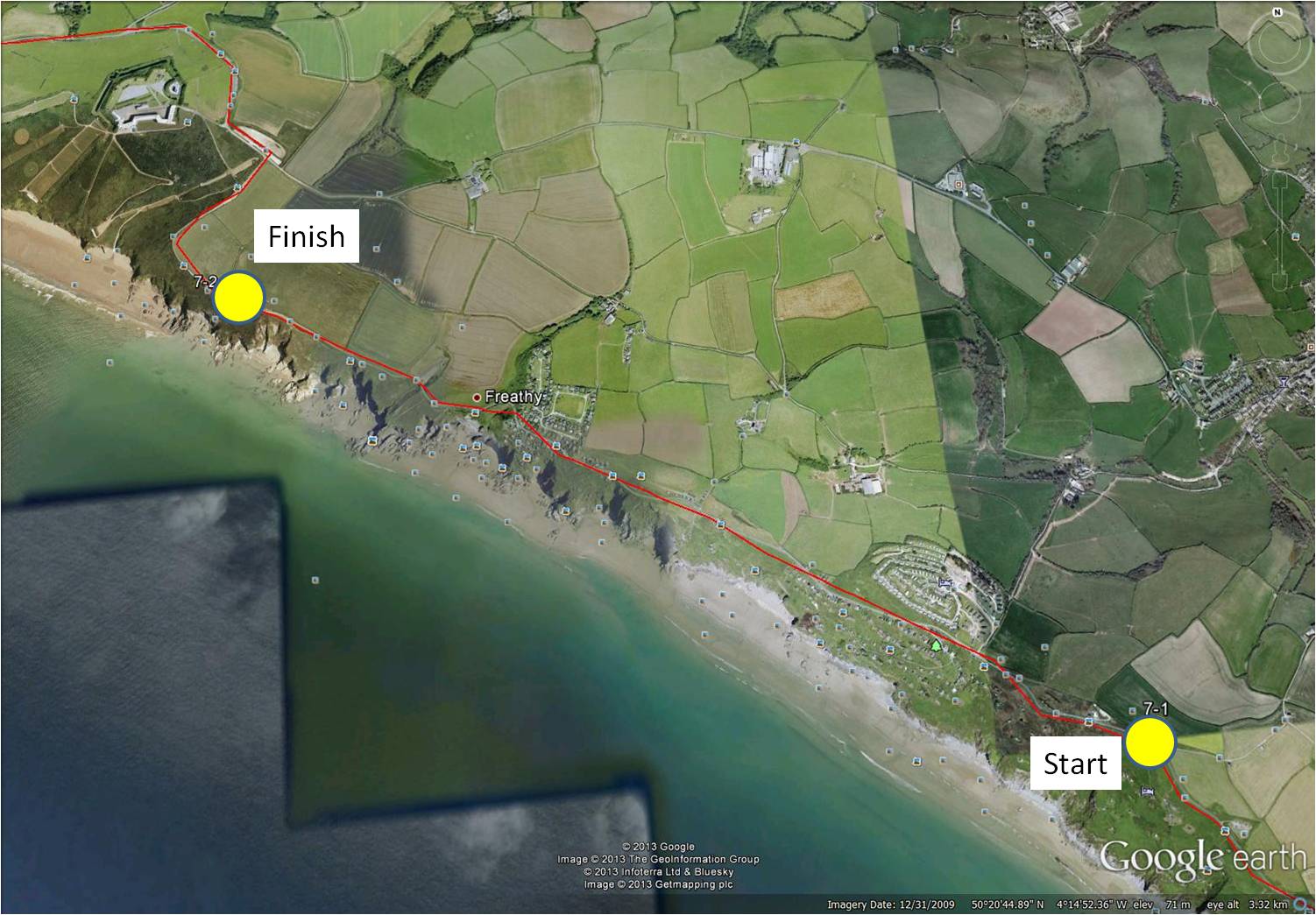
map showing distance travelled (map from Google Earth)
~
My virtual biking trip along the Cornwall coast has me totally enchanted. I love the rugged landscape, the hills (huff, puff), and the huge variety of wildflowers …
~

a view of the rugged coast and the yellow Gorse growing along the road (image from Street View)
~
Today’s drive along the Military Road showed me that the people love to spend recreational time along this coast. There are vacation communities …
~
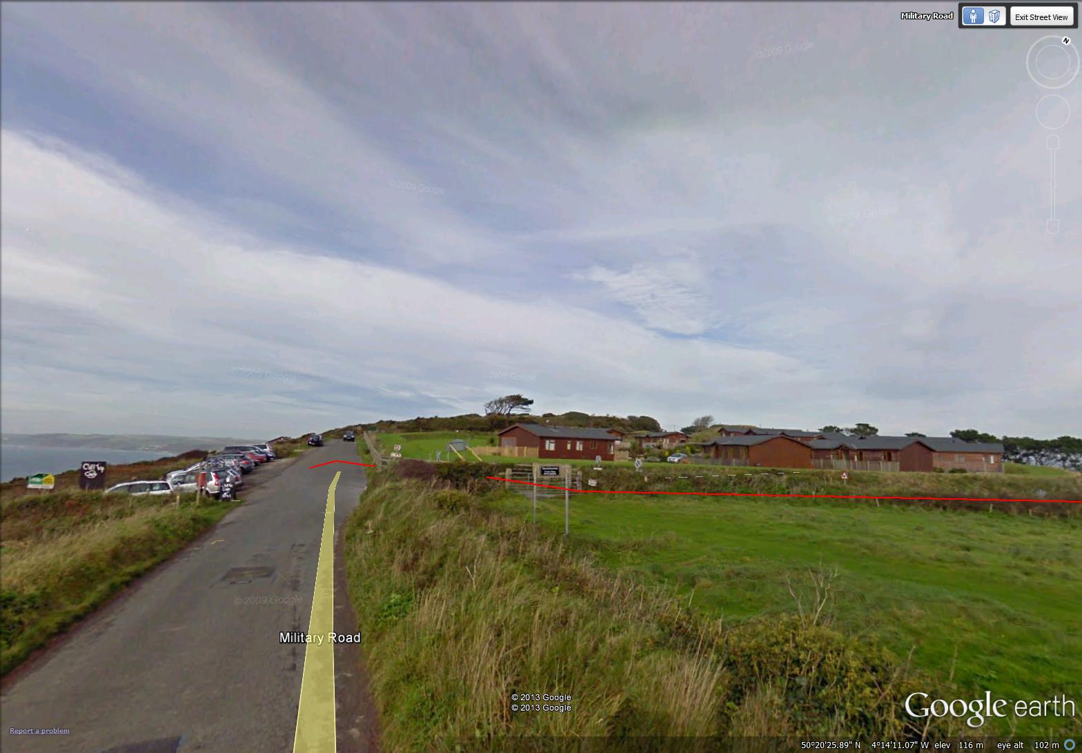
a vacation community (image from Street View)
~
Homes and cottages were downhill from the road. I am sure you could step from the road to one of these rooftops!
~
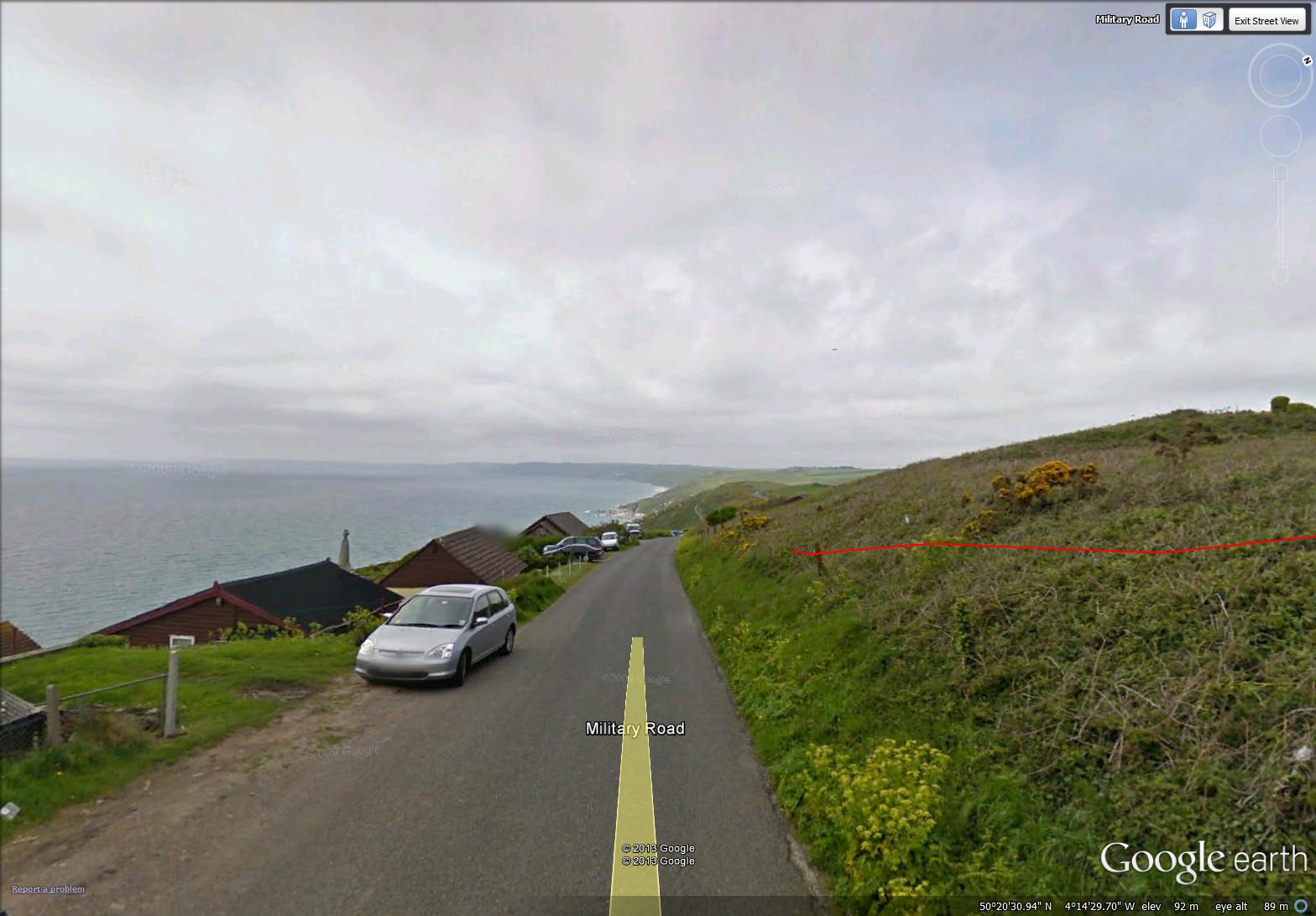
a view of houses along the road (image from Street View)
~
The cottages were small, not much bigger than our own cabin …
~

cabins overlooking the ocean (image from Street View)
~
Best View: acres of Gorse along the road …
~
a ‘learning-watercolor’ note: the first painting below was done on 140 lb paper made for watercolor. The second painting was done on sketch paper of much lighter weight. The second painting is wrinkled (see dark shadows in the left and right margins). This is called ‘cockling’ and can be prevented by stretching lighter papers before painting. I tape the edges of my paintings on a hard surface prior to painting.
~
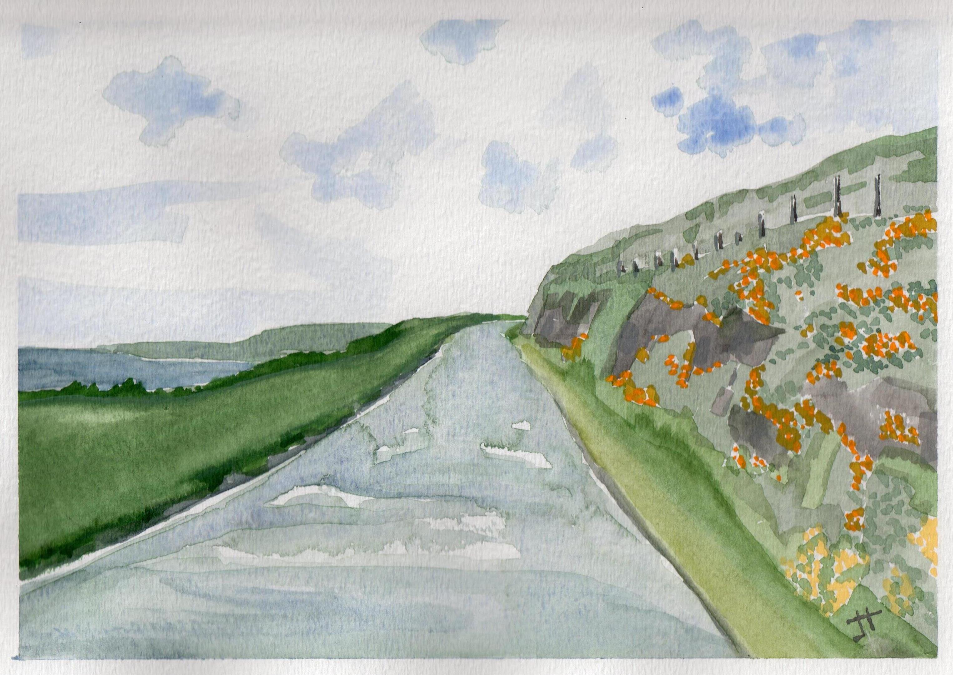
July 3, 2013 “Military Road, Cornwall coast’ Jane Tims
~
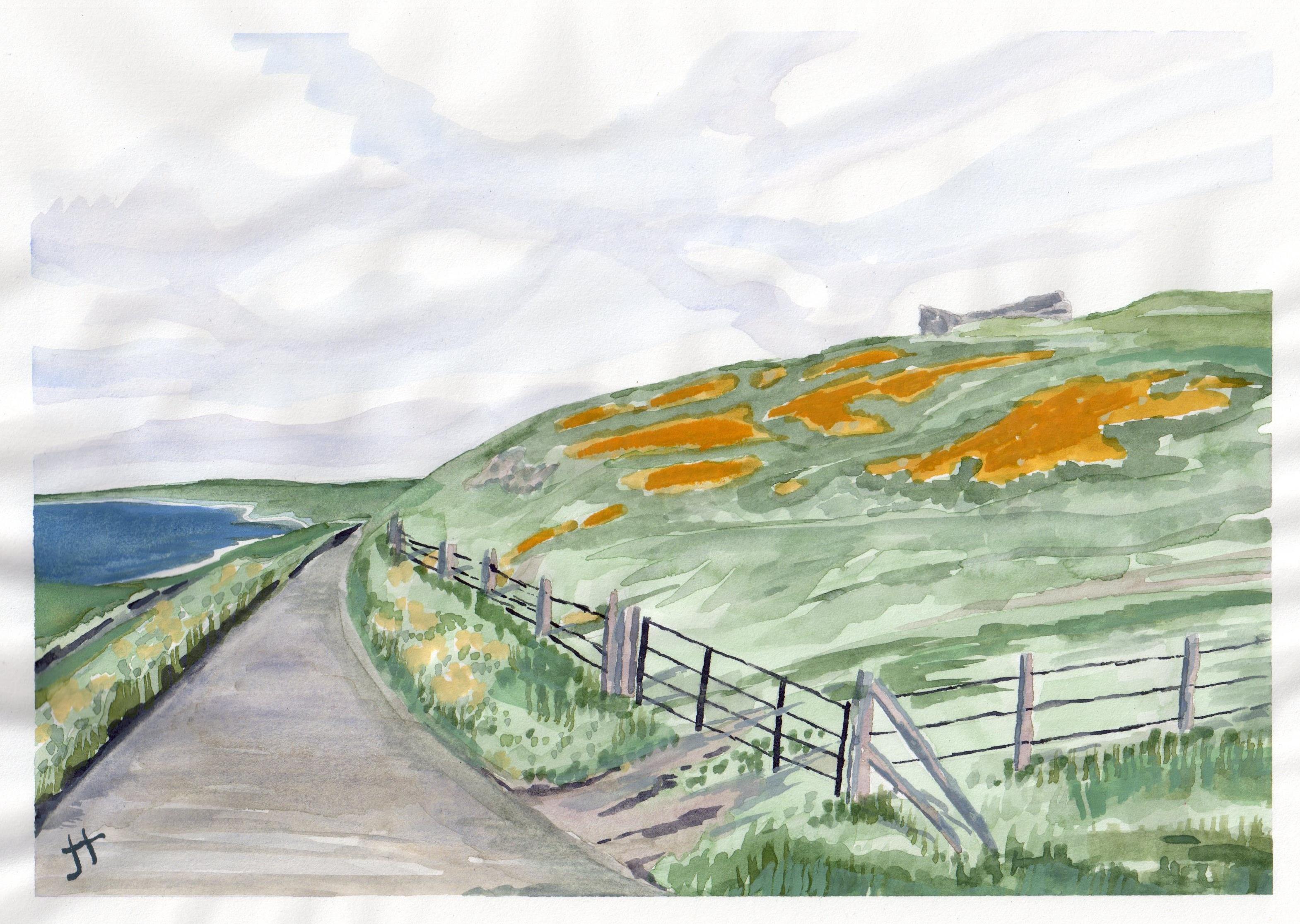
July 3, 2013 ‘Gorse’ Jane Tims
~
Copyright 2013 Jane Tims
along the Cornwall shore 7-1
After completing my virtual bike journey through central France, I was faced with a decision …. where to go next? I considered all sorts of places, but the winner has been the setting for some of my favorite literature … the Cornwall coast of England.
A few minutes with Street View convinced me. Along the Cornwall coast are the ocean views I love, the rugged shoreline of Daphne du Maurier fame, the hilly countryside of southern England, and numerous opportunities for side trips to see farmsteads, churchyards and ruins. It was hard to settle on the 26 images that would take me through my first 30 minute virtual bike excursion. So hard, in fact, I selected 39 images for the first trip!
I decided to begin just west of Plymouth, and I plotted ten, 3 km trips to begin. Beyond that is a more than 300-km-distance around the entire Cornwall coast.
~

~

~
Today’s trip took me through the hamlet of Rame, along the Whitsand Bay of the Atlantic Ocean. The Street View image of the parking lot at Rame’s Head provides a view of 14th century Saint Michael’s chapel on a cone-shaped headland. The chapel is now derelict and is thought to be the site of a Celtic hermitage …
~

St Michael’s chapel is the tiny building on the cone-shaped hill at about 5 o’clock (image from Street View)
~
The first part of the trip took me past the Saint Germanus churchyard …
~
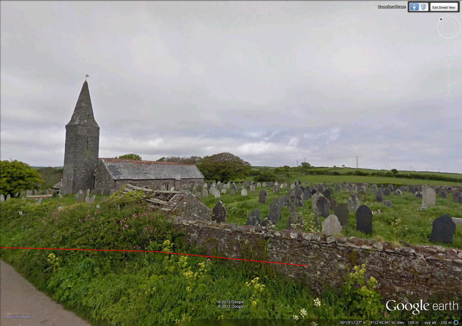
Saint Germanus churchyard (image from Street View)
~
The church was dedicated in 1259, on the site of an older building. In the church are pews surviving from the 16th century! Since there is no electricity or gas, services are by candlelight. I particularly like the lych gate in front of the church since my novel begins with my main character standing under a lych gate to keep dry from the rain. A lych gate is a covered gate – during a funeral, the body of the deceased person is carried through the lych gate on the way to the church …
~
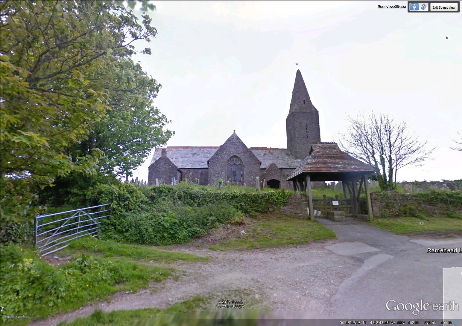
Saint Germanus church in Rame (image from Street View)
~
The next part of my trip was along the Military Road. This road runs along the coast on the high land. Other, narrower (!) roads run between the small communities closer to the coast. My guess is, this road was built as a way to patrol the coastline for military purposes …
~

Military Road near Rame – Gorse blooming along the road (image from Street View)
~
I enjoyed my visit with a herd of horses along the Military Road …
~

~
As I looked back along the road I’d just travelled (virtually), I was so glad I chose this as the next stage of my exercise scheme …
~
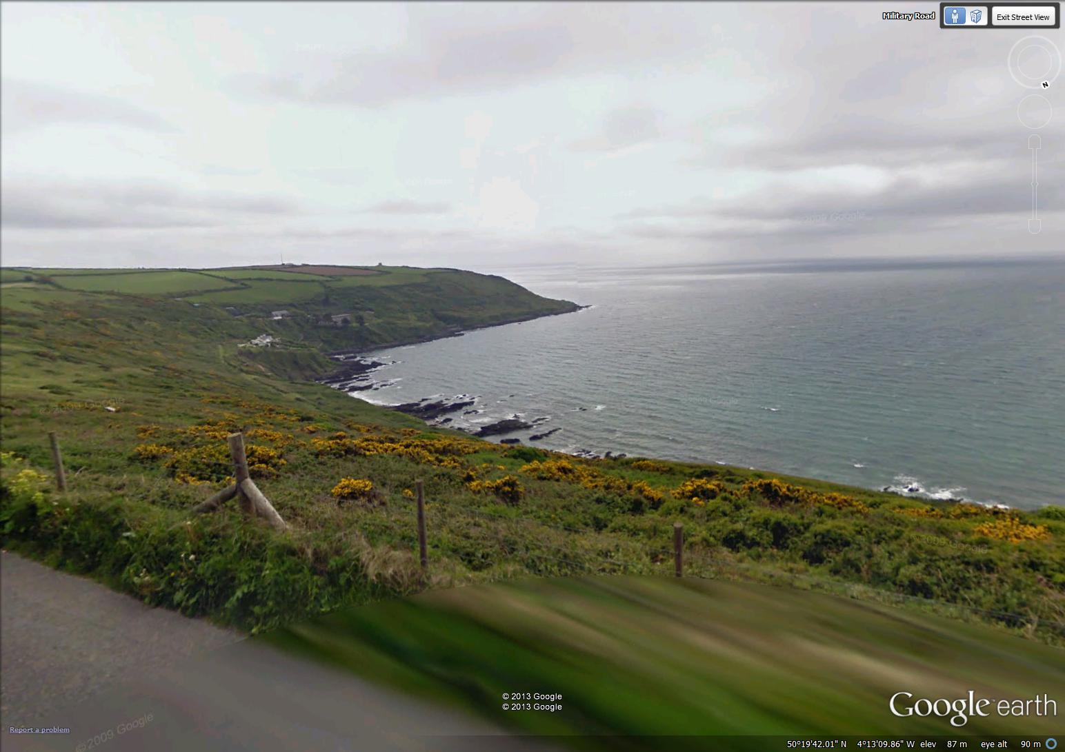
~
Best View: so many to choose from! I liked a view of lilacs in the yard of a house near Rame …
~

July 1, 2013 ‘Lilacs near Rame’ Jane Tims
~
Copyright Jane Tims 2013
a covered bridge – the Burpee Bridge, Queens County, New Brunswick
Last weekend, driving home from Miramichi, we followed the Grand Lake Road. It is mostly unpopulated, devoted to tree plantations and a preservation site for mature white pine.
~
Along the way, we stopped in at the Burpee Covered Bridge on the Gaspereau River near Gaspereau Forks, Queens County. This bridge is listed as Gaspereau River #2 in the April 1992 pamphlet ’Covered Bridges in New Brunswick’ (no author indicated). This means there was once another covered bridge crossing the Gaspereau River but it is now gone.
~

~
The Burpee Bridge was built in 1913. It is 167′ 9″ long with a span of 163′ 6″. The roadway width is 14′ 8″, and the load limit is 8 t. The maximum clearance is 3.9 meters.
The bridge is on a main road and the grounds on both sides of the river are nicely kept and mowed. The bridge was named for the family living nearby in 1913.
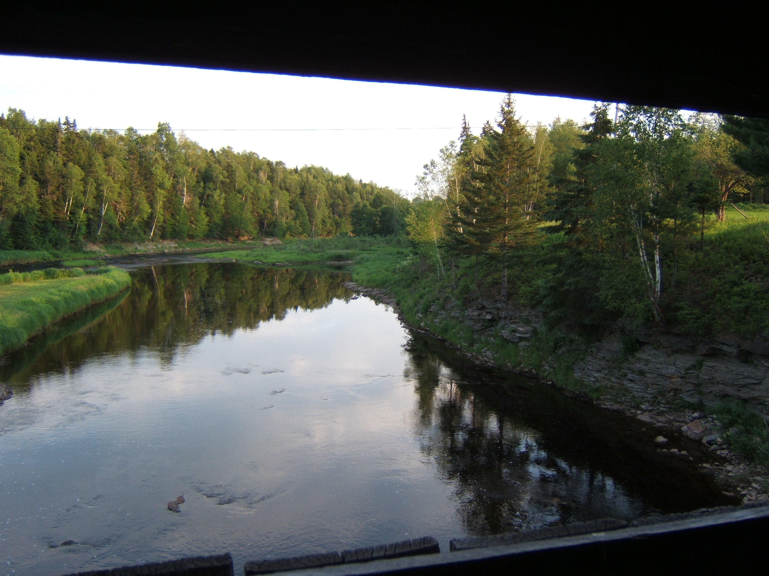
Inside the bridge, there is a window, with a good view of the Gaspereau River, showing the exposed bedrock of the river banks.
~
~
The rafters of the bridge are populated with swallows and their nests. The swallows chirped at me and swooped in and out of the bridge while I was there.
~
I couldn’t find any carvings in the failing light, but the inside of the bridge is covered in graffiti.
~

~
A lot of fluorescent paint has been used and it would be interesting to shine a black light inside the bridge … no doubt it would glow with spooky color …
~

~
We didn’t visit this bridge in 1992 as part of our Covered Bridge Project for Canada’s 125th anniversary. I am sorry we didn’t do more bridges that year … some are now gone, and it is interesting to compare the information for those that have survived.
~
This year, on July 27, the community plans a celebration of the 100th anniversary of the Burpee Bridge. The bridge will be turned (temporarily) into a museum of photos and artifacts about the bridge and community. Keeping our covered bridges in the eye of the community helps to preserve their heritage and value. It also encourages sharing of the wonderful stories about the part these bridges have played in our communities and lives.
~
Copyright 2013 Jane Tims
a patio overlooking the ocean 6-14
Well, I have reached the end of Phase 6 of my virtual tour through central France!!!
~
~
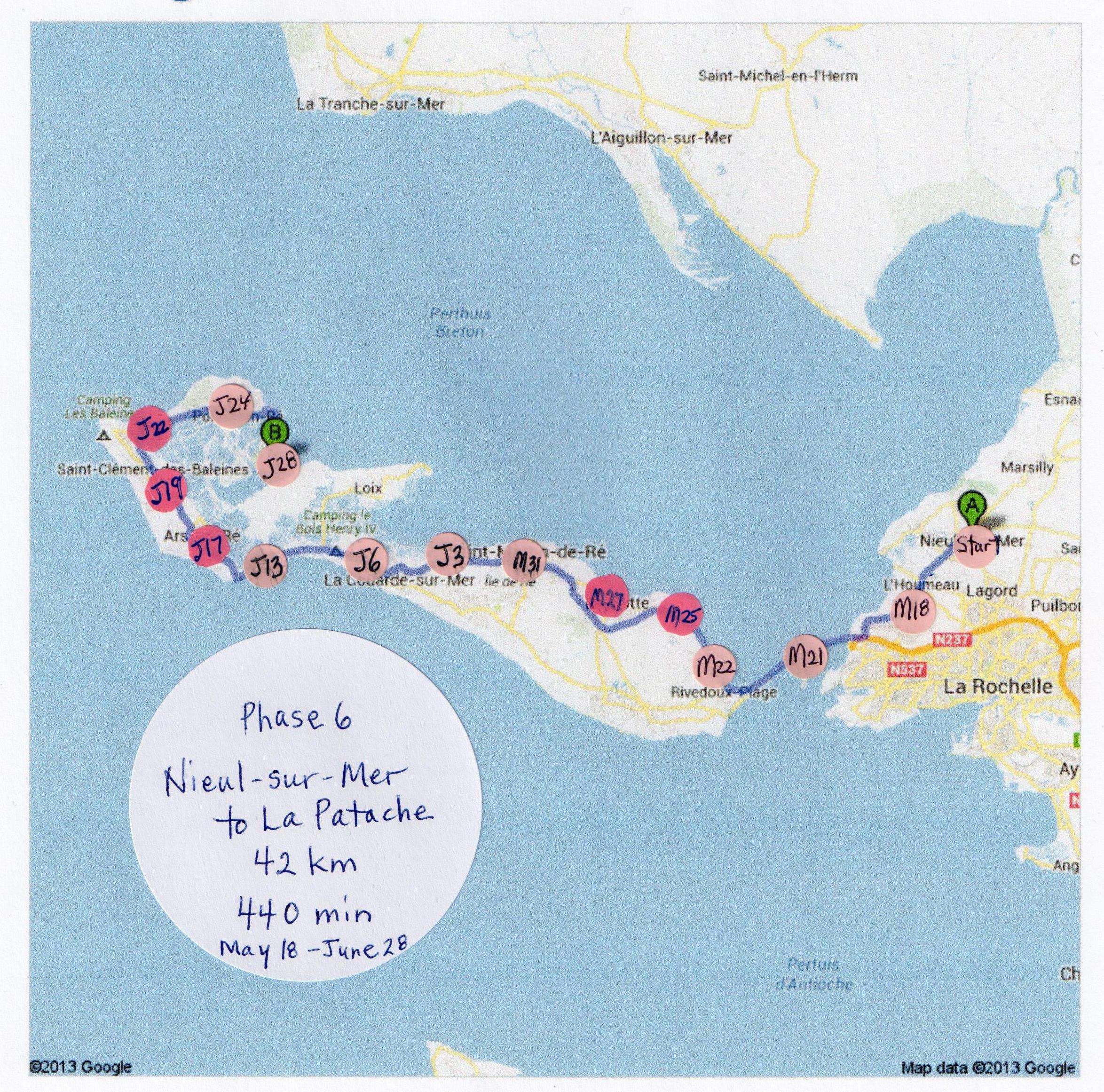
This last day on Ile de Ré marked the end of a sort of odyssey for me. When I began, on January 30, 2013, I had little hope that my exercise plan would last very long. And here I am, 196.8 kilometers and 1975 minutes of stationary cycling later.
~

~

map showing distance travelled (map from Google Earth)
~
I have learned a lot about central France, I have practiced my French, I have drawn and painted a lot of my impressions, and I have had fun telling you all about it in my Blog posts.
~
I also have several health benefits to report. My blood pressure is consistently down to normal, my blood cholesterol is improved, and I feel more energetic. As a result of this last, my house is (slightly) more organised. I have not lost one ounce of weight, but I have probably gained some muscle and lost some fat. My knees are no better but they are also no worse.
~
I think, most important, I have learned two things about exercise …
1. about 2-3 months of regular exercise is needed to see a benefit, and
2. after about one month, exercise starts to be a habit, so it does not take so large an effort to continue as to begin.
~
The vistas on this last day were not so different from other days on the island. I saw many paths to the beach, but rarely saw the ocean …
~
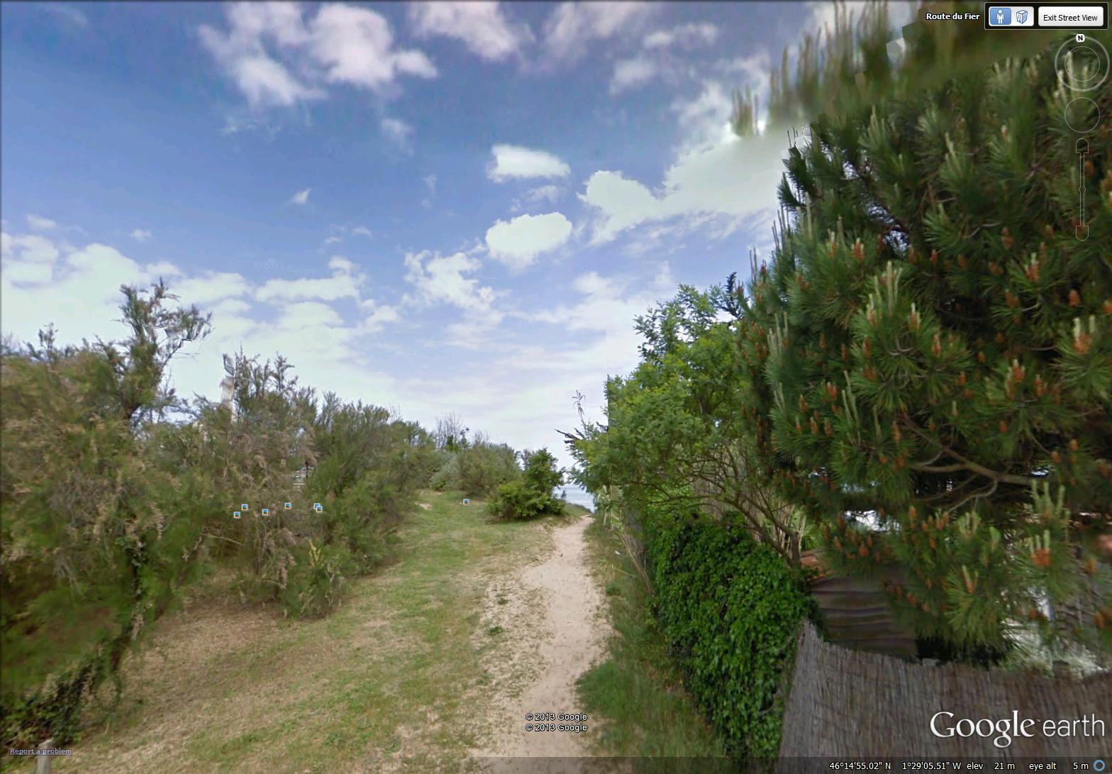
a path to the beach (image from Street View)
~
I saw an interesting ‘pink-flowered’ shrub growing along the ponds of the salt marsh …
~
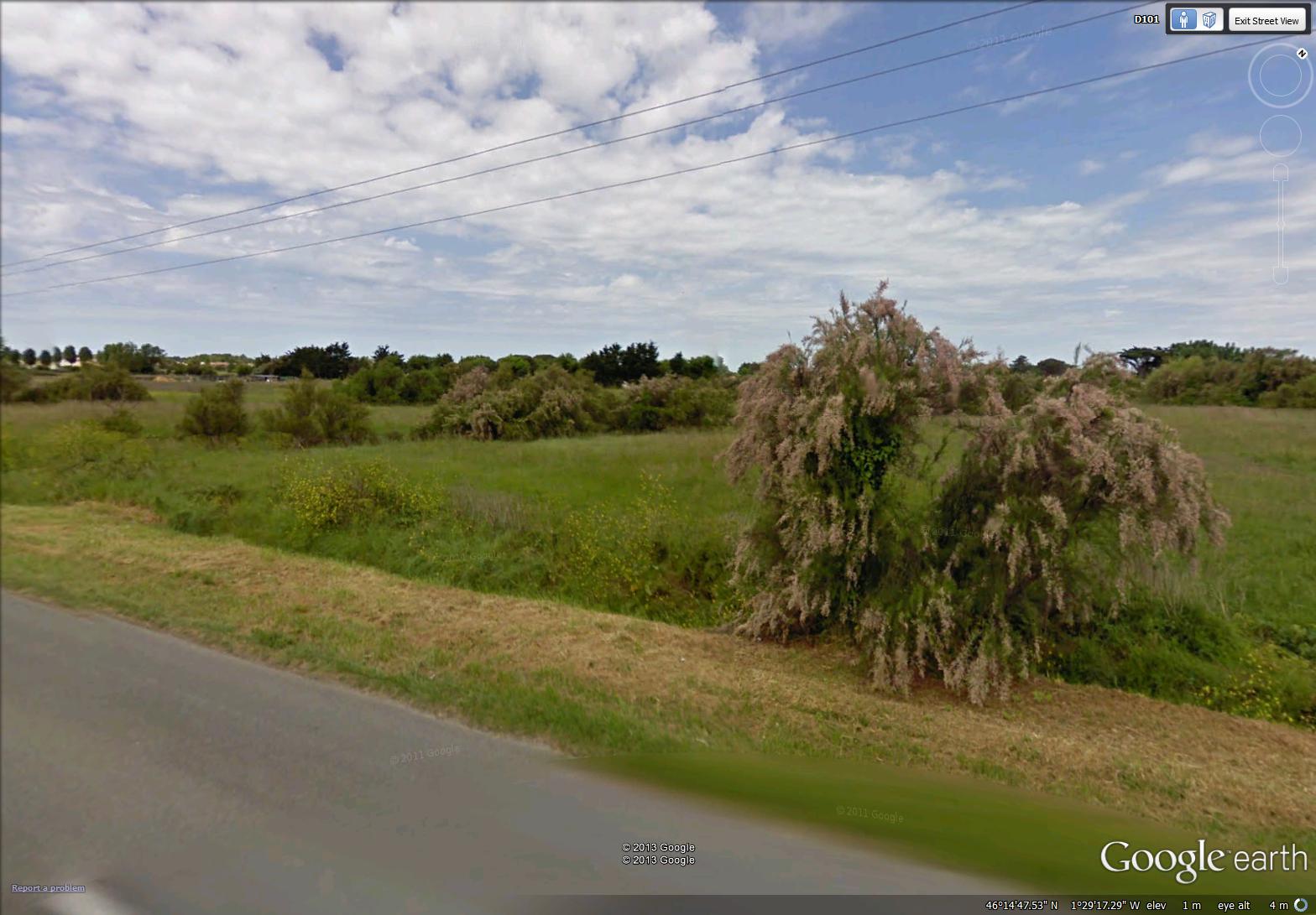
a shrub with pink flowers (image from Street View)
~
And I ended my sixth phase of my virtual bike trip virtually enjoying a virtual lemonade at a charming patio in La Patache, overlooking the sea …
~
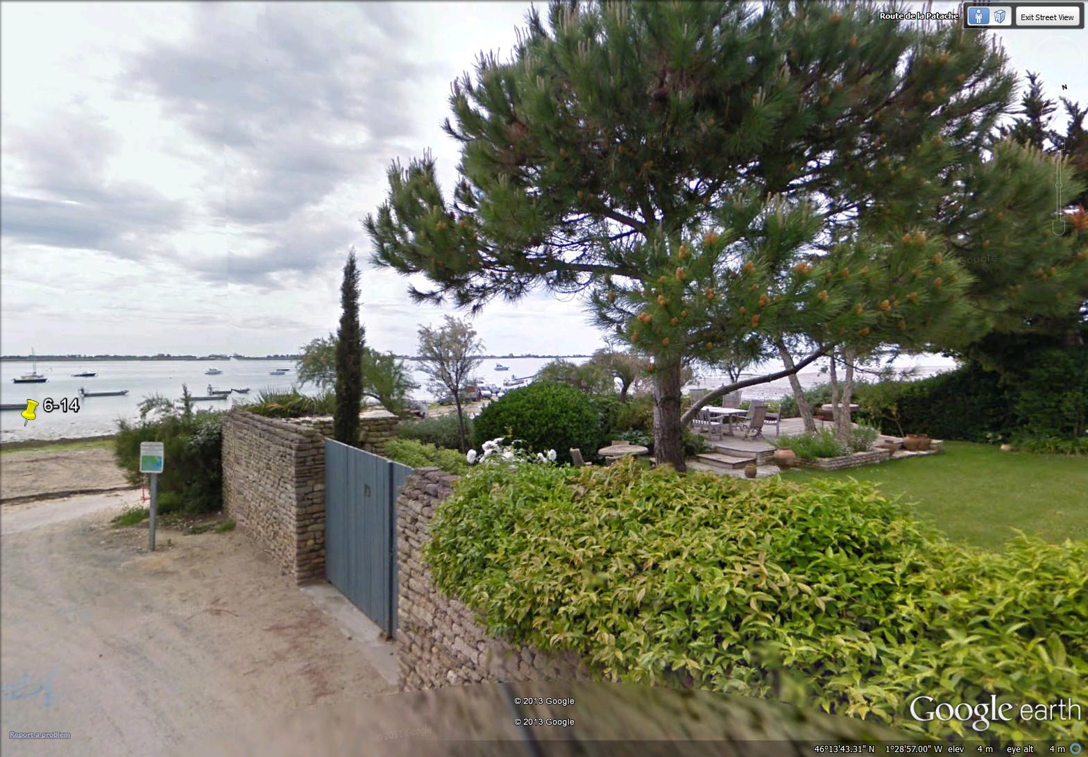
a patio overlooking the ocean at La Patache (image from Street View)
~
Best View: the salt marshes of Ile de Ré …
~
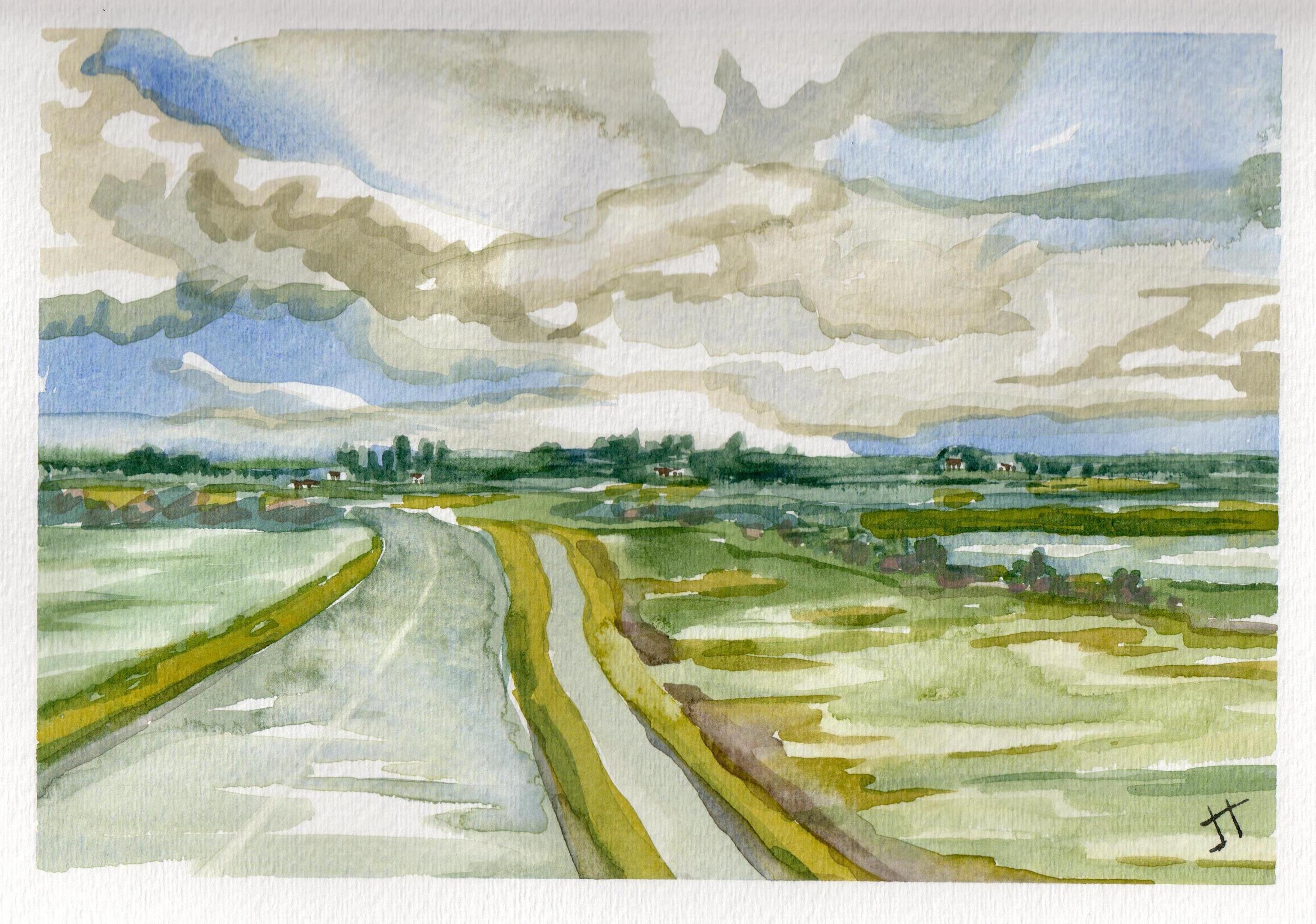
June 26, 2013 ‘salt marsh on Ile de Re #2’ Jane Tims
~
So, am I going to continue this exercise plan? You bet! Next, I am going for a 4 day tour of the city of Mermaid Waters in Australia. A very good friend of mine lived there once and biked every day to university along the path I will take. Then, I will choose a place in Britain to continue my virtual bike tour. I hope you will join me!!!!
~
Copyright Jane Tims 2013
a covered bridge – the Marven Bridge, Kings County, New Brunswick
In late June, we drove to Sussex to do some errands. On the way back, we drove off the highway to find the covered bridge over the Belleisle Creek (Kings County). This bridge is known as the Marven Bridge and is listed as Belleisle Creek #2 in the April 1992 pamphlet ’Covered Bridges in New Brunswick’ (no author indicated). This means there was once another covered bridge crossing the Belleisle Creek but it is now gone.
The Marven Bridge was built in 1903. It is 79′ long with a span of 71′. The roadway width is 15′ 8″, and the load limit is 10 t. The maximum clearance is 15′ 8″.
The bridge is on a relatively good road in a steep valley. The blackberries were blooming in profusion along the road near the entryway to the bridge.
Inside the bridge, there is damage to the window openings where boards have been kicked out beside and below the windows. Otherwise the bridge is in good condition. We didn’t stop to look at carvings inside the bridge, but I saw a lot of graffiti as we crossed, including a giant ‘2012’.
We didn’t visit this bridge in 1992 as part of our Covered Bridge Project for Canada’s 125th anniversary. However, my husband remembers going fishing there many years ago.
I was disappointed to discover we did not bring the camera on this drive, but I did a quick sketch on site and a painting when we arrived home. I hope you like it!!!
~

June 26, 2013 ‘Marven Covered Bridge, Kings County’ Jane Tims
~
Copyright Jane Tims 2013
a mysterious mechanism 6-13

salt ponds on Ile de Re (image from Street View)
~

~
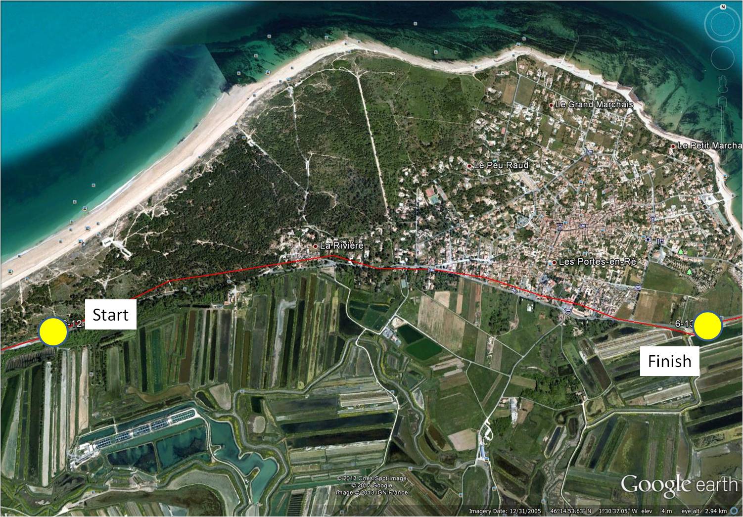
map showing distance travelled … the rectangular salt ponds on Ile de Re are visible (map from Google Earth)
~
On this second-to-last day of my virtual travels through France, I found a mystery. The disadvantage of travelling far away from the images you see is, you can’t stop and ask when you see something you don’t understand. As I drove along the salt ponds dominating the eastern part of Ile de Ré, I saw a circular structure. It was corral-like and at first I thought it must be a corral for a horse. But, closer observation suggests another purpose …
~

circular ‘corral’ … click the photo to enlarge and see the internal mechanism … rectangular salt ponds are visible in the background (image from Street View)
~
The clues are these:
1. the structure is circular
2. a fence surrounds the structure, suggesting need to contain an animal or something else
3. on second look, the fence is more like a wall, perhaps able to contain some substance, perhaps even a liquid
4. a horse trailer is parked in the yard
5. a grass-free track surrounds the structure
6. the corral is not empty, but contains a complex structure, including an elevated ‘pipe’ near the middle, and two long horizontal poles supported by wires
7. at the end of each pole is a flat, paddle-like structure
~
I have a theory about this mysterious device. I think it is a horse-driven mechanism for collecting salt.
~
My theory: salt water is pumped into the structure, a horse is used to turn the paddles through the water and salt is collected on the paddles.
~
Although I searched on the Internet, I could not find any reference to this method of collecting salt.
~
On Ile de Ré, salt is typically collected from large rectangular salt ponds called ‘pans’. The salt is formed as the sun and wind ‘lift’ the salt from the water. The collection process is very labour-intensive. People stand on the narrow grassed dividers between ponds and ‘rake’ the fleur de sel (top layer of crystallised salt), collecting it into large salt piles. Fleur de sel is more expensive than table salt because of the complexity of the harvest. It is often sold in jars, is moist and contains sand which gives it a grey color. Some Ile de Ré salt has a pink tint, from its phytoplankton content!
~

~
Do you know what the circular corral is used for? Do you think I have solved the mystery???
~
Best View: a house covered with white roses …
~
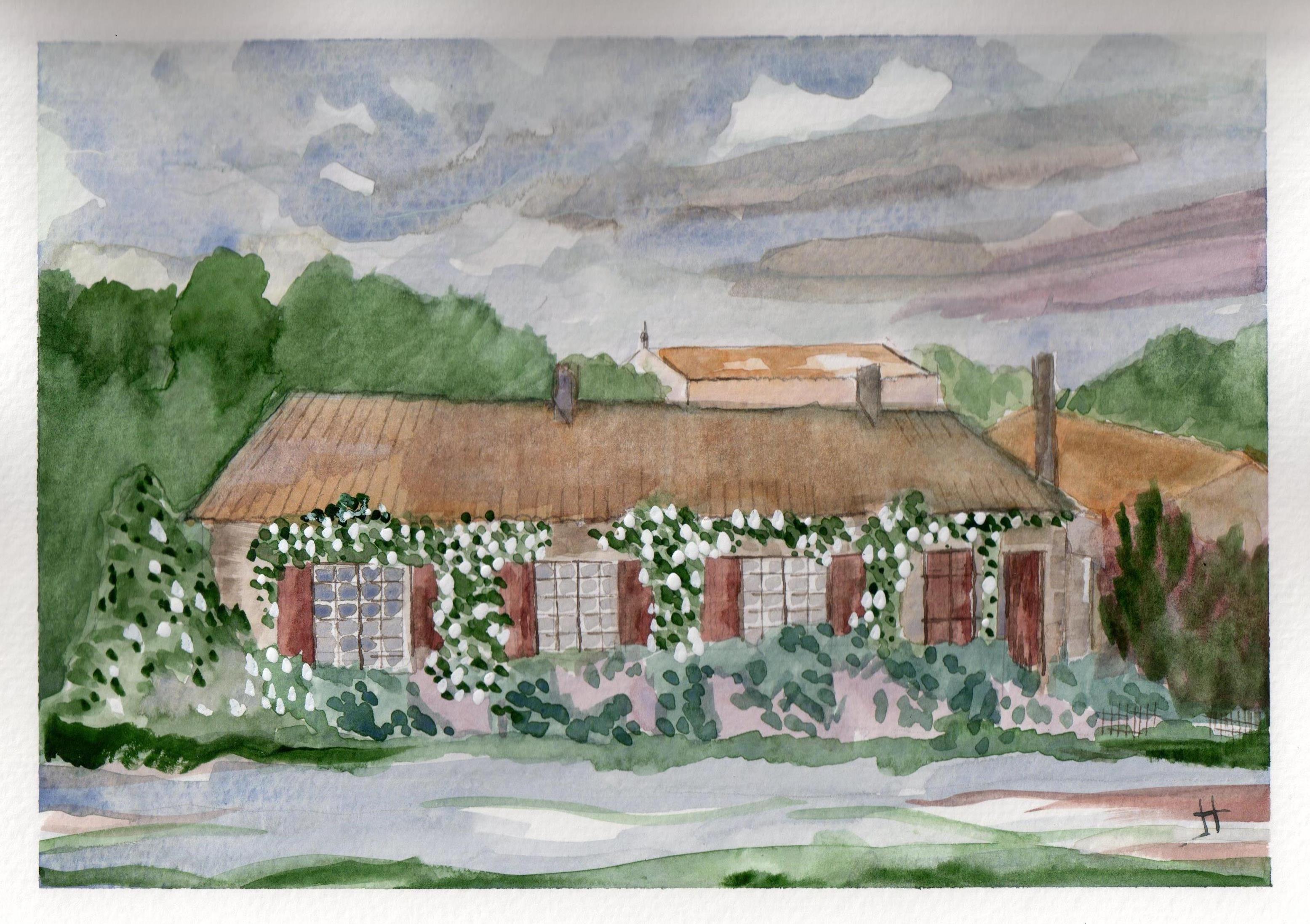
June 25, 2013 ‘house with white roses’ Jane Tims
~
Copyright 2013 Jane Tims
forested dunes 6-12
~
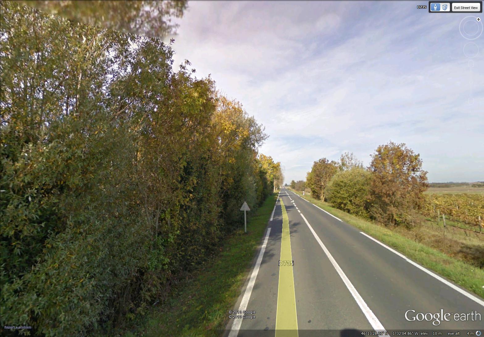
long empty roads (image from Street View)
~

~

~
My virtual bike trip on day 12 of Phase 6 took me along a very uninteresting length of highway. Other, more interesting roads showed on the map, but Street View just didn’t go there. The houses along the way were screened by long stretches of walls …
~

miles of walls (image from Street View)
~
Sometimes the walls were covered in graffiti …
~

miles of graffiti-covered walls (image from Street View)
~
When I turned to travel along the beach, the first house I saw was a charming cottage named ‘Solitude’ …
~
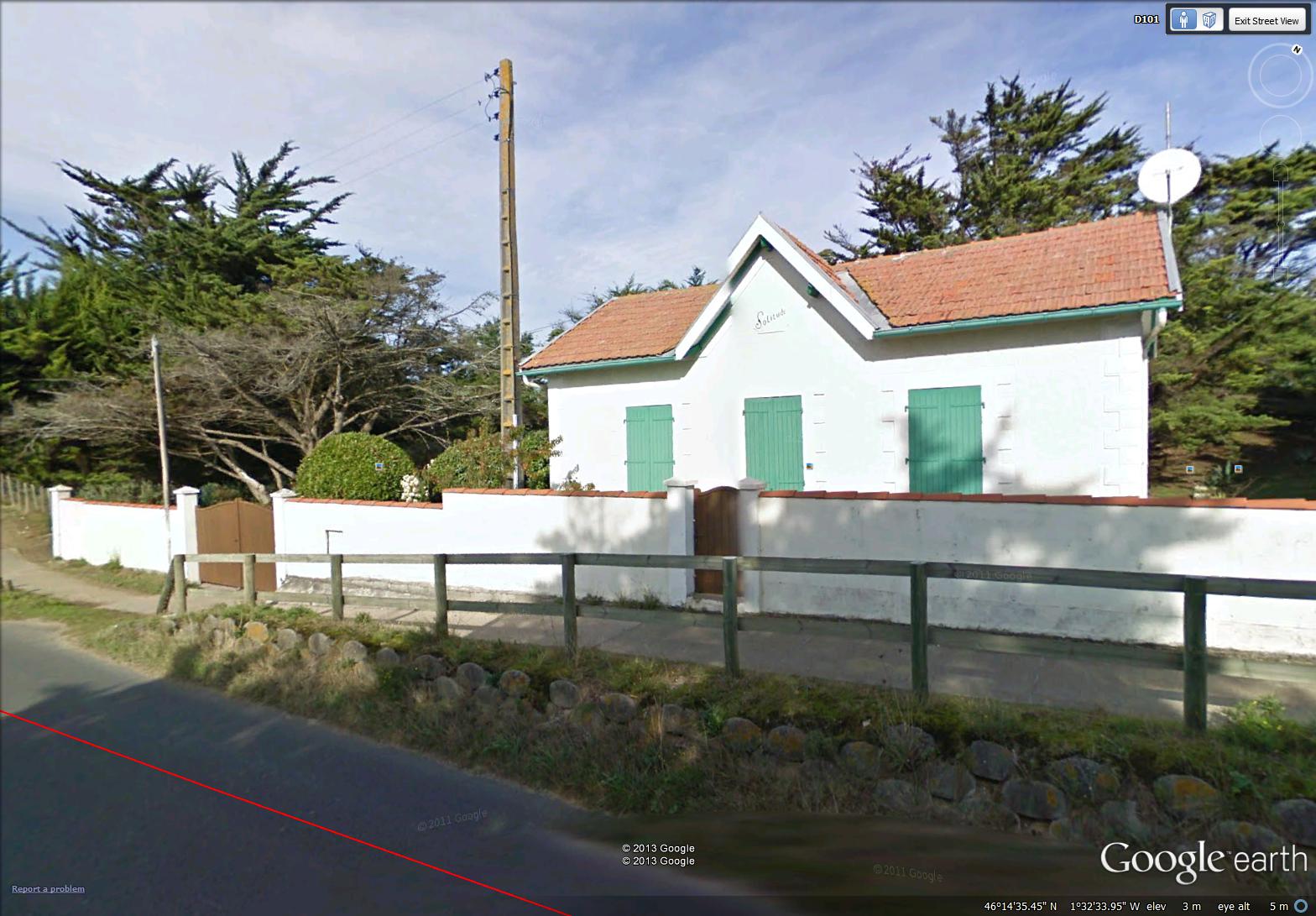
cozy cottage named Solitude (image from Street View)
~
The rest of the route along the beach was obscured by trees. Although it meant I couldn’t see the beach, a forested dune is actually an environmental goal. There is lots of evidence that the eventual natural state of a dune is forest. In New Brunswick, we have only three forested dunes. Usually erosion of the grassed dune occurs long before forest is able to establish itself …
~

forested dune along the north shore of Ile de Ré (image from Street View)
~
Best View: a view across the salt marsh ponds near Le Gillieux ….
~

June 25, 2013 ‘salt marsh on Ile de Re’ Jane Tims
~
Copyright Jane Tims 2013
seaweed for gardens and vines for trees 6-11
~
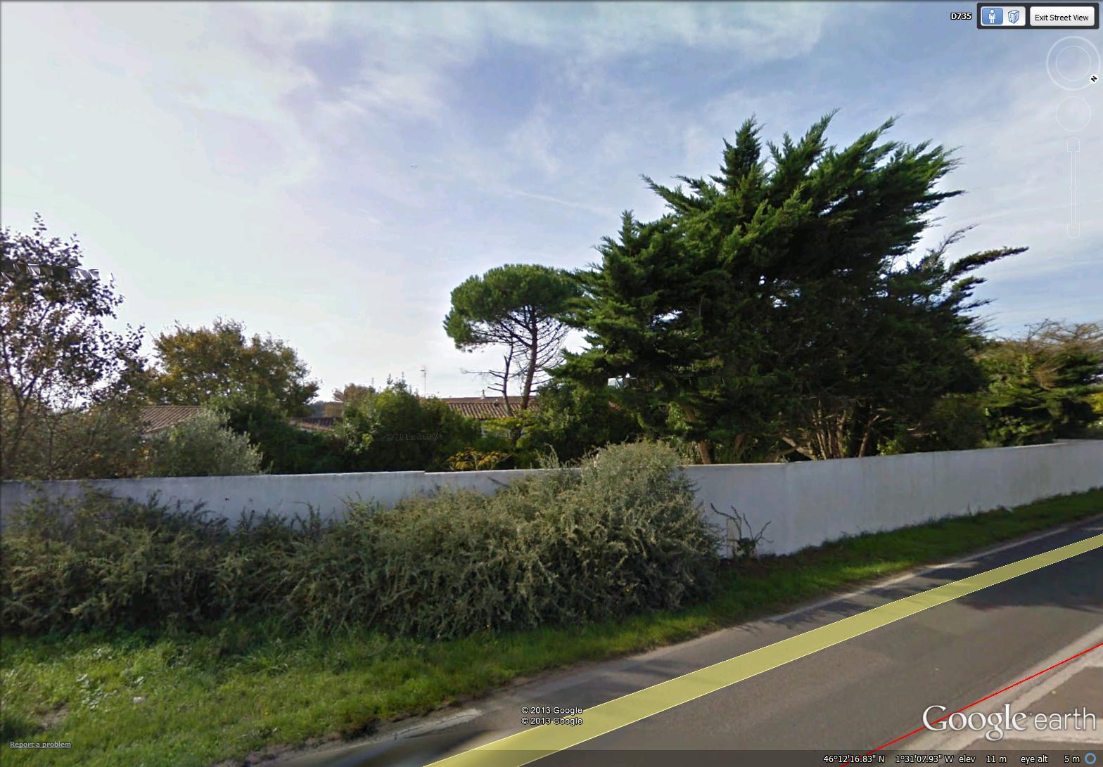
greenery in a walled yard (image from Street View)
~

~

map showing distance travelled (map from Google Earth)
~
I am nearing the end of Phase 6 of my virtual cycling trip through central France, but I am seeing so many interesting things, it is hard to look forward to the end. Today I saw a man digging seaweed into his garden. He had spread the seaweed uniformly across his garden and was slowly digging it into the soil …
~

man digging seaweed into the garden (image from Street View)
~
I am interested in gardening, so of course, I stopped to talk …
Jane: Bonjour. ‘Qu-est-ce que vous ajoutez au jardin???’ (‘Hello! What is it you are digging into your garden?’)
Gardener: ‘Bonjour. Ce sont des algues marines! Il sont très bon pour le sol.’ (‘Hello. I am adding seaweed. It is very good for the soil.’)
Jane: ‘Bon pour le sol? C’est vrai?’ (‘Good for the soil. Is that true?’)
Gardener: ‘Mais oui! Ils ajoutent la nourriture et les matières organiques aux sol!’ (‘Of course! They add nutrients and organic matter to the soil!’)
Jane: ‘D’où est-ce que vous avez obtainer ces algues marines?’ (‘Where did you get the seaweed?’)
Gardener: ‘Ah, juste à côté de l’ocean! Ils ne coûtent rien!’ (‘Ah, just by the ocean!’ It’s free!!!’)
~
Using seaweed on gardens is common on this side of the Atlantic Ocean also. For example, in his book Vineyard Chill (Scribner, New York, 2008), Phillip R. Craig opened his mystery novel with a family going to the beach to gather seaweed for their garden on Martha’s Vineyard.
~
There was lots of evidence of gardening and green thumbs on this part of my bike drive across Ile de Ré …

greenhouses on Ile de Ré (image from Street View)
~
Best View: old trees, their trunks covered with vines (I loved doing this watercolor so much, I tried three versions) …
~
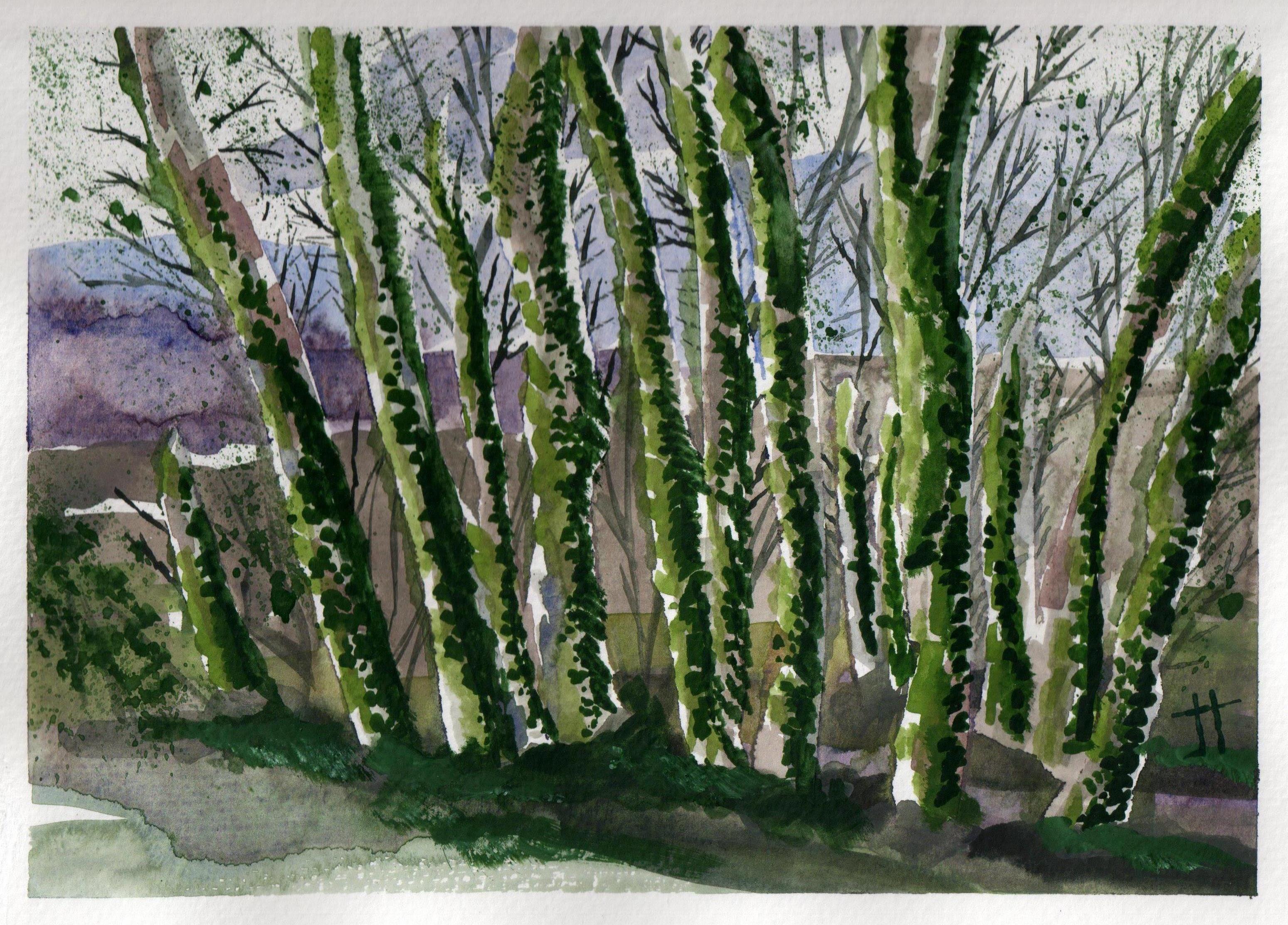
June 17, 2013 ‘vine-covered trees #1’ Jane Tims
~

June 17, 2013 ‘vine-covered trees #2’ Jane Tims
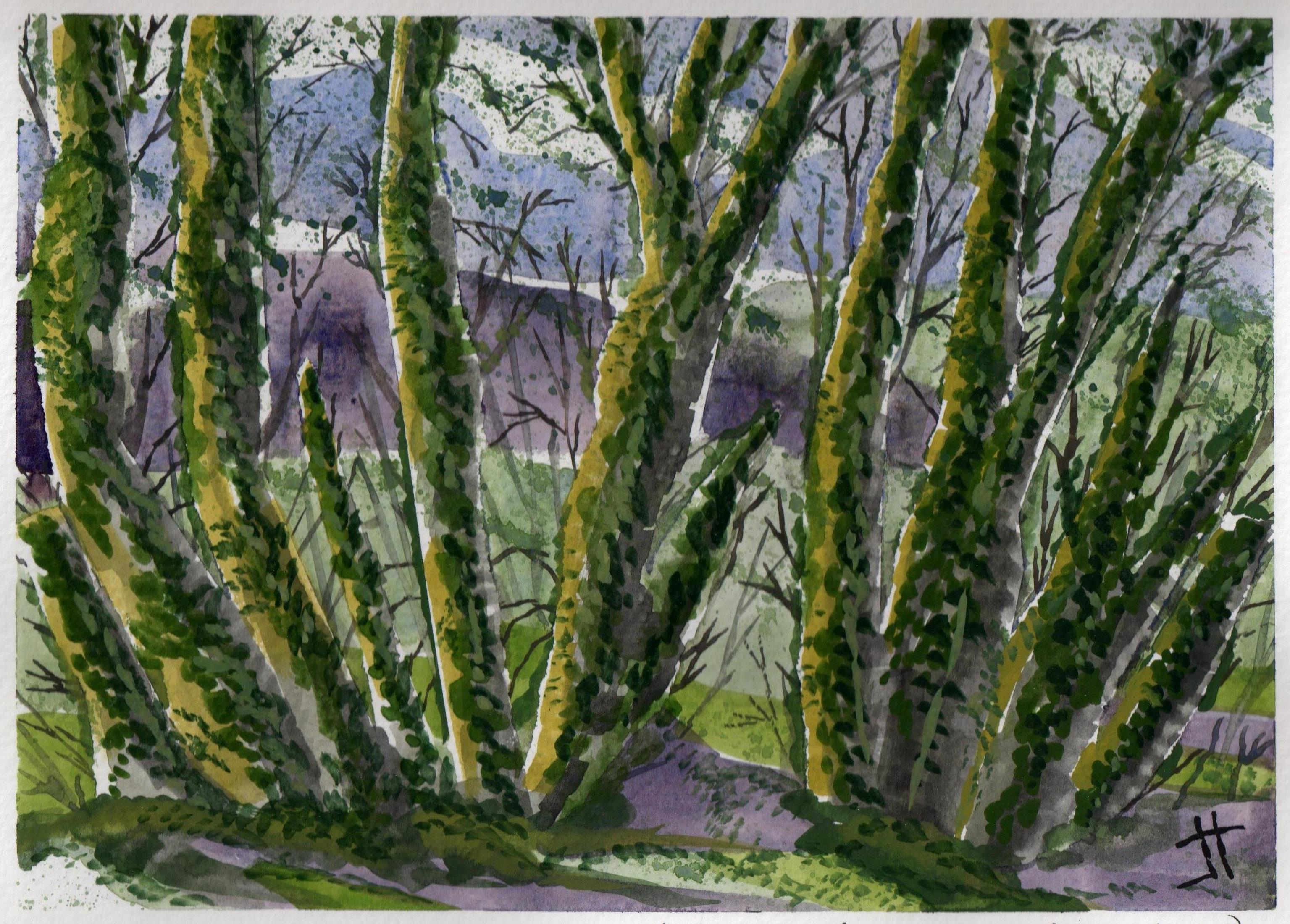
June 18, 2013 ‘vine-covered trees #3’ Jane Tims
~
This is the view that inspired the paintings …
~

vine-covered trees (image from Street View)
~
Copyright Jane Tims 2013