Archive for the ‘my exercise plan’ Category
industry and old barns (day 15 and 16)
One of the best things about ‘biking’ a new section of road every time I exercise is – I never know what theme is going to suggest itself …
~
~
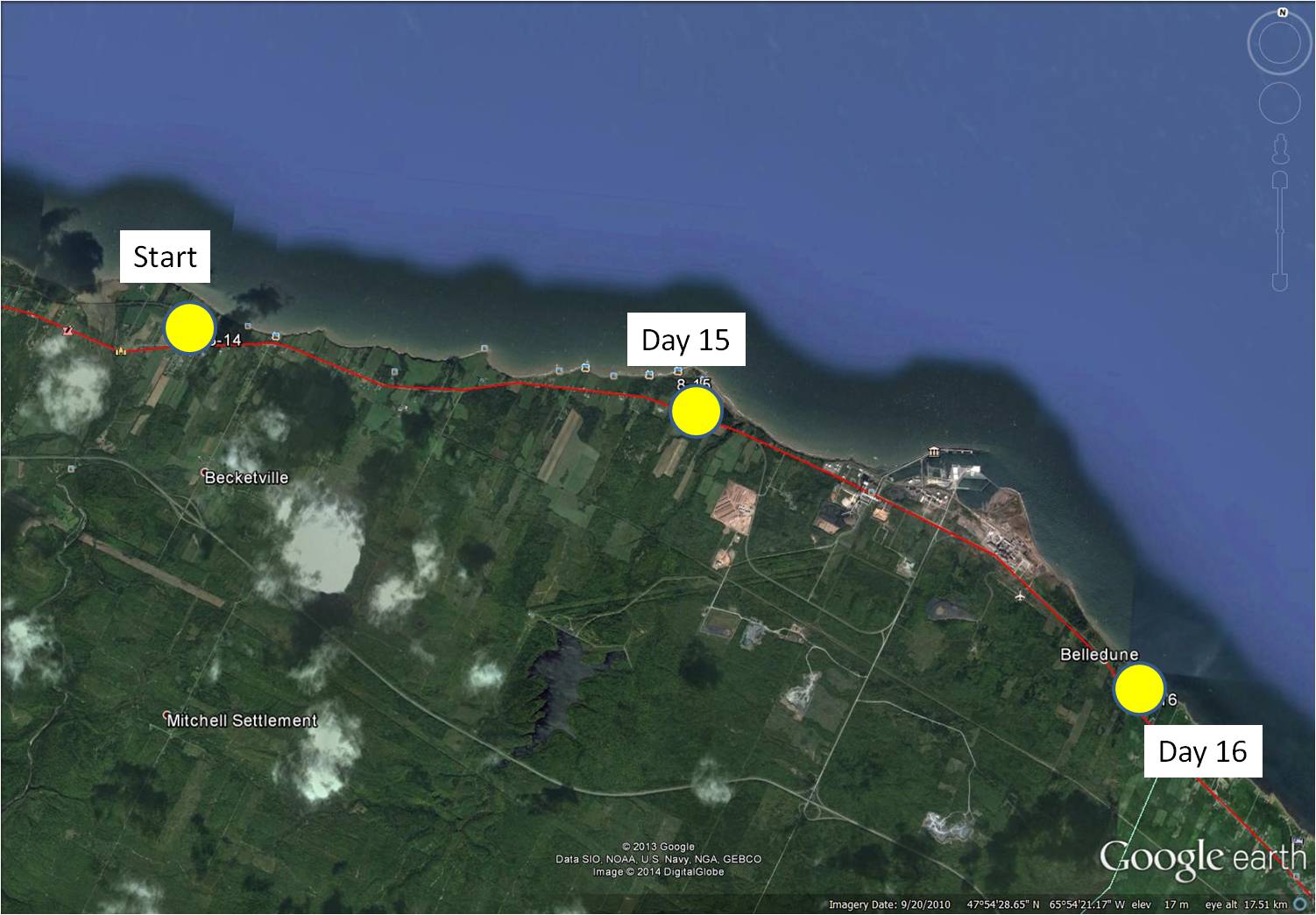
8-15 February 12, 2014 30 minutes (Jacquet River to Culligan)
8-16 February 16, 2014 35 minutes (Culligan to Belledune)
~
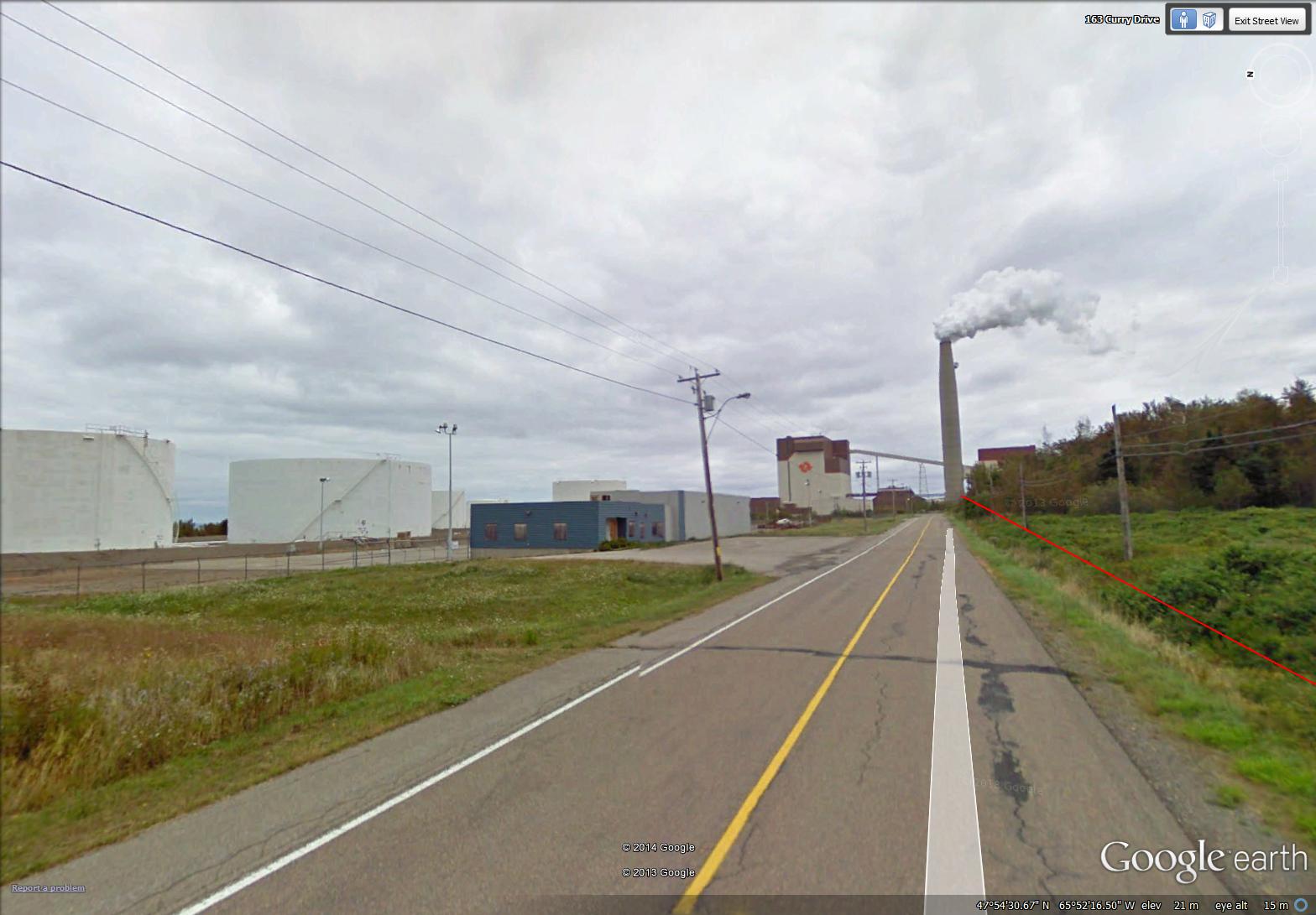
This session of virtual touring took me to Belledune. The area is quite industrialized, since it is the site of the Xstrata Zinc Canada Brunswick Smelter …
~
~
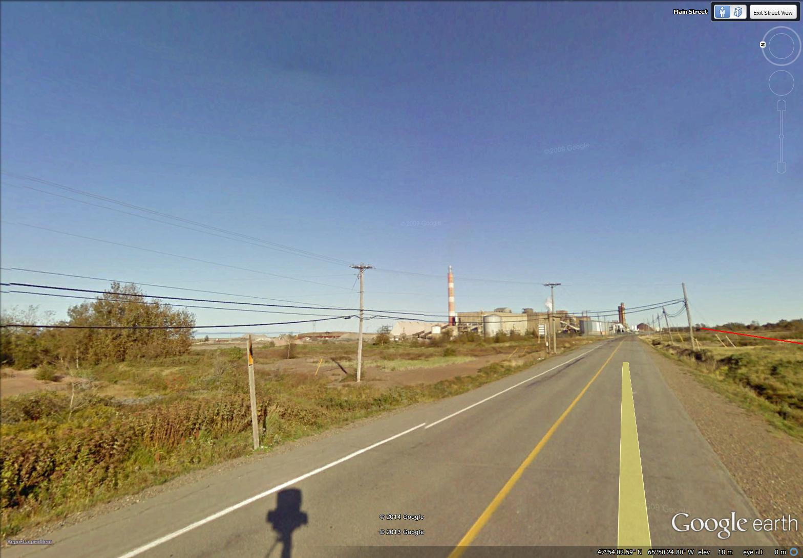
and the location of the Belledune Thermal Generating Station …
~
~
The smelter is a primary lead smelter and refinery. Its air emissions are controlled by various process-specific pollution control equipment including a scrubber and baghouse facilities.
The 450 MW (megawatt) generator burns coal and has a ‘scrubber’ to help remove sulphur dioxide emissions. At the present time, there are only two thermal generating stations still operating in New Brunswick. Most of the rest of our power comes from hydroelectric and nuclear stations; we also have some wind power.
I studied the air emissions of both the thermal generating station and the smelter at Belledune.
~
At first glance, this industrial activity in a mostly rural area may seem out-of-place. However, the smelter and generating station use the Port of Belledune. This is a world-class deep water port in the Baie-des-Chaleurs with year-round cargo handling ability. The port, one of Atlantic Canada’s most successful, offers a gateway to North America.
~
In the midst of all this industrial activity, in my search for paintings to represent my ‘travels’, I chose images of the rural landscape …
~
an old barn with red doors …
~
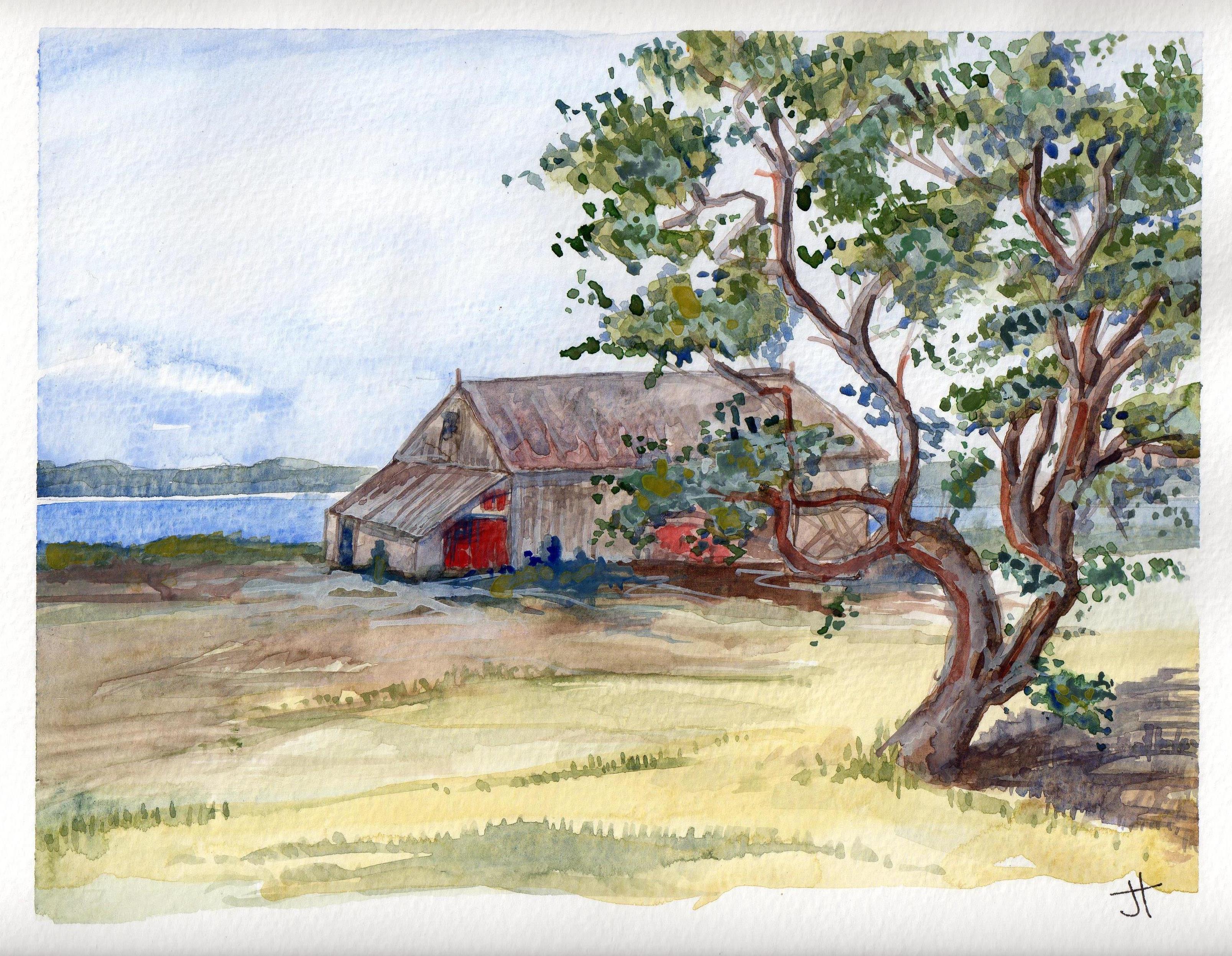
February 21, 2014 ‘barn along the bay’ Jane Tims
~
and a barn near a huge Mountain Ash, its red berries magnificent …
~

February 22, 2014 ‘red berries – Mountain Ash’ Jane Tims
~
Copyright 2014 Jane Tims
islands and gorges (day 13 and 14)
My virtual bike ride continues with a ride from Blackland to Belledune …
~
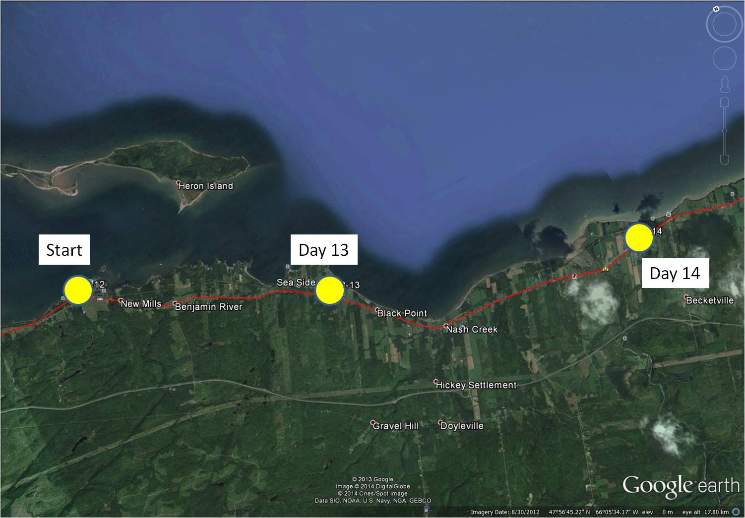
distance travelled (map from Google Earth)
~
8-13 February 5, 2014 20 minutes 3.0 km (Blackland to Sea Side)
8-14 February 8, 2014 35 minutes 7.0 km (Sea Side to west of Belledune)
~
As I have said, I have often visited the area I am ‘biking’ through as part of my past work. In the 1970s and 1980s, we visited many sites in the area to measure the levels of air pollutants in local lichens. We collected lichens of the genus Cladina (reindeer lichens) since they absorb all of their nutrition from the air and air pollutants accumulate in their tissues …
~

species of the lichen ‘Cladina’ grow in tufts on high elevation, rocky areas and in low-lying bogs
~
One of our sampling locations was Heron Island, an island 3.5 km long, lying just off the coast …
~
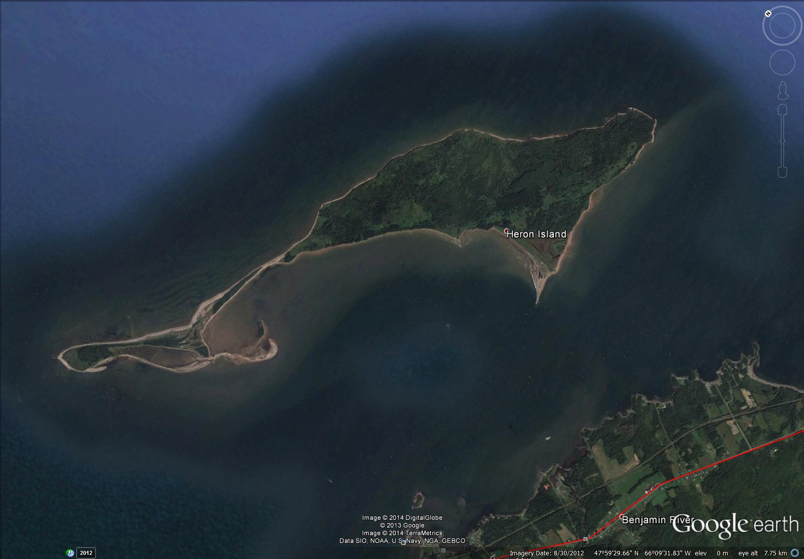
satellite image of Heron Island (map from Google Earth)
~
I have been on the island several times … it was a good place to collect lichens since there are not many local emissions to contaminate the sample (no cars, dusty roads, and so on).
~
The island is a landscape of low-lying salt marsh and beach as well as forested and grown-over old-field areas. On the boat on the way to the island, I remember watching scallop fishermen working on their barges in the shallow waters. Although people have lived on the island as recently as 1940, the island is now protected and co-managed by the provincial government and First Nations peoples who have traditionally used the island as a summer residence.
~
Today’s painting is of a rather stormy day along the bay shore just east of Heron Island …
~

February 11, 2014 ‘Baie des Chaleurs’ Jane Tims
~
Also in the area where I was ‘biking’ is the very hilly landscape of the Jacquet River. The high elevation plateau has been deeply eroded by the Jacquet River – the river and its tributaries flow through deep gorges. The 26,000 hectare ‘Jacquet River Gorge’ is one of New Brunswick’s Protected Natural Areas. Reaching the locations of our lichen collections took us deep into the area and I remember how steep the hills (and the roads) were as we went to our collection sites.
~

February 17, 2014 ‘lower Jacquet River’ Jane Tims
~
Copyright 2014 Jane Tims
rural relics (day 10 to 12)
On my virtual bike trip along the north coast of New Brunswick, I am seeing many aspects of rural New Brunswick that are almost relics in our modern world.
~

distance travelled (map from Google Earth)
~
8-11 January 31, 2014 45 minutes 3.0 km (Eel River Bar to Charlo)
8-12 January 28, 2014 30 minutes 7.0 km (Charlo to Blackland)
~
relic:
- object that is interesting because of its age or association
- surviving custom, belief or object from a past age
(Oxford dictionary)
~
One of these relics is the rural mailbox. Amid controversy, the single mailbox at the end of a driveway is gradually being replaced, so there are very few end-of-drive mailboxes along the route I am travelling.
~
We had a mailbox for many years and it was always fun going to the end of the drive to get our mail. Once when I was at my grandfather’s farm for a vacation, my Aunt Anna sent me a parcel so I would have the fun of getting a box in the mail. I remember well reaching up to get the parcel and I remember what was inside – a snow globe!

getting a parcel at my grandfather’s mailbox
~
About ten years ago, we were shifted to a community mail box. We have a key and an assigned box. It is still fun to get the mail, but less convenient …
~

mailboxes near New Mills (image from Street View)
~
Another relic of a more self-sufficient way of life is the remnant apple orchard. In some cases, the apples are still used by thrifty families, but often the fallen fruit is left for the deer …
~

orchard near Blackland (image from Street View)
~
I also see derelict barns and sheds along the road, abandoned as people give up farming and a more rural way of life …
~

February 11. 2014 ‘old shed near Charlo’ Jane Tims
~
Do you encounter remnant bits of our past in your travels? Do they bring back memories?
~
Copyright 2014 Jane Tims
a bay and a bar (day 7 to day 10)
Today I am happy to announce – it has been one year since I began my virtual travel, as part of my efforts to exercise and to motivate me to ride my stationary bike more regularly. Although I have really only biked in my tiny exercise room in our basement, I have travelled, with the help of Street View (Google Earth) to central France, to the south coast of Cornwall and, now, to northern New Brunswick. During the past year, I biked 143 days (an average of 30 minutes on each day) and over 530 kilometers. I am so proud of myself!!
~
During the last four days of my virtual biking, I went through the Town of Dalhousie, at the mouth of the Restigouche River. At this point, the river opens into the Bay of Chaleur (la Baie des Chaleur) …
~
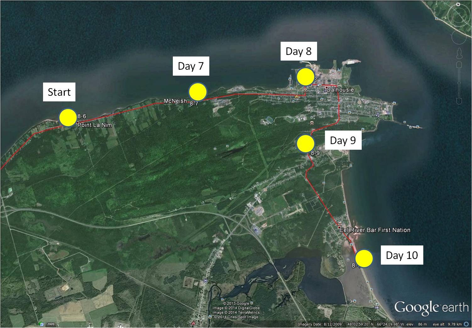
8-7 January 21, 2014 30 minutes 3.0 km (Point La Nim to McNeish)
8-8 January 23, 2014 30 minutes 3.0 km (McNeish to Dalhousie)
8-9 January 25, 2014 30 minutes 3.0 km (Dalhousie to Darlington)
8-10 January 28, 2014 35 minutes 3.0 km (Darlington to Eel River Bar)
~
One of the sights along this part of my journey is the 315 MW power generating station at Dalhousie, once operated by NB Power. This generating station was decommissioned in 2012 but remains interesting to me since I was hired in 1978 to monitor the biological effects of air emissions of the various industries in the Province. One of the reasons I travelled in northern New Brunswick was to carry out a monitoring program to study the effects of the Dalhousie power generating station.
~

Dalhousie power generating station (image by Street View)
~
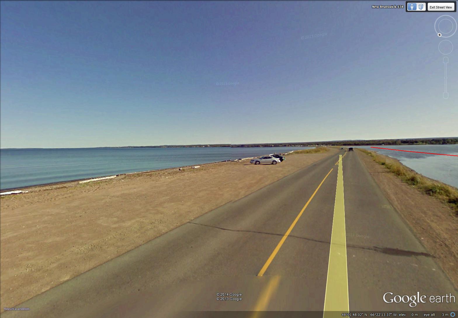
At the end of my four day ‘virtual travel’ last week, I crossed the beautiful Eel River Bar. This is the location of the Eel River Bar First Nation (Mi’kmaq people). The sandy bar is a barrier beach and one of the longest natural sand bars in the world. Water on one side of the Bar is salt and on the other is fresh. The highway is built directly on the Bar …
~
~
Across the Bay from the Bar is the low-lying peninsula of Miguasha, Quebec and the backdrop of the hills and mountains of the Gaspé peninsula. Boats at the entrance to Eel River are tethered as part of a fish netting system …

February 2, 2014 ‘boats at Eel River Bar’ Jane Tims
~
Copyright 2014 Jane Tims
another Cornwall gate
Yesterday, I completed another in the ‘Cornwall gates’ series.
They are fun to find and paint. I have learned this – trying to paint what is just beyond the gate takes away from the mystery!
~

~
Copyright 2014 Jane Tims
walk along a shady lane (day 6)
~
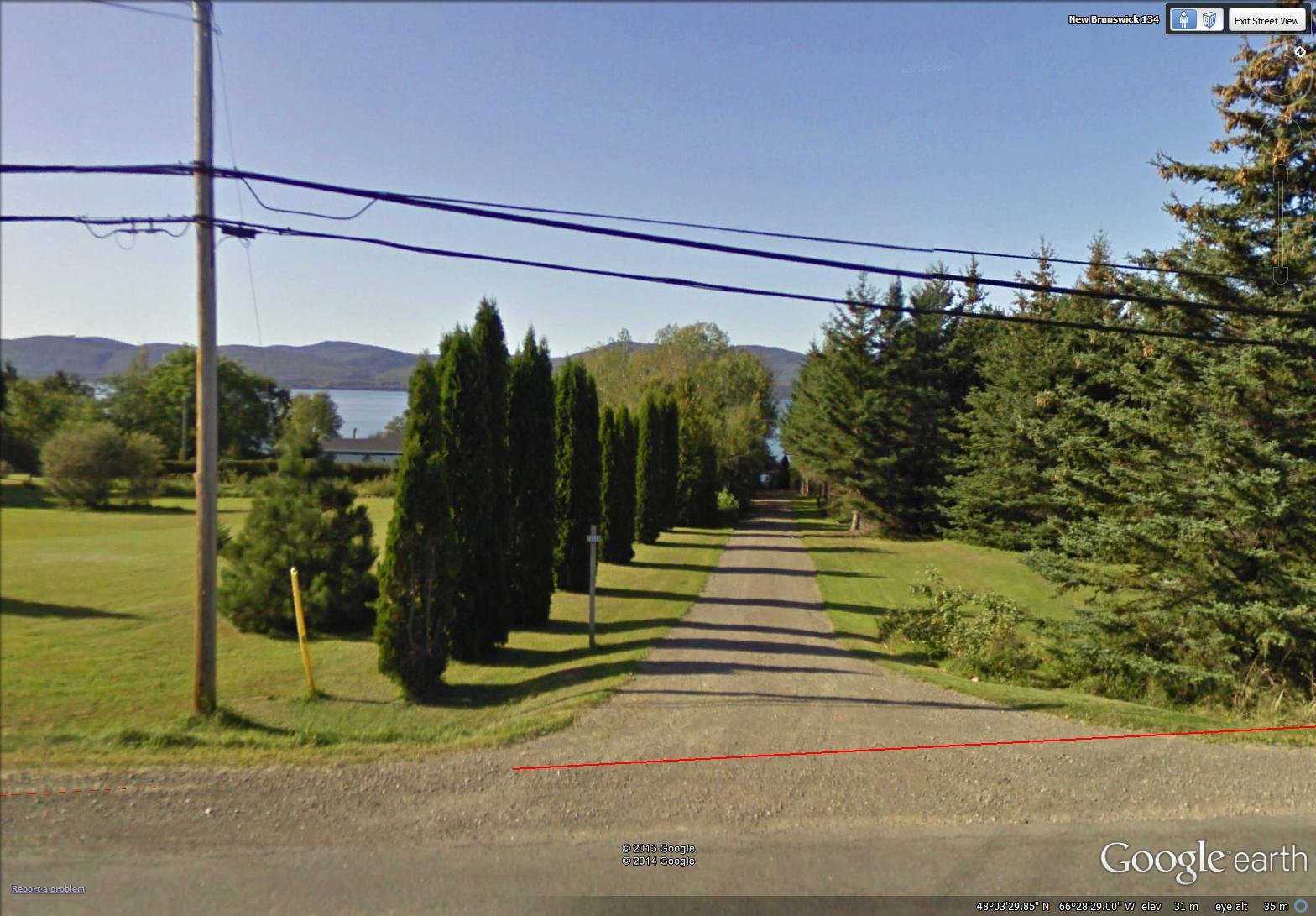
‘Biking’ in northern New Brunswick, I am constantly on the look-out for scenes and themes quintessentially ‘New Brunswick’. And the long lanes leading to homes set back from the road leap out at me …
~
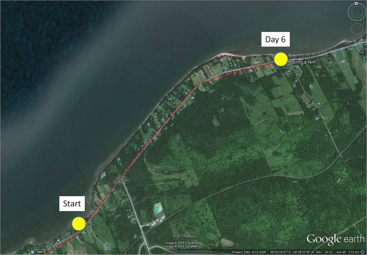
map showing distance travelled (map from Google Earth)
~
8-6 January 16, 2014 30 minutes 3.0 km (Dalhousie Junction to Point La Nim)
~
When I was a kid, I spent hours wandering up and down the long lane at my mother’s ‘old home place’. There were blueberries to pick, a lovely shade, a breeze coaxed from the hot day by the two rows of trees, and a dear silver poplar to turn its leaves in greeting as I approached the elbow of the lane …
~
It’s not the same, of course, without trees, but most lanes show the center grassy strip, flanked on either side by tracks worn by years of cars coming and going …
~

treeless lane along the Restigouche River shore (image from Street View)
~
And sometimes planted trees take the place of the narrow wooded walls of the lane in my memory …
~
a carefully planted lane (image from Street View)
~
But occasionally, I see a treed lane and I feel like a kid again, eager to go wandering …
~

January 21, 2014 ‘lane’ Jane Tims
~
Copyright 2014 Jane Tims
Cornwall gates
~
Among the paintings I did during my virtual cycling trip along the Cornwall coast are a few on the theme of gates and entryways …
~

September 14, 2013 ‘afternoon by the gate’ Jane Tims
~

October 24, 2013 ‘ gate on Old Church Road’ Jane Tims
~

January 9, 2014 ‘gate in Falmouth’ Jane Tims
~

January 10, 2014 ‘rainbow gate in Falmouth’ Jane Tims
~

January 12, 2014 ‘red gate’ Jane Tims
~
Gates are symbolic of so many things. They represent any portal into a new place, a new life, a new adventure. We know what is on this side of the gate. We may not know what we will find when we open the gate and step through.
This week, I am stepping through a gate, by taking the first step toward showing my paintings to the general public. I have submitted one of my ‘gate’ paintings (‘rainbow gate in Falmouth’), for showing and sale, to Isaac’s Way at 649 Queen Street in Fredericton, New Brunswick.
~
Isaac’s Way is a fine dining restaurant as well as an art gallery. Since 2007, they have held 19 showings and auctions of the work of local artists. Paintings are shown in the restaurant and sold by silent auction. A large part of the money raised from the sale of the paintings goes to sponsor a charity. The auction ending January 26, for example, will go to help enable underprivileged children to take winter music lessons. For more information and for a look at the art in the most recent showing (ending January 26th, 2014 at 9:00 PM) go to http://isaacsway.ca/art/
~
If you are in the Fredericton area, I encourage you to visit Isaac’s Way, to see the paintings and enjoy the comfortable atmosphere and delicious menu items.
~
Copyright 2014 Jane Tims
dangers on the roads (day 5)
On day 5 of my virtual cycling beside the Restigouche River, towards Dalhousie, New Brunswick, I encountered part of a story …
~

map showing distance travelled (map from Google Earth)
~
8-5 January 14, 2014 35 minutes 3.0 km (Maple Green to Dalhousie Junction)
~
Along the route, I passed two police cars, headed in the opposite direction. Hmm, I said to myself, you never see two police cars together unless something bad has happened.
~
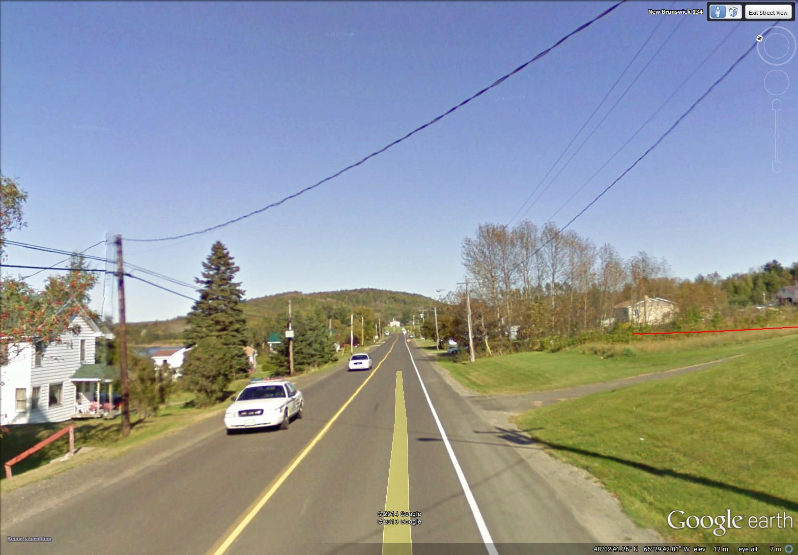
(image from Street View)
~
So I was not surprised to see this figure flagging me down …
~

(image from Street View)
~
Or the real flagman and two power trucks …
~

(image from Street View)
~
And a broken power pole. An accident, now four and a half years in the past (the Street View image was taken in 2009). But a reminder of the dangers and sad history of our highways.
~
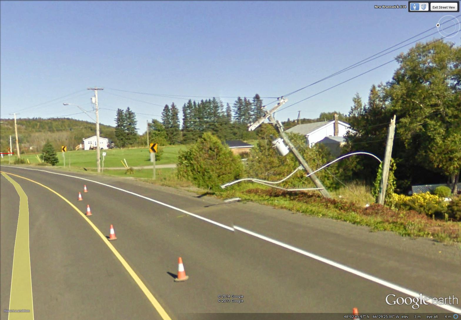
power pole, broken in half (image from Street View)
~

January 14, 2014 ‘railway crossing on Route 134’ Jane Tims
~
Copyright 2014 Jane Tims
a close look at the landscape (day 4)
On day 4 of my virtual travels in northern New Brunswick, I continued to follow the Restigouche River …
~

~
8-4 January 11, 2014 30 minutes 3.0 km (McLeods to Maple Green)
~
I love the topography of the area. As I’ve said before, the mountains here are part of the northern Appalachians. These mountains were created about 480 million years ago and were gradually eroded to a flat plain. Then, upheaval of the earth’s crust gave us the undulating hills and mountains we see today.
~
Today on my virtual bike trip, I could see one of these features, a low dark hill on the right of the horizon.
~
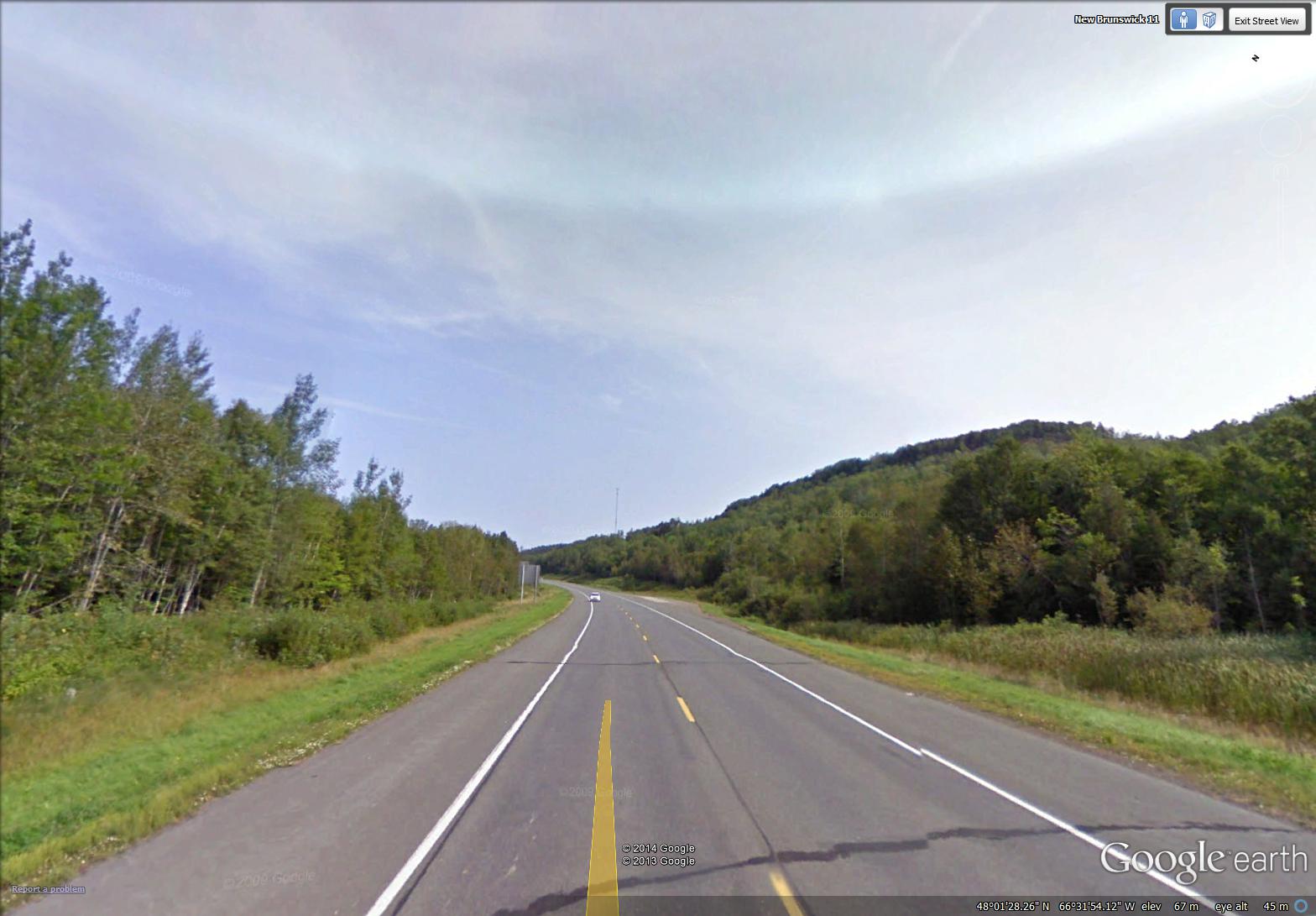
mountain along the highway near Maple Green (image from Street View)
~
I think it is interesting to look for these elements of landscape on the satellite map – I found this feature easily, a dark curved escarpment, just south of Maple Green. It is a ‘mountain’ caught between the water of Porcupine Brook (flowing out of Hicks Lake) and the deposits of the Restigouche River …
~

labelled satellite image (image from Google Earth)
~
You can also look at the mountain in the ‘ground-level view’ of Google Earth. I don’t know how this ‘mountain’ was formed, but a geologist could likely tell an interesting story of its history …
~

the ‘mountain’ is in the upper right hand corner (image from Google Earth)
~
A look at the view above shows how different land owners have taken different approaches to managing their woodlands (the tan-coloured band is a strip of clear-cut forest). The property boundaries, of course, pay little attention to geology, so there are several landowners on the ‘mountain’.
~
In one respect, the property boundaries do pay attention to the landscape. As in other areas along rivers or the coast, properties were historically arranged so each land owners had access to the waterway. You can see this on the satellite image …
~

properties along the river – every owner originally had some access to the river (image from Street View)
~
and also on an old property map of the area …
~

old property map of area around Maple Green (Source: Provincial Archives of New Brunswick)
~
Sometimes, to get access to property by the river, people need long driveways. Sometimes the road has to cross the railroad …
~

January 12, 2014 ‘railroad crossing’ Jane Tims
~
Copyright 2014 Jane Tims
trees and more trees (day 3)
Once I was asked to conduct a bus tour of southern New Brunswick for some visiting city administrators. I prepared well for the tour and had lots to show and tell them. I got a laugh for beginning my tour with: ” There’s a tree and there’s a tree and there’s a tree…. ” All joking aside, New Brunswick has a lot of trees. A drive almost anywhere means driving through many kilometers of forest or woods.
~

map showing distance travelled (map from Google Earth)
~
8-3 January 7, 2014 30 minutes 3.0 km (south of McLeods to McLeods)
~
On the third day of my virtual cycling trip in northern New Brunswick, I took a few backroads and, you guessed it – saw lots of trees. Well I love trees, so that may be one reason New Brunswick, in my opinion, is a great place to call home.
For the most part, we have a mixed wood composition to our forests – both hardwood and softwood. One thing I’ve noticed in painting my first watercolours of New Brunswick is the dark blue tinge to hills on the horizon. I think this is due to the large number of conifers (White, Black and Red Spruce, Balsam Fir and White Pine, among other species).
~

January 8, 2014 ‘Route 280 near Dundee’ Jane Tims
~
Painting trees is a challenge for me. My biggest problem is ‘green’ … I use Sap Green and Oxide of Chromium, and mix these with blue and yellow, but I can never seen to capture the emeralds of nature!
~
Copyright 2014 Jane Tims


