Posts Tagged ‘stationary cycling’
old stone town
~

old Arcais (image from Street View)
~ ~
~

map showing distance travelled (map from Google Earth)
~
The first part of my trip was through the countryside near Sainte-Sabine. The houses in this area are generally more modern and smaller than those I saw further to the east…
~

smaller, one-story houses line the country road … notice the shadow of the Street View camera (image from Street View)
~
Arçais is an old town, with stone buildings and narrow streets…
~

~
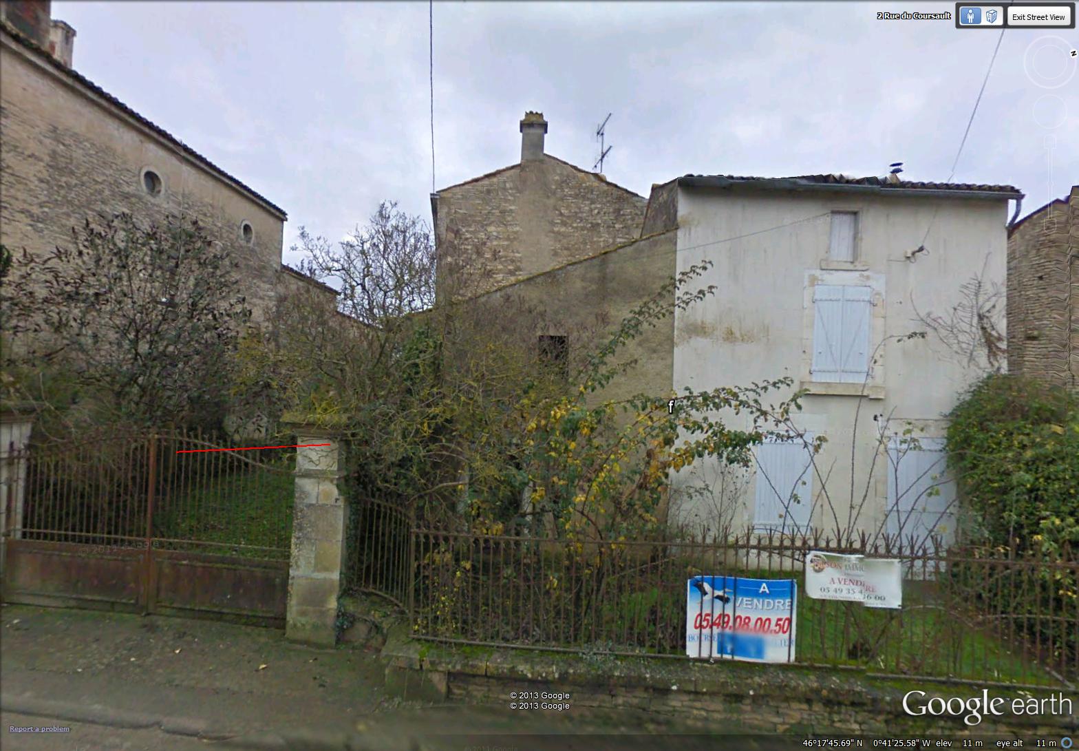
I found another house to buy, a charming two-story with a tiny front yard and an old gate – it may need a new roof…
~
~
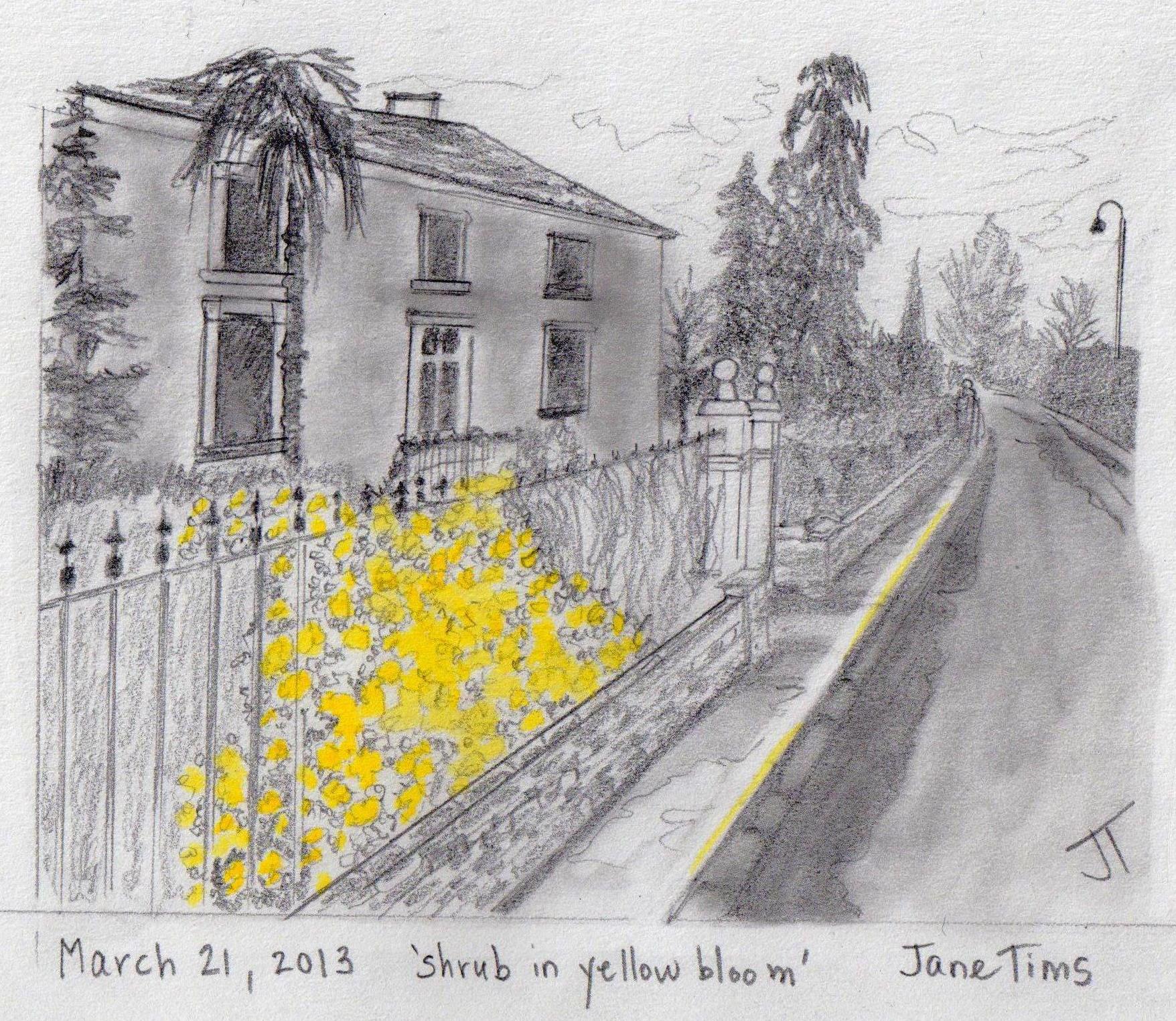
Best View: yellow flowering bush in Arçais…
~
~
Copyright Jane Tims 2013
sky on water

~

map showing distance travelled (map from Google Earth)
~
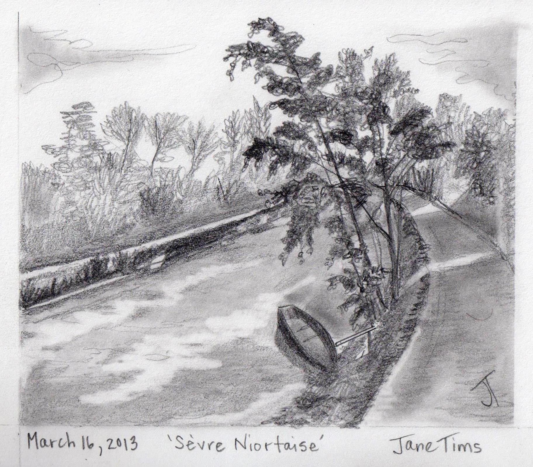
Although only part of my path was along the Sèvre Niortaise, the wet landscape was obvious everywhere. There were so many canals, houses appeared to be on islands…
~

is all land surrounded by water an island??? (image from Street View)
~
I was tempted to go ‘off-route’ by the entrance to this bike trail, but, ever afraid of getting lost, I peddled on towards Sainte-Sabine…
~

entrance to bike trail (image from Street View)
~
Best View: reflection of sky on water along the Sèvre Niortaise…
~

~
Copyright Jane Tims 2013
a sudden change of seasons
~

a pleasant bike trip along the river (image by Street View)
~
~

map showing distance travelled (map by Google Earth)
~
On March 18, I spent my time biking along the river (the Sèvre Niortaise). I loved the reflections on the water and the boats docked along the shore …
~

boats along the river (image by Street View)
~
Along the road, I was delighted to see a house draped in blooming Wisteria…
~

in the distance, a house with blooming Wisteria (image by Street View)
~
But by the time I got there, the seasons had changed, the blooms were gone and I was so disappointed not to see the flowers. I should have peddled faster!!! (Street View had photographed the blooming in April, 2010 and then recommenced in winter, January 2011) …
~

Wisteria, no longer in bloom (image by Street View)
~

winter vines (image by Street View)
~
I also saw a fisherman along the river. He was fishing in January!
~

fisherman and his truck (image by Street View)
We had a short conversation:
Fisherman: Bonjour Madame! (Hello madame!)
Jane: Bonjour. Est-ce que vous avez attraper des poissons? (Hi. Have you caught any fish?)
Fisherman: Bien sûr! Il y a un grand poisson dans mon camion … voyez-vous que les ressorts à boudin de mon camion sont en bas? (Of course! There’s a huge fish in my truck. Can’t you see how low the truck springs are?!)
~
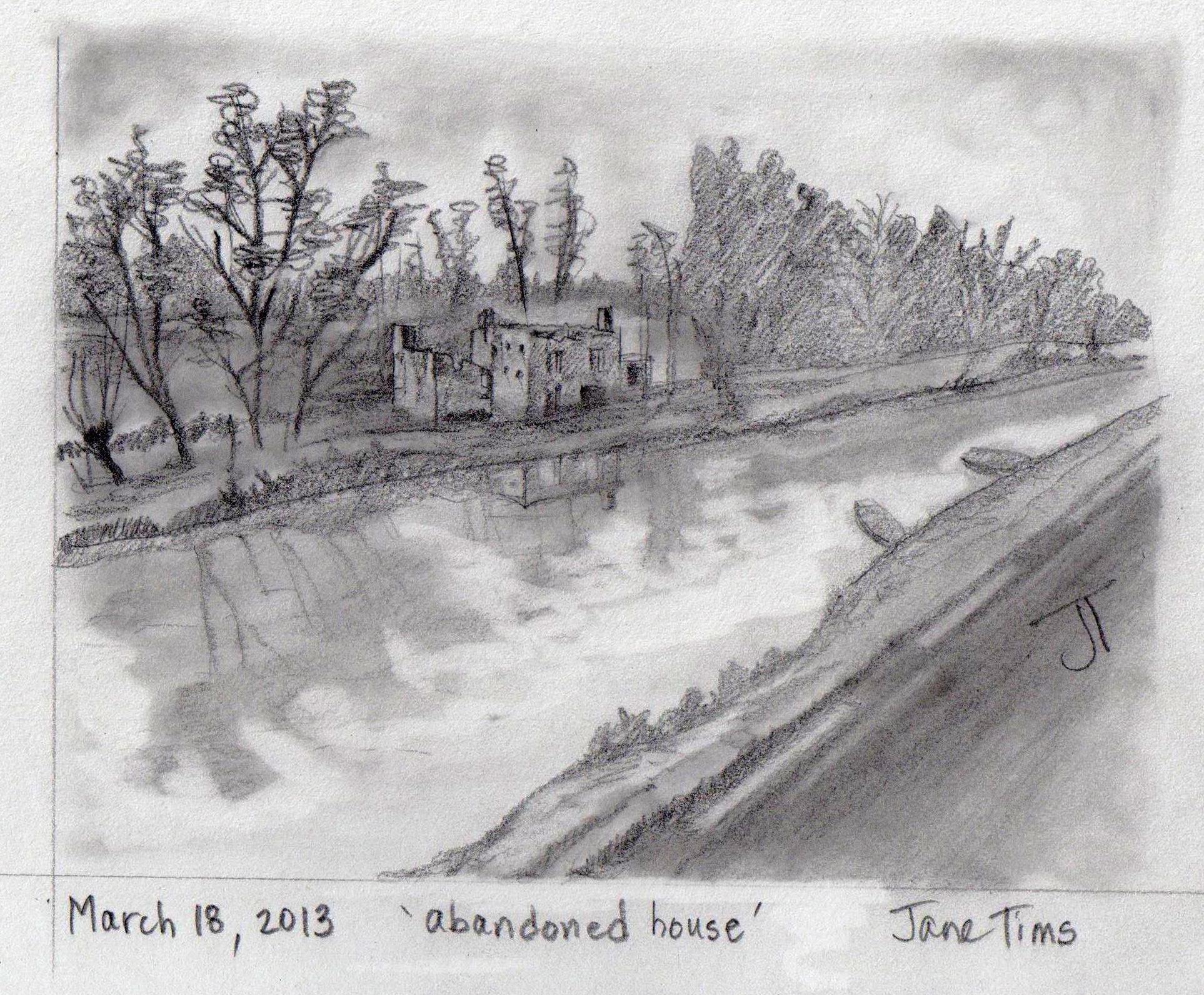
Best View: an abandoned house along the river…
~
~
Copyright Jane Tims 2013
along the river
~

a house along the river (image by Street View)
~

~

map showing distance travelled (map from Google Maps)
~
Today, I met two cyclists along the road…
~

two cyclists along the road (image by Street View)
~
Jane: Bonjour! Il fait beau, oui? (Hello. It’s nice out, eh?)
Pierre de Cheveux-Blancs (Pierre with the white hair): Bonjour Madame. Pourquoi est-ce que votre bicyclette n’ont pas des roues? (Hello – why doesn’t your bicycle have any wheels?)
Jane: Parce que c’est un bicyclette stationnaire! (Because it’s a stationary bicycle!)
Pierre de Cheveux-Blanc: Un bicyclette stationnaire! Comment est-ce que vous faites de progrès? (A stationary bicycle? How do you make any progress?)
Jane: Je fais mon progrès dans ma tête! (I make my progress in my head!)
~
My bike trip took me along the banks of the Sèvre Niortaise in the resort town of Coulon…
~

boats along the river in Coulon (image by Street View)
~
Wouldn’t it be pleasant to live along the river?
~

houses along the river (image by Street View)
~
Best View: a boat docked along the Sèvre Niortaise…
~
~
Copyright Jane Tims 2013
canal by boat
~

a side trip on the river (image by Street View)
~

~
On March 15, in order to return to my main route, I took a boat trip along a canal. This area of central France is very wet, dominated by the wetland known as the Marais Poitevin. The waterways are known as La Venise Verte. Land has been reclaimed from the wetland to create a labyrinth of waterways and dry land.
~

my side trip, including a trip by boat (map from Google Earth)
~
At the bridge in Le Gué de Magné, I put myself and my bike into one of the barges along the river and took a trip along the waterway…
~

boats along the shore (image from Street View)
~
The boat trip was a relaxing virtual vacation from all the biking I have been doing. In reality, I ‘simulated’ the boat trip by sitting down for 20 minutes with a book of Monet’s waterlily paintings…
~

view along the canal from the bridge (image by Street View)
~
It reminded me of a real trip I took on a barge at the Upper Canada Village in Ontario last fall…
~

barge trip, Upper Canada Village, 2012 … barge was hauled along the river using horse power!
~
The biking portion of the trip was along the Route de la Garette…
~

the Route de la Garette, showing water as a major feature of the landscape
~
I loved the view of this old barn and the rustic gates of the farm…
~

old farm (image from Street View)
~
~
Copyright Jane Tims 2013
a stone church
~

Chapelle de Sainte-Macrine (image from Street View)
~
~
On March 13, I strayed from my planned path to take a 3 km side trip to see the Chapelle de Sainte-Macrine. I have seen very few churches on my virtual bike trip, since Street View follows only the main roads – churches tend to be on side streets.
~

map showing distance travelled (map from Google Maps)
~
The first part of my trip was along the Rue des Ouches (meaning garden or orchard). True to the name, many of the properties had neat gardens…
~

one of the gardens along Rue des Ouches (image from Street View)
~
The church was of stone, cross-shaped, with buttresses and a large rose window. The buttresses project from the sides of the church and serve to reinforce its walls. Saint Macrine was a fourth century Saint who lived in the woods near Niort, France for seven years to escape persecution…
~

Chapelle de Saint-Macrine (image from Street View)
~
Best View: the rose window in the church…
~

~
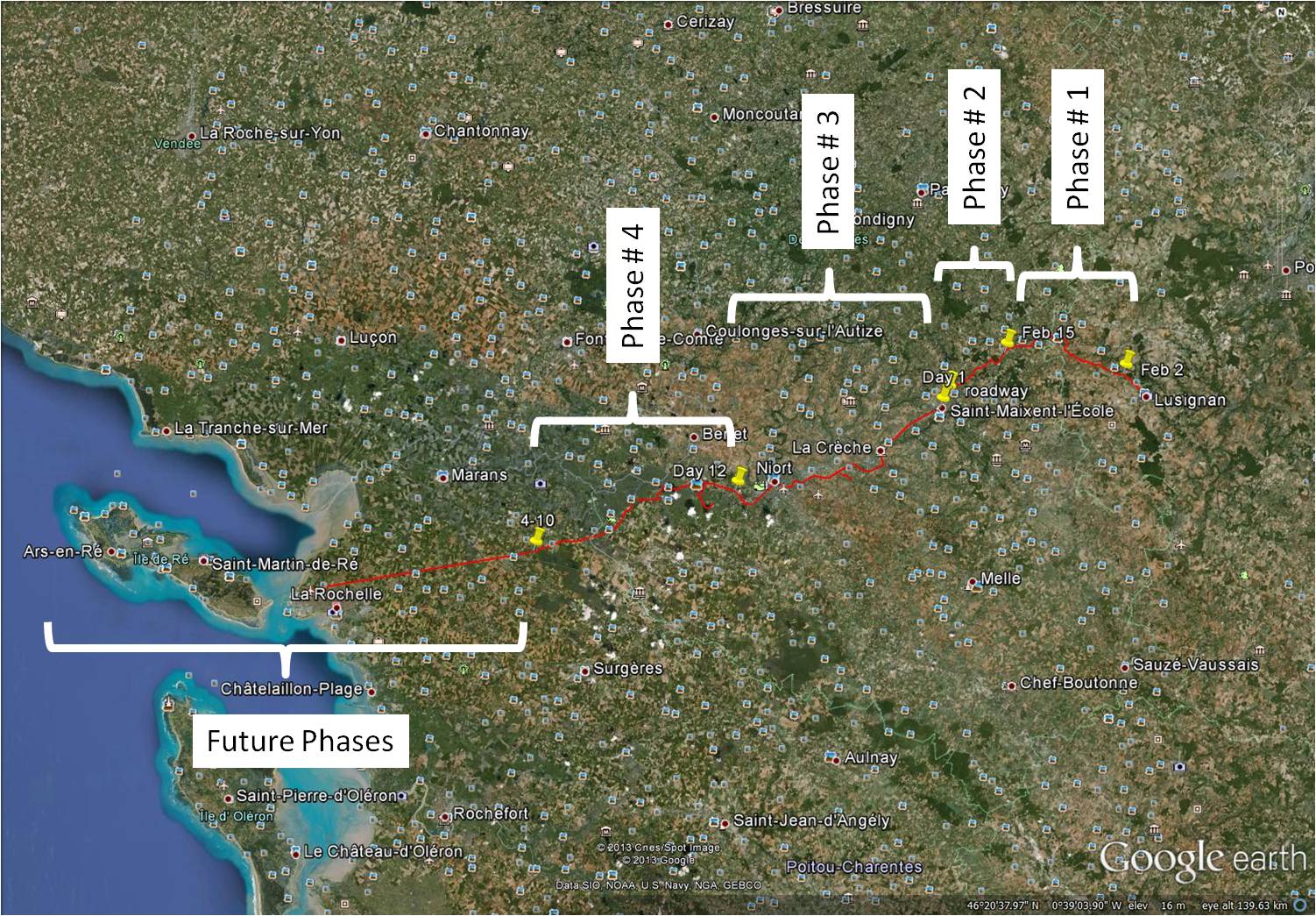
I have realised that by following a single route, I have missed many features of the countryside. In Phase 4 of my virtual bike trip, I am going to plan some side trips to see some interesting features of the French countryside.
~
Don’t you think that side trips can be the best part of a journey?
~
Copyright Jane Tims 2013
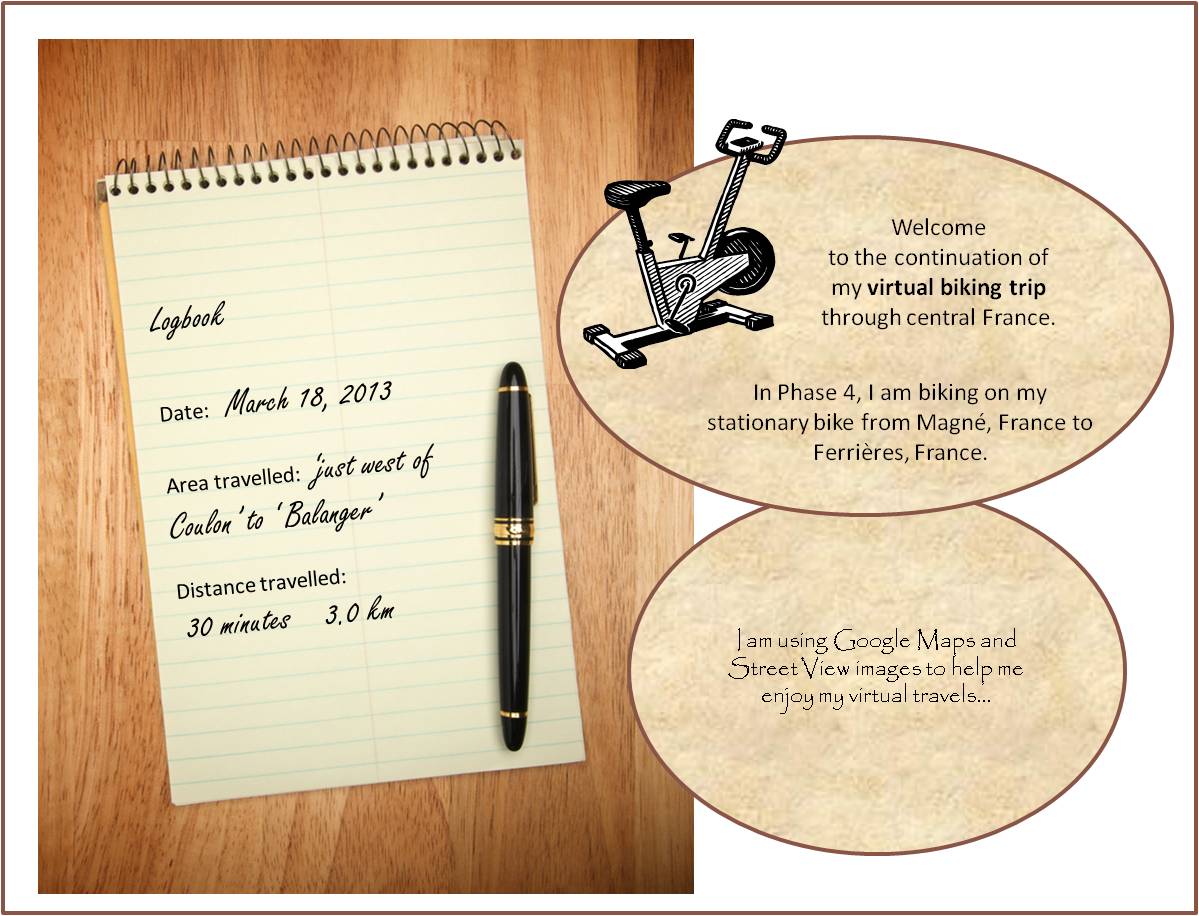
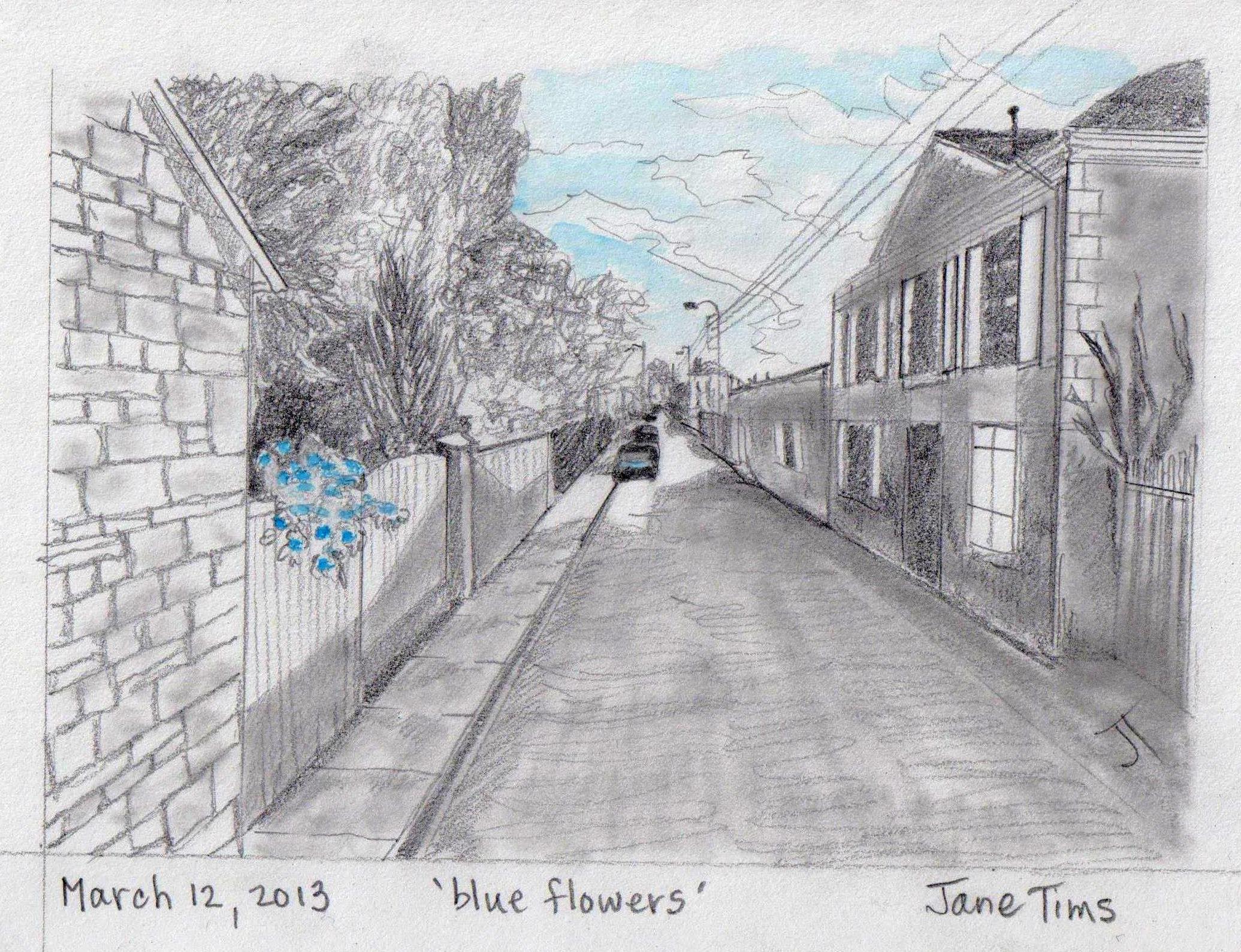
flowers and fences
The beginning of Phase 4 ! My exercise scheme of virtual biking is paying off. After going 385 minutes (67.8 km) on my stationary bike in Phases 1, 2 and 3, I have lost weight, I feel stronger and I have more walking stamina. I am looking forward to my progress in Phase 4. I am also going to try to make my trip more interesting for you, my reader.
~

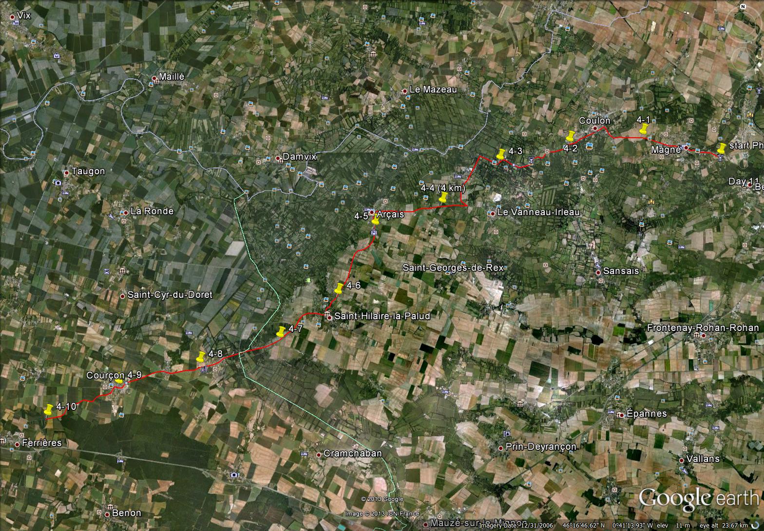
map showing distance travelled (map from Google Maps)
~
Interesting views along the route on my first day of Phase 4 included a young hardwood plantation…
~

a plantation of trees (image from Street View)
~
and a fence made of woven grasses…
~

hay fence … appears to be made from grasses ‘sewn’ together (image from Street View)
~
Best view: a pot of blue flowers perched on a fence in Magné…
~
~
Copyright Jane Tims 2013
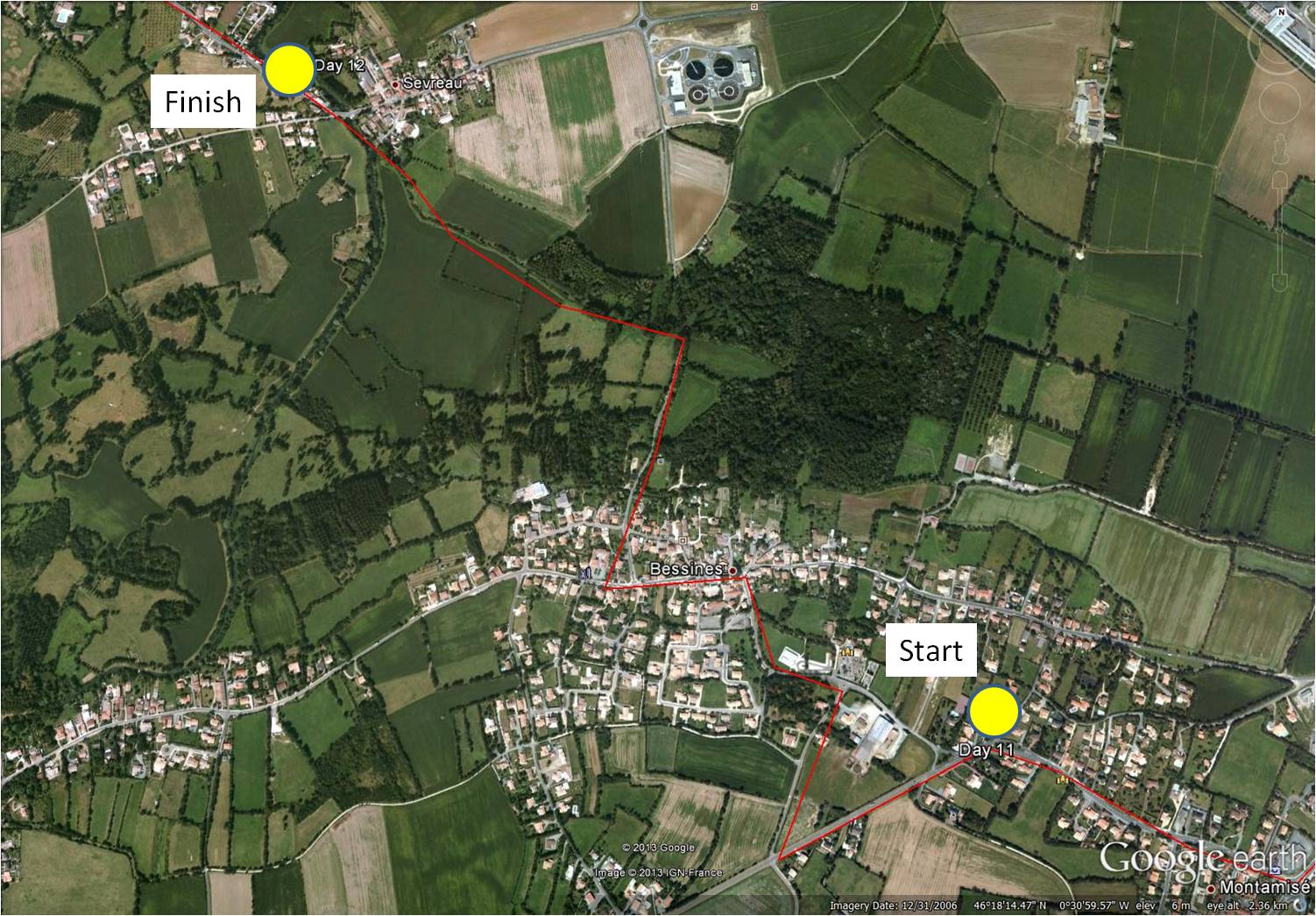
visiting Town Hall – biking log book Day #12
I can’t belive it – I have completed the third phase of my virtual bike trip through central France. In this phase, I biked (virtually) 36 km in 12 days from Exireuil to Magné just west of Niort.
~

Phase 3 map (map from MapQuest)
~
On March 10, I continued my virtual biking through the pretty town of Bessines and into the river town of Sevreau.
~
~
It was pleasant to be back in the rural areas – I appreciated the flat land – biking where there are a lot of hills is not fun!!!
~

~
The town hall (mairie) in Bessines had red shutters and a big town bulletin board…
~

town hall in Bessines – note bulletin boards
~
I think the bulletin board must tell people to be on the look-out for a crazy Canadian lady pretending to bike through the French countryside…
~

Town Hall – not ‘Mairie’ in stone over door
~
The final stretch of the trip was in a shaded road called the Rue des Trois Ponts…
~

one of three bridges
Log Book: March 10, 2013
Area travelled: ‘outskirts of Magné’ to ‘town of Sevreau’
Distance: 30 minutes 3.0 km
Best view: house with blue shutters along the Place de la Mairie
Notes: took a shortcut to Sevreau along the stream!
~

~
Total distance in Phase 1 (Jan 30 to Feb 11): 14.0 km (145 minutes of stationary biking)
Total distance in Phase 2 (Feb 12 to Feb 18): 17.8 km (180 minutes of stationary biking)
Total distance in Phase 3 (Feb 21 to March 10): 36.0 km (360 minutes of stationary biking)
~
Total Distance: 67.8 km (685 minutes or 11 hours and 25 minutes of stationary biking)
~
This ends Phase 3 of my virtual biking adventure. I plan to continue this virtual bike trip in Phase 4, a 10 day trip from Magné to Ferrières.
~
~
Eventually, I want to reach the west coast of France and see an island called Îsle de Ré.
~
~
I hope you will continue to follow me as I travel virtually through central France. I want to make my posts more interesting, so I would like to know what you would like to see in a posting of my Log Book.
~
~
Copyright Jane Tims 2013
negotiating traffic circles – biking log book Day #11
Since February 21, I have been in the third phase of my virtual bike trip through central France. For Phase 3 of my trip, I am biking in 12 days from Exireuil to Magné just west of Niort.
~
On March 8, I continued my virtual biking through the city of Niort to a town on the outskirts called Montamisé. Only 1 more day to go before Phase 3 of my virtual biking adventure is over.
~

~
I will always remember this as the ‘day of the traffic circle’.
~

completely understandable (%^&#$@$!) traffic circle sign (image from Street View)
~
I didn’t get lost because I took some shortcuts … directly across the island in the middle of each traffic circle!
~

one of a few traffic circles I negotiated – notice my red ‘path’ goes directly through the middle of the circle…I love shortcuts!!!! (image from Street View)
~
The traffic was intimidating and I especially worried about the big trucks who couldn’t see me at all (because I wasn’t there)…
~

truck traffic
~
Log Book: March 9, 2013
Area travelled: ‘in the city of Niort’ to ‘town of Montamisé’
Distance: 30 minutes 3.0 km
Best view: white house on la Rue de la Rochelle
Notes: in real life, I vow to be more considerate to cyclists!
~

~
Distance Travelled Feb 21 to Mar 9: 33.0 km (330 minutes of stationary biking)
Total Distance Travelled Jan 30 to Mar 9 : 64.8 km (655 minutes of stationary biking)
~
Do you prefer driving through a traffic circle or a regular intersection?
~
Copyright Jane Tims 2013
the mystery of the uniformed man – biking log book Day #10
Welcome to my report for Day #10 of the third phase of my virtual bike trip through central France. For Phase 3 of my trip, I am biking in 12 days from Exireuil to Magné just west of Niort.
~
On March 6, I continued my virtual biking through the city of Niort.
~

map showing distance travelled (map from Google Earth)
~
Niort is a city of older buildings, most 2 or 3 stories in height. There was lots of traffic but I remembered the sage driving advice … ‘go with the flow’…
~

buildings and traffic on l’Avenue de Limoges (image from Street View)
~
There were some interesting architectural surprises…
~

narrow building along ramp from highway to city street (image from Street View)
~
And beautiful flower gardens…
~

flower garden along ramp (image from Street View)
~
I encountered a mystery as I biked through the streets. Along the Avenue de Limoges, I saw a man in a uniform and his scooter…
~

uniformed man and his scooter to the left (image from Street View)
~
But in the next Street View frame, he had disappeared…
~

where did he go??? (note the palm tree in the yard) (image from Street View)
~
I think he must have stepped out to talk to the odd-looking ‘Street View camera car’ and then scooted off before the camera commenced its photography!!
~
Log Book: March 6, 2013
Area travelled: ‘in the city of Niort’
Distance: 30 minutes 3.0 km
Notes: I saw an apartment for sale on la Rue de la Rochelle and thought hmmmmm………
~

a place to buy (image from Street View)
~
Distance Travelled Feb 21 to Mar 6: 30.0 km (300 minutes of stationary biking)
Total Distance Travelled Jan 30 to Mar 6 : 61.8 km (625 minutes of stationary biking)
~
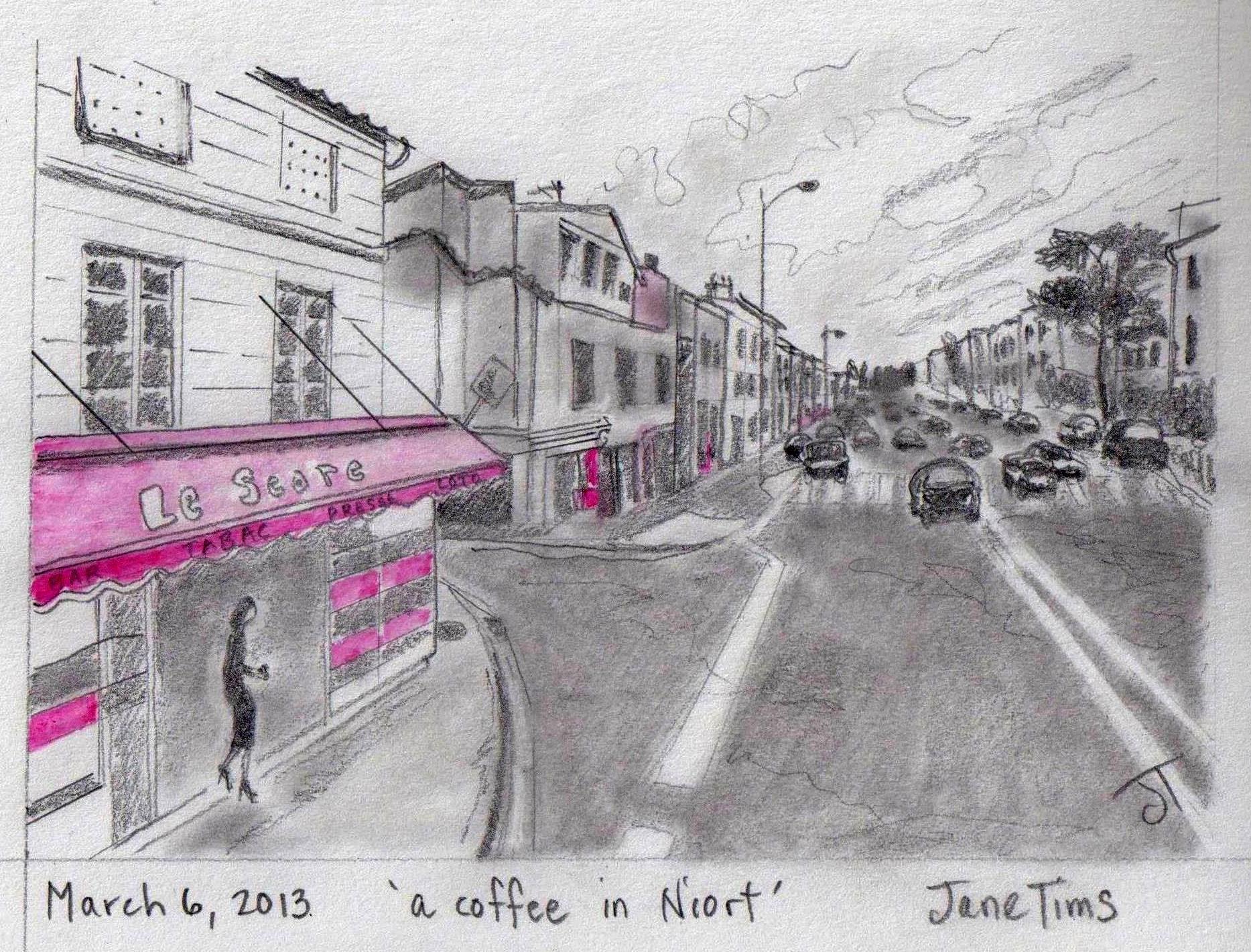
Best view: a lady buying coffee at a shop in Niort
~
Do you think I should have bought that apartment on la Rue de la Rochelle ???
~
Copyright Jane Tims 2013


