Posts Tagged ‘virtual travel’
biking log book – places I have never seen #2
So far, my exercise plan is working. I am biking on my stationary bike more often since I began my virtual bike trip from Lusignan, France to Sanxay, France, a total distance of about 14 km.
I have discovered several tools in Google Earth to help me, including a ‘ruler’ under ‘tools’ – this gives me the approximate distance from place to place!
~

map showing progress for Feb 2 (map from MapQuest)
~
Log Book: February 2, 2013
Area travelled: from ‘intersection with road to Mangadon’ to ‘hill beyond Le Breuil’ 20 minutes 1.6 km
Best view: fence at entry to a farm road near Le Breuil
Notes: Great to be able to drive on the same side of the road as at home!!!
~
Total distance from January 30 to February 2: 2.8 km
~

~
Copyright Jane Tims 2013
biking log book – places I have never seen #1
This will seem a bit strange, but I am trying a new strategy to get myself on my exercise bike at least three times a week.
I am lucky to have a good quality recumbent bike to use. I have the tiniest exercise room, located in our basement. It is basically a large open closet that fits my bike and a small table for a clock and other items. I finished the walls in stucco and have a wall shelf to put photos and art to look at as I bike.
I know biking is good for me, especially in the winter when it is harder to get outside on some days. However, getting myself down to my exercise room is harder than it sounds. I invent all kinds of excuses not to go. Often, the end of the day comes and I ‘discover’ I have skipped yet another day of exercise.
In January, I began to work on a new plan for encouraging biking. You will quickly note that making the plan and preparing takes a lot more time than doing the actual exercise. Although this may be another form of procrastination, the time I spend serves other purposes. I learn about new places, I practice my drawing skills, and I don’t mindlessly watch TV and eat if I am busy working on my plan.
The plan is this. When I bike, I pretend I am riding my bike through the countryside of some place I have never been. There are bikes that actually have this feature built-in (just Google ‘exercise bike with google maps’), but I am using an old-fashioned approach.
I select a place and print out a scaled map with a 10 or 15 km distance to travel. Then I go on Google Earth and ‘travel’ the road on the computer, using Street View to have a look at places along the way. I print off some of the more interesting views so I will have an idea how the countryside appears. Then I glue maps and images into a notebook and plot my progress on the map. Each 10 minutes on my exercise bike equals approximately one kilometer on the map. I use small stickers to mark my progress. After I have ridden through an area, I can use the views as source material for drawing in my sketch book.
~
My first virtual bike ride has been through the Poitiers area of France. This is in the Poitou-Charentes Region of western France, south-west of Paris. I selected this area because a few years ago I worked with a woman from Poitiers and her descriptions of the area made it sound so interesting. She also gave me some brochures and other tourist materials that featured the beauty of the countryside and some of the local history. I have never been to Europe, so this is quite a learning for me. To start, I have selected a road from Lusignan, France to Sanxay, France, a total distance of about 14 km. At 10 minutes per km, this will take me 140 minutes or more of biking (about seven biking sessions).

‘MapQuest’ map showing route from Lusignan (A), France to Sanxay (B), France
~
From Street View, I can tell that this is a very rural area. The road passes by farms and connects small communities. Most of the scenes in Street View in this area were taken in the spring, so trees are in blossom but not yet in leaf. There are sheep in the pastures and the houses are roofed with clay tiles. Many houses have small kitchen gardens and are bounded by low rock walls. At the intersection of major roads, there are frequently shrines, including crucifixes and statues of Saints.
~
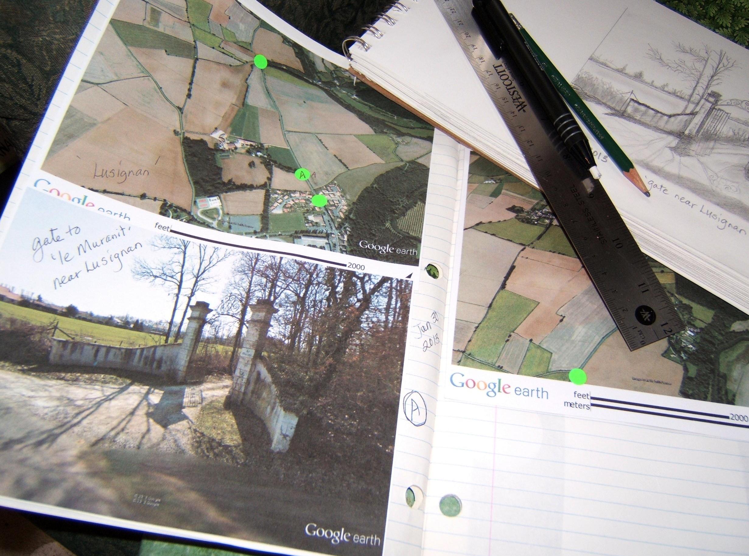
Log Book: January 30, 2013
Area travelled: from ‘just north-west of Lusignan’ to ‘intersection with road to Mongadon’
Distance: 20 minutes 1.2 km
Best view: gate to ‘le Muranit’ near Lusignan
Notes: It took longer to cover this stretch of road because I kept getting off the bike to see the sights …
~

~
Please come back often, as I plan to update my Log Book each time I bike.
~
Copyright Jane Tims 2013


