Posts Tagged ‘stationary cycling’
white sand and phthalo water 7-24
~

~

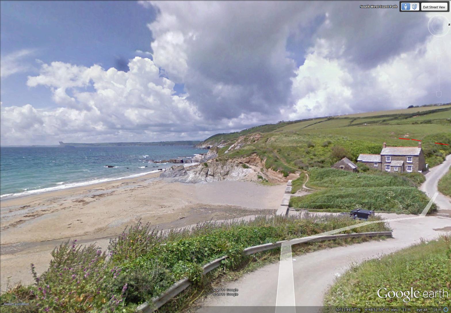
map showing distance travelled (map from Google Earth)
~
I love the salt water, so it is no surprise that my favorite views on my virtual bike trip are those along the coast. Near Penare, I discovered a spot where a stone house overlooks a sandy beach. The water was the color of the phthalo blue in my paint box …
~
~
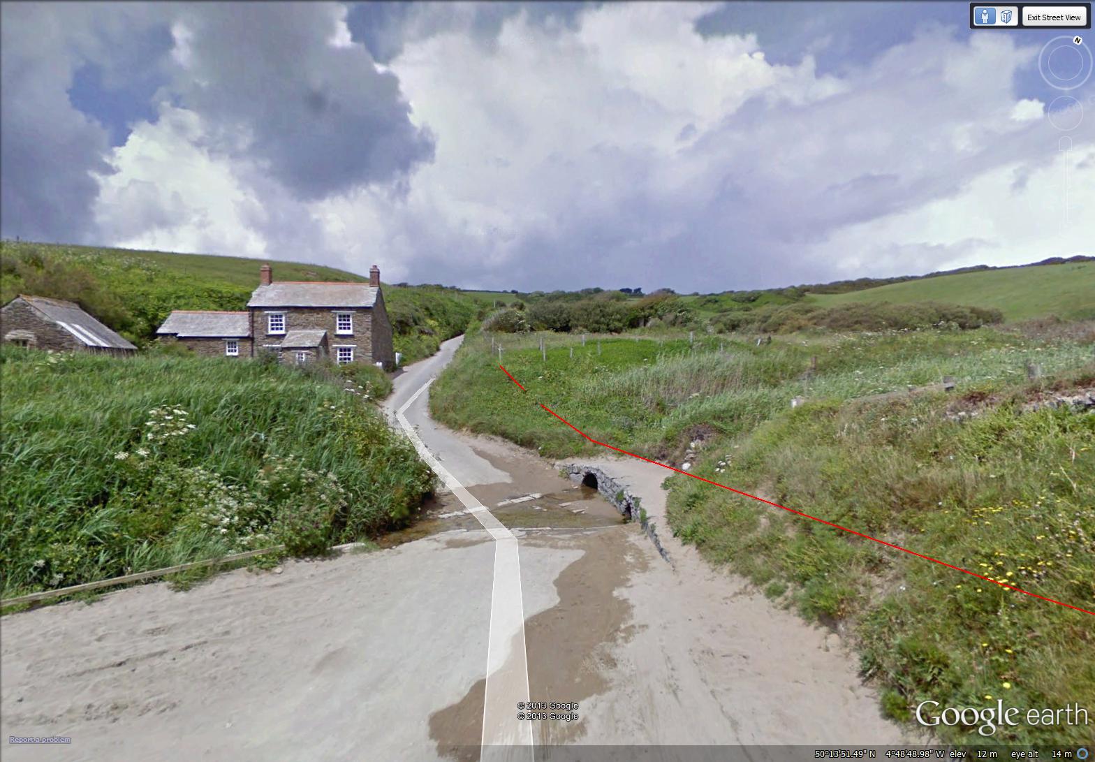
Near the beach, where a stream runs across the road, is an interesting ford. It looks like there was once a bridge at the crossing, but the encroachment of sand and vegetation made it easier to ford the stream. I would love to know the history of this stream crossing …
~
~
Best View: a house by the sea near Penare, the road lined with crowds of purple flowers (my painting looks quite different from the inspiration, above) …
~

Aug 24, 2013 ‘purple mallow near Penare’ Jane Tims
~
Copyright 2013 Jane Tims
pasture grazers and sea-creatures 7-23
~

~

map showing distance travelled (map from Google Earth)
~
On this virtual bike trip, I saw lots of animals – not surprising in an agricultural countryside.
There were sheep grazing beside the road …
~

~
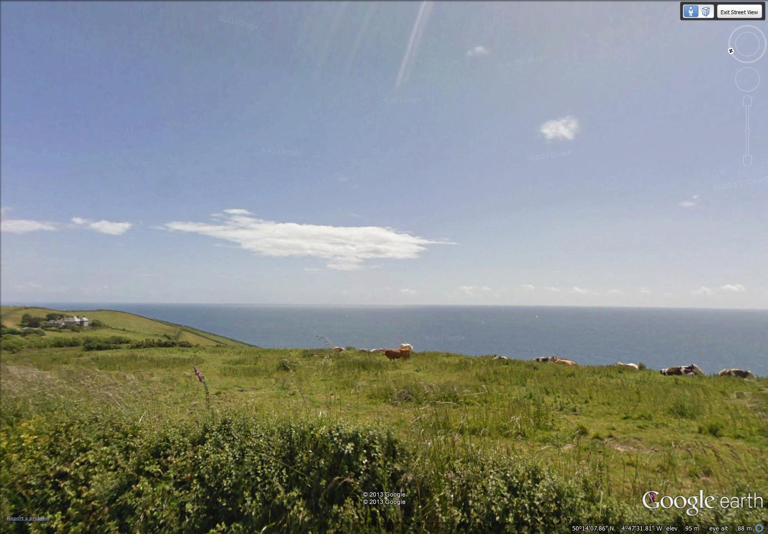
cattle in a pasture at the top of the cliff …
~
~
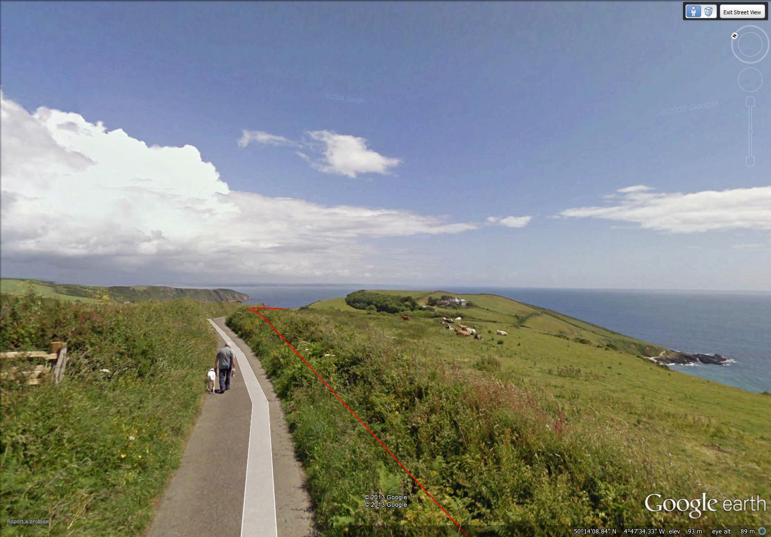
and a man walking his dog along this part of the South West Coast Path …
~
~
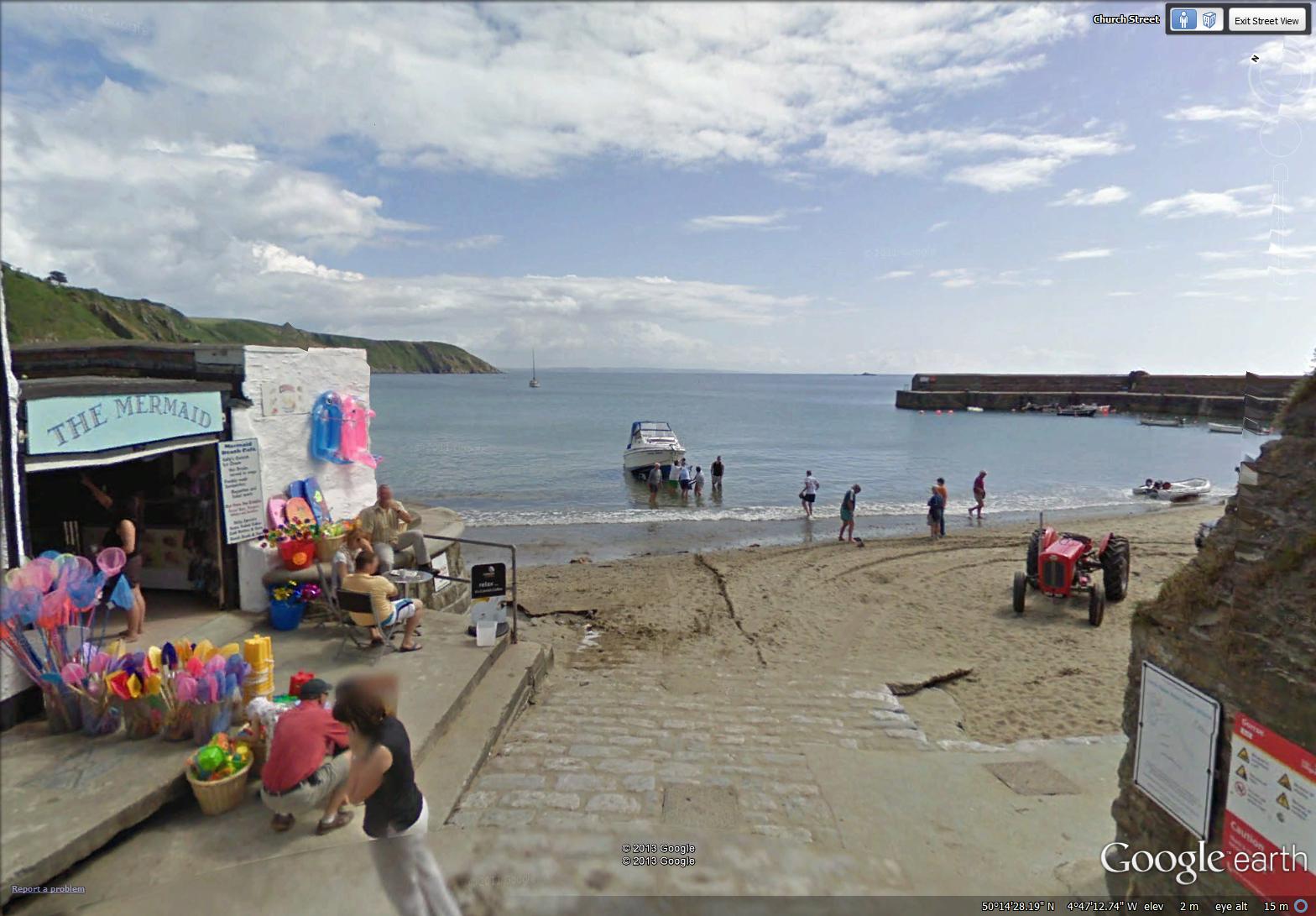
Although I didn’t stop to see any, there must also have been tiny sea creatures to catch in the shallows along the beach. The beach-side shop in Gorran Haven sells small nets to catch them – I hope there was a note to say ‘please return these creatures to the sea’ …
~
~
Best View: the Cornwall coast near Penare …
~

Aug 14 ‘headland near Penare’ Jane Tims
~
Copyright 2013 Jane Tims
views of the coast 7-22
~

~

map showing distance travelled (map from Google Earth)
~
My bike trip for today took me near the Cornwall coast and showed me how much the English people enjoy their seascapes.
~
Mevagissey is a large port town with lots of sailing ships and boats at dock …
~

Mevagissey harbour (image from Street View)
~
Often, you see either the woods or the coast but not both. Here, I ‘saw’ a view of both wood and ocean …
~

looking towards Mevagissey (image from Street View)
~
I liked the Portmellon beach area. There were walkers and swimmers, kayakers and sailors, all enjoying their bit of the Cornwall coast …
~

swimmer at Portmellon beach (image from Street View)
~
Best View: the Portmellon coastline – I like the way this turned out … stormy sky, uniform ocean and perspective are all the way I wanted them to be … it’s fun doing the shadows on the road …
~

~
Copyright 2013 Jane Tims
~
glimpses of the South West Coast Path 7-21
~

~

map showing distance travelled (map from Google Earth)
~
As I bike along the road, following the Street View path of images, I know that between me and the ocean is a path. Known as the South West Coast Path, this long-distance footpath is a National Trail in the UK. It runs 630 miles or 1014 km from Somerset, along the coast Devon and Cornwall and into Dorset. It originated as a path to watch for smugglers and is now a major tourist attraction.
~
Sometimes, where the road I am following approaches the coast, the path becomes synonymous with the road. Most of the time, however, it runs along the high land overlooking the sea …
~

stretch of coastal path near Pentewan, marked in red … part of the path runs along the road and part along the top of the cliff overlooking the ocean ( map from Google Earth)
~
Where the path and the road run together, there is often a rail fence to mark the way …
~

~
Sometimes I see a set of stairs or a parking lot to allow public access the trail …
~

stairs to access coastal path near Looe (image from Street View)
~
It occurs to me that a variant on what I am doing for exercise would be to walk the path virtually. In reality, the path takes about 8 weeks to walk, although one runner has run the path in a little more than 16 days. The path is quite visible in aerial view in Google Earth.
~
Best View: stone walls as I neared Mevagissey …
~

Aug 2, 2013 ‘road near Megavissey’ Jane Tims
~
Copyright 2013 Jane Tims
haying time 7-20
~

hay bales in a field along the Cornwall coast (image from Street View)
~

~

map showing distance travelled (map from Google Earth)
~
In New Brunswick, a common sight is of hayfields with their bales of hay …
~

hay bales in New Brunswick
~
Haying and hay bales are also a common sight along the Cornwall coast …
~

a farmer works at his trailer of hay near Trenarren (image from Street View)
~
So, today’s virtual biking trip felt a little like biking at home …
~

bales of hay along Cornwall coast (image from Street View)
~
Best View: round hay bales along the Cornwall coast …
~

Aug 18, 2013 ‘haybales near Trenarren’ Jane Tims
~
Copyright 2013 Jane Tims
sailboats and tall ships 7-19
~

tall ships in harbour at Charlestown (image from Street View)
~

~

map showing distance travelled (map from Google Earth)
~
My trip on the 19th day of my virtual journey through Cornwall took me along the Porthpean Beach Road. The houses along the road came in many architectural styles. One, a stone house, made a charming roofline over the hedges around it …
~

stone house with hedges and vined walls (image from Street View)
~
Others were like stone fortresses, with walls and gates and history …
~

walled house on Porthpean Beach Road (image from Street View)
~
My favorite house, of white-washed stone, was in Porthpean, with the ocean in sight …
~

house with a green door, in Porthpean (image from Street View)
~
Best View: sailboats in dock at Porthpean Beach … I did two versions of this. #1 is my favorite, but I painted the scene too literally and made the masts of the boats curved (as they appear in the Street View camera lens)! I corrected this in #2, but I don’t like the colors as well …
~

August 5, 2013 ‘Porthpean Beach #1’ Jane Tims
~

August 7, 2013 ‘Porthpean Beach #2’ Jane Tims
~
Copyright 2013 Jane Tims
seasonal shifts 7-18
~

treed roadways near Carlyon Bay (image from Street View)
~

~

map showing distance travelled (map from Google Earth)
~
On my virtual tour of the residential area of Carlyon Bay, I encountered another of the seasonal shifts I have noticed before in Street View. One minute, I am in the month of May and the hydrangea are unremarkable green shrubs …
~

hydrangea in May (image from Street View)
~
and the next minute I am in August, and the hydrangea are in full bloom …
~

hydrangea in August (image from Street View)
~
Hydrangeas are like natural litmus paper … the color of the blue-tinted flowers is determined by the acidity of the soil. Lower pH soils (less than 6) tend to produce blue flowers. Higher pH soils (greater than 6) produce pink flowers.
~
Best View: hydrangea in magnificent bloom, Carylon Bay …
~

August 10, 2013 ‘hydrangeas, Carlyon Bay’ Jane Tims
~
Copyright 2013 Jane Tims
technology and industry along the road 7-17
~
My virtual biking has taken a turn for the better. As a reward to myself for keeping at my biking for 6 months (!), I splurged on an I-Pad. My son set up wireless in our house and now I can go to my stationary cycle and use Street View directly. I am using an app called MobiMaps (Brainflash).
Previously, I spent hours downloading images from Street View and transporting them physically on a flash drive to my small computer. Using the I-Pad is a great time saver. The I-Pad has also given me the ability to look around the countryside more, so I am biking longer (35 to 50 minutes per session compared to the 30 minutes I was doing). My goal now is to work up to the recommended 150 minutes per week of exercise.
~

~

map showing distance travelled (map from Google Earth)
~
Today’s journey was not particularly photogenic. The area between Par and Carlyon Bay is very industrial. I saw lots of evidence of abandoned industrial buildings …
~

abandoned chimney with vines (image from Street View)
~
One of the abandoned chimneys had a tree growing from the flue opening!
~

abandoned industrial space (image from Street View)
~
The road also followed the train track and I was treated to the view of a high-speed train going by …
~

a passing train (image from Street View)
~
Best View: an abandoned industrial building near Carlyon Bay … not very pretty, but it gave me a chance to practice a different approach to ‘sky’. The bush of Gorse did not turn out so well, but I like the vine-covered roof of the building and the vine-covered chimney …
~

Aug 9, 2013 ‘abandoned industry, Carlyon Bay’ Jane Tims
~
Copyright 2013 Jane Tims
historic hills 7-16
On the 17th day of my virtual bike trip along the Cornwall coast, I enjoyed a long trip down Polmear Hill near Par. I also learned about the Rashleigh family who built the mansion of Menabilly, the inspiration for Manderley, the house in my favorite book, Daphne du Maurier’s Rebecca.
~

~

Map showing distance travelled (map from Google Earth)
~
On my way down Polmear Hill, I spotted this Celtic Cross by the road. Some research told me this stone commemorates a carriage accident on Polmear Hill …
~

stone cross on Polmear Hill (image from Street View)
~
At the bottom of the hill was an interesting group of connected houses, the Rashleigh Almshouses. Jonathan Rashleigh (1591-1675), a merchant and politician, had these built in 1653 to provide a home for poor widows in the area …
~

Rashleigh Almshouses – the small units once housed poor women from the community – today, groups of two units have been joined to make private residences (image from Street View)
~
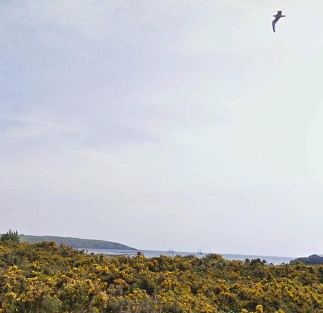
Near the end of my bike trip I saw two tall ships out in St. Austell Bay …
~
~
Best View: a hut on Polmear Hill … since it is near a bus stop and at the end of a paved footpath, I wonder if this is an old abandoned hut, or if it was built or repurposed for a bus stop shelter…
~

August 2, 2013 ‘hut on Polmear Hill’ Jane Tims
~
Copyright 2013 Jane Tims
legends along the road 7-15
Biking (virtually using Street View) through Cornwall is proving to be an adventure. I am seeing interesting houses, encountering magical byways and learning a lot of history. Today I drove through the town of Fowey, famous for its associations with Daphne du Maurier, one of my favorite authors.
~

view of Polruan from Fowey (image from Street View)
~

~

map showing distance travelled (map from Google Earth)
~
Fowey is a place of grand estates and mansions …
~

mansion in Fowey (image from Street View)
~
and colorful houses …
~

colorful houses in Fowey (image from Street View)
~
Beside the road outside of Fowey is a granite pillar known as The Longstone or the Tristan Stone. This may be the burial place of the archetype of Tristan, of the legend of Tristan and Isolde. The legend tells the tragic story of a Cornish knight and an Irish princess who fall in love after ingesting a potion …
~

Tristan Stone by road west of Fowey (image from Street View)
~
I also took a quick side trip to an interesting place on the map, just north of Fowey. From the road, Castle Dore appears as an irregularity in the landscape. It is the grass-covered ruin of a ‘hill fort’ of the Iron Age, occupied first during the 4th to 1st century B.C. ! The fort protected people from Roman invaders …
~

Castle Dore from road (image from Street View)
~
The fort was also occupied during the Dark Ages. In legend, it is identified as the hall of King Mark (who Isolde was supposed to marry) and is therefore associated with the legend of Tristan and Isolde …
~

aerial view of Castle Dore (map from Google Maps)
~
Best View: New Road Hill in Fowey, a ‘sunken’ roadway with a staircase for pedestrians …
~

July 28, 2013 ‘Fowey roadway’ Jane Tims
~
Copyright 2013 Jane Tims


