Archive for March 2013
biking log book – Day #4 – a haunting in the Rue de l’Aumônerie !
On February 21, I began the third phase of my virtual bike trip through central France. For Phase 3 of my trip, I plan to bike in 12 days from Exireuil to Magné just west of Niort.
~
Day #4 of my adventure followed a virtual path along a country road, past large fields, over the Sèvre Niortaise River, and into the town of La Crèche.

Day 4 map showing distance travelled (map from Street View)
~
My trip ended at a Chocolatier/Patissier in La Crèche … yum!!!!
~

patissier in La Creche (image from Google Street View)
~
Log Book: February 25, 2013
Area travelled: from ‘a field south-west of Kadore’ to ‘La Crèche’
Distance: 30 minutes 3.0 km
Best view: man on bike in Rue de l’Aumônerie
Notes: Tried to talk to the cyclist … a chance to practice my French!!!
Jane: Bonjour, Monsieur! (Hello Sir!)
Man on bicycle: Quoi? ???!? (What?!)
Jane: Bonjour, je m’appelle ‘Jane’. Je viens du Canada! (Hi. My name is Jane. I come from Canada.)
Man on bicycle: Qui est là? Qui dit ça????!? (Who is there? Who said that?)
Jane: Il fait beau temps, eh? (It’s nice out, eh?)
Man on bicycle: Aghhh! C’est un fantôme! Au secours!!!!! (Aghhh! It’s a ghost! Help, Help!)
~

~
Distance Travelled Feb 21 to Feb 25 : 12.0 km (120 minutes of stationary biking)
Total Distance Travelled Jan 30 to Feb 25 : 43.8 km (445 minutes of stationary biking)
~
Do you think the Rue de ‘Aumônerie is haunted????
~
Copyright Jane Tims 2013
biking log book – virtual bike trip from Exireuil, France to Magne – Day #3
On February 21, I began the third phase of my virtual bike trip through central France. For Phase 3 of my trip, I plan to bike in 12 days from Exireuil to Magné just west of Niort.
~
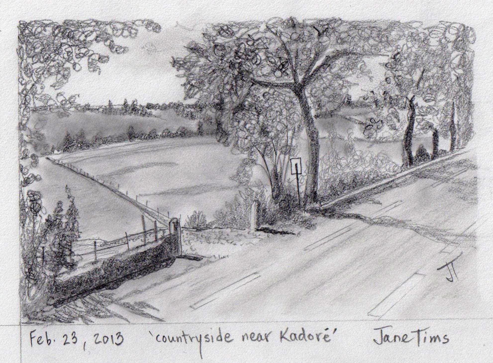
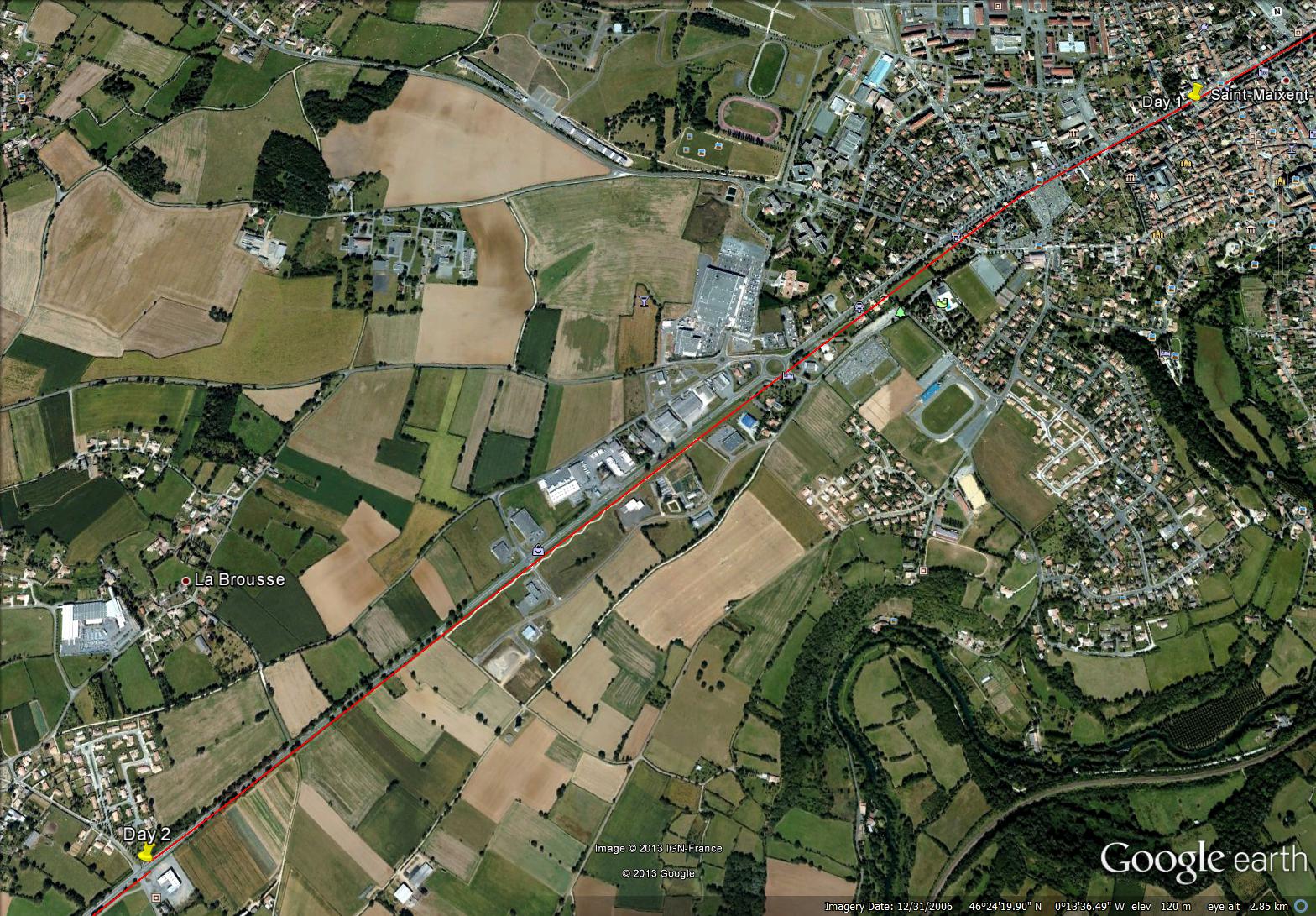
Today I (virtually) biked 3.0 km from Azay-le-Brûle to a big field south-west of Kadoré. The route was in three parts, including a country stretch, the village of Kadoré, and the tree-lined Route Nationale Kadoré.

map showing distance travelled (image from Google Earth)
Kadoré is a small village with charming homes and lots of greenery.

houses and greenery in Kadore (image from Street View)
~
Log Book: February 23, 2013
Area travelled: from ‘Azay-le-Brûle’ to ‘a field south-west of Kadore’
Distance: 30 minutes 3.0 km
Best view: countryside and tree-lined highway … gentle hills reminded me of Kennebecasis Valley in New Brunswick
Notes: late in day, so lots of shadows … bike trip along tree-lined highway fluctuated light, dark, light, dark, light, dark ……
~
~
Distance Travelled Feb 21 to Feb 23 : 9.0 km (90 minutes of stationary biking)
Total Distance Travelled Jan 30 to Feb 23 : 40.8 km (415 minutes)
~
If you lived in Kadoré, would you rather have a lawn mower or a hedge-trimmer?
~
Copyright Jane Tims 2013
biking log book – virtual bike trip from Exireuil, France to Magne – Day #2
On February 21, I began the third phase of my virtual bike trip through central France. For Phase 3 of my trip, I plan to bike in 12 days from Exireuil to Magné just west of Niort.
~
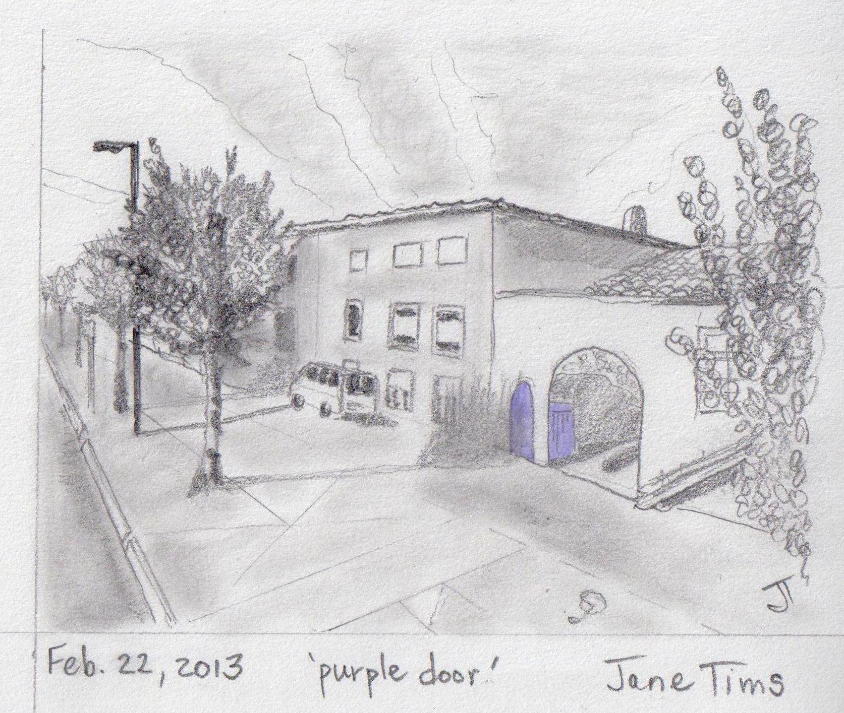
Today I (virtually) biked 3.0 km of a very straight stretch of road between Exireuil and Azay-le-Brûle. The first part of the road was in the town. I saw a McDonald’s … looked like the ones at home … but I did not stop in for a burger and fries!!!!
The second part of the road was a pleasant boulevard lined with trees.

~
Log Book: February 22, 2013
Area travelled: from ‘center of Exireuil’ to ‘Azay-le-Brûle’
Distance: 30 minutes 3.0 km
Best view: white house with archway to inner court – door and gate were painted bright purple!
Notes: boulevard was lovely, but lots of litter in ditches
~
~
Distance Travelled Feb 21 to Feb 22 : 6.0 km (60 minutes of stationary biking)
Total Distance Travelled Jan 30 to Feb 22 : 37.8 km (385 minutes)
~
What do you think of the idea of using just a touch of color on doors, gates and windows to add curb appeal ?
~
Copyright Jane Tims 2013
biking log book – virtual bike trip from Exireuil, France to Magne – Day #1
On February 21, I began the third phase of my virtual bike trip through central France. For Phase 3 of my trip, I plan to bike in 12 days from Exireuil to Magné just west of Niort.
~
Although the first two phases of my trip have been a success, I have encountered two problems:
1. the time it takes to print the maps and views and scan them for the notebook, and
2. the ink it has taken to print out enough views to make the trip more interesting.
~
With some trial and error, I have found a solution. I have gone digital. To save time, I am now using my Flash Drive and a portable computer.
1. I now prepare my trip by saving the Street View images to a file on my Flash Drive (USB portable drive). I don’t print the images and this saves ink. I can also save as many Street View images as I want to represent the trip.
2. I transfer the images to my small computer via its USB port. You could use a laptop, but I have an inexpensive ASUS Eee PC my son gave me several years ago. It is just the right size to put on the book shelf of my stationary cycle.

small PC and notebook on the book shelf of my stationary bike
3. If my small computer is not available, I can also use my SONY S-Frame (a digital Photo Display unit). It also has a USB port and it cycles through the photos or lets me view them one by one.
4. When I begin my bike ride, I just turn on the PC, call up the USB drive and look at the photos one at a time, or in a slide show. I also save an image of the Google Map so I can follow along at my rate of ’10 minutes equals 10 km’.

view of Street View map on PC – thin red line represents the path I am following – this is generated in Street View of Google Earth
5. I miss my ‘notebook’ version, so I do print out a map and a memento image of my bike trip on a given day.
6. I can easily use the images on my PC to do my drawings!
~

Day 1 map (from Google Earth) showing distance travelled
Log Book: February 21, 2013
Area travelled: from ‘outskirts of Exireuil’ to ‘center of Exireuil’
Distance: 30 minutes 3.0 km
Best view: two people out working in their very tidy garden
Notes: Not at all the rural landscape of my earlier biking. I saw apartment buildings and a roundabout for the first time on my trip. I got lost and went around the roundabout eight times before I found the right road!!!!
~

apartment building in Exireuil (image from Google Street View)
~
Distance Travelled Feb 21 : 3.0 km
Total Distance Travelled Jan 30 to Feb 21 : 34.8 km
~

~
When you bike, do you prefer rural or urban areas??
~
Copyright Jane Tims 2013


